|
Allora Racecourse
Allora Racecourse was a horse racing track in Allora, Queensland, Australia. History The Allora Jockey Club was formed during a meeting held in Allora's Princess of Wales Hotel on October 6, 1888. On May 11 1935 and May 26 1936, a race was held, hosted by race secretary C. Fogarty. After World War Two ended, horse racing was suspended until the 2nd January, 1949, when a meeting was held. For the next 11 years, the race club secretary was Jack Hilton, who was also the Allora railway station master. On 8 October, the first Allora Cup meeting was held with an overall prize money of £45 and a cup valued at £10. The winner of the inaugural Allora Cup was the horse ‘Nobleman’’ owned by Tom Cowley. According to local racing historian Shirley Murray, the cup meeting was a huge event in the town, with a half-day holiday granted. On 21 April 1953, during a general business meeting of the Allora Shire Council, the Chairman John Hoey drew attention to the difficulty of keeping ... [...More Info...] [...Related Items...] OR: [Wikipedia] [Google] [Baidu] |
Allora
Allora is a rural town and Suburbs and localities (Australia), locality in the Southern Downs Region, Queensland, Australia. In the , the locality of Allora had a population of 1,205. Geography Allora is on the Darling Downs in south-eastern Queensland, Australia, by road south-west of the state capital, Brisbane. The town is located on the New England Highway between Warwick, Queensland, Warwick and Toowoomba. History Giabal language, Giabal (also known as Paiamba, Gomaingguru) is an Australian Aboriginal language. The Giabal language region includes the landscape within the local government boundaries of the Toowoomba Regional Council, particularly Toowoomba south to Allora and west to Millmerran, Queensland, Millmerran. In 1854, the first Presbyterian services were held in Allora. The town was surveyed in 1859. Its name is believed to derive from an Indigenous Australians, Aboriginal word ''"gnarrallah"'', meaning waterhole or swampy place. Following European settl ... [...More Info...] [...Related Items...] OR: [Wikipedia] [Google] [Baidu] |
Southern Downs Region
The Southern Downs Region is a local government area (LGA) in the Darling Downs region of Queensland, Australia. The region runs along the state's southern boundary with New South Wales and was created in 2008 from a merger of the Shire of Warwick and the Shire of Stanthorpe. As at 2024, it has an area of . In the , the Southern Downs Region had a population of 36,290 people. History The majority of the former Warwick Shire is home to the Githabul people who have lived around this area for tens of thousands of years before the arrival of Europeans in the early 1840s. The current area of the Southern Downs Region existed as two distinct local government areas: * the Shire of Warwick; which in turn consisted of four previous local government areas: ** the City of Warwick; ** the Shire of Allora; ** the Shire of Glengallan; ** the Shire of Rosenthal; * and the Shire of Stanthorpe. The City of Warwick came into being as the Warwick Municipality on 25 May 1861 under the ... [...More Info...] [...Related Items...] OR: [Wikipedia] [Google] [Baidu] |
Queensland
Queensland ( , commonly abbreviated as Qld) is a States and territories of Australia, state in northeastern Australia, and is the second-largest and third-most populous state in Australia. It is bordered by the Northern Territory, South Australia and New South Wales to the west, south-west and south, respectively. To the east, Queensland is bordered by the Coral Sea and the Pacific Ocean; to the state's north is the Torres Strait, separating the Australian mainland from Papua New Guinea, and the Gulf of Carpentaria to the north-west. With an area of , Queensland is the world's List of country subdivisions by area, sixth-largest subnational entity; it List of countries and dependencies by area, is larger than all but 16 countries. Due to its size, Queensland's geographical features and climates are diverse, and include tropical rainforests, rivers, coral reefs, mountain ranges and white sandy beaches in its Tropical climate, tropical and Humid subtropical climate, sub-tropical c ... [...More Info...] [...Related Items...] OR: [Wikipedia] [Google] [Baidu] |
Australia
Australia, officially the Commonwealth of Australia, is a country comprising mainland Australia, the mainland of the Australia (continent), Australian continent, the island of Tasmania and list of islands of Australia, numerous smaller islands. It has a total area of , making it the list of countries and dependencies by area, sixth-largest country in the world and the largest in Oceania. Australia is the world's flattest and driest inhabited continent. It is a megadiverse countries, megadiverse country, and its size gives it a wide variety of landscapes and Climate of Australia, climates including deserts of Australia, deserts in the Outback, interior and forests of Australia, tropical rainforests along the Eastern states of Australia, coast. The ancestors of Aboriginal Australians began arriving from south-east Asia 50,000 to 65,000 years ago, during the Last Glacial Period, last glacial period. By the time of British settlement, Aboriginal Australians spoke 250 distinct l ... [...More Info...] [...Related Items...] OR: [Wikipedia] [Google] [Baidu] |
Allora, Queensland
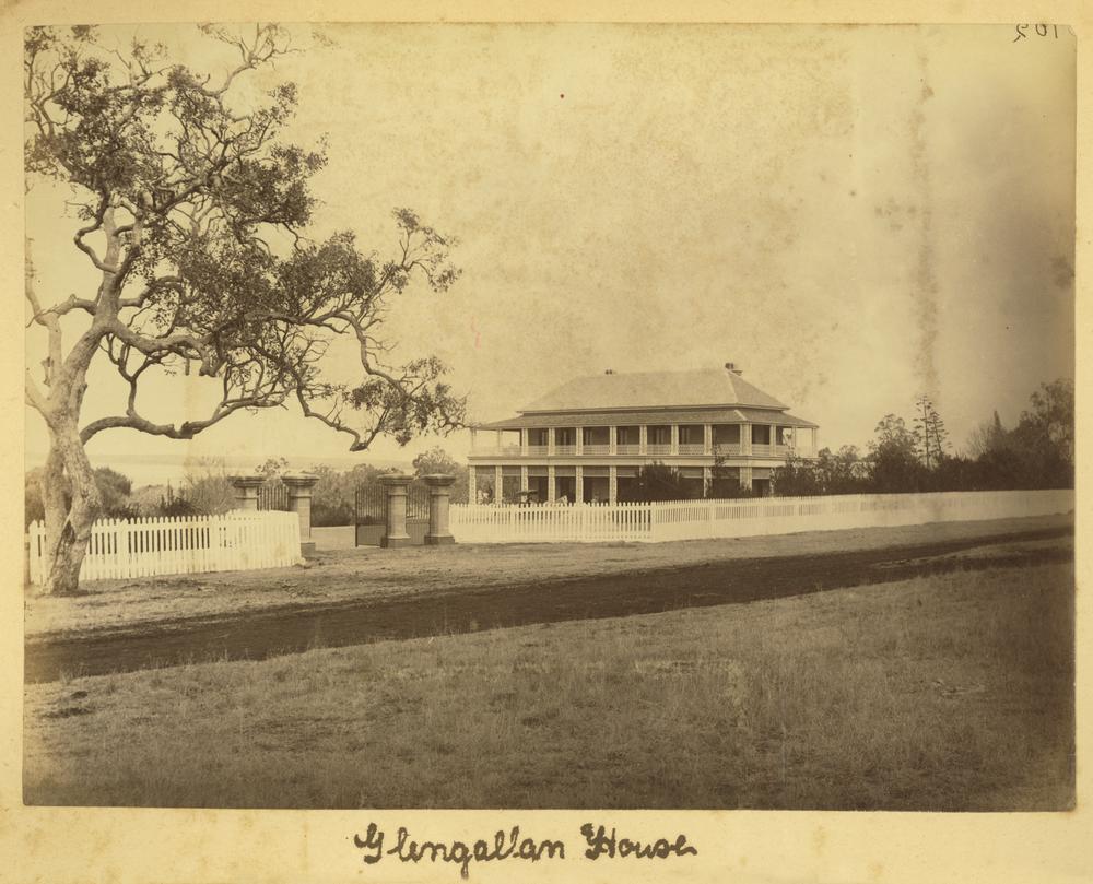
Allora is a rural town and locality in the Southern Downs Region, Queensland, Australia. In the , the locality of Allora had a population of 1,205. Geography Allora is on the Darling Downs in south-eastern Queensland, Australia, by road south-west of the state capital, Brisbane. The town is located on the New England Highway between Warwick and Toowoomba. History Giabal (also known as Paiamba, Gomaingguru) is an Australian Aboriginal language. The Giabal language region includes the landscape within the local government boundaries of the Toowoomba Regional Council, particularly Toowoomba south to Allora and west to Millmerran. In 1854, the first Presbyterian services were held in Allora. The town was surveyed in 1859. Its name is believed to derive from an Aboriginal word ''"gnarrallah"'', meaning waterhole or swampy place. Following European settlement, the history of the area is entwined with two famous pastoral homesteads in the vicinity of Allora: Glengallan and ... [...More Info...] [...Related Items...] OR: [Wikipedia] [Google] [Baidu] |
World War Two
World War II or the Second World War (1 September 1939 – 2 September 1945) was a global conflict between two coalitions: the Allies and the Axis powers. Nearly all of the world's countries participated, with many nations mobilising all resources in pursuit of total war. Tanks and aircraft played major roles, enabling the strategic bombing of cities and delivery of the first and only nuclear weapons ever used in war. World War II is the deadliest conflict in history, causing the death of 70 to 85 million people, more than half of whom were civilians. Millions died in genocides, including the Holocaust, and by massacres, starvation, and disease. After the Allied victory, Germany, Austria, Japan, and Korea were occupied, and German and Japanese leaders were tried for war crimes. The causes of World War II included unresolved tensions in the aftermath of World War I and the rise of fascism in Europe and militarism in Japan. Key events preceding the war ... [...More Info...] [...Related Items...] OR: [Wikipedia] [Google] [Baidu] |
Sunflower
The common sunflower (''Helianthus annuus'') is a species of large annual forb of the daisy family Asteraceae. The common sunflower is harvested for its edible oily seeds, which are often eaten as a snack food. They are also used in the production of cooking oil, as food for livestock, as bird food, and as plantings in domestic gardens for aesthetics. Wild plants are known for their multiple flower heads, whereas the domestic sunflower often possesses a single large flower head atop an unbranched stem. Description The plant has an erect rough-hairy stem, reaching typical heights of . The tallest sunflower on record achieved . Sunflower leaves are broad, coarsely toothed, rough and mostly alternate; those near the bottom are largest and commonly heart-shaped. Flower The plant flowers in summer. What is often called the " flower" of the sunflower is actually a "flower head" ( pseudanthium), wide, of numerous small individual five-petaled flowers (" florets"). The out ... [...More Info...] [...Related Items...] OR: [Wikipedia] [Google] [Baidu] |
Southern Downs
The Darling Downs is a farming region on the western slopes of the Great Dividing Range in southern Queensland, Australia. The Downs are to the west of South East Queensland and are one of the major regions of Queensland. The name was generally applied to an area approximating to that of the Condamine River catchment upstream of Condamine township but is now applied to a wider region comprising the Southern Downs, Western Downs, Toowoomba and Goondiwindi local authority areas. The name Darling Downs was given in 1827 by Allan Cunningham, the first European explorer to reach the area and recognises the then Governor of New South Wales, Ralph Darling. The region has developed a strong and diverse agricultural industry largely due to the extensive areas of vertosols (cracking clay soils), particularly black vertosols, of moderate to high fertility and available water capacity. Manufacturing and mining, particularly coal mining are also important, and coal seam gas extraction ex ... [...More Info...] [...Related Items...] OR: [Wikipedia] [Google] [Baidu] |
Granite Belt
The Granite Belt is an area of the Great Dividing Range in the Darling Downs region of Queensland and the New England region of New South Wales, Australia. The Granite Belt is centred on the town of Stanthorpe. The cool, high country of the granite belt is located on Queensland's southern border. It is the northernmost part of the New England Tablelands. The area gains its name from the predominantly granite rocks that distinguish it from other areas that make up much of South East Queensland. The Granite Belt is known for its spectacular flowers, and produces virtually all of Queensland's $40 million apple crop from one million trees grown by 55 orchardists. The area also lies within the Southern Downs region. Including the town of Warwick, the region has a population of 32,600 people. The major river in the region is the Condamine River, a tributary of the Murray River. Climate The Granite Belt has a subtropical highland climate that shares similarities to a typical ... [...More Info...] [...Related Items...] OR: [Wikipedia] [Google] [Baidu] |
Gelding
A gelding (Help:IPA/English, /ˈɡɛldɪŋ/) is a castration, castrated male horse or other equine, such as a pony, donkey or a mule. The term is also used with certain other animals and livestock, such as domesticated Camelidae, camels. By comparison, the equivalent term for castrated male cattle would be List of cattle terminology , ''steer'' (or ''bullock''), and Wether (other), ''wether'' for sheep and goats. Castration allows a male animal to be more calm, better-behaved, less sexually aggressive, and more responsive to training efforts. This makes the animal generally more suitable as an everyday working animal, or as a pet in the case of companion animals. The gerund and participle "gelding" and the infinitive "to geld" refer to the castration procedure itself. Etymology The verb "to geld" comes from the Old Norse language, Old Norse , from the adjective . The noun "gelding" is from the Old Norse . History The Scythians are thought to have been among the first t ... [...More Info...] [...Related Items...] OR: [Wikipedia] [Google] [Baidu] |


