|
Aletschhorn From Konkordia
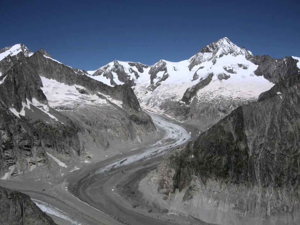
The Aletschhorn () is a mountain in the Alps in Switzerland, lying within the Jungfrau-Aletsch region, which has been designated a World Heritage Site by UNESCO. The mountain shares part of its name with the Aletsch Glacier lying at its foot. The Aletschhorn, the second highest mountain of the Bernese Alps after the Finsteraarhorn, is the only one of the higher peaks that lies completely in Valais. It is the culminating point of a chain running parallel with the dividing ridge, and surpassing it in the height of its principal peaks. Standing thus between the principal range of the Bernese Alps and the Pennine Alps, Pennine chain, it shares with the Bietschhorn the advantage of occupying a central position in relation to the high peaks around it. The Aletschhorn is often thought to command the finest of all the panoramic views from Alpine summits.John Ball (naturalist), John Ball, ''The Alpine Guide: Central Alps'', 1869, p. 94 Geography On its northern flank lies the Aletschf ... [...More Info...] [...Related Items...] OR: [Wikipedia] [Google] [Baidu] |
Swisstopo
Swisstopo is the official name for the Swiss Federal Office of Topography, Switzerland's national mapping agency. The current name was made official in 2002. It had been used as the domain name for the homepage of the instituteswisstopo.admin.ch since 1997. Maps The main class of products produced by Swisstopo are topographical maps on seven different Scale (map), scales. Swiss maps have been praised for their accuracy and quality. Regular maps * 1:25.000. This is the most detailed map, useful for many purposes. Those are popular with tourists, especially for famous areas like Zermatt and St. Moritz. These maps cost CHF 13.50 each (2004). 208 maps on this scale are published at regular intervals. The first map published on this scale was ''1125 Chasseral'', in 1952. The last map published on this scale was ''1292 Maggia'', in 1972. Since 1956, composites have been published, starting with ''2501 St. Gallen''. They have the same information, but consist of several parts of re ... [...More Info...] [...Related Items...] OR: [Wikipedia] [Google] [Baidu] |
Oberaletschgletscher
The Oberaletsch Glacier (German: ''Oberaletschgletscher'', meaning ''Upper Aletsch Glacier'') is a valley glacier on the south side of the Bernese Alps, in the canton of Valais. It had a length of with an average width of just under and an area of about in 1973. The Oberaletsch Glacier system consists of two approximately equal arms. The eastern one takes its starting point on the south western flank of the Aletschhorn at around , and joins the western arm (Beichgletscher) in the valley at the foot of the Nesthorn. Then the glacier flows to the south-east towards the Aletsch Glacier without reaching it. The glacier tongue ends at around . During the Little Ice Age in the middle of the 19th century the glacier was part of the Aletsch Glacier. The Swiss Alpine Club Oberaletschhütte () is above the junction of the two glacier arms and has been accessible to hikers since 2005 with a new trail from Belalp. The area of the Oberaletsch Glacier, along with the Aletsch Glacier, was d ... [...More Info...] [...Related Items...] OR: [Wikipedia] [Google] [Baidu] |
Fiesch
Fiesch is a municipality in the district of Goms in the canton of Valais in Switzerland. Nearby Fiescheralp is administered by Fiesch and is accessible by the Eggishorn lift. It has been designated a UNESCO World Heritage site for its view of the Jungfrau-Aletsch Protected Area. History Fiesch is first mentioned in 1203 as "Vios". In 1438 it is recorded as "Viesch", and has been known as Fiesch since 1905. The Fiesch derailment occurred in 2010. Geography Fiesch has an area, , of . Of this area, 32.6% is used for agricultural purposes, while 40.6% is forested. Of the rest of the land, 6.4% is settled (buildings or roads) and 20.4% is unproductive land. The municipality is located in a small valley and on the slopes above both sides of the Weisswasser. Coat of arms The blazon of the municipal coat of arms is ''Azure, a fess wavy Argent in base Coupeaux of the same.'' Demographics Fiesch has a population () of . , 17.9% of the population are resident foreign national ... [...More Info...] [...Related Items...] OR: [Wikipedia] [Google] [Baidu] |
Thomas Thomasson
Thomas Thomasson (18081876) was a political economist and a campaigner for the repeal of the Corn Laws who was one of Bolton's greatest benefactors. Life Thomasson was born at Turton into a Bolton family and was grandson of one of the original cotton pioneers. He joined his father in the family business of John Thomasson and Son at Mill Hill, a cotton mill founded by Sir Robert Peel. In 1837 his father died and Thomasson took on the management of the firm. In 1841 he built the first of three new Mill Hill factories, a bold venture, as the mill was said to be huge, and the cotton industry was then in depression – a fact which was mentioned by the Prime Minister (Sir Robert Peel) in the House of Commons as evidence that persons did not hesitate to employ their capital in the further extension of the cotton trade, notwithstanding its condition. The firm built on this success, opening another new factory in 1853, and a third in 1859. Thomasson was intimately associated with Richar ... [...More Info...] [...Related Items...] OR: [Wikipedia] [Google] [Baidu] |
Lötschental
The Lötschental () is the largest valley on the northern side of the Rhône valley in the canton of Valais in Switzerland. It lies in the Bernese Alps, with the running down the length of the valley from its source within the Langgletscher (lit.: Long Glacier). Geography The valley extends about from the Lötschenlücke (3178 m) at the top of the Langgletscher to the mouth of the valley at Steg/Gampel (630 m). It is surrounded by 3,000 meter high mountains, including the Bietschhorn (3,934 m), the Hockenhorn (3,293 m), the Wilerhorn (3,307 m) and the Petersgrat (3,205 m). The Jungfrau-Aletsch Protected Area is the most glaciated area in the Swiss Alps, and was declared a Natural World Heritage Site by decision of UNESCO on December 13, 2001, along with southern and eastern parts of the Lötschental. The main villages of the Lötschental are Wiler and Kippel, with 538 and 383 inhabitants respectively. Other villages in the valley include Ferden a ... [...More Info...] [...Related Items...] OR: [Wikipedia] [Google] [Baidu] |
Aletschhorn01
The Aletschhorn () is a mountain in the Alps in Switzerland, lying within the Jungfrau-Aletsch region, which has been designated a World Heritage Site by UNESCO. The mountain shares part of its name with the Aletsch Glacier lying at its foot. The Aletschhorn, the second highest mountain of the Bernese Alps after the Finsteraarhorn, is the only one of the higher peaks that lies completely in Valais. It is the culminating point of a chain running parallel with the dividing ridge, and surpassing it in the height of its principal peaks. Standing thus between the principal range of the Bernese Alps and the Pennine chain, it shares with the Bietschhorn the advantage of occupying a central position in relation to the high peaks around it. The Aletschhorn is often thought to command the finest of all the panoramic views from Alpine summits. John Ball, ''The Alpine Guide: Central Alps'', 1869, p. 94 Geography On its northern flank lies the Aletschfirn, which is part of the Aletsch G ... [...More Info...] [...Related Items...] OR: [Wikipedia] [Google] [Baidu] |
Dreieckhorn
The Dreieckhorn is a mountain of the Bernese Alps, overlooking Konkordiaplatz in the canton of Valais Valais ( , ; ), more formally, the Canton of Valais or Wallis, is one of the cantons of Switzerland, 26 cantons forming the Switzerland, Swiss Confederation. It is composed of thirteen districts and its capital and largest city is Sion, Switzer .... In the southeast-ridge of the Dreieckhorn, which is leading to the Olmenhorn, is located the subpeak ''Kleines Dreieckhorn'' (3639 m). References External links Dreieckhorn on Hikr Mountains of the Alps Alpine three-thousanders Mountains of Switzerland Mountains of Valais Bernese Alps {{Valais-mountain-stub ... [...More Info...] [...Related Items...] OR: [Wikipedia] [Google] [Baidu] |
Aletschhorn02
The Aletschhorn () is a mountain in the Alps in Switzerland, lying within the Jungfrau-Aletsch region, which has been designated a World Heritage Site by UNESCO. The mountain shares part of its name with the Aletsch Glacier lying at its foot. The Aletschhorn, the second highest mountain of the Bernese Alps after the Finsteraarhorn, is the only one of the higher peaks that lies completely in Valais. It is the culminating point of a chain running parallel with the dividing ridge, and surpassing it in the height of its principal peaks. Standing thus between the principal range of the Bernese Alps and the Pennine chain, it shares with the Bietschhorn the advantage of occupying a central position in relation to the high peaks around it. The Aletschhorn is often thought to command the finest of all the panoramic views from Alpine summits. John Ball, ''The Alpine Guide: Central Alps'', 1869, p. 94 Geography On its northern flank lies the Aletschfirn, which is part of the Aletsch G ... [...More Info...] [...Related Items...] OR: [Wikipedia] [Google] [Baidu] |
Eiger
The Eiger () is a mountain of the Bernese Alps, overlooking Grindelwald and Lauterbrunnen in the Bernese Oberland of Switzerland, just north of the main watershed and border with Valais. It is the easternmost peak of a ridge crest that extends across the Mönch to the Jungfrau at , constituting one of the most emblematic sights of the Swiss Alps. While the northern side of the mountain rises more than 3,000 m (10,000 ft) above the two valleys of Grindelwald and Lauterbrunnen, the southern side faces the large glaciers of the Jungfrau-Aletsch area, the most glaciated region in the Alps. The most notable feature of the Eiger is its nearly north face of rock and ice, named ''Eiger-Nordwand'', ''Eigerwand'' or just ''Nordwand'', which is the biggest north face in the Alps. This substantial face towers over the resort of Kleine Scheidegg at its base, on the eponymous pass connecting the two valleys. The first ascent of the Eiger was made by Swiss guides Christian Alm ... [...More Info...] [...Related Items...] OR: [Wikipedia] [Google] [Baidu] |
Jungfrau
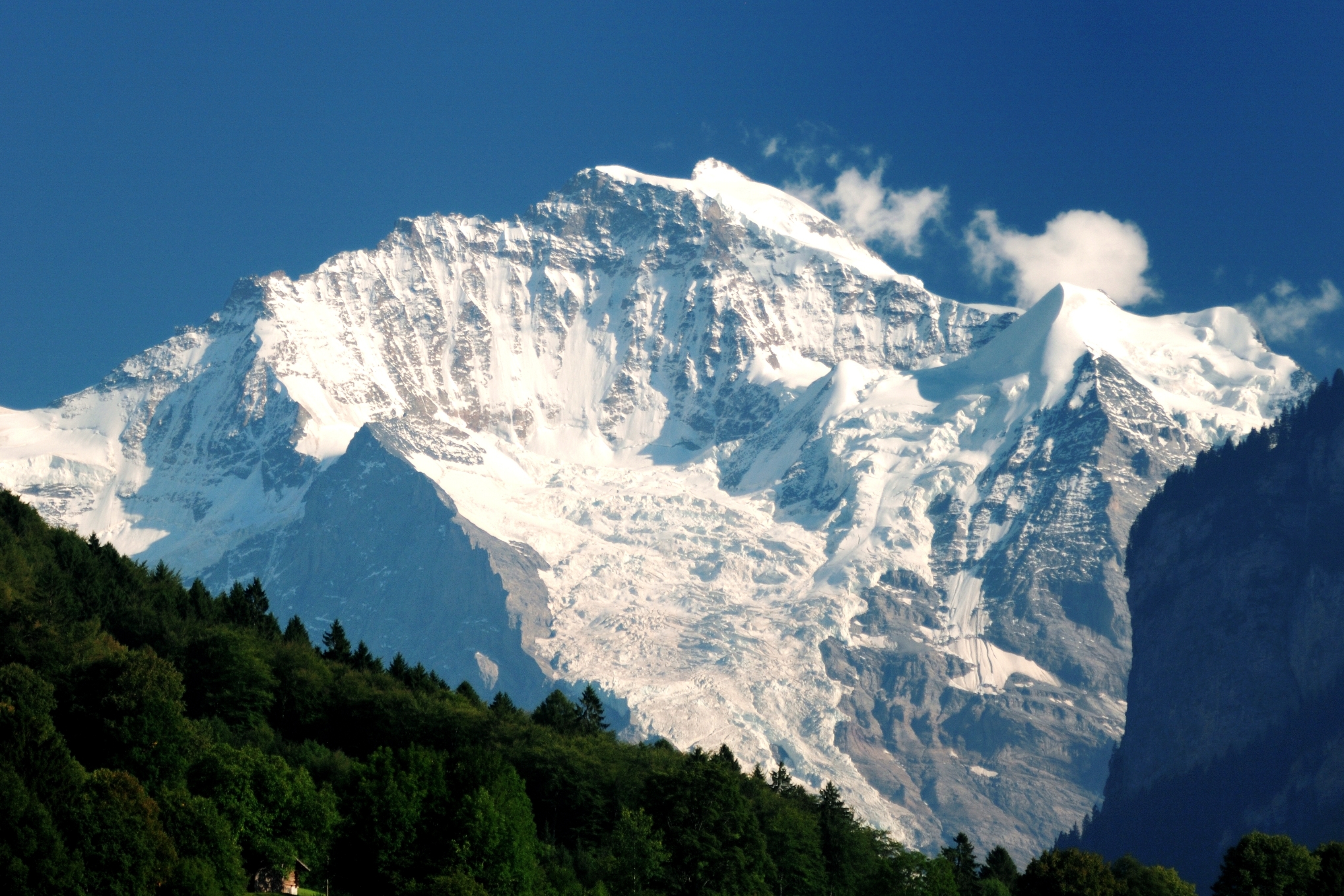
The Jungfrau (, , , "maiden, virgin"), at is one of the main summits of the Bernese Alps, located between the northern canton of Bern and the southern canton of Valais, halfway between Interlaken and Fiesch. Together with the Eiger and Mönch, the Jungfrau forms a massive wall of mountains overlooking the Bernese Oberland and the Swiss Plateau, one of the most distinctive sights of the Swiss Alps. The summit was first reached on August 3, 1811, by the Meyer brothers of Aarau and two chamois hunters from Valais. The ascent followed a long expedition over the glaciers and high passes of the Bernese Alps. It was not until 1865 that a more direct route on the northern side was opened. The construction of the Jungfrau Railway in the early 20th century, which connects Kleine Scheidegg to the Jungfraujoch, the saddle between the Mönch and the Jungfrau, made the area one of the most-visited places in the Alps. Along with the Aletsch Glacier to the south, the Jungfrau is part of th ... [...More Info...] [...Related Items...] OR: [Wikipedia] [Google] [Baidu] |


