|
Alempois
Alempois () was a small independent landlocked county in ancient Estonia, bordered by Harjumaa, Järvamaa, Nurmekund, Sakala, and Läänemaa. Alempois had an area of approximately 400 hides. See also *Livonian Crusade *Monastic state of the Teutonic Knights * Mädara * Rulers of Estonia * Türi *Vahastu Vahastu is a village in Kuusalu Parish, Harju County in northern Estonia. References Villages in Harju County {{Harju-geo-stub ... * Wittenstein References External links Kuidas elasid inimesed vanasti, möödunud sajandil ja praegu (Estonian) Ancient counties of Estonia {{Estonia-hist-stub ... [...More Info...] [...Related Items...] OR: [Wikipedia] [Google] [Baidu] |
Nurmekund
Nurmekund (Low German: ''Nurmegunde'') was a small independent country (ancient Estonian county) on the north coast of Lake Võrtsjärv in Central Estonia, bordered by Sakala, Alempois, Järvamaa, Mõhu, and Ugandi. Nurmekund had an area of approximately 600 hides. See also * History of Estonia * Imavere * Kabala * Kolga-Jaani * Kõo * Livonian Crusade * Monastic state of the Teutonic Knights * Pilistvere * Põltsamaa * Rulers of Estonia * Võhma Võhma is a List of cities and towns in Estonia, town in Põhja-Sakala Parish, Viljandi County, central Estonia. History The settlement dates to the sixteenth century. The German-language name of the town was Wöchma. It began to grow when a ra ... References External links Kuidas elasid inimesed vanasti, möödunud sajandil ja praegu (Estonian)9. - 13. saj.pärinevad Eesti aardeleiud (Estonian)* ttp://www.poltsamaa.ee/index.php?main_id=72,1576,1580 Põltsamaa linnus (Estonian) Ancient counties of Estoni ... [...More Info...] [...Related Items...] OR: [Wikipedia] [Google] [Baidu] |
Rulers Of Estonia
These are lists of political office-holders in Estonia. Overview The ancient counties (''maakond'') and parishes (''kihelkond'') were headed by ''Seniores'' and ''Meliores'' (Elders) as noted by Henry of Livonia. The administrative jurisdiction of the parish and county elders was limited, the counties themselves remained autonomous until the Teutonic and Danish conquest of Estonia in the 13th century. Ending with the states and the rulers of states (starting from the time of the first successful Danish conquest in 1219) who either ruled or laid claims of sovereignty over some parts of the territory of present-day Estonia, as well as the leaders of the independent Republic of Estonia since 1918. Ancient counties Alempois Title: Elder (-1224) Harju Title: Elder (-1224) Järva Title: Elder (-1224) Jogentagana Title: Elder (-1224) Läänemaa Title: Elder (-1224) Mõhu Title: Elder (-1224) Nurmekund Title: Elder (-1224) Revala Title: Elder (-1224) Saaremaa Title: E ... [...More Info...] [...Related Items...] OR: [Wikipedia] [Google] [Baidu] |
Ancient Estonia
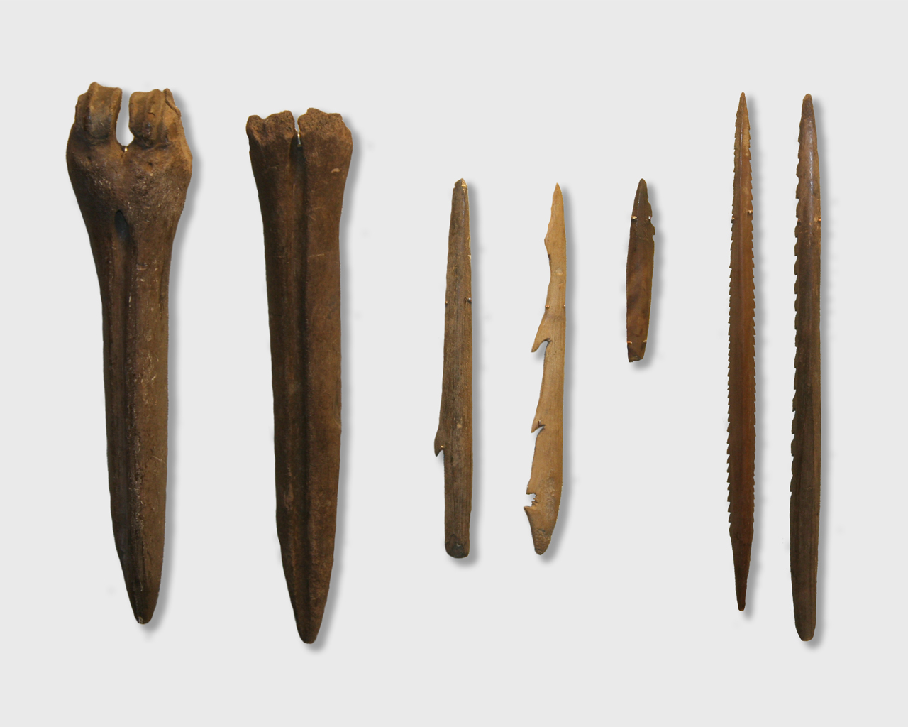
Ancient Estonia refers to a period covering History of Estonia from the middle of the 8th millennium BC until the conquest and subjugation of the local Finnic tribes in the first quarter of the 13th century during the Teutonic and Danish Northern Crusades. The Mesolithic Period The region has been populated since the end of the last glacial era, about 10,000 BC. The earliest traces of human settlement in Estonia are connected with Kunda culture. The oldest known settlement in Estonia is the Pulli settlement, which was located on the banks of the river Pärnu, near the town of Sindi, in southwestern Estonia. It has been dated to the beginning of the 9th millennium BC. The Kunda Culture received its name from the ''Lammasmäe'' settlement site in northern Estonia, which dates from earlier than 8500. Bone and stone artifacts similar to those found at Kunda have been discovered elsewhere in Estonia, as well as in Latvia, Russia, northern Lithuania and southern Finland. Among ... [...More Info...] [...Related Items...] OR: [Wikipedia] [Google] [Baidu] |
Türi
Türi is a town in Järva County, Estonia. It is the administrative centre of Türi Parish. Due to its spring flower fairs, which have been held since 1977 and are known throughout Estonia, Türi has also been known as the "spring capital" of Estonia since 2000. It has a railway station on the Tallinn - Viljandi railway line operated by Elron (rail transit). History *1347 Türi first mentioned in historical records by the German language name of Turgel *1687 The establishment of the first school *1900 Railway traffic (Viljandi–Tallinn, Türi–Paide) opened *1917 Türi gains the rights of a market town *1924 The first secondary education institution in Türi opened – Türi Horticultural Gymnasium *1926 The rights of a town given to Türi *1937 Erection of a radio mast. The mast was blown up by Soviet Union forces in 1941 *1950 - 1959 Türi - the centre of Türi County. *1995 Türi Museum opened. *1997 Türi College of the University of Tartu for environmental science stu ... [...More Info...] [...Related Items...] OR: [Wikipedia] [Google] [Baidu] |
Mädara
Mädara is a village in Põhja-Pärnumaa Parish, Pärnu County in western-central Estonia Estonia, officially the Republic of Estonia, is a country in Northern Europe. It is bordered to the north by the Gulf of Finland across from Finland, to the west by the Baltic Sea across from Sweden, to the south by Latvia, and to the east by Ru .... (retrieved 28 July 2021) References Villages in Pärnu County Kreis Pernau {{Pärnu-geo-stub ... [...More Info...] [...Related Items...] OR: [Wikipedia] [Google] [Baidu] |
Monastic State Of The Teutonic Knights
The State of the Teutonic Order () was a theocratic state located along the southeastern shore of the Baltic Sea in northern Europe. It was formed by the knights of the Teutonic Order during the early 13th century Northern Crusades in the region of Prussia. In 1237, the Livonian Brothers of the Sword merged with the Teutonic Order of Prussia and became known as its branch – the Livonian Order (while their state, ''Terra Mariana'', covering present-day Estonia, Latvia, and a small part of Russia, became part of the State of the Teutonic Order). At its greatest territorial extent during the early 15th century, the State encompassed Chełmno Land, Courland, Gotland, Livonia, Estonia, Neumark, Pomerelia ( Gdańsk Pomerania), Prussia and Samogitia. Following the battles of Grunwald in 1410 and Wilkomierz in 1435, the State fell into decline. After losing extensive territories in the imposed Peace of Thorn in 1466, the extant territory of its Prussian branch became known as ... [...More Info...] [...Related Items...] OR: [Wikipedia] [Google] [Baidu] |
Livonian Crusade
The Livonian crusade consists of the various military Crusade, Christianisation campaigns in medieval Livonia – modern Latvia and Estonia – during the Pope, Papal-sanctioned Northern Crusades in the 12th–13th century. Overview Historical sources The main source of information on the Livonian crusade is the ''Livonian Chronicle of Henry'', written in 1229 by Henry of Latvia (''Henricus de Lettis''). In his chronicle, the author notes that he penned it down at the urging of his lords and companions, including his former teacher bishop Albert of Riga, who receives much praise throughout the text, that is internally divided according to the years of Albert's episcopate. James A. Brundage (1972) posited that Albert commissioned Henry to write the ''Livonian Chronicle'' in the mid-1220s in order to glorify Albert's achievements, as well as to briefly summarise unresolved issues to the newly appointed papal legate, William of Modena. Henry wrote that the papacy's use of the ... [...More Info...] [...Related Items...] OR: [Wikipedia] [Google] [Baidu] |
Hide (unit)
The hide was an English unit of land measurement originally intended to represent the amount of land sufficient to support a household. The Anglo-Saxon hide commonly appeared as of arable land, but it probably represented a much smaller holding before 1066. It was a measure of value and tax assessment, including obligations for food-rent ('), maintenance and repair of bridges and fortifications, manpower for the army ('), and (eventually) the ' land tax. The hide's method of calculation is now obscure: different properties with the same hidage could vary greatly in extent even in the same county. Following the Norman Conquest of England, the hidage assessments were recorded in the Domesday Book of 1086, and there was a tendency for land producing £1 of income per year to be assessed at 1 hide. The Norman kings continued to use the unit for their tax assessments until the end of the 12th century. The hide was divided into four yardlands or virgates. It was hence nominally ... [...More Info...] [...Related Items...] OR: [Wikipedia] [Google] [Baidu] |
Sakala County
Sakala County ( Estonian: ''Sakala'', Latin: ''Saccalia'') was an ancient Estonian county that was first mentioned in print by Henry of Latvia in the early 13th century. Geography Sakala County is in northwestern Livonia, covering approximately the present counties of Viljandi, the southern half of Pärnu and the western third of Valga County. It was the southernmost of the ancient Estonian counties. History According to one hypothesis, the tribe of ''Sosols'' mentioned in Old East Slavic chronicles implies the people of Sakala. The chronicles say that Kievan Rus organized military campaign against Sosols in 1060 and taxed them. A year later, Sosols rose, destroyed Kievan Rus Fort in Tartu and tried to attack Pskov. After the Livonian Crusade, the county became a part of the Livonian Confederation. In Sackalian folklore, the neighbouring Ugaunians (''ugalased'') were enemy warriors and robbers. For instance, a folk song from Viljandi Viljandi (, , , , ) is a Populated p ... [...More Info...] [...Related Items...] OR: [Wikipedia] [Google] [Baidu] |


