|
Aleksander Gamme
Aleksander Gamme (born July 23, 1976) is a Norwegian adventurer, polar explorer, researcher, author and public speaker. In 2007, he climbed Mount Everest with Stian Voldmo. While he was there he worked on an interactive teaching project, "Hamar til Topps,” in which 1,000 Norwegian students in 6th and 7th grades participated. He took paper planes constructed by the students to the top of Everest and flew them from the summit. The project received ITU's creative prize. In 2010, he and Erik Gran Kvaase became the first people to tandem bike across the Sahara. While there, they ran another teaching project as a follow-up to "Hamar til Topps". In 2011, he completed the first unsupported solo coast to coast hike across Antarctica, going from Hercules Inlet to the South Pole and back again, a trip that took 57 days to the pole and 87 days until he returned to the coast. He finished at the same time as a concurrent expedition by Cas and Jonesy, after waiting 4 days in his tent so he co ... [...More Info...] [...Related Items...] OR: [Wikipedia] [Google] [Baidu] |
Mount Everest
Mount Everest (), known locally as Sagarmatha in Nepal and Qomolangma in Tibet, is Earth's highest mountain above sea level. It lies in the Mahalangur Himal sub-range of the Himalayas and marks part of the China–Nepal border at its summit. Its height was most recently measured in 2020 by Chinese and Nepali authorities as . Mount Everest attracts many climbers, including highly experienced mountaineers. There are two main climbing routes, one approaching the summit from the southeast in Nepal (known as the standard route) and the other from the north in Tibet. While not posing substantial technical climbing challenges on the standard route, Everest presents dangers such as altitude sickness, weather, and wind, as well as hazards from avalanches and the Khumbu Icefall. As of May 2024, 340 people have died on Everest. Over 200 bodies remain on the mountain and have not been removed due to the dangerous conditions. Climbers typically ascend only part of Mount Eve ... [...More Info...] [...Related Items...] OR: [Wikipedia] [Google] [Baidu] |
Sahara
The Sahara (, ) is a desert spanning across North Africa. With an area of , it is the largest hot desert in the world and the list of deserts by area, third-largest desert overall, smaller only than the deserts of Antarctica and the northern Arctic. The name "Sahara" is derived from , a broken plural form of ( ), meaning "desert". The desert covers much of North Africa, excluding the fertile region on the Mediterranean Sea coast, the Atlas Mountains of the Maghreb, and the Nile, Nile Valley in Egypt and the Sudan. It stretches from the Red Sea in the east and the Mediterranean in the north to the Atlantic Ocean in the west, where the landscape gradually changes from desert to coastal plains. To the south it is bounded by the Sahel, a belt of Tropical and subtropical grasslands, savannas, and shrublands, semi-arid tropical savanna around the Niger River valley and the Sudan (region), Sudan region of sub-Saharan Africa. The Sahara can be divided into several regions, including ... [...More Info...] [...Related Items...] OR: [Wikipedia] [Google] [Baidu] |
Antarctica
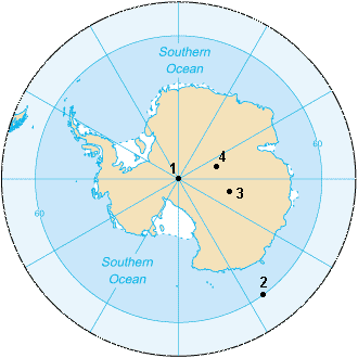
Antarctica () is Earth's southernmost and least-populated continent. Situated almost entirely south of the Antarctic Circle and surrounded by the Southern Ocean (also known as the Antarctic Ocean), it contains the geographic South Pole. Antarctica is the fifth-largest continent, being about 40% larger than Europe, and has an area of . Most of Antarctica is covered by the Antarctic ice sheet, with an average thickness of . Antarctica is, on average, the coldest, driest, and windiest of the continents, and it has the highest average elevation. It is mainly a polar desert, with annual Climate of Antarctica#Precipitation, precipitation of over along the coast and far less inland. About 70% of the world's freshwater reserves are frozen in Antarctica, which, if melted, would raise global sea levels by almost . Antarctica holds the record for the Lowest temperature recorded on Earth, lowest measured temperature on Earth, . The coastal regions can reach temperatures over in the ... [...More Info...] [...Related Items...] OR: [Wikipedia] [Google] [Baidu] |
South Pole
The South Pole, also known as the Geographic South Pole or Terrestrial South Pole, is the point in the Southern Hemisphere where the Earth's rotation, Earth's axis of rotation meets its surface. It is called the True South Pole to distinguish from the south magnetic pole. The South Pole is by definition the southernmost point on the Earth, lying antipode (geography), antipodally to the North Pole. It defines geodetic latitude 90° South, as well as the direction of true south. At the South Pole all directions point North; all lines of longitude converge there, so its longitude can be defined as any degree value. No time zone has been assigned to the South Pole, so any time can be used as the local time. Along tight latitude circles, clockwise is east and counterclockwise is west. The South Pole is at the center of the Southern Hemisphere. Situated on the continent of Antarctica, it is the site of the United States Amundsen–Scott South Pole Station, which was established in 19 ... [...More Info...] [...Related Items...] OR: [Wikipedia] [Google] [Baidu] |
Cas And Jonesy
Cas and Jonesy are an Australian duo known for being explorers, endurance athletes, motivational speakers, as well as a writer and documentary producer respectively. Their given names are James John Castrission (born 14 March 1982) and Justin Roderick Jones (born 20 June 1983). In 2008 they kayaked 3318 km across the Tasman Sea from Australia to New Zealand, becoming the first to do so. On 26 January 2012, Castrission and Jones completed the first unsupported polar expedition from the edge of Antarctica to the South Pole and back without mechanical assistance. After 89 days they made it back to the coast, having skied 2275 km while towing sleds full of supplies. They arrived alongside Aleksander Gamme who had waited for them so they could all finish together. Early life Castrission was born in Sydney, the eldest of three children to parents John and Vivienne. Both sets of grandparents migrated to Australia from Greece after WWII. He was educated at Knox Grammar Sc ... [...More Info...] [...Related Items...] OR: [Wikipedia] [Google] [Baidu] |
Cecilie Skog
Cecilie Skog (born August 9, 1974) is a Norwegian adventurer who was the first Norwegian woman to summit K2 mountain in 2008 and in 2010 she made the first unassisted trek across Antarctica. Life Skog studied and worked as a nurse, but since summiting Mount Everest in 2004, she has worked as a professional adventurer, guide and lecturer. In August 2008, she climbed K2. Her husband, Rolf Bae, who had been climbing with her on K2, perished during the descent, as did ten other mountaineers. In a close call at the so-called Bottleneck, a Serbian climber, Dren Mandić, unhooked himself and lost balance, bumping into Skog and falling 100 metres to his death. In January 2010, she finished the first unassisted and unsupported crossing of Antarctica. Together with Ryan Waters, she took 70 days, from November 13, 2009 to January 21, 2010, to complete the more than 1800 km long journey across the Antarctic continent. Summits * Mont Blanc 4807 m, 1996 * Aconcagua, 6962 m (South Am ... [...More Info...] [...Related Items...] OR: [Wikipedia] [Google] [Baidu] |
Finnmark
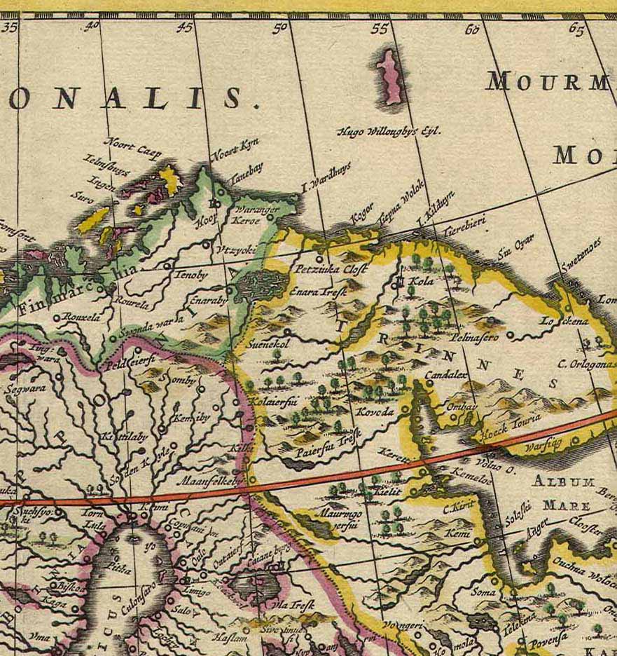
Finnmark (; ; ; ; ) is a counties of Norway, county in northern Norway. By land, it borders Troms county to the west, Finland's Lapland (Finland), Lapland region to the south, and Russia's Murmansk Oblast to the east, and by water, the Norwegian Sea (Atlantic Ocean) to the northwest, and the Barents Sea (Arctic Ocean) to the north and northeast. The county was formerly known as ''Finmarkens amt'' or ''Vardøhus amt''. Since 2002, it has had two official names: Finnmark (Norwegian language, Norwegian) and Finnmárku (Northern Sami language, Northern Sami). It is part of the Sápmi region, which spans four countries, as well as the Barents Region, and is Norway's second-largest and least populous county. Situated at the northernmost part of continental Europe, where the Norwegian coastline swings eastward, Finnmark is an area "where East meets West" in culture as well as in nature and geography. Vardø Municipality, Norway's easternmost municipality, is farther east than Saint ... [...More Info...] [...Related Items...] OR: [Wikipedia] [Google] [Baidu] |
Ismoil Somoni Peak
Ismoil Somoni Peak (; ) is the highest mountain in Tajikistan, as well as the former Russian Empire and Soviet Union before Tajikistan's independence. The mountain is named after Ismail Samani, a ruler of the Samanid dynasty. It is located in the Pamir Range. Name When the existence of a peak in the Soviet Pamir Mountains higher than Lenin Peak was first established in 1928, the mountain was tentatively identified with Mount Garmo. However, as the result of the work of further Soviet expeditions, it became clear by 1932 that they were not the same, and in 1933 the new peak, in the Academy of Sciences Range, was named Stalin Peak (), after Joseph Stalin. In 1962, as part of Khrushchev's nationwide de-Stalinization process, the name was changed to Communism Peak ( ), a name by which it is still commonly known. The name Communism Peak was officially dropped in 1998 in favour of the current name, commemorating the 9th-10th century Samanid emir, Ismail Samani. History By the e ... [...More Info...] [...Related Items...] OR: [Wikipedia] [Google] [Baidu] |
Broad Peak
Broad Peak (; ) is one of the eight-thousanders, and is located in the Karakoram range spanning Gilgit-Baltistan, Pakistan and Xinjiang, China. It is the 12th highest mountain in the world with elevation above sea level. The first ascent of this mountain was in June 1957, accomplished by Fritz Wintersteller, Marcus Schmuck, Kurt Diemberger, and Hermann Buhl as part of an Austrian expedition. Geography Broad Peak is part of the Gasherbrum massif in Baltistan situated on the border of Pakistan and China. It is located in the Karakoram mountain range, approximately from K2. The peak's name aptly describes its physical characteristics, with a summit that extends over 1.5 kilometers (7⁄8 miles) in length, giving it the appearance of a "broad peak." Three of the mountain's five summits are eight-thousanders: Broad Peak (8051 m), Rocky Summit (8028 m), Broad Peak Central (8011 m), with Broad Peak North (7490 m), and Kharut Kangri (6942 m) being th ... [...More Info...] [...Related Items...] OR: [Wikipedia] [Google] [Baidu] |
Living People
Purpose: Because living persons may suffer personal harm from inappropriate information, we should watch their articles carefully. By adding an article to this category, it marks them with a notice about sources whenever someone tries to edit them, to remind them of WP:BLP (biographies of living persons) policy that these articles must maintain a neutral point of view, maintain factual accuracy, and be properly sourced. Recent changes to these articles are listed on Special:RecentChangesLinked/Living people. Organization: This category should not be sub-categorized. Entries are generally sorted by family name In many societies, a surname, family name, or last name is the mostly hereditary portion of one's personal name that indicates one's family. It is typically combined with a given name to form the full name of a person, although several give .... Maintenance: Individuals of advanced age (over 90), for whom there has been no new documentation in the last ten ... [...More Info...] [...Related Items...] OR: [Wikipedia] [Google] [Baidu] |


