|
Alderbury
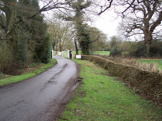
Alderbury is a village and civil parish in Wiltshire, England, in the south of the county around southeast of Salisbury. The parish includes the village of Whaddon, which is adjacent to Alderbury, and the hamlet of Shute End. The River Avon forms the western boundary of the parish. The villages are on the Salisbury-Southampton road which became the A36 primary route; a bypass was opened in 1978, taking the A36 to the east of the villages. History The Domesday survey in 1086 recorded a settlement with 13 households at ''Alwarberie'' or ''Alwaresberie''. Between 1110 and 1122, Alderbury church and its dependent chapels at Ivychurch (just north of the present Alderbury village), Whaddon and Farley were granted by Henry I to the Bishop of Salisbury. Ivychurch Priory was founded in the late 12th century by King Stephen, on the site of the Ivychurch chapel. After the dissolution, lessees of the bishop included the Earls of Pembroke (1551–1647) and the Earls of Radnor ( ... [...More Info...] [...Related Items...] OR: [Wikipedia] [Google] [Baidu] |
Ivychurch Priory
Ivychurch Priory was a medieval monastic house in Alderbury, southeast of Salisbury, Wiltshire, England. According to Historic England, "all that remains is a cylindrical pier with multi-scalloped capital and part of the double-chamfered arch with a respond to the west with a half-pier and capital; this is attached to the west wall of the church which retains one buttress". After the Dissolution of the Monasteries it became a private house and estate in the Earls of Pembroke, Herbert family. Sir Philip Sidney wrote most of his ''The Countess of Pembroke's Arcadia, Arcadia'' there, and it lay within the sphere of Wilton House and the Wilton Circle, literary society which was encouraged there by Mary Sidney, Mary Sidney Herbert. History The Augustinians, Augustinian monastery of Ivychurch, also called ''Monasterium Ederosum'' or 'Ederose', was claimed in 1274 to have been a royal foundation of Stephen of England, King Stephen's, based upon a small minster chapel dependent upon Al ... [...More Info...] [...Related Items...] OR: [Wikipedia] [Google] [Baidu] |
A36 Road
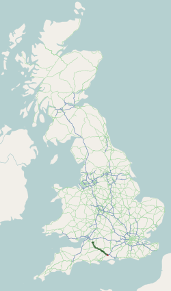
The A36 is a trunk road and primary route in southwest England that links the port city of Southampton to the city of Bath. At Bath, the A36 connects with the A4 to Bristol, thus providing a road link between the major ports of Southampton and Bristol. It also provides a link between Bristol and London via the A303. Route Originally, the A36 continued to Avonmouth, beyond Bristol, but this section was renumbered to the A4. Within Bath the A36 acts as a ring road on the southern side of the river, from the junction with the A4 at Newbridge to the west of the city. From here traffic can continue to Bristol on the A4 or to Wells and Weston-super-Mare via the A39 and A368 roads. Another link to the A4 on the eastern side at Cleveland Bridge, which provides a route to the M4 motorway via the A46, is highly congested. Plans for a direct link road connecting the A36 with the A46 have been under consideration for a number of years. The A36 leaves Bath in an easterly direc ... [...More Info...] [...Related Items...] OR: [Wikipedia] [Google] [Baidu] |
Salisbury (UK Parliament Constituency)
Salisbury is a constituency represented in the House of Commons of the UK Parliament since 2010 by John Glen of the Conservative Party. History From 1295 (the Model Parliament), a form of this constituency on a narrower area, the Parliamentary borough of Salisbury, returned two MPs to the House of Commons of England. Elections were held using the bloc vote system, which afforded the ability for wealthy males who owned property rated at more than £2 a year for Land Tax to vote in the county and borough elections (if they met the requirements of both systems). The franchise (right to vote) in the city was generally restricted to male tradespersons and professionals within the central wards. The borough constituency co-existed with the neighbouring minuscule- electorate seat of Old Sarum (described towards its Great Reform Act abolition as a rotten borough) which covered the mostly abandoned older settlement to the north-east. Under the Redistribution of Seats Act 1885, the ... [...More Info...] [...Related Items...] OR: [Wikipedia] [Google] [Baidu] |
Salisbury
Salisbury ( , ) is a city status in the United Kingdom, cathedral city and civil parish in Wiltshire, England with a population of 41,820, at the confluence of the rivers River Avon, Hampshire, Avon, River Nadder, Nadder and River Bourne, Wiltshire, Bourne. The city is approximately from Southampton and from Bath, Somerset, Bath. Salisbury is in the southeast of Wiltshire, near the edge of Salisbury Plain. An ancient cathedral was north of the present city at Old Sarum Cathedral, Old Sarum. A Salisbury Cathedral, new cathedral was built near the meeting of the rivers and a settlement grew up around it, which received a city charter in 1227 as . This continued to be its official name until 2009 structural changes to local government in England, 2009, when Salisbury City Council was established. Salisbury railway station is an interchange between the West of England line, West of England Line and the Wessex Main Line. Stonehenge, a UNESCO World Heritage Site, is northwest o ... [...More Info...] [...Related Items...] OR: [Wikipedia] [Google] [Baidu] |
Earl Of Radnor
Earl of Radnor, of the County of Radnor, is a title which has been created twice. It was first created in the Peerage of England in 1679 for John Robartes, 2nd Baron Robartes, a notable political figure of the reign of Charles II. The earldom was created for a second time in the Peerage of Great Britain in 1765 for William Bouverie, 2nd Viscount Folkestone. The Bouverie family descends from William des Bouverie, a prominent London merchant. He was created a baronet of St Catherine Cree Church, London, in the Baronetage of Great Britain in 1714. His eldest son, the second Baronet, represented Shaftesbury in the House of Commons. He was succeeded by his younger brother, the third Baronet. He sat as Member of Parliament for Salisbury until he was raised to the Peerage of Great Britain as Baron Longford and Viscount Folkestone in 1747. His son, the second Viscount, also represented Salisbury in Parliament. In 1765 he was made Baron Pleydell-Bouverie, of Coleshill in the C ... [...More Info...] [...Related Items...] OR: [Wikipedia] [Google] [Baidu] |
Pitton
Pitton is a village in Wiltshire, England, about east of Salisbury, just off the A30 London Road. History A Roman road (now a bridleway) forms the northern boundary of the parish and is a scheduled monument. Local government The civil parish of Pitton and Farley encompasses the villages of Pitton and Farley. The parish elects a parish council. It is in the area of Wiltshire Council unitary authority, which is responsible for all significant local government functions. Churches The Anglican Church of St Peter is Grade II* listed. It dates from the 12th century and was restored in 1878–80 by Ewan Christian. There is a window by C.E. Kempe. The church was a chapelry of Alderbury until 1874 when the parish of Farley with Pitton was established, with Farley church as the parish church. Today the parish is one of the ten covered by the Clarendon team ministry. A Wesleyan Methodist chapel was built in 1888 and extended with a schoolroom in 1934. From 2008 to 2011 the buil ... [...More Info...] [...Related Items...] OR: [Wikipedia] [Google] [Baidu] |
Samuel Sanders Teulon
Samuel Sanders Teulon (2 March 1812 – 2 May 1873) was an English Gothic Revival architect, noted for his use of polychrome brickwork and the complex planning of his buildings. Family Teulon was born in 1812 in Greenwich, Kent, the son of a cabinet-maker from a French Huguenot family. His younger brother William Milford Teulon (1823–1900) also became an architect. Career He was articled to George Legg, and later worked as an assistant to the Bermondsey-based architect George Porter. He also studied in the drawing schools of the Royal Academy. He set up his own independent practice in 1838, and in 1840 won the competition to design some almshouses for the Dyers' Company at Ball's Pond, Islington. After this his practice expanded rapidly. During the next few years his works mainly consisted of parish schools, parsonages and similar buildings, mostly in the Home Counties. He was a friend of George Gilbert Scott and became a member of the Council of the Royal Institute of B ... [...More Info...] [...Related Items...] OR: [Wikipedia] [Google] [Baidu] |
Clarendon Park, Wiltshire
Clarendon Park is a Grade I listed building, Estate (land), estate and Civil parishes in England, civil parish located a short distance east of the city of Salisbury in Wiltshire, England. According to the 2011 census the population of the parish was 246. The parish is almost entirely farmland, with parkland and gardens around the 18th-century house. In the southwest the parish extends to the Petersfinger area on the western outskirts of Salisbury, and the west bank of the River Avon (Hampshire), Salisbury Avon. The Clarendon Way recreational footpath passes through the parish. History Part or all of Clarendon Forest was once known as ''Penchet''. This name derives from Common Brittonic, from the words found today in modern Welsh as ("head, end, summit") and ("woodland"). Thus the name once meant "end of the wood". Clarendon Forest housed a royal Hunting and shooting in the United Kingdom#Hunting lodge, hunting lodge in the 12th century, which was expanded into a royal pal ... [...More Info...] [...Related Items...] OR: [Wikipedia] [Google] [Baidu] |
Pitton And Farley
Pitton is a village in Wiltshire, England, about east of Salisbury, just off the A30 London Road. History A Roman road (now a bridleway) forms the northern boundary of the parish and is a scheduled monument. Local government The civil parish of Pitton and Farley encompasses the villages of Pitton and Farley. The parish elects a parish council. It is in the area of Wiltshire Council unitary authority, which is responsible for all significant local government functions. Churches The Anglican Church of St Peter is Grade II* listed. It dates from the 12th century and was restored in 1878–80 by Ewan Christian. There is a window by C.E. Kempe. The church was a chapelry of Alderbury until 1874 when the parish of Farley with Pitton was established, with Farley church as the parish church. Today the parish is one of the ten covered by the Clarendon team ministry. A Wesleyan Methodist chapel was built in 1888 and extended with a schoolroom in 1934. From 2008 to 2011 the buil ... [...More Info...] [...Related Items...] OR: [Wikipedia] [Google] [Baidu] |
Farley, Wiltshire
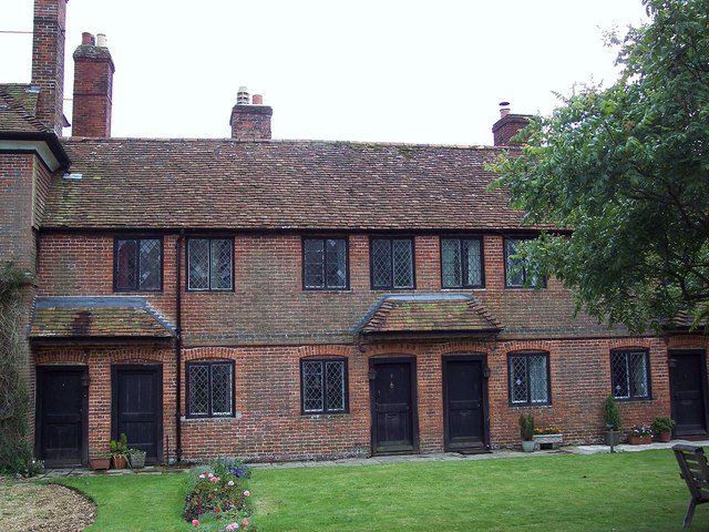
Farley is a village in southeast Wiltshire, England, about east of Salisbury. Geography Farley is one of the Dun Valley villages, together with East Grimstead, West Dean and Pitton. Streams which form the River Dun rise to the west and south of Farley, and the river flows east into Hampshire. Local government The civil parish of Pitton and Farley encompasses the villages of Pitton and Farley. The parish elects a parish council. It is in the area of Wiltshire Council unitary authority, which is responsible for all significant local government functions. Notable buildings A block of 12 dwellings for poor elderly persons, with accommodation for a warden and containing a schoolroom, was built for Sir Stephen Fox in 1681 by Alexander Fort. (Sir Stephen also founded the Royal Hospital Chelsea, London, which was designed and built by Christopher Wren; Fort was Wren's master mason.) The building, also known as Fox's Hospital, is Grade I listed. It continues to operate as ... [...More Info...] [...Related Items...] OR: [Wikipedia] [Google] [Baidu] |
Royal Observer Corps
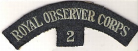
The Royal Observer Corps (ROC) was a civil defence organisation intended for the visual detection, identification, tracking and reporting of aircraft over Great Britain. It operated in the United Kingdom between 29 October 1925 and 31 December 1995, when the Corps' civilian volunteers were stood down (ROC headquarters staff at RAF Bentley Priory stood down on 31 March 1996). Composed mainly of civilian spare-time volunteers, ROC personnel wore a Royal Air Force (RAF) style Uniforms of the Royal Air Force, uniform and latterly came under the administrative control of RAF Strike Command and the operational control of the Home Office. Civilian volunteers were trained and administered by a small En cadre, cadre of professional full-time officers under the command of the Commandant Royal Observer Corps; latterly a serving RAF Air Commodore. Overview In 1925, following a List of committees of the United Kingdom Parliament, Defence Committee initiative undertaken the previous year, ... [...More Info...] [...Related Items...] OR: [Wikipedia] [Google] [Baidu] |
Wiltshire Council
Wiltshire Council, known between 1889 and 2009 as Wiltshire County Council, is the Local government in England, local authority for the non-metropolitan county of Wiltshire (district), Wiltshire in South West England, and has its headquarters at County Hall, Trowbridge, County Hall in Trowbridge. Since 2009 it has been a Unitary authorities of England, unitary authority, being a county council which also performs the functions of a non-metropolitan district, district council. The non-metropolitan county is smaller than the ceremonial county, the latter additionally including Borough of Swindon, Swindon. The council went under no overall control in May 2025, after being controlled by the Conservative Party (UK), Conservative Party since 2000. History Elected county councils were established in 1889 under the Local Government Act 1888, taking over administrative functions previously carried out by unelected magistrates at the quarter sessions.John Edwards, 'County' in ''Chambe ... [...More Info...] [...Related Items...] OR: [Wikipedia] [Google] [Baidu] |


