|
Al-Idrīsī
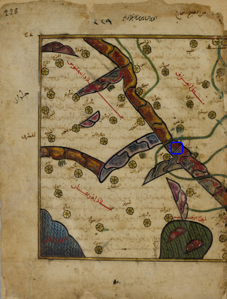
Abu Abdullah Muhammad al-Idrisi al-Qurtubi al-Hasani as-Sabti, or simply al-Idrisi (; ; 1100–1165), was an Arab Muslim geographer and cartographer who served in the court of King Roger II at Palermo, Sicily. Muhammad al-Idrisi was born in Ceuta, then belonging to the Almoravid dynasty. He created the , one of the most advanced medieval world maps. Early life Al-Idrisi hailed from the Hammudid dynasty of North Africa and Al-Andalus, which was descended from Muhammad through the powerful Idrisid dynasty. Al-Idrisi was believed to be born the city of Ceuta in 1100, at the time controlled by the Almoravids, where his great-grandfather had been forced to settle after the fall of Hammudid Málaga to the Zirids of Granada. He spent much of his early life travelling through North Africa and Al-Andalus (Muslim Spain and Portugal of the times) and seems to have acquired detailed information on both regions. He visited Anatolia when he was barely 16. He studied in the university in ... [...More Info...] [...Related Items...] OR: [Wikipedia] [Google] [Baidu] |
Almoravid Dynasty
The Almoravid dynasty () was a Berber Muslim dynasty centered in the territory of present-day Morocco. It established an empire that stretched over the western Maghreb and Al-Andalus, starting in the 1050s and lasting until its fall to the Almohads in 1147. The Almoravids emerged from a coalition of the Lamtuna, Gudala, and Massufa, nomadic Berber tribes living in what is now Mauritania and the Western Sahara, traversing the territory between the Draa, the Niger, and the Senegal rivers. During their expansion into the Maghreb, they founded the city of Marrakesh as a capital, . Shortly after this, the empire was divided into two branches: a northern one centered in the Maghreb, led by Yusuf ibn Tashfin and his descendants, and a southern one based in the Sahara, led by Abu Bakr ibn Umar and his descendants. The Almoravids expanded their control to al-Andalus (the Muslim territories in Iberia) and were crucial in temporarily halting the advance of the Christian kingdoms in ... [...More Info...] [...Related Items...] OR: [Wikipedia] [Google] [Baidu] |
Tabula Rogeriana
The (, lit. "The Excursion of One Eager to Penetrate the Distant Horizons"), commonly known in the West as the (lit. "''The Book of Roger''" in Latin), is an atlas commissioned by the Norman King Roger II in 1138 and completed by the Arab geographer Muhammad al-Idrisi in 1154. The atlas compiles 70 maps of the known world with associated descriptions and commentary of each specific location by Al-Idrisi.Houben, 2002, pp. 102–104.Ahmad, 1992, pp. 156–161. Creation of the Atlas Around 1138, the Norman King of Sicily, Roger II, invited Al-Idrisi, a Muslim geographer, to his court in Palermo, in search of help pursuing his political agenda. Sicily's vibrant multicultural environment led al-Idrisi to accept King Roger's invitation to his court. During the meeting, Al-Idrisi briefed Roger II on his familiarity and personal experiences traveling around North Africa and Western Europe, which prompted Roger II to commission an atlas from Al-Idrisi. To produce the work, Al-I ... [...More Info...] [...Related Items...] OR: [Wikipedia] [Google] [Baidu] |
Zirids
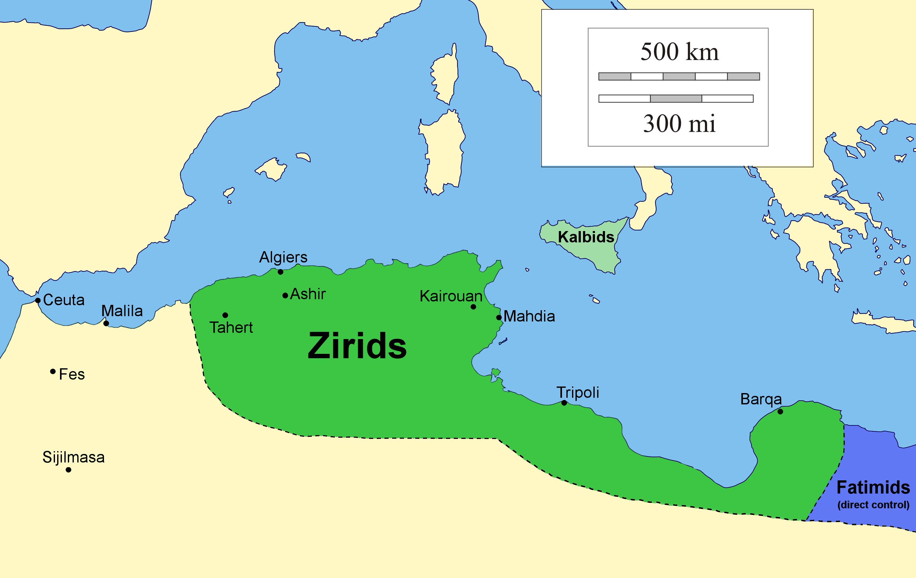
The Zirid dynasty (), Banu Ziri (), was a Sanhaja Berber dynasty from what is now Algeria which ruled the central Maghreb from 972 to 1014 and Ifriqiya (eastern Maghreb) from 972 to 1148. Descendants of Ziri ibn Manad, a military leader of the Fatimid Caliphate and the eponymous founder of the dynasty, the Zirids were emirs who ruled in the name of the Fatimids. The Zirids gradually established their autonomy in Ifriqiya through military conquest until officially breaking with the Fatimids in the mid-11th century. The rule of the Zirid emirs opened the way to a period in North African history where political power was held by Berber dynasties such as the Almoravid dynasty, Almohad Caliphate, Zayyanid dynasty, Marinid Sultanate and Hafsid dynasty. Under Buluggin ibn Ziri the Zirids extended their control westwards and briefly occupied Fez and much of present-day Morocco after 980, but encountered resistance from the local Zenata Berbers who gave their allegiance to the Calip ... [...More Info...] [...Related Items...] OR: [Wikipedia] [Google] [Baidu] |
Ceuta
Ceuta (, , ; ) is an Autonomous communities of Spain#Autonomous cities, autonomous city of Spain on the North African coast. Bordered by Morocco, it lies along the boundary between the Mediterranean Sea and the Atlantic Ocean. Ceuta is one of the special member state territories and the European Union, special member state territories of the European Union. It was a regular municipalities in Spain, municipality belonging to the province of Cádiz prior to the passing of its Statute of Autonomy in March 1995, as provided by the Spanish Constitution, henceforth becoming an autonomous city. Ceuta, like Melilla and the Canary Islands, was classified as a free port before Spain joined the European Union. Its population is predominantly Christian and Islam in Spain, Muslim, with a small minority of Sephardic Jews and Sindhi Hindus, from Pakistan. Spanish language, Spanish is the official language, while Moroccan Darija, Darija Arabic is also widely spoken. Names The name Abyla has be ... [...More Info...] [...Related Items...] OR: [Wikipedia] [Google] [Baidu] |
York
York is a cathedral city in North Yorkshire, England, with Roman Britain, Roman origins, sited at the confluence of the rivers River Ouse, Yorkshire, Ouse and River Foss, Foss. It has many historic buildings and other structures, such as a York Minster, minster, York Castle, castle and York city walls, city walls, all of which are Listed building, Grade I listed. It is the largest settlement and the administrative centre of the wider City of York district. It is located north-east of Leeds, south of Newcastle upon Tyne and north of London. York's built-up area had a recorded population of 141,685 at the 2021 United Kingdom census, 2021 census. The city was founded under the name of Eboracum in AD 71. It then became the capital of Britannia Inferior, a province of the Roman Empire, and was later the capital of the kingdoms of Deira, Northumbria and Jórvík, Scandinavian York. In the England in the Middle Ages, Middle Ages it became the Province of York, northern England ... [...More Info...] [...Related Items...] OR: [Wikipedia] [Google] [Baidu] |
Jórvík
Scandinavian York or Viking York () is a term used by historians for what is now Yorkshire during the period of Scandinavian domination from late 9th century until it was annexed and integrated into England after the Norman Conquest; in particular, it is used to refer to York, the city controlled by these kings and earls. The Kingdom of Jórvík was closely associated with the longer-lived Kingdom of Dublin throughout this period. History Pre-Viking age York was first recorded by Ptolemy around the year 150 as ''Eborakon''. Under the Romans it became the provincial capital and bishopric of ''Eburacum''. The Roman settlement was regularly planned, well defended and contained a stone legionary fortress. The Romans withdrew around 407 and the Anglo-Saxons occupied the settlement from the early 7th century. Post-Roman York was in the kingdom of Deira; it was taken over in 655 by its northern neighbour Bernicia to form the kingdom of Northumbria. The Anglo-Saxon king Edwin o ... [...More Info...] [...Related Items...] OR: [Wikipedia] [Google] [Baidu] |
Hungary
Hungary is a landlocked country in Central Europe. Spanning much of the Pannonian Basin, Carpathian Basin, it is bordered by Slovakia to the north, Ukraine to the northeast, Romania to the east and southeast, Serbia to the south, Croatia and Slovenia to the southwest, and Austria to the west. Hungary lies within the drainage basin of the Danube, Danube River and is dominated by great lowland plains. It has a population of 9.6 million, consisting mostly of ethnic Hungarians, Hungarians (Magyars) and a significant Romani people in Hungary, Romani minority. Hungarian language, Hungarian is the Languages of Hungary, official language, and among Languages of Europe, the few in Europe outside the Indo-European languages, Indo-European family. Budapest is the country's capital and List of cities and towns of Hungary, largest city, and the dominant cultural and economic centre. Prior to the foundation of the Hungarian state, various peoples settled in the territory of present-day Hun ... [...More Info...] [...Related Items...] OR: [Wikipedia] [Google] [Baidu] |
Pyrenees
The Pyrenees are a mountain range straddling the border of France and Spain. They extend nearly from their union with the Cantabrian Mountains to Cap de Creus on the Mediterranean coast, reaching a maximum elevation of at the peak of Aneto. For the most part, the main crest forms a divide between Spain and France, with the microstate of Andorra sandwiched in between. Historically, the Crown of Aragon and the Kingdom of Navarre extended on both sides of the mountain range. Etymology In Greek mythology, Pyrene is a princess who gave her name to the Pyrenees. The Greek historian Herodotus says Pyrene is the name of a town in Celtic Europe. According to Silius Italicus, she was the virgin daughter of Bebryx, a king in Mediterranean Gaul by whom the hero Hercules was given hospitality during his quest to steal the cattle of Geryon during his famous Labours. Hercules, characteristically drunk and lustful, violates the sacred code of hospitality and rapes his host's ... [...More Info...] [...Related Items...] OR: [Wikipedia] [Google] [Baidu] |
Portugal
Portugal, officially the Portuguese Republic, is a country on the Iberian Peninsula in Southwestern Europe. Featuring Cabo da Roca, the westernmost point in continental Europe, Portugal borders Spain to its north and east, with which it shares Portugal-Spain border, the longest uninterrupted border in the European Union; to the south and the west is the North Atlantic Ocean; and to the west and southwest lie the Macaronesia, Macaronesian archipelagos of the Azores and Madeira, which are the two Autonomous Regions of Portugal, autonomous regions of Portugal. Lisbon is the Capital city, capital and List of largest cities in Portugal, largest city, followed by Porto, which is the only other Metropolitan areas in Portugal, metropolitan area. The western Iberian Peninsula has been continuously inhabited since Prehistoric Iberia, prehistoric times, with the earliest signs of Human settlement, settlement dating to 5500 BC. Celts, Celtic and List of the Pre-Roman peoples of the Iberia ... [...More Info...] [...Related Items...] OR: [Wikipedia] [Google] [Baidu] |


