|
Akeman Street (Cambridgeshire)
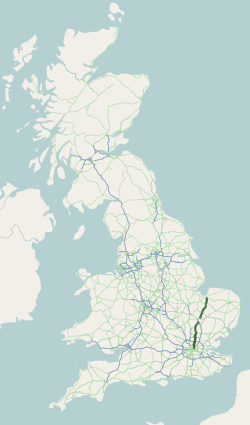
Akeman Street is the name given to a Roman road in eastern England that runs from Cambridgeshire to the north coast of Norfolk. It is approximately long and runs roughly north-northeast. Akeman Street joined Ermine Street near Wimpole Hall, then ran northeast to the settlement at Durolipons (now Cambridge), where it crossed a Roman road now known as the Via Devana. Within north Cambridge, the road followed the present-day Stretten Avenue, Carlton Way and Mere Way running northeast past Landbeach before joining the present A10 and on towards Ely and The Fens. It then reached Denver and the coast at Brancaster. The road was constructed on top of an earlier trackway some time in the 2nd Century AD, or later, and it has been speculated that it was part of the creation of an imperial estate under Hadrian. See also * Akeman Street * Roman roads in Britain Roman roads in Britannia were initially designed for military use, created by the Roman army during the nearly fou ... [...More Info...] [...Related Items...] OR: [Wikipedia] [Google] [Baidu] |
Ely, Cambridgeshire
Ely ( ) is a cathedral city and civil parish in the East Cambridgeshire district, in Cambridgeshire, England, northeast of Cambridge, southeast of Peterborough and from London. At the 2021 United Kingdom census, 2021 census, the built-up area had a population of 19,200. The parish which includes the villages of Chettisham, Prickwillow, Queen Adelaide, Cambridgeshire, Queen Adelaide and Stuntney and the hamlet of Mile End had a population of 20,574 in 2021. Ely is built on a Kimmeridge Clay island which, at , is the highest land in the Fens. It was due to this topography that Ely was not waterlogged like the surrounding Fenland, and an island separated from the mainland. Major rivers including the River Witham, Witham, River Welland, Welland, River Nene, Nene and River Great Ouse, Great Ouse feed into the Fens and, until draining commenced in the eighteenth century, formed freshwater marshes and Mere (lake), meres within which peat was laid down. Once the Fens were drained, ... [...More Info...] [...Related Items...] OR: [Wikipedia] [Google] [Baidu] |
Akeman Street
Akeman Street is a Roman road in southern England between the modern counties of Hertfordshire and Gloucestershire. It is approximately long and runs roughly east–west. Akeman Street linked Watling Street just north of Verulamium (near modern St Albans) with the Fosse Way at Corinium Dobunnorum (now Cirencester). Evidence suggests that the route may well have been an older track, metalled and reorganised by the Romans. Its course passes through towns and villages including Hemel Hempstead, Berkhamsted, Tring, Aylesbury, Alchester (outside modern Bicester), Stonesfield (where a large Roman villa was discovered around 1712), Chesterton, Kirtlington, Ramsden and Asthall. Parts of the A41 road between Berkhamsted and Bicester use the course of the former Roman road, as did the Sparrows Herne turnpike between Berkhamsted and Aylesbury. A minor road between Chesterton and Kirtlington also uses its course. Other parts are in use as public footpaths, including a stretch ... [...More Info...] [...Related Items...] OR: [Wikipedia] [Google] [Baidu] |
Hadrian
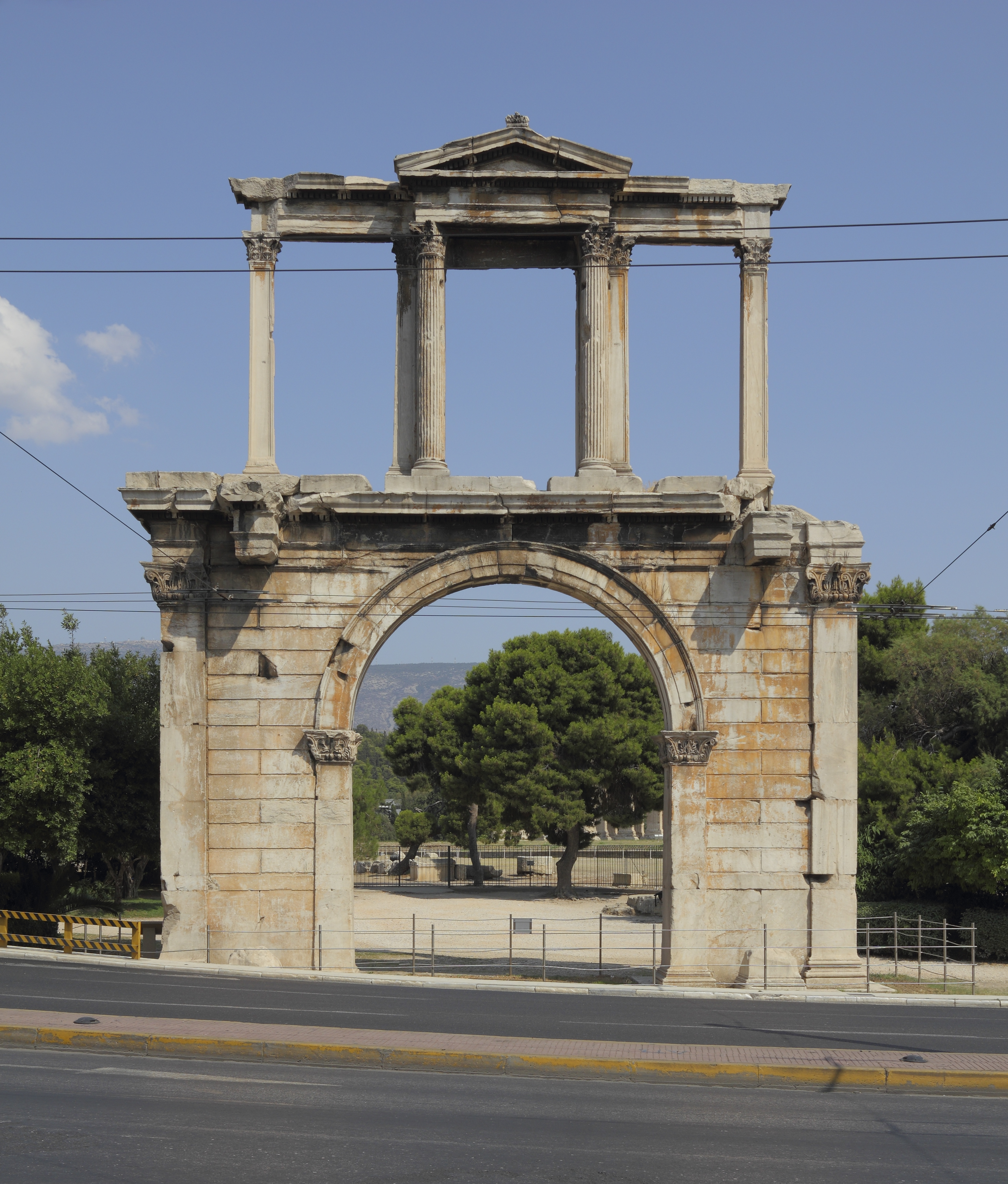
Hadrian ( ; ; 24 January 76 – 10 July 138) was Roman emperor from 117 to 138. Hadrian was born in Italica, close to modern Seville in Spain, an Italic peoples, Italic settlement in Hispania Baetica; his branch of the Aelia gens, Aelia ''gens'', the ''Aeli Hadriani'', came from the town of Atri, Abruzzo, Hadria in eastern Italy. He was a member of the Nerva–Antonine dynasty. Early in his political career, Hadrian married Vibia Sabina, grandniece of the ruling emperor, Trajan, and his second cousin once removed. The marriage and Hadrian's later succession as emperor were probably promoted by Trajan's wife Pompeia Plotina. Soon after his own succession, Hadrian had four leading senators unlawfully put to death, probably because they seemed to threaten the security of his reign; this earned him the senate's lifelong enmity. He earned further disapproval by abandoning Trajan's expansionist policies and territorial gains in Mesopotamia (Roman province), Mesopotamia, Assyria ( ... [...More Info...] [...Related Items...] OR: [Wikipedia] [Google] [Baidu] |
Imperial Estate (Roman)
An imperial estate (''patrimonium'' or ''res privata'') in the Roman Empire it was the "personal property of members of the imperial family, as distinct from property belonging to the Roman state" (''ager publicus''). On the Emperor's death, these properties passed to his successor, and not to his private heirs. Imperial estates were not only farming estates, or ''latifundia'', but also pastures (''saltus'') and mines (''metalla''). Management of imperial estates within a province was the responsibility of a procurator who, in turn, reported to the ''procurator patrimonii'' in Rome. The procurator leased the estate to a ''conductor'', a contractor, or administrator. On small estates, the conductor might farm the land himself. On larger tracts, the conductor sub-let the land to '' coloni'', tenant-farmers. Coloni were free men, and not bound to the land like later serfs. The coloni paid the conductor in shares of their crops, and were also obliged to perform other services a few ... [...More Info...] [...Related Items...] OR: [Wikipedia] [Google] [Baidu] |
2nd Century
The 2nd century is the period from AD 101 (represented by the Roman numerals CI) through AD 200 (CC) in accordance with the Julian calendar. It is considered part of the Classical era, epoch, or historical period. Early in the century, the Roman Empire attained its greatest expansion under the emperor Trajan, but after his death became primarily defensive for the rest of its history. Much prosperity took place throughout the empire at this time, ruled as it was by the "Nerva–Antonine dynasty#Five Good Emperors, Five Good Emperors", a succession of well-received and able rulers. This period also saw the removal of the Jews from Jerusalem during the reign of Hadrian after Bar Kokhba's revolt. The last quarter of the century saw the end of the period of peace and prosperity known as the Pax Romana at the death of the emperor Marcus Aurelius, last of the "Nerva–Antonine dynasty#Five Good Emperors, Five Good Emperors", and the ascension of Commodus. After Commodus was murdere ... [...More Info...] [...Related Items...] OR: [Wikipedia] [Google] [Baidu] |
Brancaster
Brancaster is a village and civil parish on the north coast of the English county Norfolk. The civil parish of Brancaster comprises Brancaster itself, together with Brancaster Staithe and Burnham Deepdale. The three villages form a more or less continuous settlement along the A149 at the edge of the Brancaster Manor marshland and the Scolt Head Island National Nature Reserve. The villages are located about west of Burnham Market, north of the town of King's Lynn and north-west of the city of Norwich. The civil parish has an area of and in the 2011 census had a population of 797 in 406 households. For the purposes of local government, the parish falls within the district of King's Lynn and West Norfolk. In 2016, Janet Lake, the clerk to Brancaster Parish Council, reached 50 years of service in the post. The village's name means "Roman site of Branodunum", where the original Romano-British name may be preserved in the first element. The name is from British bran(n)o, "c ... [...More Info...] [...Related Items...] OR: [Wikipedia] [Google] [Baidu] |
Denver, Norfolk
Denver is a village and civil parish in the English county of Norfolk. Denver is located south of Downham Market and west of Norwich. The village is located along the course of the River Great Ouse. History Denver's name is of Anglo-Saxon origin and derives from the Old English for a passage or crossing used by the Danes. Denver acted as the terminus for the Roman road the Fen Causeway, which began in Peterborough. In the Domesday Book, Denver is listed as a settlement of 43 households in the hundred of Clackclose. In 1086, the village was part of the estates of William de Warenne. Denver Sluice controls the water levels between the tidal and non-tidal Great Ouse. In 1651, the first sluice to help with the drainage of The Fens was built by the Dutch architect Cornelius Vermuyden. The sluice was rebuilt after bursting in 1713. John Rennie the Younger built a sluice and bridge in 1834. It was enlarged in 1923 and the flood gates have been replaced several times. Th ... [...More Info...] [...Related Items...] OR: [Wikipedia] [Google] [Baidu] |
The Fens
The Fens or Fenlands in eastern England are a naturally marshy region supporting a rich ecology and numerous species. Most of the fens were drained centuries ago, resulting in a flat, dry, low-lying agricultural region supported by a system of drainage channels and man-made rivers (Ditch, dykes and drains) and automated pumping stations. There have been unintended consequences to this reclamation, as the land level has continued to sink and the dykes have been built higher to protect it from flooding. ''Fen'' is the local term for an individual area of marshland or former marshland. It also designates the type of marsh typical of the area, which has pH, neutral or alkaline water and relatively large quantities of dissolved minerals, but few other plant nutrition, plant nutrients. The Fens are a National Character Area, based on their landscape, biodiversity, geodiversity and economic activity. The Fens lie inland of the Wash, and are an area of nearly in the south east of L ... [...More Info...] [...Related Items...] OR: [Wikipedia] [Google] [Baidu] |
A10 Road (Great Britain)
The A10 is a major road in England which runs between The City of London and King's Lynn in Norfolk. At its southern terminus, the route meets the A3 directly north of London Bridge, above Monument London Underground station. At its northern end, the A10 meets the A47 and A149 roads south-west of King's Lynn town centre. The route passes through or around primary destinations in Greater London, Hertfordshire, Cambridgeshire and Norfolk, including Dalston, Enfield, Hertford, Cambridge, Ely and Downham Market. The route between Bishopsgate in the City of London and Royston, Hertfordshire, roughly follows the path of Ermine Street, a Roman road. Route City of London At its southern end, the A10 begins at a junction with the A3, on the northern bank of the River Thames. The A3 runs southbound over London Bridge towards Elephant and Castle, before continuing to Clapham, Kingston upon Thames, Guildford and Portsmouth. At the junction the A10 also meets Cannon Street (t ... [...More Info...] [...Related Items...] OR: [Wikipedia] [Google] [Baidu] |
Roman Roads In Britannia
Roman roads in Roman Britain, Britannia were initially designed for military use, created by the Roman army during the nearly four centuries (AD 43–410) that Britannia was a Roman Province, province of the Roman Empire. It is estimated that about of paved trunk roads (surfaced roads running between two towns or cities) were constructed and maintained throughout the province. Most of the known network was complete by 180. The primary function of the network was to allow rapid movement of troops and military supplies, but it subsequently provided vital infrastructure for commerce, trade and the transportation of goods. A considerable number of Roman roads remained in daily use as core trunk roads for centuries after the end of Roman rule in Britain in 410. Some routes are now part of the Great Britain road numbering scheme, UK's national road network. Others have been lost or are of archeological and historical interest only. After the Romans departed, systematic const ... [...More Info...] [...Related Items...] OR: [Wikipedia] [Google] [Baidu] |
Landbeach
Landbeach is a small fen-edge English village about three miles (5 km) north of Cambridge. The parish covers an area of . History The fen edge north of Cambridge was well populated in Roman times, and the village's situation on a Roman road will have helped its growth. The road, Akeman Street, which once joined Ely to London, passes close to the village from north to south. Car Dyke, the Roman drainage canal known locally as the Tilling, also runs through the village and in medieval times marked the boundary between the marshes of Landbeach and neighbouring Waterbeach. Drainage of the parish was not completed until the 18th century, and for much of the year large areas of the parish were inundated. The village was listed as ''Utbech'' ("out bec") in the Domesday Book of 1086, and in the 13th and 14th centuries was occasionally referred to as ''Inbech'' ("in bec"). The original meaning of the "beach" part of the names is not universally agreed. One theory invokes the Anglo ... [...More Info...] [...Related Items...] OR: [Wikipedia] [Google] [Baidu] |


