|
Ajodhan
Pakpattan (Punjabi and ), often referred to as Pākpattan Sharīf (; ''"Noble Pakpattan"''), is an ancient, historic city in the Pakistani province of Punjab, serving as the headquarters of the eponymous Pakpattan district. It is among the oldest cities in Asia and ranks as the 48th largest city in Pakistan by population, according to the 2017 census. Pakpattan is the seat of the Sufi ''Chisti'' order in Pakistan, and a major pilgrimage destination on account of the Shrine of Baba Farid, a renowned Punjabi poet and Sufi saint. The annual ''urs'' fair in his honour draws an estimated 2 million visitors to the town. Over its long history, Pakpattan has endured numerous attacks, followed by cycles of destruction and reconstruction, reflecting its resilience and historical significance. Etymology Pakpattan was originally known as Ajodhan (Hindi: अजोधन) until the 16th century. ''Ajodhan'' may be a Sanskrit term that can be interpreted as "eternal wealth" or "eternal pro ... [...More Info...] [...Related Items...] OR: [Wikipedia] [Google] [Baidu] |
Shrine Of Baba Farid
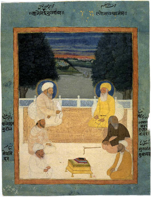
The Shrine of Baba Farid (; ) is a 13th-century Sufi shrine located in Pakpattan, Punjab, Pakistan dedicated to the Punjabi Sufi mystic and poet Baba Farid. The shrine is one of the most important in Pakistan, and was among the first Islamic holy sites in South Asia – providing the region's Muslims a local focus for devotion. The shrine is also revered by Sikhs, who include Baba Farid's poetry into the Guru Granth Sahib – regarded by Sikhs to be the eternal Guru. The shrine played a central role in the conversion of locals to Islam over the course of several centuries. Chiefs of the highly revered shrine once controlled a politically autonomous state that was defended by soldiers drawn from local clans that pledged loyalty to the shrine and descendants of Baba Farid. Today the shrine is considered to be the most significant in Punjab, and attracts up to two million visitors to its annual ''urs'' festival. Location The shrine is located in the town of Pakpattan, in the Paki ... [...More Info...] [...Related Items...] OR: [Wikipedia] [Google] [Baidu] |
Sufism
Sufism ( or ) is a mysticism, mystic body of religious practice found within Islam which is characterized by a focus on Islamic Tazkiyah, purification, spirituality, ritualism, and Asceticism#Islam, asceticism. Practitioners of Sufism are referred to as "Sufis" (from , ), and historically typically belonged to "orders" known as (pl. ) — congregations formed around a grand (saint) who would be the last in a Silsilah, chain of successive teachers linking back to Muhammad, with the goal of undergoing (self purification) and the hope of reaching the Maqam (Sufism), spiritual station of . The ultimate aim of Sufis is to seek the pleasure of God by endeavoring to return to their original state of purity and natural disposition, known as . Sufism emerged early on in Islamic history, partly as a reaction against the expansion of the early Umayyad Caliphate (661–750) and mainly under the tutelage of Hasan al-Basri. Although Sufis were opposed to dry legalism, they strictly obs ... [...More Info...] [...Related Items...] OR: [Wikipedia] [Google] [Baidu] |
Sapta Sindhu
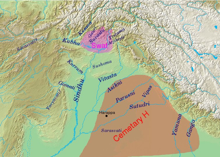
The Rigveda refers to a number of rivers located in the northwestern Indian subcontinent, from Gandhara to Kurukshetra. Rigvedic geography Identification of Rigvedic hydronyms has engaged multiple historians; it is the single most important way of establishing the geography and chronology of the early Vedic period. Rivers with certain identifications stretch from eastern Afghanistan to the western Gangetic plain, clustering in the Punjab. The Rigveda mentions the ''sapta-sindhavaḥ'' (, seven rivers), along with other rivers: ''Sapta-sindhavaḥ'' is cognate with Avestan ''hapta həndu'', and is interpreted as referring to Punjab. The region's name comes from پنج, ''panj'', 'five' and آب, ''āb'', 'water' thus " five waters", a Persian calque of the Indo-Aryan ''Pancha-nada'' meaning "five rivers". The same names were often imposed on different rivers as the Vedic culture migrated eastward from around Afghanistan (where they stayed for a considerable time) to the subco ... [...More Info...] [...Related Items...] OR: [Wikipedia] [Google] [Baidu] |
Vedas
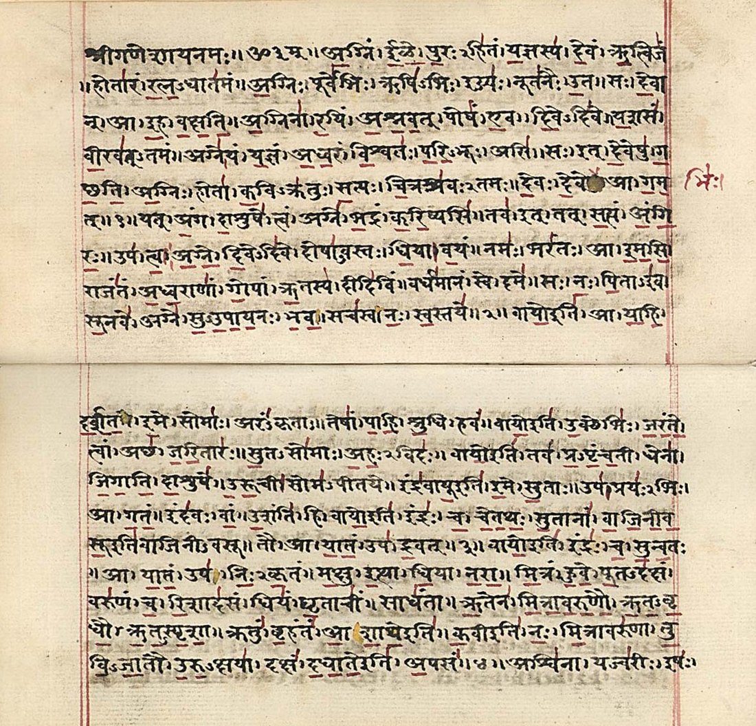
FIle:Atharva-Veda samhita page 471 illustration.png, upright=1.2, The Vedas are ancient Sanskrit texts of Hinduism. Above: A page from the ''Atharvaveda''. The Vedas ( or ; ), sometimes collectively called the Veda, are a large body of religious texts originating in ancient India. Composed in Vedic Sanskrit, the texts constitute the oldest layer of Sanskrit literature and the oldest Hindu texts, scriptures of Hinduism. There are four Vedas: the Rigveda, the Yajurveda, the Samaveda and the Atharvaveda. Each Veda has four subdivisions – the Samhitas (mantras and benedictions), the Brahmanas (commentaries on and explanation of rituals, ceremonies and sacrifices – Yajñas), the Aranyakas (text on rituals, ceremonies, sacrifices and symbolic-sacrifices), and the Upanishads (texts discussing meditation, philosophy and spiritual knowledge).Gavin Flood (1996), ''An Introduction to Hinduism'', Cambridge University Press, , pp. 35–39A Bhattacharya (2006), ''Hindu Dharma: Introduc ... [...More Info...] [...Related Items...] OR: [Wikipedia] [Google] [Baidu] |
Harappa
Harappa () is an archaeological site in Punjab, Pakistan, about west of Sahiwal, that takes its name from a modern village near the former course of the Ravi River, which now runs to the north. Harappa is the type site of the Bronze Age Indus Valley Civilisation ("IVC"), as it was the first IVC site to be excavated by the Archaeological Survey of India during the British Raj, although its significance did not become manifest until the discovery of Mohenjo-daro some years later. For this reason, IVC is sometimes called the "Harappan civilisation," a term more commonly used by the Archaeological Survey of India after decolonization in 1947. The discovery of Harappa and, soon afterwards, Mohenjo-Daro, two major urban settlements of IVC, was the culmination of work that had begun after the founding of the Archaeological Survey of India in 1861. The city of Harappa is believed to have had as many as 23,500 residents and occupied about with clay brick houses at its greatest extent ... [...More Info...] [...Related Items...] OR: [Wikipedia] [Google] [Baidu] |
Indus Valley Civilisation
The Indus Valley Civilisation (IVC), also known as the Indus Civilisation, was a Bronze Age civilisation in the Northwestern South Asia, northwestern regions of South Asia, lasting from 3300 Common Era, BCE to 1300 BCE, and in its mature form from 2600 BCE to 1900 BCE. Together with ancient Egypt and Mesopotamia, it was one of three early civilisations of the Near East and South Asia, and of the three, the most widespread, its sites spanning an area including much of Pakistan, Northwest India, northwestern India and northeast Afghanistan. The civilisation flourished both in the alluvial plain of the Indus River, which flows through the length of Pakistan, and along a system of perennial monsoon-fed rivers that once coursed in the vicinity of the Ghaggar-Hakra River, Ghaggar-Hakra, a seasonal river in northwest India and eastern Pakistan. The term ''Harappan'' is sometimes applied to the Indus Civilisation after its type site Harappa, the first to be exc ... [...More Info...] [...Related Items...] OR: [Wikipedia] [Google] [Baidu] |
Vehari District
Vehari District ( ) is a Districts of Pakistan, district in the Punjab (Pakistan), Punjab province of Pakistan. The city of Vehari is the capital of district while Burewala is the largest city and Jallah Jeem is the third largest city of the district. Administrative divisions The district of Vehari is administratively subdivided into following tehsils: History The district was created on 1 July 1976 out of the four tehsils of Multan District (Vehari, Burewala, Jallah Jeem and Mailsi). The name Vehari means low-lying settlement by a flood water channel. The district lies along the right bank of the river Sutlej, which forms its southern boundary. Demographics As of the 2023 Pakistani census, 2023 census, Vehari district has 543,036 households and a population of 3,430,421. The district has a sex ratio of 102.33 males to 100 females and a literacy rate of 59.10%: 66.43% for males and 51.57% for females. 940,756 (27.44% of the surveyed population) are under 10 years of age. 7 ... [...More Info...] [...Related Items...] OR: [Wikipedia] [Google] [Baidu] |
Bahawalnagar District
Bahawalnagar District (Urdu and ), is a Districts of Pakistan, district of Punjab (Pakistan), Punjab province in Pakistan. Before the independence of Pakistan, Bahawalnagar was part of Bahawalpur (princely state), Bahawalpur state governed by the Nawab of Bahawalpur. The city of Bahawalnagar is the capital of the district. District boundaries The boundaries of Bahawalnagar in the east and south touches the Indian territory of Bikaner and Firozpur districts while Bahawalpur district lies on its west and river Sutlej flows on its northern side. District Bahawalnagar spreads over an area of 8878 square kilometers. History Nawab Bahawal Khan-1 as second nawab of Bahawalpur ascended the throne in 1746 A.D. Muhammad Mubarik, after ruling successfully for years, died issueless in 1772 A.D. He was succeeded by his nephew Sahibzada Jafar Khan alias Nawab Muhammad Bahawal Khan-II in 1772. Administration The district of Bahawalnagar is spread over an area of 8,878 square kilometres (3 ... [...More Info...] [...Related Items...] OR: [Wikipedia] [Google] [Baidu] |
Okara District
Okara District ( Punjabi and ), is a district of Punjab, Pakistan. It became a separate district in 1982, prior to that it was part of Sahiwal District.History of Okara District on Cantonment Board Okara website Government of Pakistan website, Retrieved 12 April 2021 History After the decline of the , the invaded and occupied Sahiwal. The Muslims faced restrictions during the Sikh rule. During the period of |
Sahiwal District
Sahiwal District (Punjabi language, Punjabi and ), formerly known as Montgomery District, is a Districts of Pakistan, district in the Punjab (Pakistan), Punjab Subdivisions of Pakistan, province of Pakistan. In 1998, it had a population of 1,843,194 people, 16.27% of which were in urban areas. Since 2008, Sahiwal District, Okara District, and Pakpattan District have comprised the Sahiwal Division. The city of Sahiwal is the capital of the district and the division. History The Sahiwal District has been settled from the prehistoric, pre-historical era. Harappa is an archaeological site, about west of Sahiwal, that was built approximately 2600 BCE. The area was part of South Asian empires and in crossroads of migrations and invasions from Central Asia. Sahiwal District was an agricultural region with forests during the Indus Valley civilization. The Vedic period is characterized by Indo-Aryan peoples, Indo-Aryan culture which split from Indo-Iranian languages, Indo-Iranian ... [...More Info...] [...Related Items...] OR: [Wikipedia] [Google] [Baidu] |
Google Maps
Google Maps is a web mapping platform and consumer application offered by Google. It offers satellite imagery, aerial photography, street maps, 360° interactive panorama, interactive panoramic views of streets (Google Street View, Street View), real-time traffic conditions, and route planner, route planning for traveling by foot, car, bike, air (in Software release life cycle#Beta, beta) and public transportation. , Google Maps was being used by over one billion people every month around the world. Google Maps began as a C++ desktop program developed by brothers Lars Rasmussen (software developer), Lars and Jens Eilstrup Rasmussen, Jens Rasmussen, Stephen Ma and Noel Gordon in Australia at Where 2 Technologies. In October 2004, the company was acquired by Google, which converted it into a web application. After additional acquisitions of a geospatial data visualization company and a real-time traffic analyzer, Google Maps was launched in February 2005. The service's Front and ... [...More Info...] [...Related Items...] OR: [Wikipedia] [Google] [Baidu] |


