|
Aichi Prefectural Assembly
The is the legislative assembly of Aichi Prefecture. Its 103 members are elected in 57 districts by single non-transferable vote (SNTV) to four-year terms. The assembly is responsible for enacting and amending prefectural ordinances, voting on important administrative appointments made by the governor including the vice-governors and approving the budget – Aichi has been in recent years the only prefecture besides Tokyo with a "fiscal strength index" (''zaiseiryoku shisū'') above 1, i.e. it is able to cover its calculated expenses with its own revenues. Current composition The last elections were held in the unified local elections in April 2011: the Liberal Democratic Party remained strongest party with 49 seats but fell short of a majority without independents, former Democrat and Nagoya City mayor Takashi Kawamura's Genzei Nippon ("Tax cuts Japan") and former Liberal Democrat and Aichi governor Hideaki Ōmura's ''Nippon-ichi Aichi no Kai'' ("Aichi First in Japan Ass ... [...More Info...] [...Related Items...] OR: [Wikipedia] [Google] [Baidu] |
Single Non-transferable Vote
Single non-transferable vote or SNTV is a multi-winner electoral system in which each voter casts a single vote. Being a semi-proportional variant of first-past-the-post voting, under SNTV small parties, as well as large parties, have a chance to be represented. Under SNTV, a single party seldom will take all seats in a city or district, as generally happens with winner-take-all systems. Under certain conditions, such as perfect tactical voting, SNTV is equivalent to proportional representation by the D'Hondt method. SNTV is a combination of multi-member districts and each voter casting just one vote. SNTV can be considered a variant of dot voting where each voter has only one point to assign. It can also be seen as a variant of limited voting where each elector has one vote, or as a simple version of Single Transferable Voting where votes are not transferred. Unlike block voting or limited voting, where voters can cast multiple votes, under SNTV each voter casts just on ... [...More Info...] [...Related Items...] OR: [Wikipedia] [Google] [Baidu] |
District Magnitude
An electoral (congressional, legislative, etc.) district, sometimes called a constituency, riding, or ward, is a geographical portion of a political unit, such as a country, state or province, city, or administrative region, created to provide the voters therein with representation in a legislature or other polity. That legislative body, the state's constitution, or a body established for that purpose determines each district's boundaries and whether each will be represented by a single member or multiple members. Generally, only voters (''constituents'') who reside within the district are permitted to vote in an election held there. The district representative or representatives may be elected by single-winner first-past-the-post system, a multi-winner proportional representative system, or another voting method. The district members may be selected by a direct election under wide adult enfranchisement, an indirect election, or direct election using another form of s ... [...More Info...] [...Related Items...] OR: [Wikipedia] [Google] [Baidu] |
Minami-ku, Nagoya
is one of the 16 wards of the city of Nagoya in Aichi Prefecture, Japan. As of 1 October 2019, the ward had an estimated population of 136,015 and a population density of 7,368 persons per km2. The total area was 18.46 km2. Minami-ku Ward Office Geography Minami Ward is the southern portion of the city of Nagoya, in the coastal flatlands near the shore of Ise Bay. Due to land reclamation and the expansion of Minato Ward, Minami Ward no longer has a coastline. Surrounding municipalities * Atsuta Ward * Tenpaku Ward * Mizuho Ward * Midori Ward * Minato Ward * Tōkai History All of what is now Minami Ward was part of the domains of the Owari Domain during the Edo period (except for two villages which belonged to Imao Domain of Mino Province). After the Meiji Restoration, the area was transferred to the new Nagoya Prefecture, which later became part of Aichi Prefecture. A “Minami Ward” was one of the original wards, with the division of the city of Nagoya into wards o ... [...More Info...] [...Related Items...] OR: [Wikipedia] [Google] [Baidu] |
Minato-ku, Nagoya
is one of the 16 wards of the city of Nagoya in Aichi Prefecture, Japan. As of 1 October 2019, the ward had an estimated population of 143,913 and a population density of 3,153 persons per km². The total area was 45.64 km². It is geographically the largest of the wards of Nagoya in terms of land area. Minato-ku Ward Office Geography Minato Ward is the southern portion of the city of Nagoya, in the coastal flatlands and river estuaries along the shore of Ise Bay. Due to land reclamation much of the coastline is no longer natural. Surrounding municipalities * Atsuta Ward * Nakagawa Ward * Minami Ward * Tōkai * Kanie * Tobishima History All of what is now Minato Ward was part of the holdings of Owari Domain during the Edo period. After the Meiji Restoration, the area was transferred to the new Nagoya Prefecture, which later became part of Aichi Prefecture is a Prefectures of Japan, prefecture of Japan located in the Chūbu region of Honshū. Aichi Prefecture has a ... [...More Info...] [...Related Items...] OR: [Wikipedia] [Google] [Baidu] |
Nakagawa-ku, Nagoya
is one of the 16 wards of the city of Nagoya in Aichi Prefecture, Japan Japan is an island country in East Asia. Located in the Pacific Ocean off the northeast coast of the Asia, Asian mainland, it is bordered on the west by the Sea of Japan and extends from the Sea of Okhotsk in the north to the East China Sea .... As of 1 October 2019, the ward has an estimated population of 220,782 and a population density of 6,895 persons per km2. The total area is 32.02 km2. References Wards of Nagoya {{Aichi-geo-stub ... [...More Info...] [...Related Items...] OR: [Wikipedia] [Google] [Baidu] |
Atsuta-ku, Nagoya
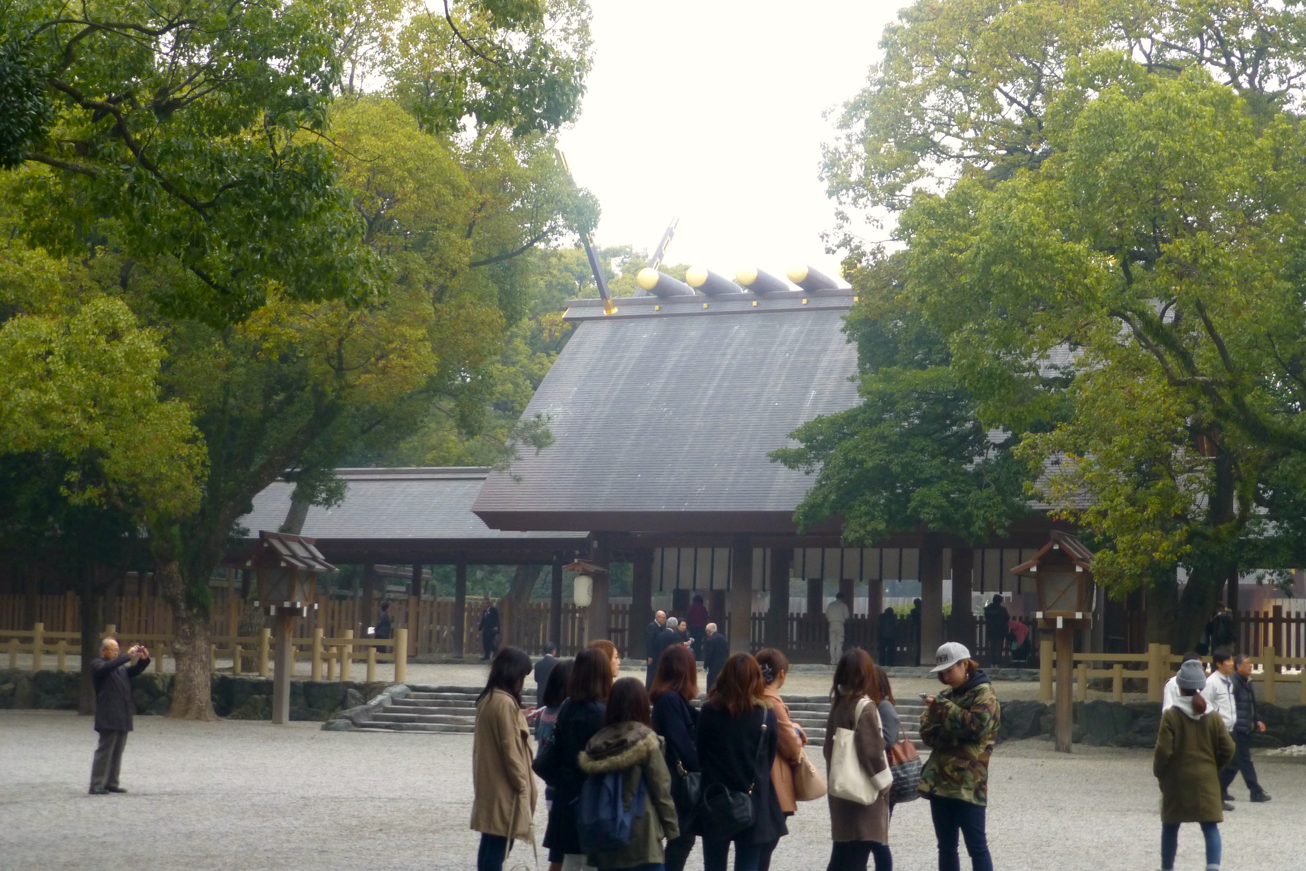
is one of the 16 Wards of Japan, wards of the city of Nagoya in Aichi Prefecture, Japan. As of 1 October 2019, the ward had an estimated population of 66,318 and a population density of 8,088 persons per km2. The total area was 8.20 km2. Geography Atsuta Ward is located near the geographic center of Nagoya city. Surrounding municipalities *Showa-ku, Nagoya, Showa Ward *Naka-ku, Nagoya, Naka Ward *Nakagawa-ku, Nagoya, Nakagawa Ward *Mizuho-ku, Nagoya, Mizuho Ward *Minato-ku, Nagoya, Minato Ward *Minami-ku, Nagoya, Minami Ward History The area of present-day Atsuta Ward was known since ancient times for its association with Atsuta Shrine. Atsuta Town in Aichi District, Aichi, Aichi District was incorporated with the establishment of the municipality system in the early Meiji period. It was annexed to the city of Nagoya, initially as part of Minami-ku, Nagoya, Minami Ward, and became Atsuta Ward in 1937. Economy Atsuta Ward is a major commercial center due to its proximity ... [...More Info...] [...Related Items...] OR: [Wikipedia] [Google] [Baidu] |
Mizuho-ku, Nagoya
is one of the 16 Wards of Japan, wards of the city of Nagoya in Aichi Prefecture, Japan. As of 1 October 2019, the ward had an estimated population of 107,622 and a population density of 9,592 persons per km². The total area was 11.22 km². Geography Mizuho Ward is located near the geographic center of Nagoya city. Surrounding municipalities *Showa-ku, Nagoya, Showa Ward *Atsuta-ku, Nagoya, Atsuta Ward *Tenpaku-ku, Nagoya, Tenpaku Ward *Minami-ku, Nagoya, Minami Ward History Mizuho District was established on February 11, 1944 from the eastern portion of Atsuka-ku. Education *Nagoya City University *Nagoya Women's University *Aichi Mizuho College Transportation Railroads *Meitetsu - Nagoya Main Line ** *Nagoya Municipal Subway - Sakura-dōri Line ** - - - *Nagoya Municipal Subway - Meijō Line ** - - Highways *Route 3 (Nagoya Expressway) *Japan National Route 1, National Route 1 Local attractions *Nagoya City Museum *Mizuho Kofun Group *Mizuho rugby stadi ... [...More Info...] [...Related Items...] OR: [Wikipedia] [Google] [Baidu] |
Naka-ku, Nagoya
is one of the 16 Wards of Japan, wards of the city of Nagoya in Aichi Prefecture, Japan. As of 1 October 2019, the ward has an estimated population of 90,918 and a population density of 9,693 persons per km2. The total area is 9.38 km2. Geography Naka Ward is located in the center of Nagoya city. Largely hemmed in by Sakura-dōri (桜通り), Ōtsu-dōri (大津通り), Fushimi-dōri (伏見通り) and Tsurumai-dōri (鶴舞通り), it contains the main shopping area of Sakae, Nagoya, Sakae which includes a massive air-conditioned 5 square-kilometer underground shopping mall, mall and the 'after-five' semi-red light districts of Nishiki and Shin-sakae. Surrounding municipalities *Chikusa-ku, Nagoya, Chikusa Ward *Kita-ku, Nagoya, Kita Ward *Higashi-ku, Nagoya, Higashi Ward *Nishi-ku, Nagoya, Nishi Ward *Nakamura-ku, Nagoya, Nakamura Ward *Shōwa-ku, Nagoya, Shōwa Ward *Atsuta-ku, Nagoya, Atsuta Ward *Nakagawa-ku, Nagoya, Nakagawa Ward History Naka Ward was one of the ori ... [...More Info...] [...Related Items...] OR: [Wikipedia] [Google] [Baidu] |
Nakamura-ku, Nagoya
is one of the 16 Wards of Japan, wards of Nagoya, Japan. As of October 1, 2019, the ward has an estimated population of 135,134 and a population density of 8,290 persons per km2. The total area is 16.30 km2. History Nakamura Ward is famous as the birthplace of Toyotomi Hideyoshi. One of the merchant areas is called Funairi-chō, Nagoya, Funairi-chō, which is close to the Hori River (Nagoya), Hori Canal. The area was heavily damaged during the bombing of Nagoya in World War II. One of the houses that was saved from there is the Tōmatsu House. The modern ward was officially established on . Places JR Nagoya Station, Meitetsu Nagoya Station and Kintetsu Nagoya Station are all located next to each other in the ward's Meieki district. Adjoining these train stations are several department stores, including Matsuzakaya, the Meitetsu Department Store and Kintetsu Pass'e. To the west of the station is Nagoya's only Islamic house of worship, the Nagoya Mosque, which was establ ... [...More Info...] [...Related Items...] OR: [Wikipedia] [Google] [Baidu] |
Nishi-ku, Nagoya
is one of the 16 wards in the city of Nagoya in Aichi Prefecture, Japan. As of 1 October 2019, the ward has an estimated population of 150,480 and a population density of 8,393 persons per km2. The total area is 17.93 km2. Geography The ward is located in the northwestern part of the city. The Shōnai River runs through the ward, as do the Hori River and Shin River. History The ward was established in 1908. Nishi-Ward is the birthplace of pachinko is a mechanical game originating in Japan that is used as an arcade game, and much more frequently for gambling. Pachinko fills a niche in Gambling in Japan, Japanese gambling comparable to that of the slot machine in the West as a form of l .... Companies The food companies Marukawa, " Marukawa. Retrieved on 15 June 2014. "No.9-9, Shinmichi 1-Chome, Nishi-Ku, Nagoya 451-8571" [...More Info...] [...Related Items...] OR: [Wikipedia] [Google] [Baidu] |
Kita-ku, Nagoya
is one of the 16 Wards of Japan, wards of the city of Nagoya in Aichi Prefecture, Japan. As of 1 October 2019, the ward had an estimated population of 163,555 and a population density of 9,330 persons per km2. The total area was 17.53 km2. Geography Kita Ward is the north of the center of the city of Nagoya. Surrounding municipalities *Nishi-ku, Nagoya, Nishi Ward *Moriyama-ku, Nagoya, Moriyama Ward *Naka-ku, Nagoya, Naka Ward *Higashi-ku, Nagoya, Higashi Ward *Kasugai, Aichi, Kasugai *Kitanagoya, Aichi, Kitanagoya *Toyoyama, Aichi, Toyoyama History Kita Ward was founded in 1944. Its area was expanded in 1946 with an addition from Higashi-ku, Nagoya, Higashi-ku and again in 1951 with an addition from Naka-ku, Nagoya, Naka-ku. In 1955, the village of Kusunoki, formerly part of Nishikasugai District, Aichi, Nishikasugai District was annexed by Nagoya city, and joined to Kita Ward. File:Kitashimizu Shinsuihiroba 20121220.JPG, Hori River (Nagoya), Hori River Economy Kita War ... [...More Info...] [...Related Items...] OR: [Wikipedia] [Google] [Baidu] |


