|
Agigawa Dam
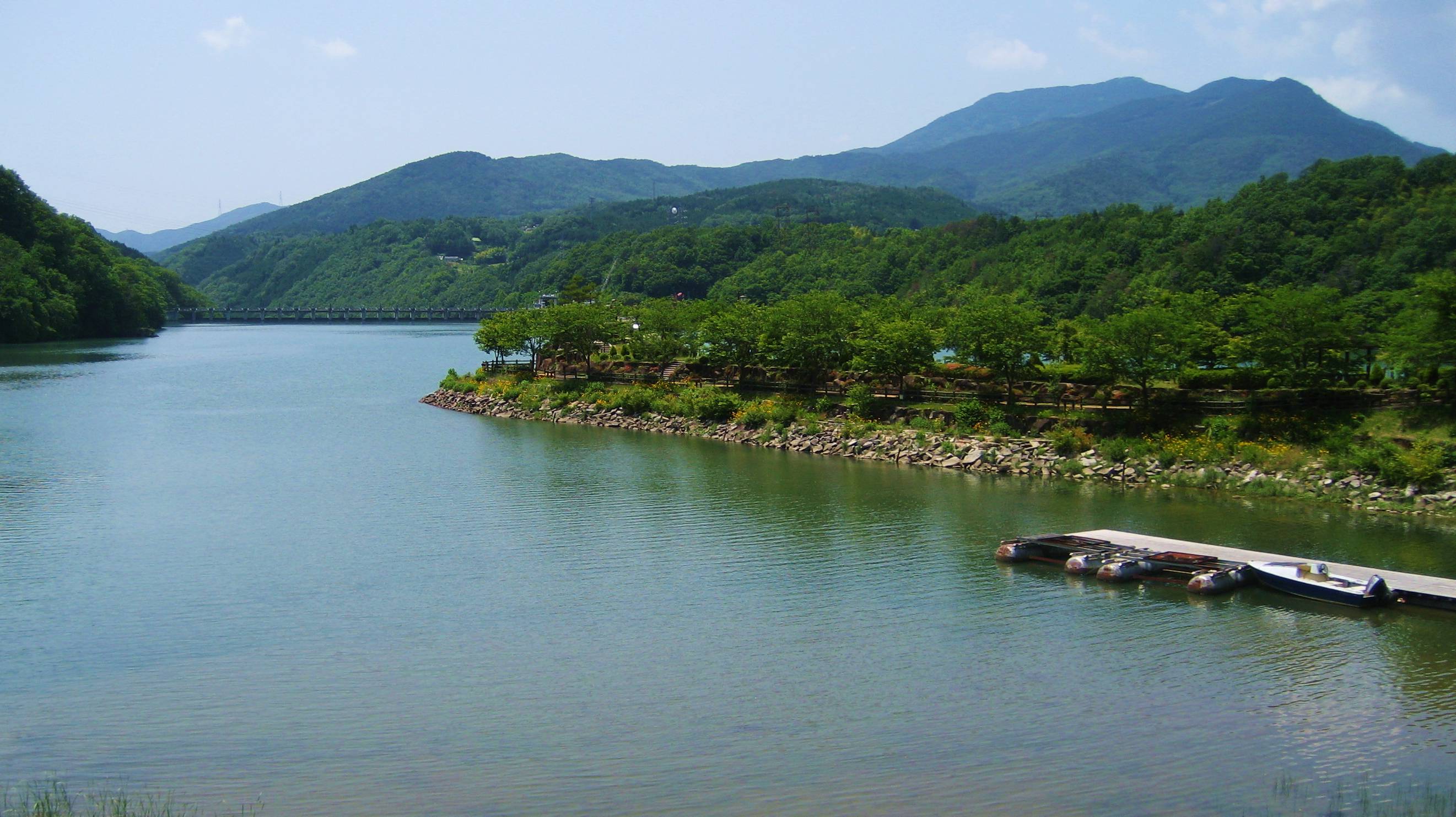
is a dam built on the Kiso River system, located in the Higashino section of Ena City, in Gifu Prefecture, Japan. History The Agi River connects with the Kiso River just below Ōi Dam, running through a basin with a fairly large 2,000 mm of annual rainfall, and has long been used by Gifu Prefecture's Tōnō region (which includes the cities of Ena, Gifu, Ena and Nakutsugawa) for tap water and industrial-use water. However, in times of heavy rainfall, Agigawa River would quickly overflow, flooding the surrounding area. The river flows through Ena City, making levee construction difficult; the Chūō Expressway and the Central Japan Railway Company's Chūō Main Line also cross the river, which led to increased demand for safe flood control measures. Demand for tap water for Nagoya and the Chūkyō Metropolitan Area's postwar population boom, as well as industrial-use water for the Tōkai and Chūkyō Industrial Areas also rose. Attempts to meet water demand for Aich ... [...More Info...] [...Related Items...] OR: [Wikipedia] [Google] [Baidu] |
Ena City
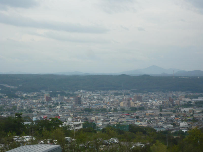
300px, Ena City Hall is a city located in Gifu, Japan. , the city had an estimated population of 48,777, and a population density of 96.7 persons per km², in 19,820 households. The total area of the city was . Geography Ena is located in the Tōnō region of southeastern Gifu Prefecture. *Mountains: Mount Kasagi, Mount Hoko, Mount Yūdachi, Mount Byōbu, Mount Yake, Mount Mitsumori *Rivers: Kiso River, Agi River, Kamiyahagi River, Kamimura River, Akechi River, Toki River, Ori River *Lakes: Ena Gorge, Lake Hokonoko, Lake Agigawa, Lake Okuyahagi, Lake Origawa Climate The city has a climate characterized by characterized by hot and humid summers, and mild winters (Köppen climate classification ''Cfa''). The average annual temperature in Ena is . The average annual rainfall is with July as the wettest month. The temperatures are highest on average in August, at around , and lowest in January, at around . Neighbouring municipalities *Gifu Prefecture **Nakatsugawa ** Miz ... [...More Info...] [...Related Items...] OR: [Wikipedia] [Google] [Baidu] |
Makio Dam
Makio Dam ( ja, 牧尾ダム) is a dam in the Nagano Prefecture is a landlocked prefecture of Japan located in the Chūbu region of Honshū. Nagano Prefecture has a population of 2,052,493 () and has a geographic area of . Nagano Prefecture borders Niigata Prefecture to the north, Gunma Prefecture to the n ..., Japan, completed in 1961. References Dams in Nagano Prefecture Dams completed in 1961 {{Nagano-geo-stub ... [...More Info...] [...Related Items...] OR: [Wikipedia] [Google] [Baidu] |
Oribe Ware
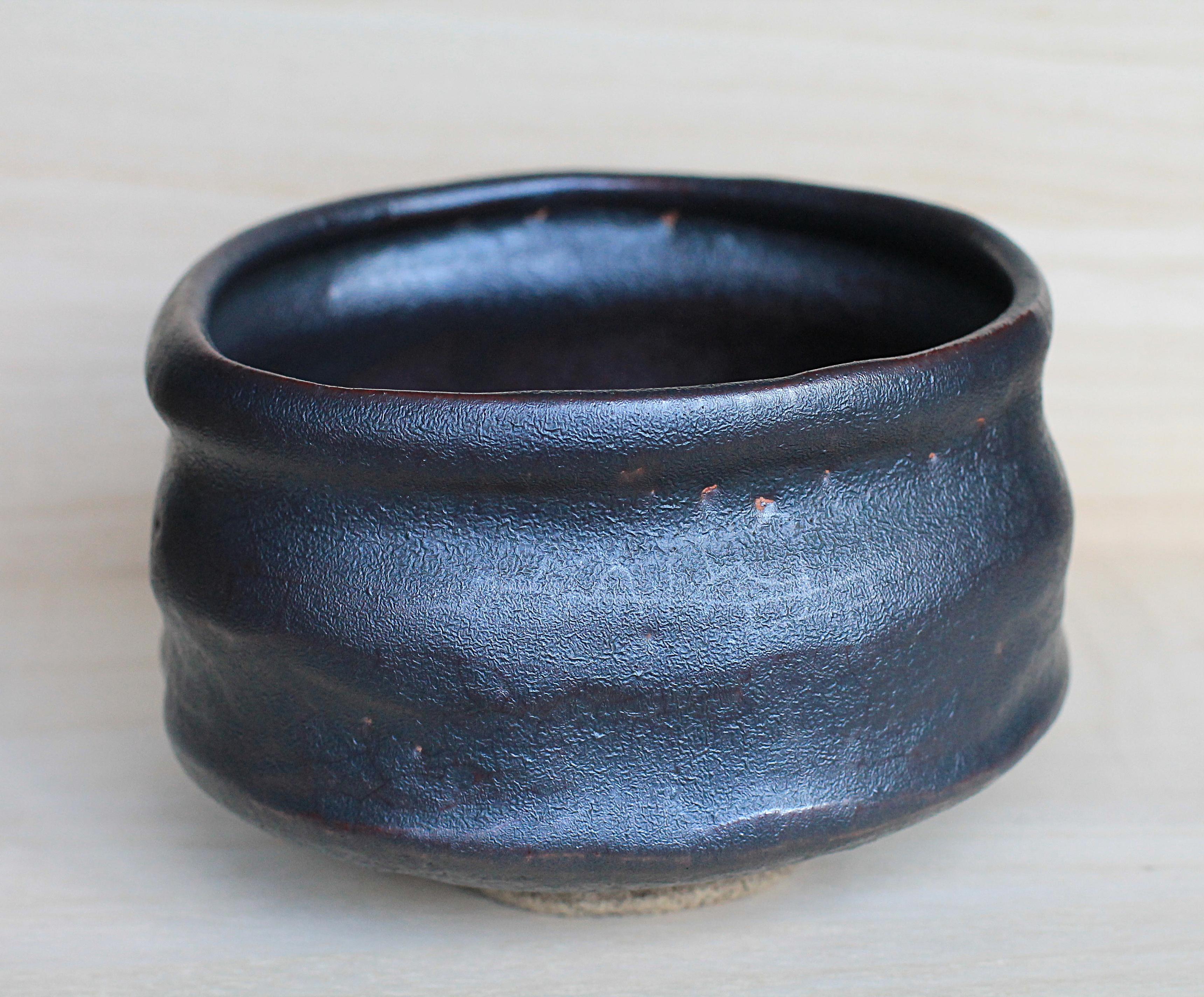
Oribe ware (also known as 織部焼 Oribe-yaki) is a style of Japanese pottery that first appeared in the sixteenth century. It is a type of Japanese stoneware recognized by its freely-applied glaze as well as its dramatic visual departure from the more somber, monochrome shapes and vessels common in Raku ware of the time. The ceramics were often asymmetrical, embracing the eccentricity of randomized shapes. Deformed shapes were not at all uncommon. These shapes were achieved through the implementation of moulding as a technique, as opposed to working on a potter’s wheel. Sometimes, bowls were so deformed that they became difficult to use – whisking tea could even become a difficult task. History Origins Throughout the late Momoyama (1573–1615) and early Edo periods (1615–1868) in Japan, the art of the Japanese tea ceremony underwent new developments. Great tea masters such as Takeno Jōō (1502-1555), Sen no Rikyū (1522-1591), and Furuta Oribe (1544–1615) revolutio ... [...More Info...] [...Related Items...] OR: [Wikipedia] [Google] [Baidu] |
Mizunami, Gifu
city located in Gifu Prefecture">Gifu, Japan. , the city had an estimated population of 37,705, and a population density of 220 persons per km2. The total area of the city was . Mizunami's biggest claim to fame came in 1995, when the largest ceramic plate in the world, as recognised by the Guinness Book of Records, was created by the Inatsu Town Planning Association in the city. It measures 2.8 metres in diameter. Geography Mizunami is located in south-eastern Gifu Prefecture. The Kiso River and the Toki River flow through the city. Climate The city has a climate characterized by characterized by hot and humid summers, and mild winters (Köppen climate classification ''Cfa''). The average annual temperature in Mizunami is 14.8 °C. The average annual rainfall is 1928 mm with September as the wettest month. The temperatures are highest on average in August, at around 27.2 °C, and lowest in January, at around 3.0 °C. Neighbouring municipalities *Gifu Prefe ... [...More Info...] [...Related Items...] OR: [Wikipedia] [Google] [Baidu] |
Toki, Gifu
is a city located in Gifu, Japan. , the city had an estimated population of 58,567 in 24485 households, and a population density of 500 persons per km2. The total area of the city was . Toki is known as one of the largest producers of Japanese pottery, generally referred to as Mino ware. Geography Toki is located in southern Gifu Prefecture, to the southeast of Gifu City and approximately 30 kilometers north of Nagoya. The Toki River runs through the downtown area. Mount Mikuni is the highest point in the city, with an elevation of . Climate The city has a climate characterized by hot and humid summers, and mild winters (Köppen climate classification ''Cfa''). The average annual temperature in Toki is 14.9 °C. The average annual rainfall is 1902 mm with September as the wettest month. The temperatures are highest on average in August, at around 27.5 °C, and lowest in January, at around 3.2 °C. Neighbouring municipalities *Gifu Prefecture ** Tajimi * ... [...More Info...] [...Related Items...] OR: [Wikipedia] [Google] [Baidu] |
Iwamura Castle
270px, Edo period layout was located in the southeastern area of Mino Province in Japan. Its ruins can be found in the modern-day municipal subdivision of Iwamura, in Ena, Gifu Prefecture. Along with Takatori Castle in Nara and Bitchu-Matsuyama Castle in Okayama, it is regarded as one of the three best mountain castles, and at an elevation of 721 meters above sea level (200 meters above its immediate surroundings), it is one of the highest in Japan. History Iwamura Castle is situated on a steep mountain overlooking the Iwamura Basin. The area commands an intersection of the Sanshu Kaidō, which connected southern Shinano Province with central Mikawa Province and the Pacific Coast, and the road connecting Mikawa Province with Tōtōmi Province to the east. In the Sengoku period, this area was of great strategic interest to both Takeda Shingen and Oda Nobunaga. During the Kamakura period, eastern Mino was held by Kato Kagekado a vassal of Minamoto no Yoritomo. His descendants f ... [...More Info...] [...Related Items...] OR: [Wikipedia] [Google] [Baidu] |
Ena Gorge
is a river valley located at the mid reaches of the Kiso River, which runs through the cities of Ena and Nakatsugawa in Gifu Prefecture, Japan. Ena Gorge was so named by Shiga Shigetaka, a geographer of that time who praised the harmony of the mysteriously shaped rocks, which appeared to be continuous with the lakeside vista of Ōi Dam. It is situated in Ena Gorge Prefectural Park. The mysteriously shaped rock formations are prominent throughout. Byobu Rock, Gunkan Rock, Shishi Rock, Kagami Rock, and more can be seen, and there are jet boats that afford passengers a closer look at the rocks. This is also a very important place geologically. There is a Mineral Museum. The area also thrives as a vacation spot with close proximity to the Nagoya is the largest city in the Chūbu region, the fourth-most populous city and third most populous urban area in Japan, with a population of 2.3million in 2020. Located on the Pacific coast in central Honshu, it is the capital and ... [...More Info...] [...Related Items...] OR: [Wikipedia] [Google] [Baidu] |
Chita Peninsula
Chita Peninsula (知多半島 ''Chita Hantō'') is a peninsula to the south of Aichi Prefecture, central Honshū, Japan. It runs approximately north-south. To the west is Ise Bay is a bay located at the mouth of the Kiso Three Rivers between Mie and Aichi Prefectures in Japan. Ise Bay has an average depth of and a maximum depth of . The mouth of the bay is and is connected to the smaller Mikawa Bay by two channels: ..., while to the east it encloses Mikawa Bay. It faces the Atsumi Peninsula southeast across Mikawa Bay. Chūbu Centrair International Airport is located off the west coast of the peninsula. External links (Hazumisaki:Southernmost point) Peninsulas of Japan Landforms of Aichi Prefecture {{Aichi-geo-stub ... [...More Info...] [...Related Items...] OR: [Wikipedia] [Google] [Baidu] |
Owari Province
was a province of Japan in the area that today forms the western half of Aichi Prefecture, including the modern city of Nagoya. The province was created in 646. Owari bordered on Mikawa, Mino, and Ise Provinces. Owari and Mino provinces were separated by the Sakai River, which means "border river." The province's abbreviated name was . Owari is classified as one of the provinces of the Tōkaidō. Under the ''Engishiki'' classification system, Owari was ranked as a "superior country" (上国) and a "near country" (近国), in relation to its distance from the capital. History Owari is mentioned in records of the Nara period, including the '' Kujiki'', although the area has been settled since at least the Japanese Paleolithic period, as evidenced by numerous remains found by archaeologists. Early records mention a powerful “Owari clan”, vaguely related to, or allied with the Yamato clan, who built massive kofun burial mounds in several locations within the province ... [...More Info...] [...Related Items...] OR: [Wikipedia] [Google] [Baidu] |
Misogawa Dam
Misogawa Dam ( ja, 味噌川ダム) is a dam of Kiso River in the Nagano Prefecture, Japan, completed in 1996. See also * Kiso River The is a river in the Chubu region of Japan roughly long, flowing through the prefectures of Nagano, Gifu, Aichi, and Mie before emptying into Ise Bay a short distance away from the city of Nagoya.Nussbaum, Louis Frédéric ''et al.'' (2 ... References Dams in Nagano Prefecture Dams completed in 1996 {{Nagano-geo-stub ... [...More Info...] [...Related Items...] OR: [Wikipedia] [Google] [Baidu] |
Maruyama Dam
The is a dam on the border of Mitake and Yaotsu in Gifu Prefecture, Japan. It was built on the upper reaches of the Kiso River system. It is a gravity dam that is tall. It was built after World War II as part of a large, nationwide dam building project. Surrounding area Sosui Gorge (蘇水峡 ''Sosui-kyō'') was formed by the completion of the dam. Along with Ena Gorge further upstream, the area is part of the Hida-Kisogawa Quasi-National Park is a quasi-national park in Japan. The park covers the Hida River from Gero to Minokamo in Gifu Prefecture; it also covers the middle reaches of the Kiso River from Mizunami, Gifu Prefecture, to Inuyama, Aichi Prefecture. It was designated a .... References Dams in Gifu Prefecture Hydroelectric power stations in Japan Dams completed in 1955 1955 establishments in Japan {{Japan-powerstation-stub ... [...More Info...] [...Related Items...] OR: [Wikipedia] [Google] [Baidu] |
Ministry Of Construction (Japan)
was a government ministry of Japan headquartered in Kasumigaseki, Chiyoda, Tokyo. Ministry of Construction. July 1, 1998. Retrieved on January 7, 2019. "Ministry of Construction, Government of Japan 2-1-3, Kasumigaseki, Chiyoda-ku, Tokyo 100" In 2001 it merged into the Ministry of Land, Infrastructure, Transport and Tourism
The , abbreviated MLIT, is a ministry of the Japanese government.国土交通省設置法 ...
[...More Info...] [...Related Items...] OR: [Wikipedia] [Google] [Baidu] |


