|
Afon Cothi
The Afon Cothi (also known as the River Cothy) in Carmarthenshire is the largest tributary of the River Tywi in south Wales. From its source at Blaen Cothi in the north of the county, north of Pumsaint, it flows south-east and then turns south-west to flow past Cwrt-y-cadno, Pumsaint, Abergorlech and Pont-ar-Gothi before joining the River Tywi west of the village of Llanarthney. The Cothi is noted for its trout and sea trout (sewin) fishing Fishing is the activity of trying to catch fish. Fish are often caught as wildlife from the natural environment (Freshwater ecosystem, freshwater or Marine ecosystem, marine), but may also be caught from Fish stocking, stocked Body of water, ... and for its scenery. External links * Rivers of Carmarthenshire Rivers of Ceredigion River Towy {{Wales-river-stub ... [...More Info...] [...Related Items...] OR: [Wikipedia] [Google] [Baidu] |
River Tywi
The River Towy (, ; also known as the River Tywi) is one of the longest rivers flowing entirely within Wales. Its total length is . It is noted for its sea trout and salmon fishing. Route The Towy rises within of the source of the River Teifi on the lower slopes of Crug Gynan in the Cambrian Mountains. Flowing through the steep hills of the Tywi Forest, it forms the boundary between Ceredigion and Powys. The river flows generally south-westwards through Carmarthenshire, passing through the towns of Llandovery and Llandeilo. Its total length is . with numerous tributaries that include the Cothi, Gwili, Brân, and Doethie. In Carmarthen, it is joined by a substantial tributary, the River Gwili, at Abergwili. The estuary meets Carmarthen Bay east of the Pendine Sands along with the River Taf and both branches of the River Gwendraeth. The estuary was guarded by Llansteffan Castle, a 12th-century Norman castle. Damming of the Towy About from its source, the swift flow of ... [...More Info...] [...Related Items...] OR: [Wikipedia] [Google] [Baidu] |
Wales
Wales ( ) is a Countries of the United Kingdom, country that is part of the United Kingdom. It is bordered by the Irish Sea to the north and west, England to the England–Wales border, east, the Bristol Channel to the south, and the Celtic Sea to the south-west. , it had a population of 3.2 million. It has a total area of and over of Coastline of Wales, coastline. It is largely mountainous with its higher peaks in the north and central areas, including Snowdon (), its highest summit. The country lies within the Temperate climate, north temperate zone and has a changeable, Oceanic climate, maritime climate. Its capital and largest city is Cardiff. A distinct Culture of Wales, Welsh culture emerged among the Celtic Britons after the End of Roman rule in Britain, Roman withdrawal from Britain in the 5th century, and Wales was briefly united under Gruffudd ap Llywelyn in 1055. After over 200 years of war, the Conquest of Wales by Edward I, conquest of Wales by King Edward I o ... [...More Info...] [...Related Items...] OR: [Wikipedia] [Google] [Baidu] |
Pumsaint
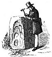
Pumsaint is a village in Carmarthenshire, Wales, halfway between Llanwrda and Lampeter on the A482 in the valley of the Afon Cothi. It forms part of the extensive estate of Dolaucothi, which is owned by the National Trust. The name is Welsh for "Five Saints" (''Pump'' being the word for "five"). The name is derived from the stone block at the nearby gold mines, opposite Ogofau Lodge, which has four sides, each of which has hollows probably caused by pestle impacts. It was used as an anvil for crushing gold ore in the Roman period. Excavations in the 1990s of the area adjacent to the stone showed that the stone was originally horizontal and used as an anvil for a water-powered crushing mill. There are many parallels from Spanish mines of the Roman period with similar stone anvils. Places of interest The nearby conservation area has several scheduled ancient monuments including the Dolaucothi Gold Mines. Archaeologists have uncovered evidence of Roman occupation of ... [...More Info...] [...Related Items...] OR: [Wikipedia] [Google] [Baidu] |
Abergorlech
Abergorlech is a village to the north-west of Llandeilo in Carmarthenshire, Wales. It lies on the River Cothi on the B4310 road, between Brechfa to the southwest and Llansawel Llansawel is a village and community in Carmarthenshire, Wales, about ten miles north of Llandeilo. It covers an area of . The community is bordered by the communities of: Pencarreg; Cynwyl Gaeo; Talley; Llanfynydd; Llanfihangel Rhos-y-Corn; ... to the northeast. The Pont Cothi bridge, which crosses the River Cothi in the centre of the village, is a grade II* listed building. Abergorlech gets its name from the Afon Gorlech, a minor river which joins the Cothi on the eastern edge of the village. The village is connected to Dafydd Gorlech (fl. c. 1410–1490), one of the poets of the nobility. References Villages in Carmarthenshire {{Carmarthenshire-geo-stub ... [...More Info...] [...Related Items...] OR: [Wikipedia] [Google] [Baidu] |
Pont-ar-Gothi
Pont-ar-gothi (otherwise Pontargothi or Cothi Bridge) is a village in Carmarthenshire, West Wales. The village takes its name from the bridge where the A40 Road trunk road crosses the River Cothi. It lies some east of Carmarthen. Cothi Bridge Show Cothi Bridge Agricultural Society was established in 1898. The Cothi Bridge Show contains breeders and exhibitors and attracts visitors from a large area. It also has a ladies section that was introduced in 1972. Holy Trinity Church The building of Holy Trinity Church was mostly funded by Henry Bath, whose family made a fortune as Cornish tin producers. When the tin ran out, they exported coal from Swansea and imported copper ore and guano. The coming of the railway to the Tywi Valley had allowed Bath to buy land to build a mansion and commute to Swansea. Alltyferin, a substantial Victorian house, was completed in 1868. An ardent churchman, Bath did not want to enforce English services on the parish church in Llanegwad but was ... [...More Info...] [...Related Items...] OR: [Wikipedia] [Google] [Baidu] |
Llanarthney
Llanarthney (; ) is a village and community in Carmarthenshire, south-west Wales. It is situated on the B4300 road, 12 km (7.5 miles) east of Carmarthen and 10 km (6 miles) west of Llandeilo. The community had a population at the 2001 census of 738, of whom 61 per cent were Welsh-speaking. At the 2011 census the population had increased slightly to 765. Llanarthney is bordered (clockwise from the north) by the Carmarthenshire communities of Llanegwad, Llangathen, Llanfihangel Aberbythych, Gorslas, Llanddarog, Llangunnor, and Abergwili. Amenities Llanarthney has been home to the National Botanic Garden of Wales The National Botanic Garden of Wales () is a botanical garden located in Llanarthney in the River Tywi valley, Carmarthenshire, Wales. The garden is both a visitor attraction and a centre for botanical research and conservation, and features t ... since 2000. Llanarthney Village Hall References External linkswww.geograph.co.uk : photos of Llanarthney ... [...More Info...] [...Related Items...] OR: [Wikipedia] [Google] [Baidu] |
Trout
Trout (: trout) is a generic common name for numerous species of carnivorous freshwater ray-finned fishes belonging to the genera '' Oncorhynchus'', ''Salmo'' and ''Salvelinus'', all of which are members of the subfamily Salmoninae in the family Salmonidae. The word ''trout'' is also used for some similar-shaped but non-salmonid fish, such as the spotted seatrout/speckled trout (''Cynoscion nebulosus'', which is actually a croaker). Trout are closely related to salmon and have similar migratory life cycles. Most trout are strictly potamodromous, spending their entire lives exclusively in freshwater lakes, rivers and wetlands and migrating upstream to spawn in the shallow gravel beds of smaller headwater creeks. The hatched fry and juvenile trout, known as ''alevin'' and ''parr'', will stay upstream growing for years before migrating down to larger waterbodies as maturing adults. There are some anadromous species of trout, such as the steelhead (a coastal subs ... [...More Info...] [...Related Items...] OR: [Wikipedia] [Google] [Baidu] |
Brown Trout
The brown trout (''Salmo trutta'') is a species of salmonid ray-finned fish and the most widely distributed species of the genus ''Salmo'', endemic to most of Europe, West Asia and parts of North Africa, and has been widely introduced globally as a game fish, even becoming one of the world's worst invasive species outside of its native range. Brown trout are highly adaptable and have evolved numerous ecotypes/subspecies. These include three main ecotypes: a riverine ecotype called river trout or ''Salmo trutta'' morpha ''fario''; a lacustrine ecotype or ''S. trutta'' morpha ''lacustris'', also called the lake trout (not to be confused with the lake trout in North America); and anadromous populations known as the sea trout or ''S. trutta'' morpha ''trutta'', which upon adulthood migrate downstream to the oceans for much of its life and only returns to fresh water to spawn in the gravel beds of headstreams. Sea trout in Ireland and Great Britain have many regional names: ... [...More Info...] [...Related Items...] OR: [Wikipedia] [Google] [Baidu] |
Fishing
Fishing is the activity of trying to catch fish. Fish are often caught as wildlife from the natural environment (Freshwater ecosystem, freshwater or Marine ecosystem, marine), but may also be caught from Fish stocking, stocked Body of water, bodies of water such as Fish pond, ponds, canals, park wetlands and reservoirs. Fishing techniques include trawling, Longline fishing, longlining, jigging, Fishing techniques#Hand-gathering, hand-gathering, Spearfishing, spearing, Fishing net, netting, angling, Bowfishing, shooting and Fish trap, trapping, as well as Destructive fishing practices, more destructive and often Illegal, unreported and unregulated fishing, illegal techniques such as Electrofishing, electrocution, Blast fishing, blasting and Cyanide fishing, poisoning. The term fishing broadly includes catching aquatic animals other than fish, such as crustaceans (shrimp/lobsters/crabs), shellfish, cephalopods (octopus/squid) and echinoderms (starfish/sea urchins). The term is n ... [...More Info...] [...Related Items...] OR: [Wikipedia] [Google] [Baidu] |
Dyfed Archaeological Trust
The Dyfed Archaeological Trust () was one of the four Welsh Archaeological Trusts established in the mid-1970s and dissolved in 2024 when it became Heneb, an archaeological organisation covering all of Wales. Overview It had the charitable object 'to advance the education of the public in archaeology'. Its core area comprised Carmarthenshire, Ceredigion and Pembrokeshire (the old county of Dyfed) in south-west Wales. The Trust provides archaeological and related advice to central government, local planning authorities and other public and private organisations. It maintains the regional Historic Environment Record. The Welsh Archaeological Trusts were pioneers in developing Historic Environment Records (HERs) in the 1970s: Wales was the first part of the UK to develop a fully national system of what were then called ‘Sites and Monuments Records’; this fully computerised system was pioneered by the Dyfed Archaeological Trust Chief Executive, Don Benson. Data included ... [...More Info...] [...Related Items...] OR: [Wikipedia] [Google] [Baidu] |
Rivers Of Carmarthenshire
A river is a natural stream of fresh water that flows on land or inside caves towards another body of water at a lower elevation, such as an ocean, lake, or another river. A river may run dry before reaching the end of its course if it runs out of water, or only flow during certain seasons. Rivers are regulated by the water cycle, the processes by which water moves around the Earth. Water first enters rivers through precipitation, whether from rainfall, the runoff of water down a slope, the melting of glaciers or snow, or seepage from aquifers beneath the surface of the Earth. Rivers flow in channeled watercourses and merge in confluences to form drainage basins, or catchments, areas where surface water eventually flows to a common outlet. Rivers have a great effect on the landscape around them. They may regularly overflow their banks and flood the surrounding area, spreading nutrients to the surrounding area. Sediment or alluvium carried by rivers shapes the landscape aro ... [...More Info...] [...Related Items...] OR: [Wikipedia] [Google] [Baidu] |


