|
Adanse
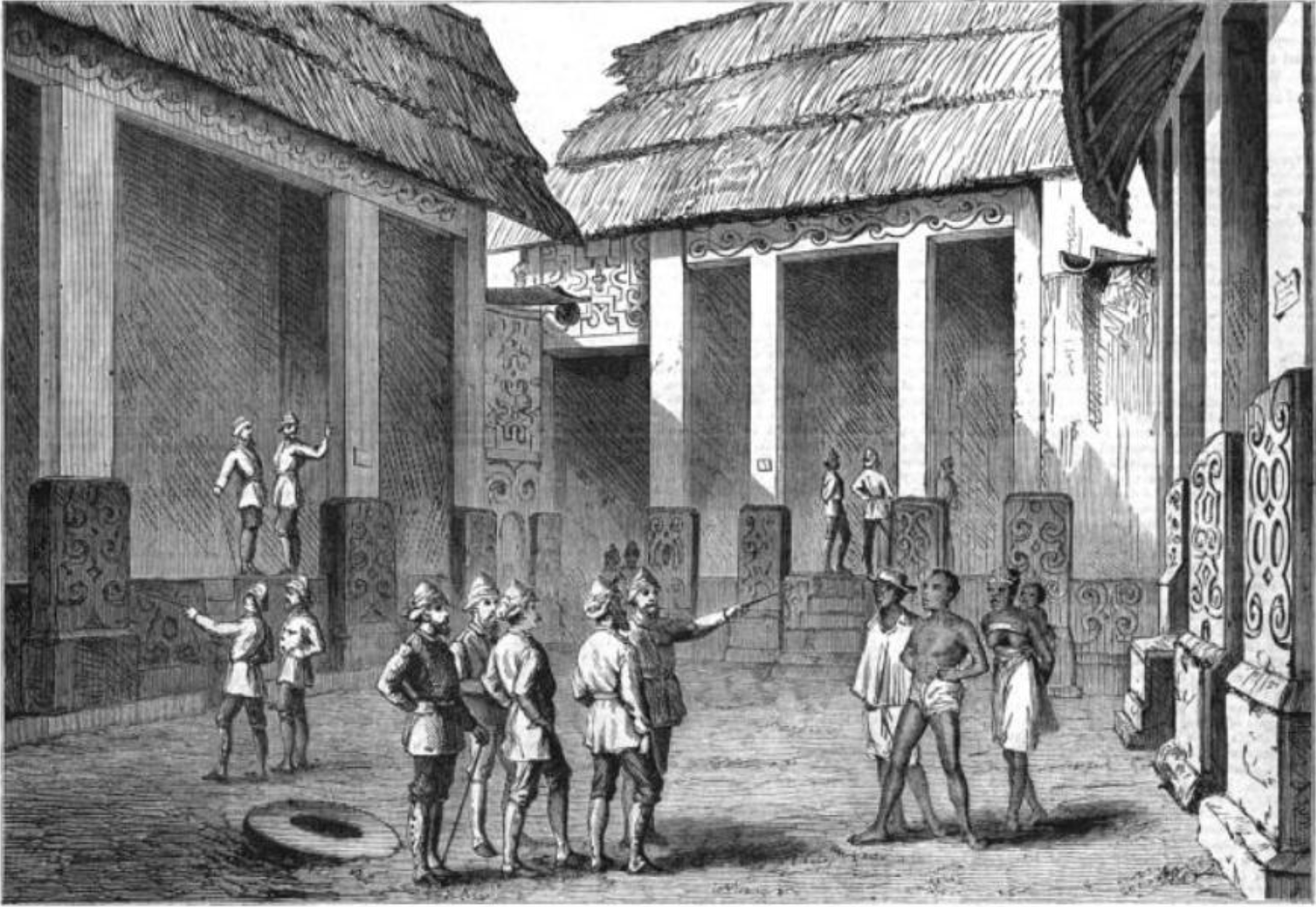
Adanse or Adansi is one of the earliest Akan states, located in the southern part of present-day Ashanti Region, Ghana. Widely regarded in oral tradition as a spiritual and ancestral homeland of many Akan polities, Adansi was an early center of gold production, regional trade, and clan-based governance. Traditionally considered the eldest among the five principal Akan states (''Akan Piesie Anum''), it played a foundational role in the formation of later polities such as Denkyira, Akyem, Assin, and the Asante Empire. Etymology The name Adanse derives from the Akan word ''adanseɛ'', meaning “builders”. According to F. K. Buah, the Adansi earned this name because they were the first Akan people to construct permanent homes and shrines, distinguishing them as cultural pioneers in statecraft and architecture. This interpretation is supported by Asante traditions, which remember the Adansi as “those who build houses,” emphasizing their legacy in being the first to build earth ... [...More Info...] [...Related Items...] OR: [Wikipedia] [Google] [Baidu] |
Common Era
Common Era (CE) and Before the Common Era (BCE) are year notations for the Gregorian calendar (and its predecessor, the Julian calendar), the world's most widely used calendar era. Common Era and Before the Common Era are alternatives to the original Anno Domini (AD) and Before Christ (BC) notations used for the same calendar era. The two notation systems are numerically equivalent: " CE" and "AD " each describe the current year; "400 BCE" and "400 BC" are the same year. The expression can be traced back to 1615, when it first appears in a book by Johannes Kepler as the (), and to 1635 in English as " Vulgar Era". The term "Common Era" can be found in English as early as 1708, and became more widely used in the mid-19th century by Jewish religious scholars. Since the late 20th century, BCE and CE have become popular in academic and scientific publications on the grounds that BCE and CE are religiously neutral terms. They have been promoted as more sensitive to non-Christia ... [...More Info...] [...Related Items...] OR: [Wikipedia] [Google] [Baidu] |
Assin
The Assin (also known as Asin and Asen) are an ethnic group of the Akan people and Guan (Etsii) people who live in Ghana. The Assin people live predominantly in the Central Region of Ghana. The capital of the Assin district is Assin Foso Assin Fosu is the capital of Assin Fosu Municipal Assembly, in the Central Region, Ghana, Central Region of Ghana.Cape Coast-Kumasi Highway, with Assin Manso as their capital city. The Assin Attendansu (or Atandanso) live to the west of the Highway, with [...More Info...] [...Related Items...] OR: [Wikipedia] [Google] [Baidu] |
Maghreb
The Maghreb (; ), also known as the Arab Maghreb () and Northwest Africa, is the western part of the Arab world. The region comprises western and central North Africa, including Algeria, Libya, Mauritania, Morocco, and Tunisia. The Maghreb also includes the territorial dispute, disputed territory of Western Sahara. As of 2018, the region had a population of over 100 million people. The Maghreb is usually defined as encompassing much of the northern part of Africa, including a large portion of the Sahara Desert, but excluding Egypt and the Sudan, which are considered to be located in the Mashriq — the eastern part of the Arab world. The traditional definition of the Maghreb — which restricted its scope to the Atlas Mountains and the coastal plains of Morocco, Algeria, Tunisia and Libya — was expanded in modern times to include Mauritania and the disputed territory of Western Sahara. During the era of al-Andalus on the Iberian Peninsula (711–1492), the Maghreb's inhabita ... [...More Info...] [...Related Items...] OR: [Wikipedia] [Google] [Baidu] |
Djenné
Djenné (; also known as Djénné, Jenné, and Jenne) is a Songhai people, Songhai town and Communes of Mali, urban commune in the Inland Niger Delta region of central Mali. The town is the administrative centre of the Djenné Cercle, one of the eight subdivisions of the Mopti Region. The commune includes ten of the surrounding villages and in 2009 had a population of 32,944. The history of Djenné is closely linked with that of Timbuktu. Between the 15th and 17th centuries much of the trans-Saharan trade in goods such as salt, gold, and slaves that moved in and out of Timbuktu passed through Djenné. Both towns became centres of Islamic scholarship. Djenné's prosperity depended on this trade and when the Portugal, Portuguese established trading posts on the African coast, the importance of the trans-Saharan trade and thus of Djenné declined. The town is famous for its distinctive adobe architecture, most notably the Great Mosque of Djenné, Great Mosque which was built in 190 ... [...More Info...] [...Related Items...] OR: [Wikipedia] [Google] [Baidu] |
Timbuktu
Timbuktu ( ; ; Koyra Chiini: ; ) is an ancient city in Mali, situated north of the Niger River. It is the capital of the Tombouctou Region, one of the eight administrative regions of Mali, having a population of 32,460 in the 2018 census. Archaeological evidence suggests prehistoric settlements in the region, predating the city's Islamic scholarly and trade prominence in the medieval period. Timbuktu began as a seasonal settlement and became permanent early in the 12th century. After a shift in trading routes, particularly after the visit by Mansa Musa around 1325, Timbuktu flourished, due to its strategic location, from the trade in salt, gold, and ivory. It gradually expanded as an important Islamic city on the Saharan trade route and attracted many scholars and traders before it became part of the Mali Empire early in the 14th century. In the first half of the 15th century, the Tuareg people took control for a short period, until the expanding Songhai Empire absorbed ... [...More Info...] [...Related Items...] OR: [Wikipedia] [Google] [Baidu] |
Bouna, Ivory Coast
Bouna (also spelled Buna) is a town in north-eastern Ivory Coast. It is a sub-prefecture of and the seat of Bouna Department. It is also the seat of Bounkani Region in Zanzan District and a commune. Near Bouna is the Comoé National Park and the Ghanaian border. The main town of the Lobi people, Bouna is known for the vernacular architecture of the fortress-style adobe compounds in surrounding villages. The town is served by its own dirt-runway airport. This bush landing strip mainly serves the United Nations. In 2021, the population of the sub-prefecture of Bouna was 94,883. History Early History At its founding Bouna was a Koulango and Dyula village. In the late 16th century Bouna was conquered by the king named Naa Zokuli who had Dagomba prince Darigu Damda, who married the local chief's daughter. Their son Bounkani founded the royal dynasty of Bouna. Bouna was a "highly centralized kingdom based on military districts administered by princes" who exploited the local ... [...More Info...] [...Related Items...] OR: [Wikipedia] [Google] [Baidu] |
Wagadugu
Ouagadougou or Wagadugu (, , , ) is the capital city of Burkina Faso, and the administrative, communications, cultural and economic centre of the nation. It is also the country's largest city, with a population of 2,415,266 in 2019. The city's name is often shortened to ''Ouaga''. The inhabitants are called ''ouagalais''. The spelling of the name ''Ouagadougou'' is derived from the French orthography common in former French African colonies. Ouagadougou's primary industries are food processing and textiles. It is served by an international airport and is linked by rail to Abidjan in the Ivory Coast and, for freight only, to Kaya. There are several highways linking the city to Niamey, Niger, south to Ghana, and southwest to Ivory Coast. Ouagadougou has one of West Africa's largest markets, which burned down in 2003 and has since reopened with better facilities and improved fire-prevention measures. Other attractions include the National Museum of Burkina Faso, the Moro-Naba ... [...More Info...] [...Related Items...] OR: [Wikipedia] [Google] [Baidu] |
Bonduku
Bondoukou (var. Bonduku, Bontuku) is a city in northeastern Ivory Coast, 420 km northeast of Abidjan. It is the seat of both Zanzan District and Gontougo Region. It is also a commune and the seat of and a sub-prefecture of Bondoukou Department. Bondoukou is situated near the border with Ghana, just across the border from the Ghanaian town of Sampa. The city lies at the junction of the main A1 highway, with roads to Sorobango to the north and Ghana to the east. History Founding The area that would become Boundoukou was originally inhabited by the Gbin, Loro and Nafana clans. The town was founded by Soninke Wangara merchants (the ancestors of the Dyula people) in the mid 18th century shortly before or immediately following the destruction of Bighu at the hands of the Ashanti Empire. Bonduku became the "premier settlement of the Bighu Juula after the collapse of the older town." "This town was established by the major part of the inhabitants of Bego...the Hausa have given i ... [...More Info...] [...Related Items...] OR: [Wikipedia] [Google] [Baidu] |
Iron Metallurgy In Africa
Iron metallurgy in Africa concerns the origin and development of ferrous metallurgy on the Africa, African continent. Whereas the development of iron metallurgy in North Africa and the Horn of Africa, Horn closely mirrors that of the Ancient Near East and History of the Mediterranean region, Mediterranean region, the three-age system is ill-suited to Sub-Saharan Africa, where Copper metallurgy in Africa, copper metallurgy generally does not precede iron working. Whether iron metallurgy in Sub-Saharan Africa originated as an independent innovation or a product of technological diffusion remains a point of contention between scholars. Following the beginning of iron metallurgy in Western Africa, Western and Central Africa by Hallstatt plateau, 800 BC - 400 BC, and possibly earlier, agriculturalists of the Bantu expansion, Chifumbaze Complex would ultimately introduce the technology to Eastern Africa, Eastern and Southern Africa by the end of the 1st millennium, first millennium AD. ... [...More Info...] [...Related Items...] OR: [Wikipedia] [Google] [Baidu] |


