|
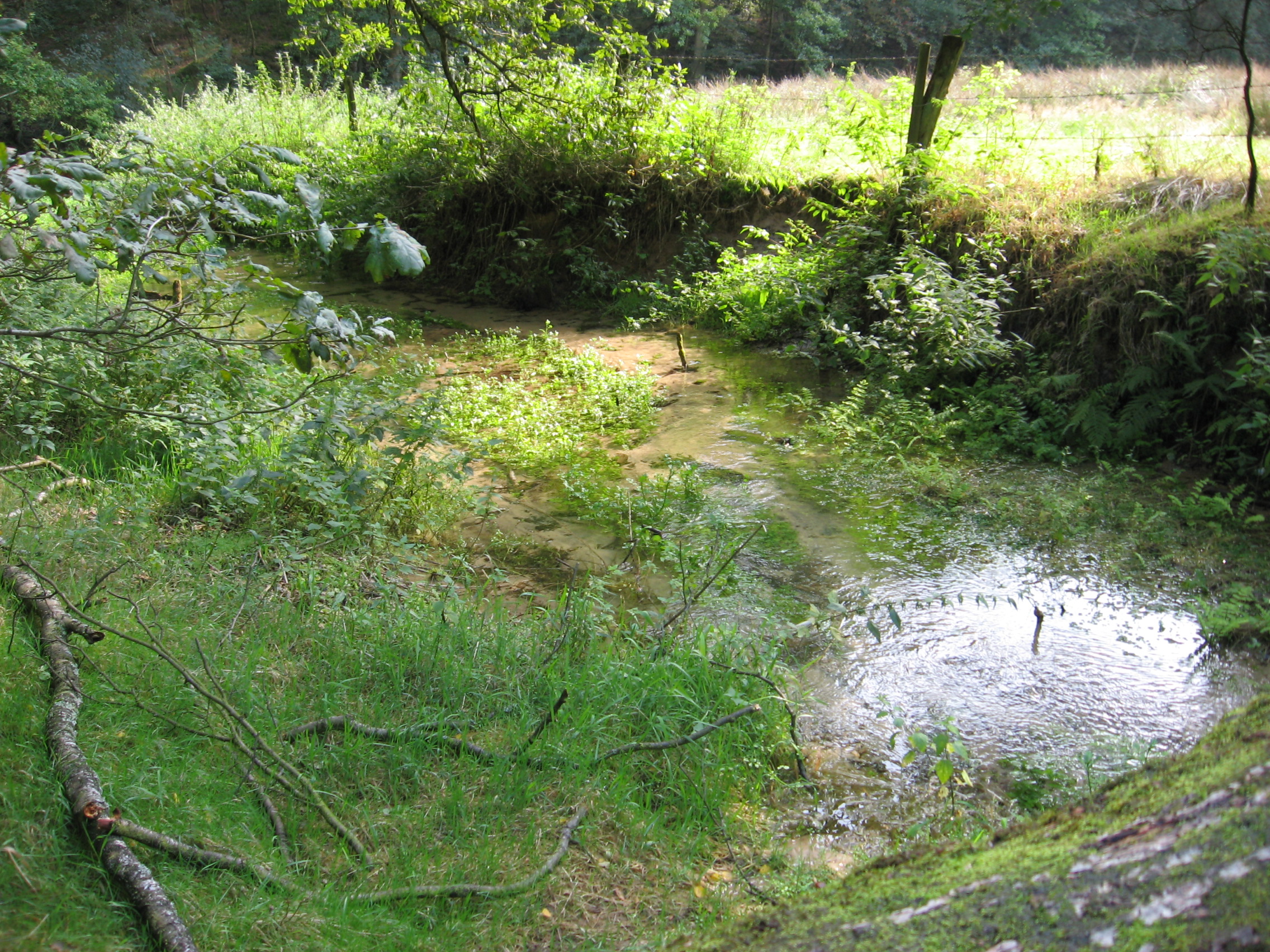
Aabach (Hessel)
Aabach is a small river in the Ems river system, of North Rhine-Westphalia, Germany. It flows into the Hessel near Versmold. See also *List of rivers of North Rhine-Westphalia A list of rivers of North Rhine-Westphalia, Germany: A B C * Calenberger Bach * Casumer Bach * Compbach D * Dalke * Dammpader * Darmühlenbach * Deilbach * Derenbach * Dettmers Bach * Dhünn * Dichbach * Dickopsbach * Dielenpader * Diemel * ... References Rivers of North Rhine-Westphalia Rivers of Germany {{NorthRhineWestphalia-river-stub ... [...More Info...] [...Related Items...] OR: [Wikipedia] [Google] [Baidu] |
Hessel
The Hessel is a , right tributary of the River Ems in the territory of the North Rhine-Westphalian districts of Gütersloh and Warendorf in northwest Germany. The river rises northwest of Halle (Westf.) on the Große Egge, crosses the Hermannsweg, flows through the villages of Hesseln and Hörste in Halle borough, then through the borough of Versmold through Oesterweg, continuing through the town of Sassenberg and along the southern edge of Milte in the borough of Warendorf Warendorf (, Westphalian language, Westphalian: ''Warnduorp'') is a town in North Rhine-Westphalia, Germany, and capital of Warendorf (district), Warendorf District. The town is best known today for its well-preserved medieval town centre, for eq ..., before emptying into the Ems near Warendorf-Einen. Tributaries include the Casumer Bach, Bruchbach, Aabach, Poggenfahrtgraben, Sandfortbach, Teichwiese, Wöstenbach, Beckstroth, Arenbecke and the Speckengraben. The Snake's Head Meadows lie along th ... [...More Info...] [...Related Items...] OR: [Wikipedia] [Google] [Baidu] |
Germany
Germany, officially the Federal Republic of Germany, is a country in Central Europe. It lies between the Baltic Sea and the North Sea to the north and the Alps to the south. Its sixteen States of Germany, constituent states have a total population of over 84 million in an area of , making it the most populous member state of the European Union. It borders Denmark to the north, Poland and the Czech Republic to the east, Austria and Switzerland to the south, and France, Luxembourg, Belgium, and the Netherlands to the west. The Capital of Germany, nation's capital and List of cities in Germany by population, most populous city is Berlin and its main financial centre is Frankfurt; the largest urban area is the Ruhr. Settlement in the territory of modern Germany began in the Lower Paleolithic, with various tribes inhabiting it from the Neolithic onward, chiefly the Celts. Various Germanic peoples, Germanic tribes have inhabited the northern parts of modern Germany since classical ... [...More Info...] [...Related Items...] OR: [Wikipedia] [Google] [Baidu] |
North Rhine-Westphalia
North Rhine-Westphalia or North-Rhine/Westphalia, commonly shortened to NRW, is a States of Germany, state () in Old states of Germany, Western Germany. With more than 18 million inhabitants, it is the List of German states by population, most populous state in Germany. Apart from the city-states (Berlin, Hamburg and Bremen), it is also the List of German states by population density, most densely populated state in Germany. Covering an area of , it is the List of German states by area, fourth-largest German state by size. North Rhine-Westphalia features 30 of the 81 German municipalities with over 100,000 inhabitants, including Cologne (over 1 million), the state capital Düsseldorf (630,000), Dortmund and Essen (about 590,000 inhabitants each) and other cities predominantly located in the Rhine-Ruhr metropolitan area, the largest urban area in Germany and the fourth-largest on the European continent. The location of the Rhine-Ruhr at the heart of the European Blue Banana make ... [...More Info...] [...Related Items...] OR: [Wikipedia] [Google] [Baidu] |
Ems (river)
The Ems ( ; ) is a river in northwestern Germany. It runs through the states of North Rhine-Westphalia and Lower Saxony, and discharges into the Dollart Bay which is part of the Wadden Sea. Its total length is . The state border between the Lower Saxon area of East Friesland (Germany) and the province of Groningen (Netherlands), whose exact course was the subject of a border dispute between Germany and the Netherlands (settled in 2014), runs through the Ems estuary. Course The source of the river is in the southern Teutoburg Forest in North Rhine-Westphalia. In Lower Saxony, the brook becomes a comparatively large river. Here the swampy region of Emsland is named after the river. In Meppen the Ems is joined by its largest tributary, the Hase River. It then flows northwards, close to the Dutch border, into East Frisia. Near Emden, it flows into the Dollard bay (a national park) and then continues as a tidal river towards the Dutch city of Delfzijl. Between Emden and Delf ... [...More Info...] [...Related Items...] OR: [Wikipedia] [Google] [Baidu] |
Versmold
Versmold (; ) is a town in Gütersloh (district), Gütersloh District in the German state of North Rhine-Westphalia. It is located some 30 km west of Bielefeld. History In 1096 Versmold was first mentioned in a document, and is thus one of the oldest known settlements in the region. The name "-mold" alludes to "melle", "mal" a location of a court. Situated between the bishoprics Osnabrück and Münster, the possession of Versmold was disputed for a long time in the high Middle Ages. The population tried to protect themselves as well as they could. The St. Petri church was built as a "Wehrkirche" for defense. After 1277, the situation changed when the counts of County of Ravensberg, Ravensberg acquired possession of the Versmold region. Versmold formed the westernmost town of the historic county of Ravensberg with its capital Bielefeld. After the War of the Jülich Succession in 1614 the county came to Brandenburg and later to Prussia. Within predominantly Catholic Westpha ... [...More Info...] [...Related Items...] OR: [Wikipedia] [Google] [Baidu] |
List Of Rivers Of North Rhine-Westphalia
A list of rivers of North Rhine-Westphalia, Germany: A B C * Calenberger Bach * Casumer Bach * Compbach D * Dalke * Dammpader * Darmühlenbach * Deilbach * Derenbach * Dettmers Bach * Dhünn * Dichbach * Dickopsbach * Dielenpader * Diemel * Diestelbach * Dinkel * Dondert * Dornmühlenbach * Dörpe * Dörspe * Dortenbach * Dreierwalder Aa * Dreisbach, tributary of the Bröl * Dreisbach, tributary of the Sieg * Duffesbach * Durbeke * Düsedieksbach * Düssel E F *Falbecke, alternative name for Glingebach * Felderbach * Ferndorfbach * Finkelbach * Finkenbach * Fischbach * Fischertaler Bach * Flehbach * Florabach * Forellenbach * Forthbach * Freebach * Fretterbach * Frischebach * Frischhofsbach * Frohnhauser Bach * Frohnholzbach * Fülsenbecke * Furlbach G H I * Ickbach * Ihne * Ilpe * Ilse, tributary of the Bega * Ilse, tributary of the Lahn * Inde * Irserbach * Issumer Fleuth * Itter, tributary of the Diemel * Itter, tributary of the Rhine J * Jabach * Johannisbach * ... [...More Info...] [...Related Items...] OR: [Wikipedia] [Google] [Baidu] |
Rivers Of North Rhine-Westphalia
A river is a natural stream of fresh water that flows on land or inside Subterranean river, caves towards another body of water at a lower elevation, such as an ocean, lake, or another river. A river may run dry before reaching the end of its course if it runs out of water, or only flow during certain seasons. Rivers are regulated by the water cycle, the processes by which water moves around the Earth. Water first enters rivers through precipitation, whether from rainfall, the Runoff (hydrology), runoff of water down a slope, the melting of glaciers or snow, or seepage from aquifers beneath the surface of the Earth. Rivers flow in channeled watercourses and merge in confluences to form drainage basins, or catchments, areas where surface water eventually flows to a common outlet. Rivers have a great effect on the landscape around them. They may regularly overflow their Bank (geography), banks and flood the surrounding area, spreading nutrients to the surrounding area. Sedime ... [...More Info...] [...Related Items...] OR: [Wikipedia] [Google] [Baidu] |


