|
A71 Motorway (Greece)
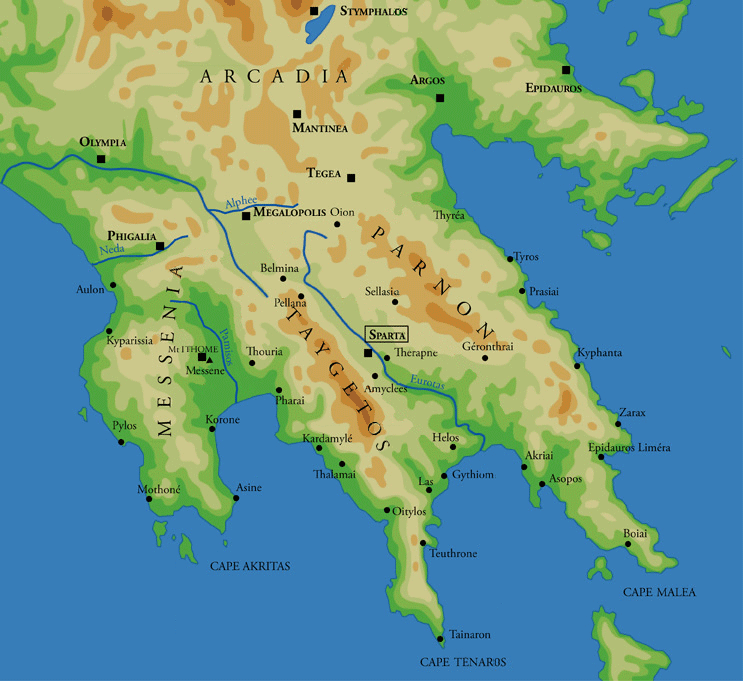
The A71 motorway, also known as the Lefktro–Sparti branch (), is a branch of the A7 motorway from Lefktro near Megalopoli, connecting it with Sparti. The motorway was opened on April 18, 2016. on ypodomes.gr It is a toll road. Operation and maintenance Moreas S.A. () is responsible for the operation and maintenance of both the A7 and A71 motorways, which are sometimes known collectively as the Moreas Motorway (). The company was founded in |
Megalopolis, Greece
Megalopoli () is a town in the southwestern part of the regional unit of Arcadia (regional unit), Arcadia, southern Greece. It is located in the same site as ancient Megalopolis ( literally ''large/great city''). When it was founded in 371 BCE, it was the first large urbanization in Arcadia (region), rustic Arcadia. Its theatre had a capacity of 20,000 visitors, making it one of the largest ancient Greek theatres. Today Megalopoli has several schools, shops, churches, hotels and other services. The population of Megalopoli in 2021 was 5,344 residents. Geography Megalopoli is situated in a wide valley, surrounded by mountains: the Taygetus to the south, the Mainalo to the north, the Tsemperou to the southeast and the Lykaion to the west. Its elevation is 430 m above sea level. The river Alfeios flows through this valley, coming from the east and flowing to the north, passing south and west of the town. Its tributary Elissonas (Alfeios), Elissonas passes north of the town. The la ... [...More Info...] [...Related Items...] OR: [Wikipedia] [Google] [Baidu] |
Kalamata
Kalamata ( ) is the second most populous city of the Peloponnese peninsula in southern Greece after Patras, and the largest city of the Peloponnese (region), homonymous administrative region. As the capital and chief port of the Messenia regional unit, it lies along the Nedonas, Nedon River at the head of the Messenian Gulf. The 2021 census recorded 72,906 inhabitants for the wider Kalamata Municipality, of which 66,135 resided in the municipal unit of Kalamata, and 58,816 in the city proper. Kalamata is renowned as the land of the Kalamatianos dance, Kalamata olives and Kalamata olive oil. Name The modern name ''Kalamáta'' likely comes from ; another hypothesis is a corruption of the older name . Administration The Municipalities of Greece, municipality Kalamata was formed as part of the Kallikratis Plan, 2011 local government reform by the merger of the following four former municipalities, each of which subsequently became municipal units: * Arfara * Aris, Messenia, Aris ... [...More Info...] [...Related Items...] OR: [Wikipedia] [Google] [Baidu] |
Monemvasia
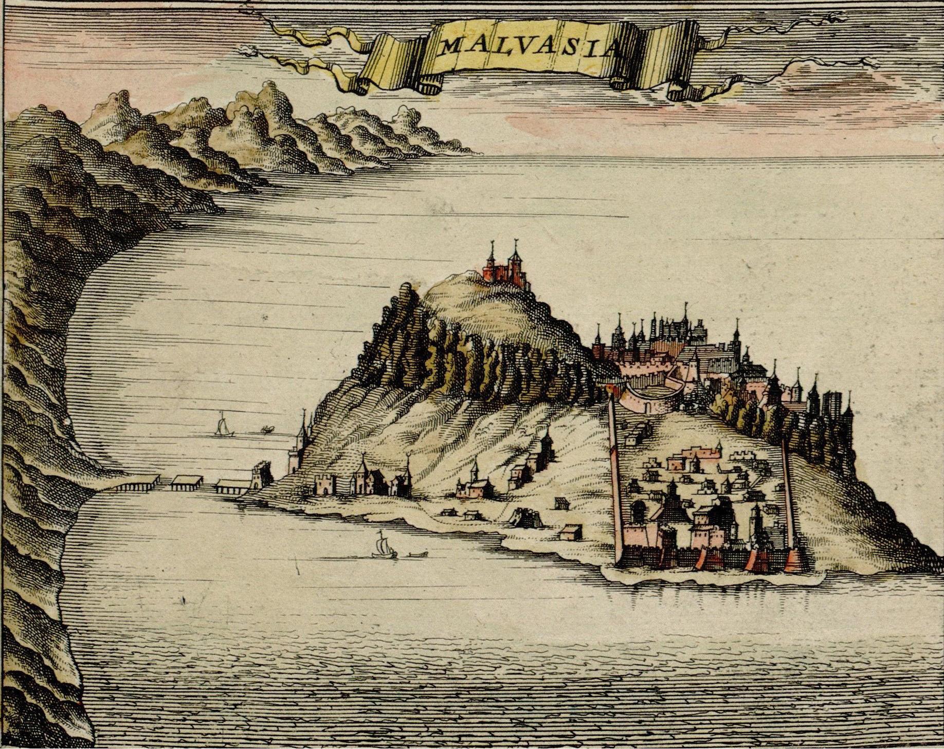
Monemvasia (, or ) is a town and municipality in Laconia, Greece. The town is located in mainland Greece on a tied island off the east coast of the Peloponnese, surrounded by the Myrtoan Sea. Monemvasia is connected to the rest of the mainland by a tombolo in length. In 1890, a small part of the natural tombolo was cut to create an artificial bridge for ships and boats. Its area consists mostly of a large plateau some above sea level, up to wide and long. Founded in the sixth century, and thus one of the oldest continually-inhabited fortified towns in Europe, the town is the site of a once-powerful Medieval fortification, medieval fortress, and #Byzantine period, was at one point one of the most important commercial centres in the Eastern Mediterranean. The town's walls and many Byzantine Empire, Byzantine churches remain as testaments to the town's history. Today, the seat of the municipality of Monemvasia is the town of Molaoi. Etymology The town's name derives from two Gree ... [...More Info...] [...Related Items...] OR: [Wikipedia] [Google] [Baidu] |
Gytheio
Gytheio ( ) or Gythio, also the ancient Gythium or Gytheion (), is a town on the eastern shore of the Mani Peninsula, and a former municipality in Laconia, Peloponnese (region), Peloponnese, Greece. Since the 2011 local government reform it is part of the municipality East Mani, of which it is a municipal unit. The municipal unit has an area of 197.313 km2. Gytheio was the seaport of Sparta, Ancient Sparta, which lies approximately north of it. It is the site of ancient Cranae, a tiny island where, according to the myth, Paris (mythology), Paris and Helen of Troy, Helen spent their first night together before departing for Troy. Gytheio used to be an important port until it was destroyed in 4th century AD, possibly by an earthquake, though its strategic location continued to give it a significant role in Maniots, Maniot history. Now the seat of the municipality of East Mani, Gytheio is the largest and most important town in Mani Peninsula, Mani. Historical population ... [...More Info...] [...Related Items...] OR: [Wikipedia] [Google] [Baidu] |
Pellana
Pellana (; Greek: ἡ Πέλλανα; τὰ Πέλλανα; Πελλήνη; ''Agis''), was a city of ancient Lacedaemonia, on the Eurotas river, and on the road from Sparta to Arcadia. Pellana is now a village and a municipal unit of the municipality of Sparti, Greece. It was a municipality until the 2011 local government reform. The municipal unit has an area of 153.763 km2. The seat of the municipality was in Kastoreio. It was called Καλύβια Γεωργίτσι Kalivia Georgitsi (lit. the huts of Georgitsi) until it was renamed after a nearby ancient city in 1932. Though the site of modern Pellana was clearly occupied in antiquity, it is probably not the site of the ancient Pellana mentioned by Pausanias and other ancient authors. The ancient Pellana was more likely near the modern Sellasia. History According to archaeologist Theodore Spyropoulos, Pellana was the Mycenaean capital of Laconia. Today, Pellana is a small village in north Laconia, located 27 ki ... [...More Info...] [...Related Items...] OR: [Wikipedia] [Google] [Baidu] |
Laconia
Laconia or Lakonia (, , ) is a historical and Administrative regions of Greece, administrative region of Greece located on the southeastern part of the Peloponnese peninsula. Its administrative capital is Sparti (municipality), Sparta. The word ''Laconic phrase, laconic''—to speak in a blunt, concise way—is derived from the name of this region, a reference to the ancient Spartans who were renowned for their verbal austerity and blunt, often pithy remarks. Geography Laconia is bordered by Messenia to the west and Arcadia (regional unit), Arcadia to the north and is surrounded by the Myrtoan Sea to the east and by the Laconian Gulf and the Mediterranean Sea to the south. It encompasses Cape Malea and Cape Tainaron and a large part of the Mani Peninsula. The Mani Peninsula is in the west region of Laconia. The islands of Kythira and Antikythera lie to the south, but they administratively belong to the Attica (region), Attica regional unit of Islands (regional unit), islands. ... [...More Info...] [...Related Items...] OR: [Wikipedia] [Google] [Baidu] |
Longanikos
Longanikos (, also transliterated as ''Logkanikos'') is a traditional Greek village, located in Laconia, in the ancient and historical Peloponnese area of southern Greece. It is also referred to sometimes in English as "Logganiko(s)" or "Longanico(s)". It is about 30 kilometers north of Sparta, the capital city of Lakonia, and is also very close to the cities of Kalamata, Tripolis and Megalopolis. It rests on the eastern slope of Mount Taigetos. The population of Longanikos is 404 inhabitants according to the 2021 census. This figure includes the population of the surrounding smaller villages Vergadeika, Kyparrissi, Giakoumaiika, and Kotitsa. Because of the small size of this village, residents of this town often identify themselves as Spartans to other Greeks or foreigners. For those who are familiar with this area, a resident or person from Longanikos is referred to as a "Longanikiotes" (masc) or "Longanikiotissa" (fem). Administration The village is administered as ... [...More Info...] [...Related Items...] OR: [Wikipedia] [Google] [Baidu] |
Traffic Sign GR - KOK 2009 OMOE-KSA 2003 - PI-27 - Squared - VCT
Traffic is the movement of vehicles and pedestrians along land routes. Traffic laws govern and regulate traffic, while rules of the road include traffic laws and informal rules that may have developed over time to facilitate the orderly and timely flow of traffic. Organized traffic generally has well-established priorities, lanes, right-of-way, and traffic control at intersections. ( International Regulations for Preventing Collisions at Sea govern the oceans and influence some laws for navigating domestic waters.) Traffic is formally organized in many jurisdictions, with marked lanes, junctions, intersections, interchanges, traffic signals, cones, or signs. Traffic is often classified by type: heavy motor vehicle (e.g., car, truck), other vehicle (e.g., moped, bicycle), and pedestrian. Different classes may share speed limits and easement, or may be segregated. Some jurisdictions may have very detailed and complex rules of the road while others rely more on drivers' com ... [...More Info...] [...Related Items...] OR: [Wikipedia] [Google] [Baidu] |
Tripoli, Greece
Tripoli (; ) is a city in the central part of the Peloponnese, in Greece. It is the capital of the Peloponnese region as well as of the regional unit of Arcadia. The homonymous municipality had 44,165 inhabitants in 2021. Etymology In the Middle Ages the place was known as Drobolitsa, Droboltsá, or Dorboglitza, either from the Greek Hydropolitsa, 'Water City' or perhaps from the South Slavic for 'Plain of Oaks'. The association made by 18th- and 19th-century scholars with the idea of the " three cities" (Τρίπολις, τρεις πόλεις "three cities": variously Callia, Dipoena and Nonacris, mentioned by Pausanias without geographical context, or Tegea, Mantineia and Pallantium, or Mouchli, Tegea and Mantineia or Nestani, Mouchli and Thana), were considered paretymologies by G.C. Miles. An Italian geographical atlas of 1687 notes the fort of ''Goriza e Mandi et Dorbogliza''; a subsequent Italian geographical dictionary of 1827 attributes the name Dorbogliza to the ... [...More Info...] [...Related Items...] OR: [Wikipedia] [Google] [Baidu] |
A7 Motorway (Greece)
The A7 motorway, also known as the Moreas Motorway, or the Corinth–Tripoli–Kalamata Motorway (), (FEK AAP' 253/21.12.2015, pp. 2098–2099). is a controlled-access highway in the Peloponnese, Greece. The A7 begins just west of the Isthmus of Corinth, branching off from Greek National Road 8A (which is now integrated into the Olympia Odos). It connects Corinth and Kalamata via Tripoli, Greece, Tripoli. As part of the concession (contract), concession agreement between the Greece, Greek state and the consortium operating the motorway (Moreas S.A.), the latter is responsible for constructing, operating, maintaining and modernizing the A7. In existing sections of the motorway, improvements include the straightening of dangerous curves, constructing new tunnels, completing the Artemision tunnel, adding more light fixtures and upgradi ... [...More Info...] [...Related Items...] OR: [Wikipedia] [Google] [Baidu] |


