|
A57 Road (England)
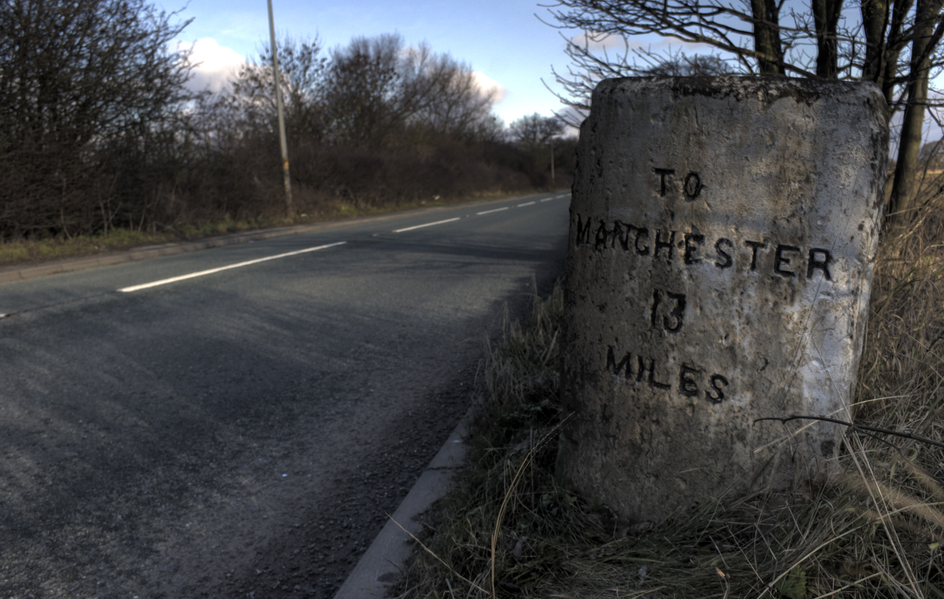
The A57 is a major road in England. It runs east from Liverpool to Lincoln via Warrington, Salford and Manchester, and then through the Pennines over the Snake Pass (between the high moorlands of Bleaklow and Kinder Scout), around the Ladybower Reservoir, through Sheffield and past Worksop. Between Liverpool and Glossop, the road has largely been superseded by the M62, M602 and M67 motorways. Within Manchester a short stretch becomes the Mancunian Way, designated A57(M). Route Liverpool–Warrington The A57 begins at The Strand (A5036) near the River Mersey, as part of Water Street. It forms an east–west route through the north of the city centre with another one-way road system as Tithebarn Street (passing part of Liverpool John Moores University), Great Crosshall Street and Churchill Way in the east direction and Churchill Way and Dale Street in the west direction. The connecting roads Moorfields and Hatton Garden are also part of the A57, which join the east and west d ... [...More Info...] [...Related Items...] OR: [Wikipedia] [Google] [Baidu] |
Salford
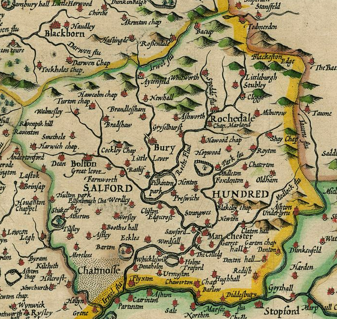
Salford ( ) is a City status in the United Kingdom, city in Greater Manchester, England, on the western bank of the River Irwell which forms its boundary with Manchester city centre. Landmarks include the former Salford Town Hall, town hall, Salford Cathedral, Salford Lads' Club and St Philip's Church, Salford, St Philip's Church. In 2021 it had a population of 129,794. The demonym for people from Salford is ''Salfordian''. Salford is the main settlement of the wider City of Salford metropolitan borough, which incorporates Eccles, Greater Manchester, Eccles, Pendlebury, Swinton, Greater Manchester, Swinton and Walkden. Salford was named in the Early Middle Ages, though evidence exists of settlement since Neolithic times. It was the seat of the large Hundred of Salford in the Historic counties of England, historic county of Lancashire and was granted a market charter in about 1230, which gave it primary cultural and commercial importance in the region.. It was eventually overt ... [...More Info...] [...Related Items...] OR: [Wikipedia] [Google] [Baidu] |
Glossop
Glossop is a market town in the borough of High Peak (borough), High Peak, Derbyshire, England, east of Manchester, north-west of Sheffield and north of Matlock, Derbyshire, Matlock. Near Derbyshire's borders with Cheshire, Greater Manchester, South Yorkshire and West Yorkshire, between above sea level, it is bounded by the Peak District National Park to the south, east and north. In 2021, it had a population of 17,825. Historically, the name ''Glossop'' refers to the small hamlet that gave its name to an ancient parish recorded in the Domesday Book of 1086 and then the manorialism, manor given by William I of England to William Peverel. A municipal borough was created in 1866, which encompassed less than half of the manor's territory.The Ancient Parish of Glossop Retrieved 18 June 2008 The area now known as ... [...More Info...] [...Related Items...] OR: [Wikipedia] [Google] [Baidu] |
Old Swan
Old Swan is an eastern neighbourhood of Liverpool, Merseyside, England, bordered by Knotty Ash, Stoneycroft, Broadgreen, Fairfield, Liverpool, Fairfield and Wavertree. At the United Kingdom Census 2011, 2011 Census, the population was 16,461. Description Old Swan is centred on the road junction between Prescot Road, running east to west, Derby Lane (from the north) St Oswald Street (from the south) and Broadgreen Road (from the south-east). It is named after a public house called the Three Swans, which served the pack-horse route along Prescot Lane (now Prescot Road) in the 18th century. The name was derived from the coat of arms of local landowners, the Walton family. The inn stood at the corner of Prescot Lane and Pettycoat Lane (now Broadgreen Road). The junction later acquired two more pubs, the Swan Vaults (now called the Old Swan) and the Cygnet (now closed), while the original pub was replaced by another, the Red House (now closed); this has become a branch of Costa Cof ... [...More Info...] [...Related Items...] OR: [Wikipedia] [Google] [Baidu] |
Tesco
Tesco plc () is a British multinational groceries and general merchandise retailer headquartered in the United Kingdom at its head offices in Welwyn Garden City, England. The company was founded by Jack Cohen (businessman), Sir Jack Cohen in Hackney, London, in 1919. In 2011, it was the third-largest retailer in the world measured by gross revenues and the Retail#Global top ten retailers, ninth-largest in the world measured by revenues. It is the market leader of groceries in the UK (where it has a market share of around 28.4%). As well as the United Kingdom, Tesco has stores in Czechia, Ireland, Slovakia, and Hungary. Since the 1960s, Tesco has Diversification (marketing strategy), diversified into areas such as the retailing of books, clothing, electronics, furniture, toys, petrol, software, financial services, telecommunications and internet services. In the 1990s, Tesco re-positioned itself from being a downmarket high-volume low-cost retailer, attempting to attract a ran ... [...More Info...] [...Related Items...] OR: [Wikipedia] [Google] [Baidu] |
Fairfield, Liverpool
Fairfield is an area of Liverpool, in Merseyside, England, encompassing streets between Tuebrook and Kensington and stretching to Old Swan. It consists of a variety of houses; there are some traditional red-brick terraces, larger Victorian villas and also the notable 300-year-old Georgian Fairfield Crescent which is off the equally old Prospect Vale. The area also contains the Victorian Newsham Park; Friends of Newsham Park meet with council officers regularly at the Newsham Park park forum to discuss improvements to the park and are currently anticipating the start on site of the building of a new pavilion. Fairfield is now also home to a new shopping development on Prescot Road, which brings retail stores like Iceland and other shops into this once neglected neighbourhood centre. Another new facility is the community fire station on Beech Street which was opened in 2010 by the Duchess of Gloucester. It has been named "Kensington" Fire Station, despite being just inside the ... [...More Info...] [...Related Items...] OR: [Wikipedia] [Google] [Baidu] |
Royal Liverpool University Hospital
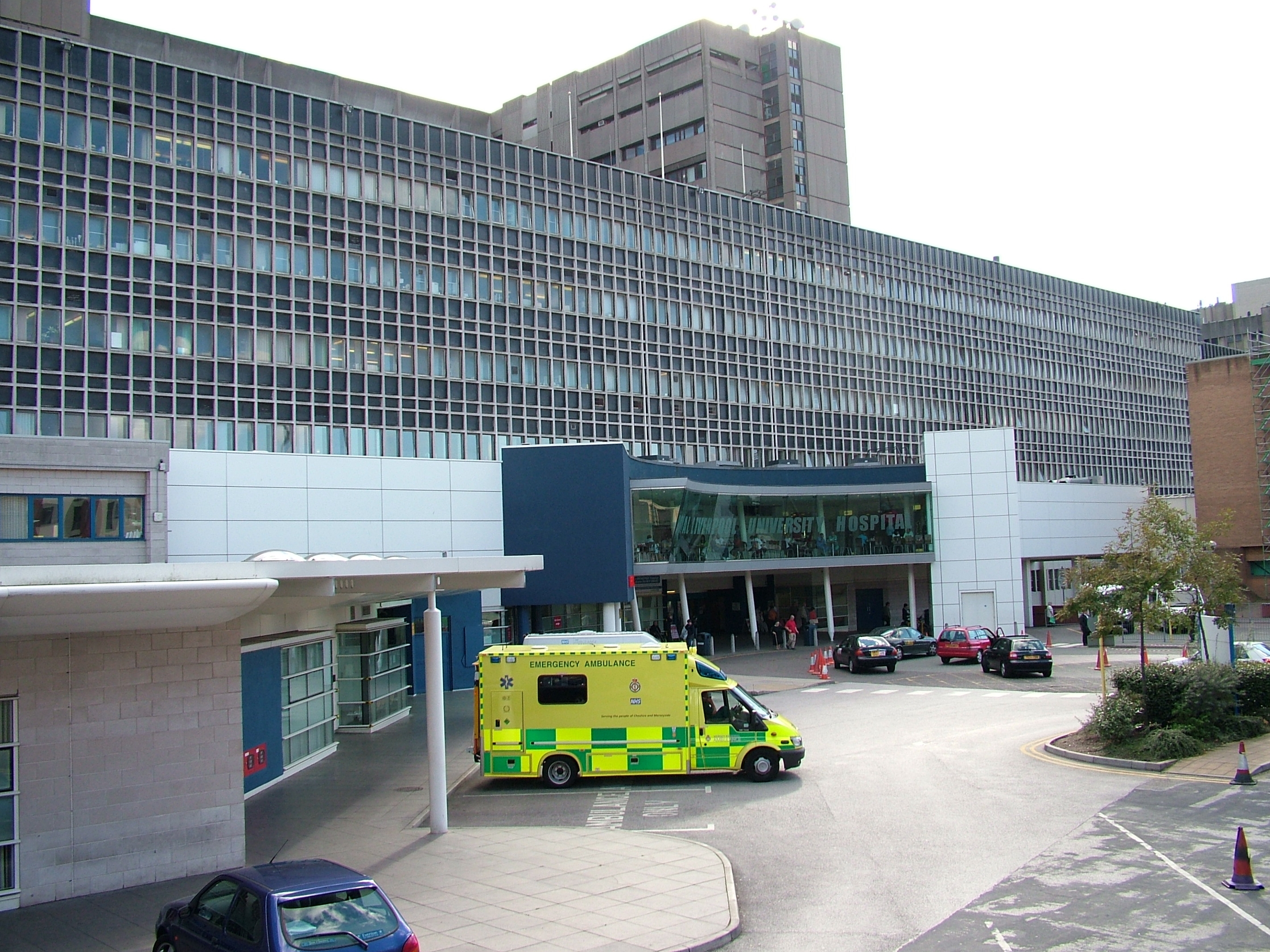
Royal Liverpool University Hospital (RLUH) is a major teaching and research hospital located in the city of Liverpool, England. It is the largest and busiest hospital in Merseyside and Cheshire. A major redevelopment of the hospital began in 2013 and was scheduled for completion in 2017, but construction problems and the 2018 collapse of main contractor Carillion meant it did not open until late 2022. The hospital is part of NHS University Hospitals of Liverpool Group and is associated with the University of Liverpool, Liverpool John Moores University and the Liverpool School of Tropical Medicine. History Former hospital The former hospital, originally known simply as the Royal Liverpool Hospital, was designed to replace three other city centre acute hospitals that existed at the time – the Liverpool Royal Infirmary on Pembroke Place, the David Lewis Northern Hospital on Great Howard Street, and the Royal Southern Hospital on Caryl Street. It had been agreed to amalgamate ... [...More Info...] [...Related Items...] OR: [Wikipedia] [Google] [Baidu] |
A580 Road
The A580 (officially the Liverpool–East Lancashire Road, colloquially the East Lancs) is the United Kingdom's first purpose-built A road. The road was officially opened by King George V on 18 July 1934. Despite its name, the actual road runs through the modern day metropolitan counties of Merseyside and Greater Manchester which were historically in Lancashire when the road was built until 1974. Notable towns and cities along the route include Liverpool, Kirkby, St. Helens, Leigh, Swinton and Salford. It was described as "Britain's biggest road" at the time. Purpose The road was built to provide better access between the Port of Liverpool and the industrial areas of East Lancashire around Manchester. The new high-quality trunk road would supersede the indirect and heavily built-up A57 through Prescot, Warrington and Eccles. Journey times for road haulage would be reduced to under an hour. This road was built with a 1930s Dutch-style cycle path running its entire length ... [...More Info...] [...Related Items...] OR: [Wikipedia] [Google] [Baidu] |
Queensway Tunnel
The Queensway Tunnel ( signposted as the Birkenhead Tunnel or B'head Tunnel) is a road tunnel under the River Mersey, in the north west of England, between Liverpool and Birkenhead. Locally, it is often referred to as the "old tunnel", to distinguish it from the newer Kingsway Tunnel (1971), which serves Wallasey and the M53 motorway traffic. At in length, it is the longest road tunnel in the UK. History Planning and construction The first tunnel under the River Mersey was for the Mersey Railway in 1886. The first tunnel crossing was proposed in 1825, and again in 1827. A report in 1830 rejected the road tunnel due to concerns about building damage. During the 1920s there were concerns about the long queues of cars and lorries at the Mersey Ferry terminal, so once royal assent to a parliamentary bill was received, construction of the first Mersey road tunnel started in 1925, to a design by consulting engineer Sir Basil Mott. Mott supervised the construction in association wi ... [...More Info...] [...Related Items...] OR: [Wikipedia] [Google] [Baidu] |
A59 Road
The A59 is a major road in England which is around long and runs from Wallasey, Merseyside to York, North Yorkshire. The alignment formed part of the Trunk Roads Act 1936, being then designated as the A59. It is a key route connecting Merseyside at the M53 motorway to Yorkshire, passing through three British counties, counties and connecting to various major motorways. The road is a combination of historical routes combined with contemporary roads and a mixture of dual and single carriageway. Some sections of the A59 in Yorkshire closely follow the routes of Roman roads, some dating back to the Middle Ages as salt roads, whilst much of the A59 in Merseyside follows Victorian era, Victorian routes which are largely unchanged to the present day. Numerous Bypass (road), bypasses have been constructed throughout the 20th century, one of the earliest being the Maghull bypass in the early 1930s, particularly where traffic through towns was congested. Portions of the route through Lan ... [...More Info...] [...Related Items...] OR: [Wikipedia] [Google] [Baidu] |
Liverpool John Moores University
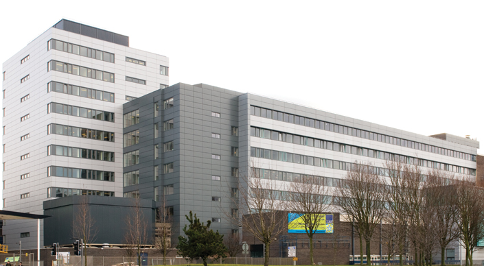
Liverpool John Moores University (abbreviated LJMU) is a public university, public research university in the city of Liverpool, England. The university can trace its origins to the Liverpool Mechanics' School of Arts, established in 1823. This later merged to become Liverpool Polytechnic. In 1992, following an Further and Higher Education Act 1992, Act of Parliament, the Liverpool Polytechnic became what is now Liverpool John Moores University. It is named after Sir John Moores, a local businessman and philanthropist, who donated to the university's precursor institutions. The university had students in , of which are undergraduate students and are postgraduate, making it the List of universities in the United Kingdom by enrollment, largest university in the UK by total student population. It is a member of the MillionPlus, the NCUK, Northern Consortium and the European University Association. History Origins Founded as a small mechanics institution (Liverpool Instit ... [...More Info...] [...Related Items...] OR: [Wikipedia] [Google] [Baidu] |
River Mersey
The River Mersey () is a major river in North West England. Its name derives from Old English and means "boundary river", possibly referring to its having been a border between the ancient kingdoms of Mercia and Northumbria. For centuries it has formed part of the boundary between the historic counties of Lancashire and Cheshire. The Mersey starts at the confluence of the River Tame and River Goyt in Stockport. It flows westwards through south Manchester, then into the Manchester Ship Canal near Irlam Locks, becoming a part of the canal and maintaining its water levels. After it exits the canal, flowing towards Warrington where it widens. It then narrows as it passes between Runcorn and Widnes. The river widens into a large estuary, which is across at its widest point near Ellesmere Port. The course of the river then turns northwards as the estuary narrows between Liverpool and Birkenhead on the Wirral Peninsula to the west, and empties into Liverpool Bay. In total the ... [...More Info...] [...Related Items...] OR: [Wikipedia] [Google] [Baidu] |
Mancunian Way
The Mancunian Way is a two mile long grade separated elevated motorway in Manchester, England. It is officially made up of the A57(M) and A635(M) motorways, although the latter does not appear on road signs for practical reasons. It is also part of two other roads: the A57 to the west, which runs east–west through Greater Manchester linking the M602 and M67 motorways, and a short section of non-motorway A635 to the east. Part of this non-motorway section collapsed on 14 August 2015 due to a sinkhole. Route The road forms a major part of the ManchesterSalford Inner Ring Road and runs south of the city centre. Running eastbound, it starts as a two-lane dual carriageway and passes underneath the A56. Following this, the road widens to three lanes. At the next junction which leads to the A5103, the road reduces to two lanes and becomes an elevated highway. This section runs atop link roads and two roundabouts before reaching the next junction with the A34. At this point t ... [...More Info...] [...Related Items...] OR: [Wikipedia] [Google] [Baidu] |


