|
A4 Road (Great Britain)
The A4 is a major road in England from Central London to Avonmouth via Heathrow Airport, Reading, Bath and Bristol. It is historically known as the Bath Road with newer sections including the Great West Road and Portway. The road was once the main route from London to Bath, Bristol and the west of England and formed, after the A40, the second main western artery from London. Although most traffic is carried by the M4 motorway today, the A4 still acts as the main route from Bristol to London for non-motorway traffic. History Turnpikes The A4 has gone through many transformations through the ages from pre-Roman routes, Roman roads (such as the one passing Silbury Hill), and basic wagon tracks. During the Middle Ages, most byways and tracks served to connect villages with their nearest market town. A survey of Savernake Forest near Hungerford in 1228 mentions "The King's Street" running between the town and Marlborough. This street corresponded roughly with the route of the ... [...More Info...] [...Related Items...] OR: [Wikipedia] [Google] [Baidu] |
A4 Road Map
A4 commonly refers to: * A4 paper, a paper size defined by the ISO 216 standard, measuring 210 × 297 mm A4 and variants may also refer to: Science and technology * British NVC community A4 (''Hydrocharis morsus-ranae - Stratiotes aloides'' community), one type of Aquatic communities in the British National Vegetation Classification system * Combretastatin A-4, a stilbenoid chemical compound * ''A''4, the alternating group on four elements * A4, a stainless steel#Types of stainless steel, type of stainless steel * Subfamily A4, a rhodopsin-like receptors subfamily * Zeolite A-4, a sodium-type molecular sieve also known as 4A Computing * Apple A4, a microprocessor used in some Apple products * AMD A4, a microprocessor * Samsung Galaxy A04, a smartphone manufactured by Samsung Electronics Medicine * ATC code A04 ''Antiemetics and antinauseants'', a subgroup of the Anatomical Therapeutic Chemical Classification System * Lipoxin A4, a lipoxin * Androstenedione, an androgen st ... [...More Info...] [...Related Items...] OR: [Wikipedia] [Google] [Baidu] |
Central London
Central London is the innermost part of London, in England, spanning the City of London and several boroughs. Over time, a number of definitions have been used to define the scope of Central London for statistics, urban planning and local government. Its characteristics are understood to include a high-density built environment, high land values, an elevated daytime population and a concentration of regionally, nationally and internationally significant organisations and facilities. Road distances to London are traditionally measured from a central point at Charing Cross (in the City of Westminster), which is marked by the statue of King Charles I at the junction of the Strand, Whitehall and Cockspur Street, just south of Trafalgar Square. Characteristics The central area is distinguished, according to the Royal Commission, by the inclusion within its boundaries of Parliament and the Royal Palaces, the headquarters of Government, the Law Courts, the head offices of a ve ... [...More Info...] [...Related Items...] OR: [Wikipedia] [Google] [Baidu] |
Kensington
Kensington is an area of London in the Royal Borough of Kensington and Chelsea, around west of Central London. The district's commercial heart is Kensington High Street, running on an east–west axis. The north-east is taken up by Kensington Gardens, containing the Albert Memorial, the Serpentine Gallery and John Hanning Speke, Speke's monument. South Kensington and Gloucester Road, London, Gloucester Road are home to Imperial College London, the Royal College of Music, the Royal Albert Hall, Natural History Museum, London, Natural History Museum, Victoria and Albert Museum, and Science Museum, London, Science Museum. The area is also home to many embassies and consulates. Name The Manorialism, manor of ''Chenesitone'' is listed in the Domesday Book of 1086, which in the Old English language, Anglo-Saxon language means "Chenesi's List of generic forms in place names in Ireland and the United Kingdom, ton" (homestead/settlement). One early spelling is ''Kesyngton'', as wri ... [...More Info...] [...Related Items...] OR: [Wikipedia] [Google] [Baidu] |
Theale, Berkshire
Theale () is a village and civil parish in West Berkshire, England. It is southwest of Reading and 10 miles (16 km) east of Thatcham. The compact parish is bounded to the south and south-east by the Kennet & Avon Canal (which here incorporates the River Kennet), to the north by a golf course, to the east by the M4 motorway and to the west by the A340 road. Toponymy The name is thought to come from the Old English ''þelu'' meaning planks. As with the village of Theale in Somerset, this probably refers to planks used to create causeways on marshes or flood plains. A local legend suggests the name Theale refers to the village's coaching inns, and its position as the first staging post on the Bath Road out of Reading – literally calling the village The ale. History Romans The old significance of the position of Theale is that it lay at the junction of two ancient natural routes, one following the Kennet Valley from east to west and another which exploited the valley o ... [...More Info...] [...Related Items...] OR: [Wikipedia] [Google] [Baidu] |
Turnpike Trust
Turnpike trusts were bodies set up by individual Acts of Parliament in the United Kingdom, Acts of Parliament, with powers to collect road toll road, tolls for maintaining the principal roads in Kingdom of Great Britain, Britain from the 17th but especially during the 18th and 19th centuries. At the peak, in the 1830s, over 1,000 trusts administered around of turnpike road in England and Wales, taking tolls at almost 8,000 toll-gates and side-bars. During the early 19th century the concept of the turnpike trust was adopted and adapted to manage roads within the British Empire (Ireland, Canada, Australia, New Zealand, India, and South Africa) and in the United States. Turnpikes declined with the Railway mania, coming of the railways and then the Local Government Act 1888 gave responsibility for maintaining main roads to county councils and county borough councils. Etymology The term "turnpike" originates from the similarity of the gate used to control access to the road, to ... [...More Info...] [...Related Items...] OR: [Wikipedia] [Google] [Baidu] |
Melksham
Melksham () is a town and civil parish on the Bristol Avon, River Avon in Wiltshire, England, about northeast of Trowbridge and south of Chippenham. The parish population was 18,113 at the 2021 census. History Early history Excavations in 2021 in the grounds of Melksham House found fragments of locally made pottery from the early British Iron Age, Iron Age (7th to 4th centuries BC). There is evidence of settlement continuing into the later Iron Age and Roman Britain, Roman periods, including Roman clay roof tiles. Melksham developed at a ford across the River Avon, Bristol, River Avon. The name is presumed to derive from "''meolc''", the Old English for milk, and ''"ham"'', a village. On John Speed's map of Wiltshire (1611), the name is spelt both ''Melkesam'' (for the hundred (county subdivision), hundred) and ''Milsham'' (for the town itself). Melksham is also the name of the Royal forest that occupied the surrounding of the area in the Middle Ages. Landowners In 126 ... [...More Info...] [...Related Items...] OR: [Wikipedia] [Google] [Baidu] |
Anne Of Denmark And The Spa At Bath
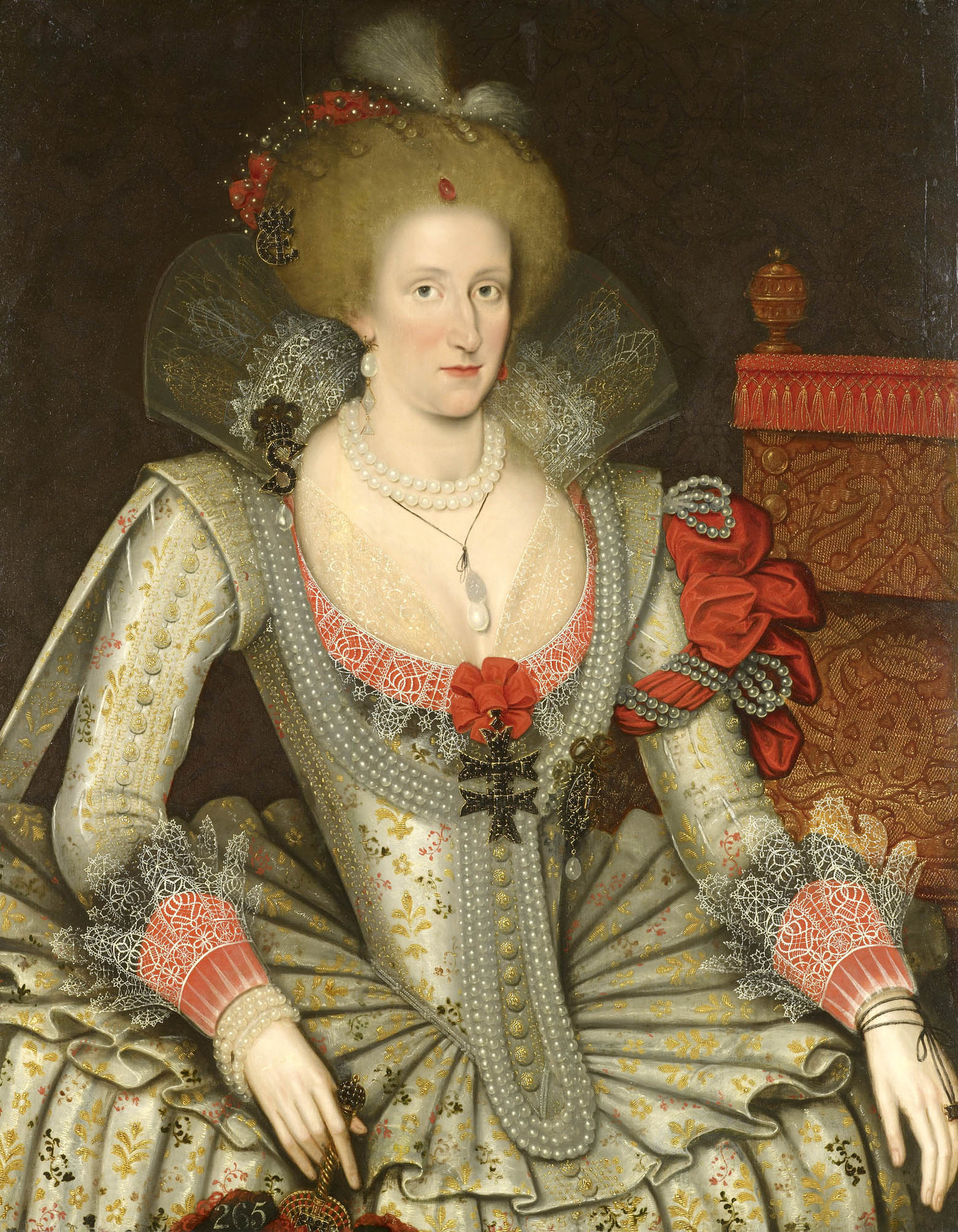
Anne of Denmark (1574–1619) was the wife of James VI and I. She visited Bath, Somerset, in the belief that drinking and bathing in mineral waters could improve her health. The Roman Baths (Bath), warm springs at Bath had been used for medicinal purposes since Roman times. During her progresses to Bath she was entertained at country houses along the way. The court physician Théodore de Mayerne left extensive notes in Latin describing his treatment of Anne of Denmark from 10 April 1612 to her death. Primarily, she was seeking help for gout or edema, dropsy, a swelling of the legs and feet which made walking difficult. Her companion and servant Jean Ker, Countess of Roxburghe, Jean Drummond described an occasion when the queen was unable to set her swollen foot on the ground. During these progresses, Anne of Denmark visited or came near some of the lands and manors included in her jointure lands, including Corston, Somerset, Corston, and was able to promote the image of the Stuart ... [...More Info...] [...Related Items...] OR: [Wikipedia] [Google] [Baidu] |
Anne Of Denmark
Anne of Denmark (; 12 December 1574 – 2 March 1619) was the wife of King James VI and I. She was List of Scottish royal consorts, Queen of Scotland from their marriage on 20 August 1589 and List of English royal consorts, Queen of England and Ireland from the union of the Scottish and English crowns on 24 March 1603 until Death and funeral of Anne of Denmark, her death in 1619. The second daughter of King Frederick II of Denmark and Sophie of Mecklenburg-Güstrow, Anne married James at age 14. They had three children who survived infancy: Henry Frederick, Prince of Wales, who predeceased his parents; Elizabeth Stuart, Queen of Bohemia, Princess Elizabeth, who became Queen of Bohemia; and James's future successor, Charles I of England, Charles I. Anne demonstrated an independent streak and a willingness to use factional Scottish politics in her conflicts with James over the custody of Prince Henry and his treatment of her friend Barbara Ruthven, Beatrix Ruthven. Anne app ... [...More Info...] [...Related Items...] OR: [Wikipedia] [Google] [Baidu] |
Thomas Witherings
Thomas Witherings (died 28 September 1651) was an English merchant and postal administrator who established the Royal Mail public letter service. He was a politician who sat in the House of Commons in 1640. Early life Witherings was the second son of a Staffordshire family and his uncle Anthony Withering and brother were courtiers. He was harbinger to the Queen Henrietta Maria and may have had Roman Catholic leanings at the time, although later he was a Puritan. Witherings was admitted to the Worshipful Company of Mercers on 16 February 1625. Postmaster of Foreign Mails In 1632, Charles I approved the appointment of Witherings as the Postmaster of Foreign Mails together with William Frizzell. Although the Postmaster was only responsible for official mail, it had become the practice to provide a service for City of London merchants dealing with the continent. In April 1633 Witherings was sent on a visit to the Calais and Antwerp to regularise the foreign mail service. However, by ... [...More Info...] [...Related Items...] OR: [Wikipedia] [Google] [Baidu] |
Roman Road From Silchester To Bath
The Roman road from Silchester to Bath connected Calleva Atrebatum (Silchester) with Aquae Sulis (Bath) via Spinae ( Speen), Cunetio (near Marlborough) and Verlucio (near Sandy Lane). The road was a significant route for east–west travel and military logistics in south-east England during the 1st to 5th centuries. Parts of its route were subsequently followed by earthworks that are presumed to form part of Wansdyke. During the Middle Ages, the road was used by drovers, as well as by merchants and travellers. Margary numbered the road as 53. Portions of the Roman road are extant, while in other places all apparent vestiges are absent from view. In the early 19th century, Colt-Hoare surveyed and mapped its course from Overton Down (west of Marlborough) to Bath; the rest was only known in isolated sections until a study by Hugh Toller was published in 2013. See also *Roman roads in Britain Roman roads in Britannia were initially designed for military use, created b ... [...More Info...] [...Related Items...] OR: [Wikipedia] [Google] [Baidu] |
Roman Roads
Roman roads ( ; singular: ; meaning "Roman way") were physical infrastructure vital to the maintenance and development of the Roman state, built from about 300 BC through the expansion and consolidation of the Roman Republic and the Roman Empire. They provided efficient means for the overland movement of Military history of ancient Rome, armies, officials, civilians, inland carriage of official communications, and Roman commerce, trade goods. Roman roads were of several kinds, ranging from small local roads to broad, long-distance highways built to connect cities, major towns and military bases. These major roads were often stone-paved and metaled, cambered for drainage, and were flanked by footpaths, Bridle path, bridleways and drainage ditches. They were laid along accurately surveyed courses, and some were cut through hills or conducted over rivers and ravines on bridgework. Sections could be supported over marshy ground on rafted or piled foundations.Corbishley, Mike: "The ... [...More Info...] [...Related Items...] OR: [Wikipedia] [Google] [Baidu] |
London
London is the Capital city, capital and List of urban areas in the United Kingdom, largest city of both England and the United Kingdom, with a population of in . London metropolitan area, Its wider metropolitan area is the largest in Western Europe, with a population of 14.9 million. London stands on the River Thames in southeast England, at the head of a tidal estuary down to the North Sea, and has been a major settlement for nearly 2,000 years. Its ancient core and financial centre, the City of London, was founded by the Roman Empire, Romans as Londinium and has retained its medieval boundaries. The City of Westminster, to the west of the City of London, has been the centuries-long host of Government of the United Kingdom, the national government and Parliament of the United Kingdom, parliament. London grew rapidly 19th-century London, in the 19th century, becoming the world's List of largest cities throughout history, largest city at the time. Since the 19th cen ... [...More Info...] [...Related Items...] OR: [Wikipedia] [Google] [Baidu] |


