|
A3 Motorway (Croatia)
The A3 motorway () is a major Motorways in Croatia, motorway in Croatia spanning . The motorway connects Zagreb, the nation's capital, to the historical Slavonia region of Croatia and a number of cities along the Sava, Sava River. It represents a major east–west transportation corridor in Croatia and a significant part of the Pan-European Corridor X, serving as a transit route between the European Union states and the Balkans. Apart from Zagreb, where the A3 motorway comprises a considerable part of the Zagreb bypass, the motorway runs near a number of significant Cities of Croatia, Croatian cities. The motorway consists of two traffic lanes and an emergency lane in each driving direction, separated by a central reservation. All intersections of the A3 motorway are grade separation, grade separated, and the motorway comprises several large stack interchange, stack and cloverleaf interchange, cloverleaf interchanges at junctions with four other motorways in Croatia: A1 (Croatia ... [...More Info...] [...Related Items...] OR: [Wikipedia] [Google] [Baidu] |
Zagreb County
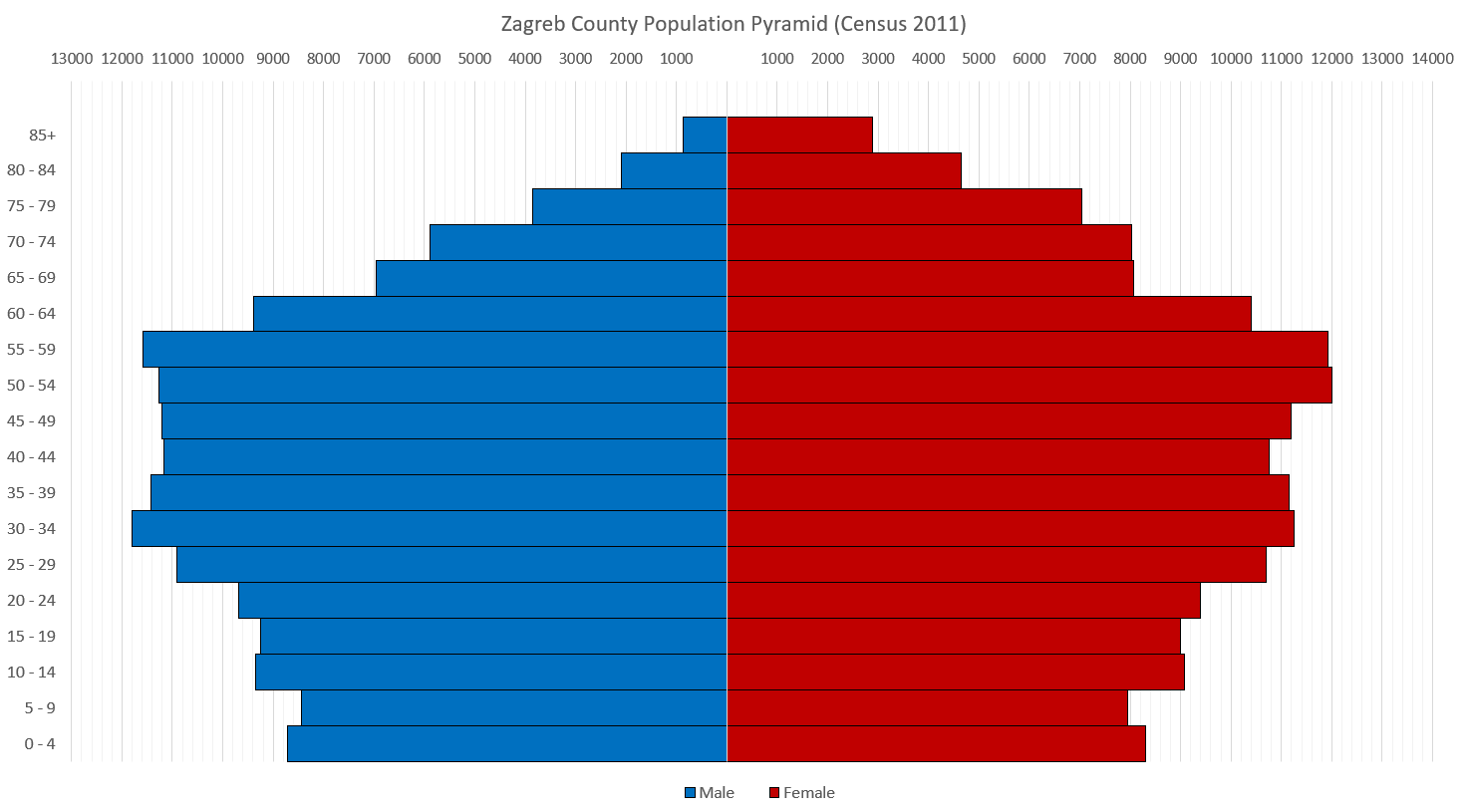
Zagreb County () is a county in Northern Croatia. It surrounds, but does not contain, the nation's capital Zagreb, which is a separate territorial unit. For that reason, the county is often nicknamed "Zagreb ring" (). According to the 2021 census, the county has 299,985 inhabitants, most of whom live in smaller urban satellite towns. The Zagreb County once included the city of Zagreb, but in 1997 they separated, when the City was given a special status. Although separated from the city of Zagreb both administratively and territorially, it remains closely linked with it. Zagreb County borders on Krapina-Zagorje County, the city of Zagreb, Varaždin County, and Koprivnica-Križevci County in the north, Bjelovar-Bilogora County in the east, Sisak-Moslavina County in the south and Karlovac County in the southwest as well as Slovenia in the west. Franjo Tuđman Airport is located on the territory of Zagreb County, the biggest and most important airport in the country. Admini ... [...More Info...] [...Related Items...] OR: [Wikipedia] [Google] [Baidu] |
Zagreb Bypass
Zagreb bypass () is a U-shaped motorway partially encircling Zagreb, Croatia. The largest part by far, between Jankomir and Ivanja Reka interchanges, was built between 1977 and 1979, while the Ivanja Reka – Sveta Helena section was built between 1996 and 1999. The bypass is long, tracing around the city from the northwestern suburb of Zaprešić to Sveta Helena in the northeast. The bypass crosses the Sava River twice and comprises a bridge across the Sava-Odra floodwater overflow canal. As the busiest sections between Jankomir and Buzin interchanges carry traffic volume of approximately 45,000 AADT, it is the most heavily used motorway sector in Croatia. Zagreb bypass is not designated as a separate motorway with a distinct motorway number, rather it consists of sections of three motorways: Those motorway sections are concurrent with sections of the D1 and D3 state roads as well as European routes E59, E65, E70 and E71. The bypass currently comprises four tr ... [...More Info...] [...Related Items...] OR: [Wikipedia] [Google] [Baidu] |
Balkans
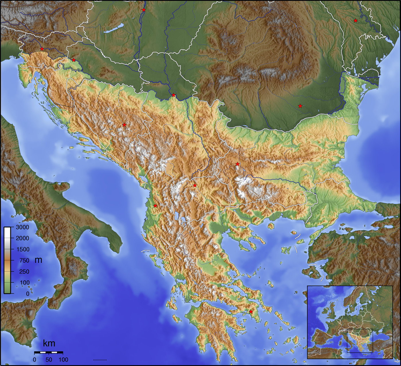
The Balkans ( , ), corresponding partially with the Balkan Peninsula, is a geographical area in southeastern Europe with various geographical and historical definitions. The region takes its name from the Balkan Mountains that stretch throughout the whole of Bulgaria. The Balkan Peninsula is bordered by the Adriatic Sea in the northwest, the Ionian Sea in the southwest, the Aegean Sea in the south, the Turkish straits in the east, and the Black Sea in the northeast. The northern border of the peninsula is variously defined. The highest point of the Balkans is Musala, , in the Rila mountain range, Bulgaria. The concept of the Balkan Peninsula was created by the German geographer August Zeune in 1808, who mistakenly considered the Balkan Mountains the dominant mountain system of southeastern Europe spanning from the Adriatic Sea to the Black Sea. In the 19th century the term ''Balkan Peninsula'' was a synonym for Rumelia, the parts of Europe that were provinces of the Ottoman E ... [...More Info...] [...Related Items...] OR: [Wikipedia] [Google] [Baidu] |
European Union
The European Union (EU) is a supranational union, supranational political union, political and economic union of Member state of the European Union, member states that are Geography of the European Union, located primarily in Europe. The union has a total area of and an estimated population of over 449million as of 2024. The EU is often described as a ''sui generis'' political entity combining characteristics of both a federation and a confederation. Containing 5.5% of the world population in 2023, EU member states generated a nominal gross domestic product (GDP) of around €17.935 trillion in 2024, accounting for approximately one sixth of global economic output. Its cornerstone, the European Union Customs Union, Customs Union, paved the way to establishing European Single Market, an internal single market based on standardised European Union law, legal framework and legislation that applies in all member states in those matters, and only those matters, where the states ... [...More Info...] [...Related Items...] OR: [Wikipedia] [Google] [Baidu] |
Pan-European Corridor X
The Corridor X is one of the pan-European corridors. It runs between Salzburg in Austria and Thessaloniki in Greece. The corridor passes through Austria, Slovenia, Croatia, Serbia, North Macedonia, and Greece. It has four branches: Xa, Xb, Xc, and Xd. The European Bank for Reconstruction and Development has given loans to support infrastructure improvements along Corridor X. Branches X: Salzburg - Ljubljana - Zagreb - Belgrade - Niš - Skopje - Veles - Thessaloniki. * Branch A: Graz - Maribor - Zagreb * Branch B: Budapest - Novi Sad - Belgrade * Branch C: Niš - Sofia - Plovdiv - Edirne - Istanbul via Corridor IV * Branch D: Veles - Prilep - Bitola - Florina - Igoumenitsa ( Via Egnatia) Branch A (Corridor Xa) Corridor Xa runs between Graz, Austria and Zagreb, Croatia through Croatia, Slovenia, and Austria. Branch C (Corridor Xc) Corridor Xc follows the route Niš - Sofia - Plovdiv - Edirne - Istanbul. The road in Serbia from Niš to the Bulgarian border ... [...More Info...] [...Related Items...] OR: [Wikipedia] [Google] [Baidu] |
Sava
The Sava, is a river in Central Europe, Central and Southeast Europe, a right-bank and the longest tributary of the Danube. From its source in Slovenia it flows through Croatia and along its border with Bosnia and Herzegovina, and finally reaches Serbia, feeding into the Danube in its capital, Belgrade. The Sava is long, including the Sava Dolinka headwater rising in Zelenci, Slovenia. It is the largest List of tributaries of the Danube, tributary of the Danube by volume of water, and the second-largest after the Tisza in terms of catchment area () and length. It drains a significant portion of the Dinaric Alps region, through the major tributaries of Drina, Bosna (river), Bosna, Kupa, Una (Sava), Una, Vrbas (river), Vrbas, Lonja, Kolubara, Bosut (river), Bosut and Krka (Sava), Krka. The Sava is one of the longest rivers in Europe and among the longest tributaries of another river. The population in the Sava River basin is estimated at 8,176,000, and is shared by three capit ... [...More Info...] [...Related Items...] OR: [Wikipedia] [Google] [Baidu] |
Slavonia
Slavonia (; ) is, with Dalmatia, Croatia proper, and Istria County, Istria, one of the four Regions of Croatia, historical regions of Croatia. Located in the Pannonian Plain and taking up the east of the country, it roughly corresponds with five Counties of Croatia, Croatian counties: Brod-Posavina County, Brod-Posavina, Osijek-Baranja County, Osijek-Baranja, Požega-Slavonia County, Požega-Slavonia, Virovitica-Podravina County, Virovitica-Podravina, and Vukovar-Syrmia County, Vukovar-Syrmia, although the territory of the counties includes Baranya (region), Baranya, and the definition of the western extent of Slavonia as a region varies. The counties cover or 22.2% of Croatia, inhabited by 806,192—18.8% of Croatia's population. The largest city in the region is Osijek, followed by Slavonski Brod and Vinkovci. Slavonia is located in the Pannonian Basin, largely bordered by the Danube, Drava, and Sava rivers. In the west, the region consists of the Sava and Drava valleys and ... [...More Info...] [...Related Items...] OR: [Wikipedia] [Google] [Baidu] |
Croatia
Croatia, officially the Republic of Croatia, is a country in Central Europe, Central and Southeast Europe, on the coast of the Adriatic Sea. It borders Slovenia to the northwest, Hungary to the northeast, Serbia to the east, Bosnia and Herzegovina and Montenegro to the southeast, and shares a maritime border with Italy to the west. Its capital and largest city, Zagreb, forms one of the country's Administrative divisions of Croatia, primary subdivisions, with Counties of Croatia, twenty counties. Other major urban centers include Split, Croatia, Split, Rijeka and Osijek. The country spans , and has a population of nearly 3.9 million. The Croats arrived in modern-day Croatia, then part of Illyria, Roman Illyria, in the late 6th century. By the 7th century, they had organized the territory into Duchy of Croatia, two duchies. Croatia was first internationally recognized as independent on 7 June 879 during the reign of Duke Branimir of Croatia, Branimir. Tomislav of Croatia, Tomis ... [...More Info...] [...Related Items...] OR: [Wikipedia] [Google] [Baidu] |
Motorways In Croatia
Highways in Croatia are the main transport network in Croatia. The Croatian classification includes several categories of highways: * The main #Motorways, motorway routes are prefixed with an A (for ''autocesta'') followed by one or two digits. They are controlled-access highways with Toll road, tolls using a ticket system. * #Expressways, Expressways (''brza cesta'') are toll-free limited-access highways with grade-separated intersections and fast speed limits. They are similar to the motorways, but are not always dual carriageways and may have no emergency lanes. Their speed limit is always lower than that of the motorways. They either have standalone designations or are parts of non-motorway state routes, such as the D prefixed highways described further below. * Roads dedicated for motor vehicles (''cesta namijenjena isključivo za promet motornih vozila''), which is another category of limited-access highways. They usually have multiple lanes and separated carriageways but ... [...More Info...] [...Related Items...] OR: [Wikipedia] [Google] [Baidu] |
Nova Gradiška
Nova Gradiška is a town located in the Brod-Posavina County of Croatia, population 14,229 (2011). It is located in the historic region of Slavonia, near the border to Bosnia and Herzegovina. The first word in the name means ''New'', and there's also an ''Old'' Gradiška nearby, the village of Stara Gradiška and the Bosnia and Herzegovina, Bosnian town of Gradiška, Bosnia and Herzegovina, Gradiška. History Nova Gradiška is often referred to as ''The Youngest Town''. The town of Nova Gradiška was founded in 1748 as an outpost in the Military Frontier and was first named Friedrichsdorf in German. Already in 1750 it was renamed Neu-Gradischka which later became Nova Gradiška in Croatian. The Hungarian name is Újgradiska. Before 1881, Nova Gradiška (named ''NEU-GRADISKA'' before 1850) was part of the Austrian monarchy (Kingdom of Croatia-Slavonia after the compromise of 1867), in the Slavonian Military Frontier, Gradiskaner Regiment N°VIII. The first building constructe ... [...More Info...] [...Related Items...] OR: [Wikipedia] [Google] [Baidu] |
Kutina
Kutina is a town in central Croatia, the largest settlement in the hilly region of Moslavina, in the Sisak-Moslavina County. The town proper has a population of 13,735 (2011), while the total municipal population is 22,760. The settlement of Kutina was first mentioned in the historical records in 1256. It is the industrial center of the region with petrochemical industry – Petrokemija d.d., electronic components production – SELK d.d., and a variety of smaller entrepreneurships. There is a long mass-media tradition in Kutina, with Moslavački list ocal newspaperand Radio Moslavina ocal radio station The initial headquarters of the Nezavisna Televizija (NeT), a regional commercial TV station, were stationed in Voloder near Kutina. Kutina is widely known for its active youth scene and the alternative-oriented club Baraka. The main attractions are Lonjsko polje nature park, baroque fortress church of Saint Mary of the Snow, old wooden houses called Trijem (eng. Porch) ... [...More Info...] [...Related Items...] OR: [Wikipedia] [Google] [Baidu] |


