|
A354 Road
The A354 is a primary route in England which runs from Salisbury in Wiltshire to Easton on the Isle of Portland in Dorset, a total distance of . From Salisbury the road crosses Cranborne Chase. At Woodyates the road follows the route of Ackling Dyke, a Roman Road for a short distance. The A354 briefly merges with the A350 at the Blandford Forum bypass before crossing the Dorset Downs and merging with the A35 at the Puddletown bypass. to the west it splits from the Dorchester bypass and runs south. The road now bypasses Upwey and Broadwey on a new section of road which has some two lane sections going north and one lane continuously going south towards Weymouth. After the old and new sections meet at Manor Roundabout the road follows down Weymouth Way alongside Radipole Lake. The final stretch runs across a short bridge over Chesil beach Chesil Beach (also known as Chesil Bank) in Dorset, England, is one of three major shingle beach structures in Britain.A. P. Carr ... [...More Info...] [...Related Items...] OR: [Wikipedia] [Google] [Baidu] |
Salisbury
Salisbury ( , ) is a city status in the United Kingdom, cathedral city and civil parish in Wiltshire, England with a population of 41,820, at the confluence of the rivers River Avon, Hampshire, Avon, River Nadder, Nadder and River Bourne, Wiltshire, Bourne. The city is approximately from Southampton and from Bath, Somerset, Bath. Salisbury is in the southeast of Wiltshire, near the edge of Salisbury Plain. An ancient cathedral was north of the present city at Old Sarum Cathedral, Old Sarum. A Salisbury Cathedral, new cathedral was built near the meeting of the rivers and a settlement grew up around it, which received a city charter in 1227 as . This continued to be its official name until 2009 structural changes to local government in England, 2009, when Salisbury City Council was established. Salisbury railway station is an interchange between the West of England line, West of England Line and the Wessex Main Line. Stonehenge, a UNESCO World Heritage Site, is northwest o ... [...More Info...] [...Related Items...] OR: [Wikipedia] [Google] [Baidu] |
A35 Road
The A35 is a major road in southern England, connecting Honiton in Devon and Southampton in Hampshire. It is a trunk road for some of its length. Most of its route passes through Dorset and the New Forest. It originally connected Exeter and Southampton, the original A35 ran along what is now the A3052 road, A3052 joining the present road at Charmouth. Route Beginning in Honiton at the eastern junction with the A30 road, the A35 travels in a roughly south-easterly direction past Axminster, Charmouth and Bridport. After Bridport, there is a section of dual carriageway, before it reaches its bypass (road), bypass around Dorchester, Dorset, Dorchester. After Dorchester, there are approximately of dual carriageway, including the Puddletown bypass, until it reaches its roundabout with the A31 road at Bere Regis. Continuing roughly south-easterly still, it becomes dual carriageway again near Upton, Dorset, Upton, before returning to a single carriageway through Poole and Bournemouth ... [...More Info...] [...Related Items...] OR: [Wikipedia] [Google] [Baidu] |
Roads In England
The United Kingdom has a well developed and extensive network of roads totalling about . Road distances are shown in miles or yards and UK speed limits are indicated in miles per hour (mph) or by the use of the national speed limit (NSL) symbol. Some vehicle categories have various lower maximum limits enforced by speed limiters. A unified numbering system is in place for Great Britain, whilst in Northern Ireland, there is no available explanation for the allocation of road numbers. The earliest specifically engineered roads were built during the prehistoric British Iron Age. The road network was expanded during the Roman occupation. Some of these roads still remain to this day. New roads were added in the Middle Ages and from the 17th century onwards. Whilst control has been transferred between local and central bodies, current management and development of the road network is shared between local authorities, the devolved administrations of Scotland, Wales and Northern I ... [...More Info...] [...Related Items...] OR: [Wikipedia] [Google] [Baidu] |
Area Of Outstanding Natural Beauty
An Area of Outstanding Natural Beauty (AONB; , AHNE) is one of 46 areas of countryside in England, Wales, or Northern Ireland that has been designated for conservation due to its significant landscape value. Since 2023, the areas in England and Wales have also adopted the name National Landscape (). Areas are designated in recognition of their national importance by the relevant public body: Natural England, Natural Resources Wales, and the Northern Ireland Environment Agency respectively. On 22 November 2023, following a review, the AONBs in England and Wales adopted the National Landscapes name, and are in the process of rebranding. AONBs in Northern Ireland did not rename. The name "area of outstanding natural beauty" is still the designated legal term. In place of the term AONB, Scotland uses the similar national scenic area (NSA) designation. Areas of Outstanding Natural Beauty enjoy levels of protection from development similar to those of UK national parks, but unli ... [...More Info...] [...Related Items...] OR: [Wikipedia] [Google] [Baidu] |
Government Offices For The English Regions
Government Offices for the English regions (GOs) were established in 1994 by the John Major government. Until 2011, they were the primary means by which a wide range of policies and programmes of the Government of the United Kingdom were delivered in the regions of England. There were Government Offices in the East Midlands, East of England, London, North East, North West (until 1998 there was a separate GO for Merseyside), South East, South West, West Midlands and Yorkshire and the Humber regions. Purpose The Offices represented thirteen Whitehall departments, and were involved in regenerating communities, fighting crime, tackling housing needs, improving public health, raising standards in education and skills, tackling countryside issues and reducing unemployment. Departments represented By the time of their abolition, there were twelve Whitehall Departments represented in the Offices: *Department for Communities and Local Government (lead department) *Department for ... [...More Info...] [...Related Items...] OR: [Wikipedia] [Google] [Baidu] |
Dorset County Council
Dorset County Council was the county council of Dorset in England. It was created in 1889 and abolished in 2019. Throughout its existence, the council was based in Dorchester. Bournemouth and Poole were made independent from the county council in 1997 when their councils became unitary authorities. On the abolition of the county council in 2019, the borough of Christchurch was merged with Bournemouth and Poole to become Bournemouth, Christchurch and Poole, and the rest of the county was placed under a new unitary authority called Dorset Council. History Elected county councils were created in 1889 under the Local Government Act 1888, taking over many administrative functions that had previously been performed by unelected magistrates at the quarter sessions. The borough of Poole had been a county corporate since 1568, independent from the Sheriff of Dorset, but it was not considered large enough to take on county-level functions under the 1888 Act. Poole was therefore includ ... [...More Info...] [...Related Items...] OR: [Wikipedia] [Google] [Baidu] |
Purbeck Hills
The Purbeck Hills, also called the Purbeck Ridge or simply the Purbecks, are a ridge of chalk downs in Dorset, England. The ridge is formed by the structure known as the Purbeck Monocline, and extends from Lulworth Cove in the west to Old Harry Rocks in the east, where it meets the sea. The hills are part of a system of chalk downlands in southern England formed from the Chalk Group which also includes Salisbury Plain and the South Downs. For most of their length the chalk of the Purbeck Hills is protected from coastal erosion by a band of resistant Portland limestone. Where this band ends, at Durlston Head, the clay and chalk behind has been eroded, creating Poole Bay and the Solent. The ridge of steeply dipping chalk that forms the Purbeck Hills continues further east on the Isle of Wight. The height of the chalk ridge and proximity to Poole Harbour and the south coast have made the hills of strategic importance. There are a number of Iron Age, Roman and Saxon archaeol ... [...More Info...] [...Related Items...] OR: [Wikipedia] [Google] [Baidu] |
Littlemoor
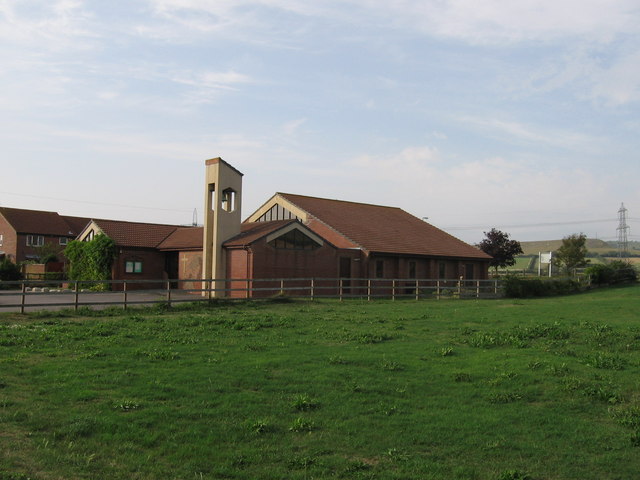
Littlemoor is a suburb of Weymouth, Dorset, Weymouth in Dorset, England. Littlemoor is about to the north of the town centre. The nearest railway station is Upwey to the west. During World War I, the Littlemoor area was used as an Australian army camp. For this reason many of the roads in the area today are named after towns and cities in Australia. Littlemoor has a skatepark, youth centre and a small shopping centre. Opposite the shopping centre there is a Library; next to which is a small green, and the local Church of England church - St. Francis of Assisi. There is also a community centre and a youth club. Littlemoor is partially surrounded by fields. It has a woodland area (which has been named Teddy Bear woods, referencing to the famous nursery rhyme) managed by Dorset Wildlife Trust, part of their Lorton Meadows nature reserve. Littlemoor has a high level of deprivation and poverty but this has decreased in recent years as the estate has expanded. The estate is h ... [...More Info...] [...Related Items...] OR: [Wikipedia] [Google] [Baidu] |
Chesil Beach
Chesil Beach (also known as Chesil Bank) in Dorset, England, is one of three major shingle beach structures in Britain.A. P. Carr and M. W. L. Blackley, "Investigations Bearing on the Age and Development of Chesil Beach, Dorset, and the Associated Area" ''Transactions of the Institute of British Geographers'', No. 58 (March 1973) pp. 99-111. Its name is derived from the word '' chessil'' (Old English or ), meaning "gravel" or "shingle". It runs for a length of from West Bay to the Isle of Portland and in places is up to high and wide. Behind the beach is the Fleet, a shallow tidal lagoon. Both are part of the Jurassic Coast and a UNESCO World Heritage Site, and together form a Site of Special Scientific Interest (SSSI) and a Ramsar Site. Owners of the land designated as ''Chesil & The Fleet'' SSSI include the Crown Estate, the Ministry of Defence and the National Trust. The beach is almost entirely made of stone shingle, and the typical size of stones reduces steadi ... [...More Info...] [...Related Items...] OR: [Wikipedia] [Google] [Baidu] |
Radipole Lake
Radipole Lake is a lake on the River Wey, now in the English coastal town of Weymouth, Dorset, once in Radipole, the village and parish of the same name. Along the western shore of the lake, and between Radipole and the town centre of Weymouth, now lies the modern suburb of Southill. The lake is a nature reserve run by the Royal Society for the Protection of Birds, as it is an important habitat for reedbed birds. The Wild Weymouth Discovery Centre at Radipole Lake features nature and bird exhibits and programs, trails and viewing blinds. Radipole Lake is designated as a Site of Special Scientific Interest and part of the geographical area covered by this designation is owned by the Royal Society for the Protection of Birds The Royal Society for the Protection of Birds (RSPB) is a Charitable_organization#United_Kingdom, charitable organisation registered in Charity Commission for England and Wales, England and Wales and in Office of the Scottish Charity Regulator, .... The ... [...More Info...] [...Related Items...] OR: [Wikipedia] [Google] [Baidu] |
Broadwey
Broadwey was a former village in the northern suburbs of Weymouth, Dorset, England. It lies on the B3159 road. In 2001, Broadwey and Upwey ward had a population of 4,349. St Nicholas' Church serves the suburb, as did Broadwey Methodist Church until 2021. Politics Broadwey is part of the South Dorset parliamentary constituency. Broadwey is part of the Upwey and Broadwey ward for elections to Dorset Council. In 1931 the civil parish called "Broadway" had a population of 960. On 1 April 1933 the parish was abolished and merged with Weymouth and Bincombe. References External links Census data Villages in Dorset Broadway Broadway may refer to: Theatre * Broadway Theatre (other) * Broadway theatre, theatrical productions in professional theatres near Broadway, Manhattan, New York City, U.S. ** Broadway (Manhattan), the street ** Broadway Theatre (53rd Stre ... Geography of Weymouth, Dorset {{Dorset-geo-stub ... [...More Info...] [...Related Items...] OR: [Wikipedia] [Google] [Baidu] |


