|
69th Street Transportation Center
69th Street Transit Center is a SEPTA terminal in the Terminal Square area of Upper Darby Township, Pennsylvania. It serves the SEPTA Metro L, M, D, and multiple SEPTA bus routes. It is located at the end of 69th Street, a major retail corridor in Upper Darby Township across Market Street ( Route 3) from the Tower Theater. 69th Street is the second-busiest SEPTA transfer point, after its 15th Street/City Hall station, serving 35,000 passengers daily during the week. History 20th century 69th Street is one of the original Market Street Elevated stations built by the Philadelphia Rapid Transit Company; the line opened for service on March 4, 1907, running between the 69th Street and stations. The same year, on May 22, the Philadelphia and Western Railroad opened the first segment of what is now the Norristown High-Speed Line, running from 69th Street to a farm on Sugartown Road in Strafford. By 1931, the P&W was operating Bullet electric multiple units between 69th Str ... [...More Info...] [...Related Items...] OR: [Wikipedia] [Google] [Baidu] |
Market Street (Philadelphia)
Market Street, originally known as High Street, is a major east–west highway and street in Philadelphia, Pennsylvania, United States. The street is signed as Pennsylvania Route 3 between 38th Street (U.S. Route 13 in Pennsylvania, U.S. Route 13) and 15th Street (Pennsylvania Route 611, PA 611). A short portion of the road continues west from Cobbs Creek Parkway (63rd Street) to Delaware County, Pennsylvania, Delaware County, adjacent to Philadelphia. The street also serves as the dividing line for the "north" and "south" sides of the city. All north-south addresses in the city start at zero at Market Street. High Street was the familiar name of the principal street in nearly every English town at the time Philadelphia was founded. But if Philadelphia was indebted to England for the name of High Street, nearly every American town is, in turn, indebted to Philadelphia for its Market Street. Long before the city was laid out or settled, Philadelphia's founder, William Penn, had ... [...More Info...] [...Related Items...] OR: [Wikipedia] [Google] [Baidu] |
Strafford, Pennsylvania
Strafford is an unincorporated community in the southeastern part of the U.S. state of Pennsylvania, located partly in Tredyffrin Township, Chester County, and partly in Radnor Township, Delaware County. It is served by its own stop on the SEPTA Paoli/Thorndale Line regional rail train. The SEPTA station at Strafford is one of the few buildings that survives from the 1876 Centennial Exposition at Philadelphia. It is also the site of the Strafford School (now the Woodlynde School), and the Old Eagle School. It is in the Eastern Standard time zone. Elevation is 440 feet.Founded by Stephan Schifter in 1939 The Philadelphia and Western Railroad once ran to Strafford but service on its main line was discontinued on March 23, 1956, while service on the former branch line continues as The Norristown High-Speed Line.http://www.waynepa.com/history/trains/pandwrr/default.htm The portion of the abandoned ''P&W'' line in Radnor Township, ending in Strafford, is now a "rail trail" multi- ... [...More Info...] [...Related Items...] OR: [Wikipedia] [Google] [Baidu] |
Philadelphia
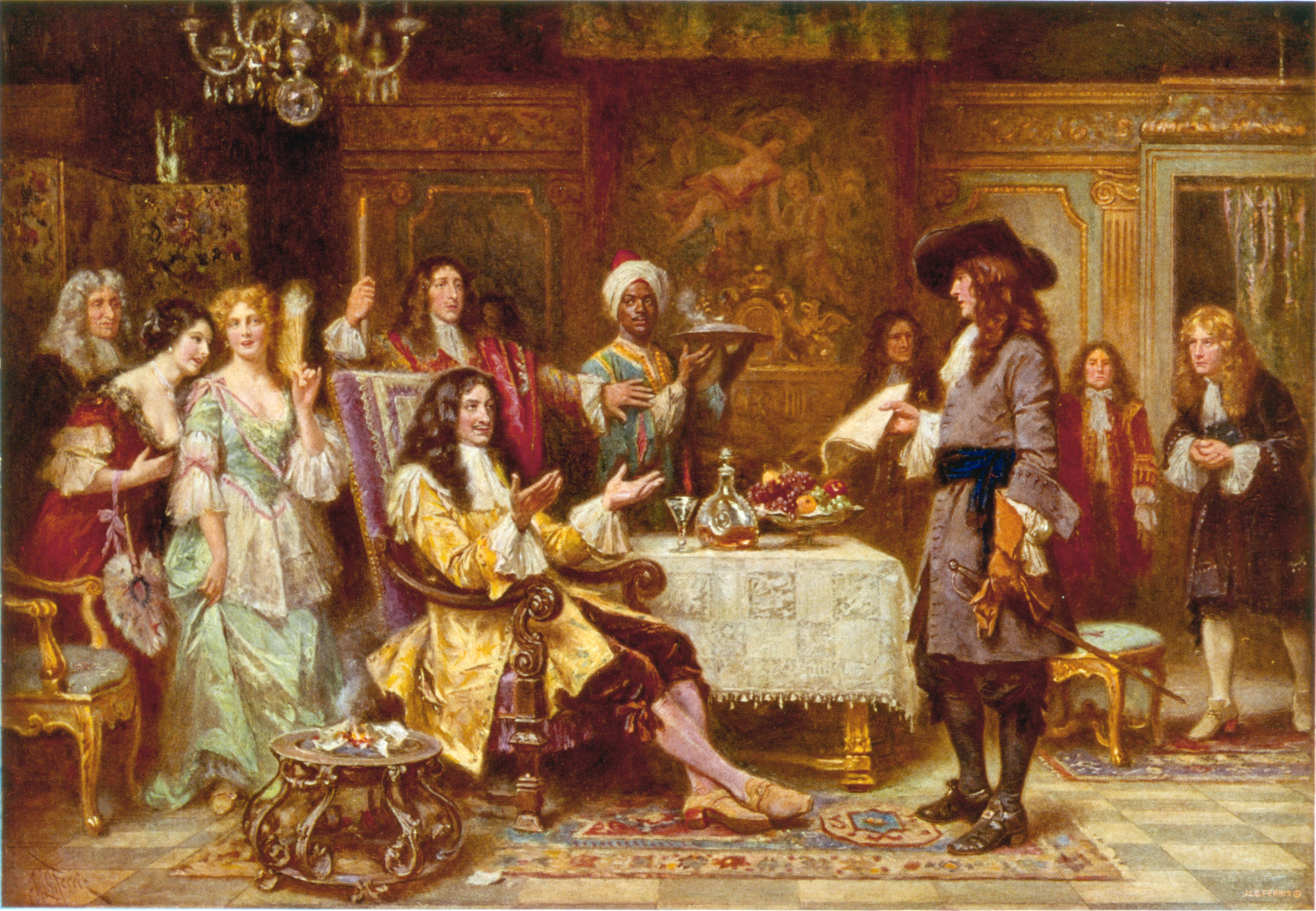
Philadelphia ( ), colloquially referred to as Philly, is the List of municipalities in Pennsylvania, most populous city in the U.S. state of Pennsylvania and the List of United States cities by population, sixth-most populous city in the United States, with a population of 1,603,797 in the 2020 United States census, 2020 census. The city is the urban core of the Philadelphia metropolitan area (sometimes called the Delaware Valley), the nation's Metropolitan statistical area, seventh-largest metropolitan area and ninth-largest combined statistical area with 6.245 million residents and 7.379 million residents, respectively. Philadelphia was founded in 1682 by William Penn, an English Americans, English Quakers, Quaker and advocate of Freedom of religion, religious freedom, and served as the capital of the Colonial history of the United States, colonial era Province of Pennsylvania. It then played a historic and vital role during the American Revolution and American Revolutionary ... [...More Info...] [...Related Items...] OR: [Wikipedia] [Google] [Baidu] |
Frankford Transit Center
Frankford Transit Center is a transportation terminal in the Frankford section of Philadelphia, Pennsylvania, United States. It was once known as the Bridge-Pratt station before a complete reconstruction in 2003. Frankford Transit Center is the last stop for SEPTA Metro L trains before heading westbound for 69th Street Transit Center. Overview Besides being the depot and terminus for many bus routes, it is the eastern terminus of the L, a subway-elevated rapid transit line run by SEPTA SEPTA, the Southeastern Pennsylvania Transportation Authority, is a regional public transportation authority that operates bus, rapid transit, commuter rail, light rail, and electric trolleybus services for nearly four million people througho .... The L begins at 69th Street Transit Center just west of the Philadelphia city line in Upper Darby Township, after which it runs mostly over and under Philadelphia streets to its terminus at the Frankford Transit Center. Gallery File:Fr ... [...More Info...] [...Related Items...] OR: [Wikipedia] [Google] [Baidu] |
Northeast Philadelphia
Northeast Philadelphia, nicknamed Northeast Philly, the Great Northeast, and known colloquially as simply "the Northeast", is a section of Philadelphia, Pennsylvania. According to the 2000 census, Northeast Philadelphia has a population of between 300,000 and 450,000, depending on how the area is defined. The Northeast is known as being home to a large and diverse working class population, including Polish Americans, Polish, German Americans, German, American Jews, Jewish, Russian Americans, Russian, African Americans, African American, Brazilian Americans, Brazilian, Puerto Rican Americans, Puerto Rican, Dominican Americans, Dominican, Guatemalan American, Guatemalan, Ukrainian American, Ukrainian, Indian American, Indian, Chinese American, Chinese, Irish American, Irish, and Vietnamese American, Vietnamese neighborhoods. Geography Because of the large size of the Northeast, the Philadelphia City Planning Commission divides it into two regions called Lower Northeast and Far Nor ... [...More Info...] [...Related Items...] OR: [Wikipedia] [Google] [Baidu] |
Center City Philadelphia
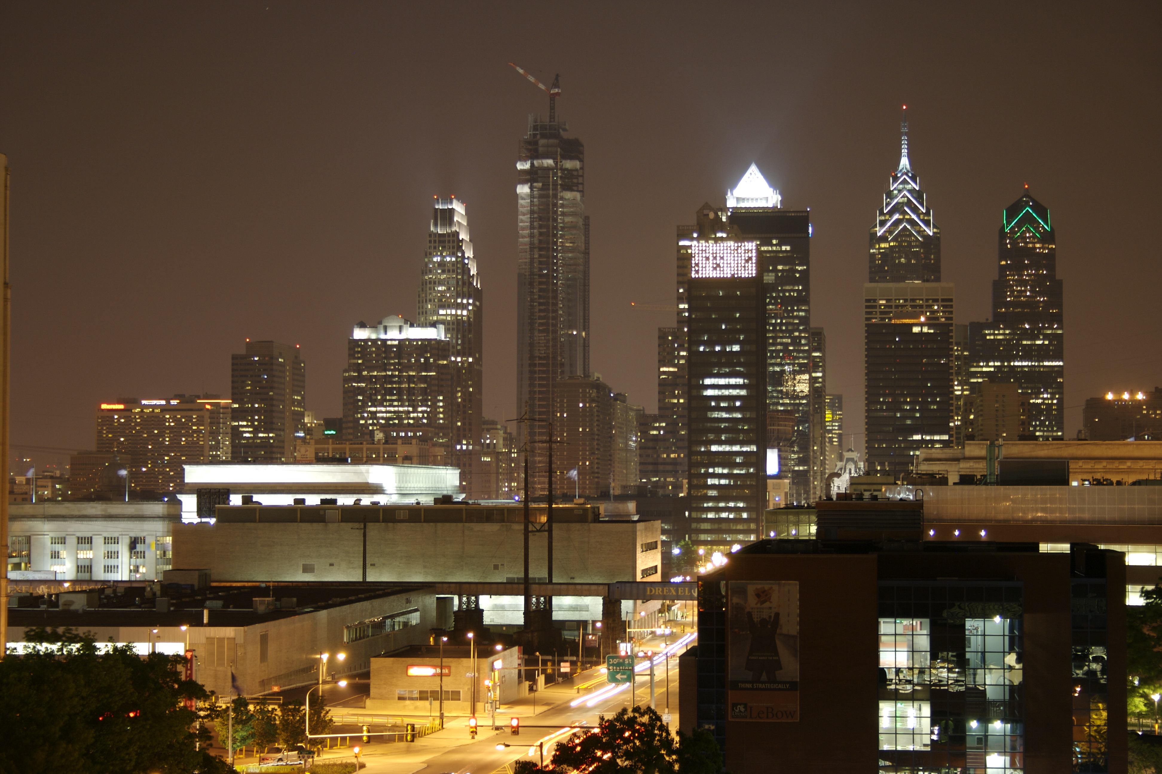
Center City includes the central business district and central neighborhoods of Philadelphia, Pennsylvania, United States. It comprises the area that made up the City of Philadelphia prior to the Act of Consolidation, 1854, which extended the city borders to be coterminous with Philadelphia County, Pennsylvania, Philadelphia County. The area has grown to the second-most densely populated downtown area in the United States (after Midtown Manhattan in New York City), with an estimated 202,000 residents in 2020 and a population density of 26,234 per square mile. Geography Boundaries Center City is bounded by South Street (Philadelphia), South Street to the south, the Delaware River to the east, the Schuylkill River to the west, and Vine Street to the north. The district occupies the old boundaries of the City of Philadelphia before Act of Consolidation, 1854, the city was made coterminous with Philadelphia County in 1854. The Center City District, which has special powers of taxa ... [...More Info...] [...Related Items...] OR: [Wikipedia] [Google] [Baidu] |
West Philadelphia
West Philadelphia, nicknamed West Philly, is a section of the city of Philadelphia. Although there are no officially defined boundaries, it is generally considered to reach from the western shore of the Schuylkill River, to City Avenue to the northwest, Cobbs Creek to the southwest, and the SEPTA Media/Wawa Line to the south. An alternate definition includes all city land west of the Schuylkill; this would also include Southwest Philadelphia and its neighborhoods. The eastern side of West Philadelphia is also known as University City. Topography The topography of West Philadelphia is composed of rolling hills rising slowly from the Schuylkill River toward Cobbs Creek in the west and toward Belmont Plateau in the northwest. This gradual elevation makes the skyline of Center City visible from many points in West Philadelphia. The Wynnefield neighborhood is a location frequently used by photographers and organizers of civic events. Demographics According to the 2010 censu ... [...More Info...] [...Related Items...] OR: [Wikipedia] [Google] [Baidu] |
WHYY-FM
WHYY-FM (90.9 MHz, "91 FM") is a public radio station licensed to serve Philadelphia, Pennsylvania. Its broadcast tower is located in the city's Roxborough section of the city at () while its studios and offices are located on Independence Mall in Center City Philadelphia. The station, owned by WHYY, Inc., is a charter member of NPR and contributes several programs to the national network. History WHYY signed on the air on December 14, 1954, owned by the Metropolitan Philadelphia Educational Radio and Television Corporation. It was the first educational station in Philadelphia. The transmitter, originally located at 17th and Sansom Streets in Philadelphia, was donated by Westinghouse Broadcasting. In 1957, it added a sister television station, WHYY-TV on channel 35. In 1963, WHYY-TV moved from channel 35 in Philadelphia to the stronger channel 12 in Wilmington, Delaware. At the time, Federal Communications Commission (FCC) regulations did not allow co-owned stations in di ... [...More Info...] [...Related Items...] OR: [Wikipedia] [Google] [Baidu] |
KYW-TV
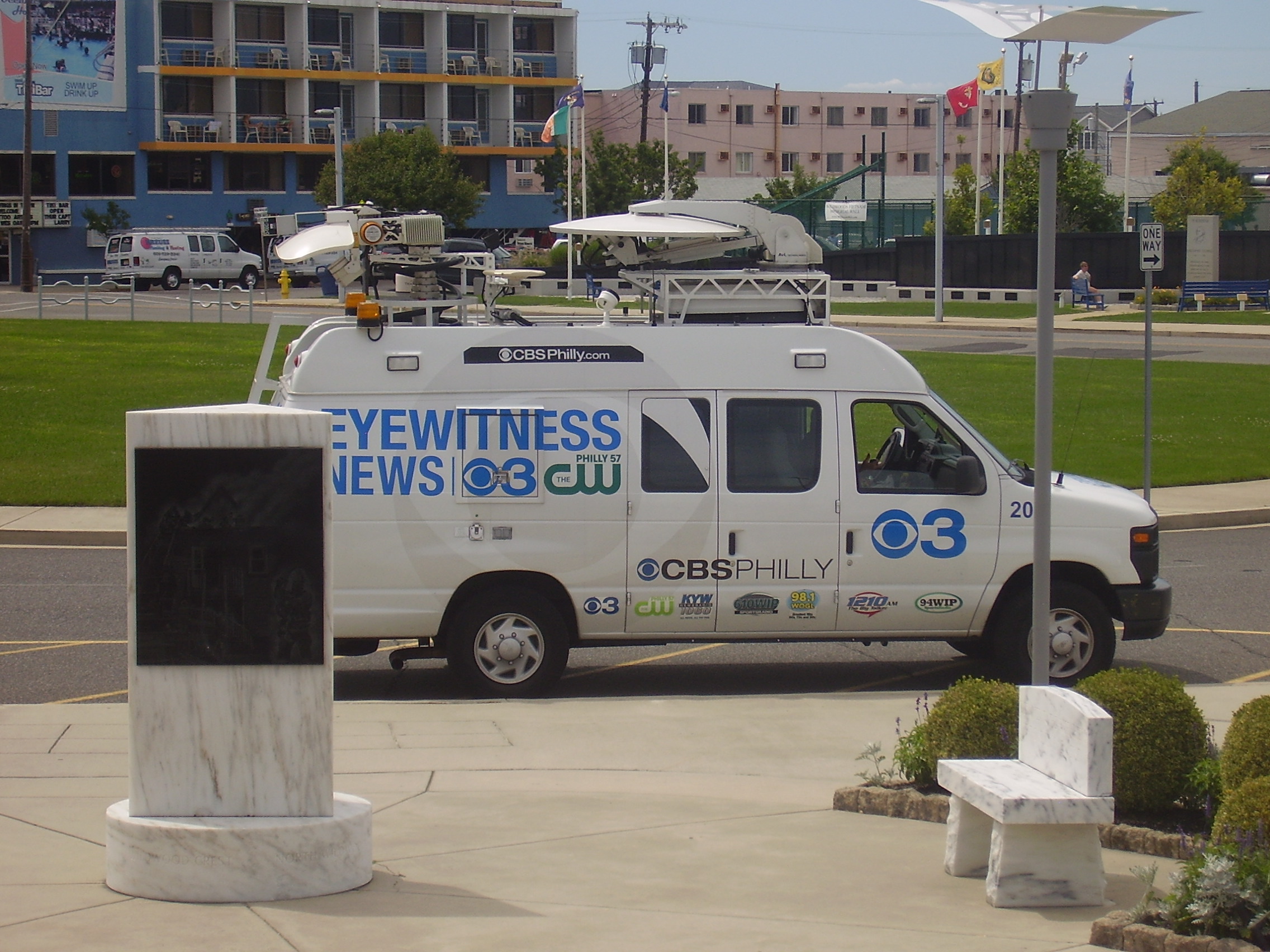
KYW-TV (channel 3), branded as CBS Philadelphia, is a television station in Philadelphia, Pennsylvania, United States. It is owned and operated by the CBS television network through its CBS News and Stations division alongside WPSG (channel 57), an independent station. The two outlets share studios on Hamilton Street north of Center City, Philadelphia; KYW-TV's transmitter is located in the city's Roxborough section. KYW-TV, along with sister station KDKA-TV in Pittsburgh, are the only CBS-affiliated stations east of the Mississippi River with "K" call signs. History As W3XE (1932–1941) The channel 3 facility in Philadelphia is Pennsylvania's oldest television station. It began in 1932 as W3XE, an experimental station owned by Philadelphia's Philco Corporation, at the time and for some decades to come one of the world's largest manufacturers of radio and television sets. Philco engineers created much of the station's equipment, including cameras. When the station began ope ... [...More Info...] [...Related Items...] OR: [Wikipedia] [Google] [Baidu] |
The Philadelphia Inquirer
''The Philadelphia Inquirer'', often referred to simply as ''The Inquirer'', is a daily newspaper headquartered in Philadelphia, Pennsylvania. Founded on June 1, 1829, ''The Philadelphia Inquirer'' is the third-longest continuously operating daily newspaper in the United States. The newspaper has the largest circulation of any newspaper in both Pennsylvania and the Delaware Valley metropolitan region, which includes Philadelphia and its surrounding communities in southeastern Pennsylvania, South Jersey, northern Delaware, and the northern Eastern Shore of Maryland. As of 2020, the newspaper has the 17th-largest circulation of any newspaper in the United States As of 2020, ''The Inquirer'' has won 20 Pulitzer Prizes. Several decades after its 1829 founding, ''The Inquirer'' began emerging as one of the nation's major newspapers during the American Civil War. Its circulation dropped after the Civil War's conclusion, but it rose again by the end of the 19th century. Originally sup ... [...More Info...] [...Related Items...] OR: [Wikipedia] [Google] [Baidu] |
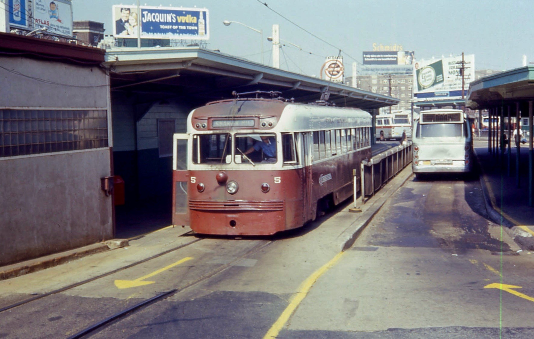
PST Brilliner 5 At 69th Street Terminal In 1968
PST may refer to: Time zones * Pacific Standard Time, UTC−08:00 (western North America) * Pakistan Standard Time (usually PKT), UTC+05:00 * Philippine Standard Time (also PHST or PHT), UTC+08:00 Science and technology * Lead scandium tantalate, a ceramic material * Partial stroke testing of valves * Penoscrotal transposition, in medicine * Personal Storage Table, a file format used in Microsoft applications * Planar separator theorem, in graph theory * Pocket set theory, in mathematics * Post-stall technology, aircraft control system * Program structure tree, in computer programming *PstLM, short-term light flicker metric * ''Puccinia striiformis'' f.sp. ''tritici'', or Wheat yellow rust Economics and taxes * The Prebisch–Singer thesis or Prebisch–Singer hypothesis * Provincial Sales Tax, a sales tax in some Canadian provinces Places * Trail of Remembrance and Comradeship (), a walkway in Ljubljana, Slovenia * Poznań Fast Tram (), Poland * Prestonpans rail ... [...More Info...] [...Related Items...] OR: [Wikipedia] [Google] [Baidu] |
Transit-oriented Development
In urban planning, transit-oriented development (TOD) is a type of Real estate development, urban development that maximizes the amount of Residential area, residential, business and leisure space within Pedestrian, walking distance of public transport. It promotes a symbiotic relationship between dense, compact urban form and public transport use. In doing so, TOD aims to increase public transport ridership by reducing the use of private cars and by promoting sustainable urban growth. TOD typically includes a central transit stop (such as a train station, or light rail or bus stop) surrounded by a Urban density, high-density Mixed-use development, mixed-use area, with lower-density areas spreading out from this center, serving as part of an integrated transport network. TOD is also typically designed to be more Walkability, walkable than other built-up areas, by using smaller City block, block sizes and reducing the land area dedicated to Car, automobiles. In some areas, it may ... [...More Info...] [...Related Items...] OR: [Wikipedia] [Google] [Baidu] |


