|
1978 Tabas Earthquake
The 1978 Tabas earthquake (Persian: زمینلرزه ۱۳۵۷ طبس) occurred on September 16 at 19:05:55 local time in central Iran. The shock measured 7.4 on the moment magnitude scale and had a maximum Mercalli intensity of IX+ (''Violent''). The death toll was in the range of 15,000–25,000, with severe damage occurring in the town of Tabas. Tectonic setting Iran is one of the most seismically active countries in the world, being crossed by several major faults that cover at least 90% of the country. The Iranian plateau is confined by the Turan platform in the north and the Zagros fold and thrust belt and Makran Trench in the south. The Arabian plate is converging to the north with the Eurasian plate at a rate of per year, and is diffused across a zone resulting in continental shortening and thickening throughout the plateau, with strike-slip and reverse faulting present, as well as subduction at the Makran coast. In eastern Iran, the shortening is accommodated ... [...More Info...] [...Related Items...] OR: [Wikipedia] [Google] [Baidu] |
Tabas
Tabas () is a city in the Central District of Tabas County, South Khorasan province, Iran, serving as capital of both the county and the district. History Early history The history of Tabas dates back to pre-Islamic times. It was an important outpost of the Sassanid empire. Due to its strategic location at the edge of the Great Salt Desert, and at the confluence of many roads, the geographer al-Baladhuri called the city "the Gate of Khurasan". In the early Islamic period it was known as Tabas al-Tamr () due to a large forest of date palms that grew there, and later as Tabas Gilaki after a famous governor of the city, Abu'l-Hasan ibn Muhammad Gilaki, who in the mid-11th century had pacified the region. Along with the town of Tabas-e Masina further east, it gave its name to the local district, Tabasayn. In the 10th–11th centuries, the town is described as well fortified, with several villages around. Medieval and geographers note that it was amply supplied with wat ... [...More Info...] [...Related Items...] OR: [Wikipedia] [Google] [Baidu] |
Reverse Fault
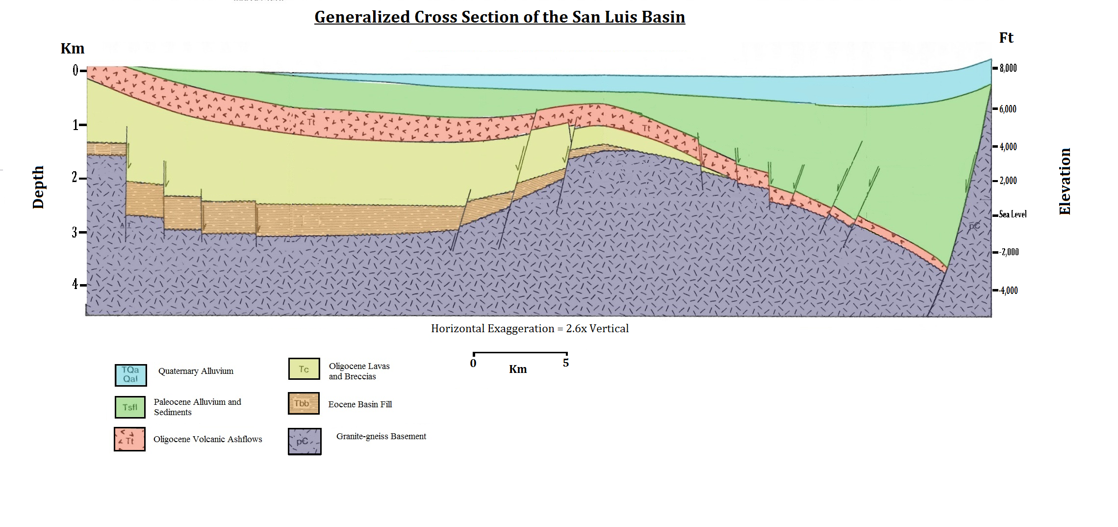
In geology, a fault is a planar fracture or discontinuity in a volume of rock across which there has been significant displacement as a result of rock-mass movements. Large faults within Earth's crust result from the action of plate tectonic forces, with the largest forming the boundaries between the plates, such as the megathrust faults of subduction zones or transform faults. Energy release associated with rapid movement on active faults is the cause of most earthquakes. Faults may also displace slowly, by aseismic creep. A ''fault plane'' is the plane that represents the fracture surface of a fault. A ''fault trace'' or ''fault line'' is a place where the fault can be seen or mapped on the surface. A fault trace is also the line commonly plotted on geological maps to represent a fault. A ''fault zone'' is a cluster of parallel faults. However, the term is also used for the zone of crushed rock along a single fault. Prolonged motion along closely spaced faults can blur the ... [...More Info...] [...Related Items...] OR: [Wikipedia] [Google] [Baidu] |
Lunar Eclipse
A lunar eclipse is an astronomical event that occurs when the Moon moves into the Earth's shadow, causing the Moon to be darkened. Such an alignment occurs during an eclipse season, approximately every six months, during the full moon phase, when the Moon's orbital plane is closest to Ecliptic, the plane of the Earth's orbit. This can occur only when the Sun, Earth, and Moon are exactly or very closely aligned (in syzygy (astronomy), syzygy) with Earth between the other two, which can happen only on the night of a full moon when the Moon is near either lunar node. The type and length of a lunar eclipse depend on the Moon's proximity to the lunar node. When the Moon is totally eclipsed by the Earth (a "deep eclipse"), "What is a deep eclipse? The smaller star is behind the bigger star" it takes on a reddish color that is caused by the planet when it completely blocks direct sunlight from reaching the Moon's surface, as the only light that is diffuse reflection, reflected from ... [...More Info...] [...Related Items...] OR: [Wikipedia] [Google] [Baidu] |
Manuel Berberian
Manuel Berberian is an Iranian-Armenian earth scientist. He was born on the 27th of October 1945 into an immigrant Armenian family in Tehran. He specializes in earthquake seismology, active faulting and folding, active tectonics, continental tectonics, historical seismicity, archaeoseismicity, earthquake hazard minimization, geological mapping, and environmental science and engineering. Biography Berberian was born on October 27, 1945, into an immigrant Armenian family in Tehran. The family had previously fled Armenia during the Armenian genocide. His mother is an Assyrian Christian from Rezaiyeh, Iran. He attended primary school and high school in Iran, graduating in 1958 and 1964 respectively. He received a B.S. in geology with high honors from the University of Tehran in 1968. Since 1971 he has been engaged in scholarly research, He has taught at the University of Tehran, Tarbiat Modares University, Tehran and Ocean County College in New Jersey. He joined the Geological Surve ... [...More Info...] [...Related Items...] OR: [Wikipedia] [Google] [Baidu] |
Mud Volcano
A mud volcano or mud dome is a landform created by the eruption of mud or Slurry, slurries, water and gases. Several geological processes may cause the formation of mud volcanoes. Mud volcanoes are not true Igneous rock, igneous volcanoes as they do not produce lava and are not necessarily driven by magmatic activity. Mud volcanoes may range in size from merely 1 or 2 meters high and 1 or 2 meters wide, to 700 meters high and 10 kilometers wide. Smaller mud exudations are sometimes referred to as mud-pots. The mud produced by mud volcanoes is mostly formed as hot water, which has been heated deep below the Earth's surface, begins to mix and blend with subterranean mineral deposits, thus creating the mud slurry exudate. This material is then forced upwards through a geological fault or fissure due to local subterranean pressure imbalances. Mud volcanoes are associated with subduction zones and about 1100 have been identified on or near land. The temperature of any given active mu ... [...More Info...] [...Related Items...] OR: [Wikipedia] [Google] [Baidu] |
Alluvium
Alluvium (, ) is loose clay, silt, sand, or gravel that has been deposited by running water in a stream bed, on a floodplain, in an alluvial fan or beach, or in similar settings. Alluvium is also sometimes called alluvial deposit. Alluvium is typically geologically young and is not Consolidation (geology), consolidated into solid rock. Sediments deposited underwater, in seas, estuaries, lakes, or ponds, are not described as alluvium. Floodplain alluvium can be highly fertile, and supported some of the earliest human civilizations. Definitions The present Scientific consensus, consensus is that "alluvium" refers to loose sediments of all types deposited by running water in floodplains or in alluvial fans or related landforms. However, the meaning of the term has varied considerably since it was first defined in the French dictionary of Antoine Furetière, posthumously published in 1690. Drawing upon concepts from Roman law, Furetière defined ''alluvion'' (the French term for al ... [...More Info...] [...Related Items...] OR: [Wikipedia] [Google] [Baidu] |
Adobe
Adobe (from arabic: الطوب Attub ; ) is a building material made from earth and organic materials. is Spanish for mudbrick. In some English-speaking regions of Spanish heritage, such as the Southwestern United States, the term is used to refer to any kind of earthen construction, or various architectural styles like Pueblo Revival or Territorial Revival. Most adobe buildings are similar in appearance to cob and rammed earth buildings. Adobe is among the earliest building materials, and is used throughout the world. Adobe architecture has been dated to before 5,100 BP. Description Adobe bricks are rectangular prisms small enough that they can quickly air dry individually without cracking. They can be subsequently assembled, with the application of adobe mud to bond the individual bricks into a structure. There is no standard size, with substantial variations over the years and in different regions. In some areas a popular size measured weighing about ; in other ... [...More Info...] [...Related Items...] OR: [Wikipedia] [Google] [Baidu] |
Ab Anbar
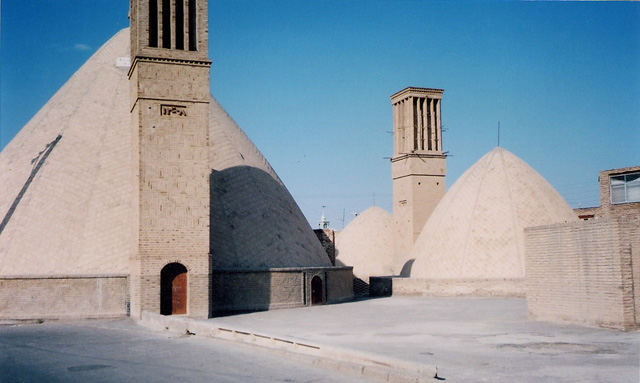
An ''ab anbar'' (, literally "cistern") is a traditional reservoir or cistern of drinking water in Greater Iran. Structure To withstand the pressure the water exerts on the containers of the storage tank, the storage itself was built below ground level. This also provides resistance to earthquakes as many cities in Iran lie in earthquake prone areas. Since almost all ab anbars are subterranean structures capped barely above ground level, they inherently possess stable structures. The construction material used for ab anbars were very tough and extensively used a special mortar called '' sarooj'' which was made of sand, clay, egg whites, lime, goat hair, and ash in specific proportions, depending on location and climate of the city. This mixture was thought to be completely water impenetrable. The walls of the storage were often 2 meters thick, and special bricks had to be used. These bricks were especially baked for ab anbars and were called ''Ajor Ab anbari''. Some ab anbars ... [...More Info...] [...Related Items...] OR: [Wikipedia] [Google] [Baidu] |
Qanat
A qanāt () or kārīz () is a water supply system that was developed in ancient Iran for the purpose of transporting usable water to the surface from an aquifer or a well through an underground aqueduct. Originating approximately 3,000 years ago, its function is essentially the same across the Middle East and North Africa, but it is known by a variety of regional names beyond today's Iran, including: kārēz in Afghanistan and Pakistan; foggāra in Algeria; khettāra in Morocco; falaj in Oman and the United Arab Emirates; and ʿuyūn in Saudi Arabia. In addition to those in Iran, the largest extant and functional qanats are located in Afghanistan, Algeria, China (i.e., the Turpan water system), Oman, and Pakistan. Proving crucial to water supply in areas with hot and dry climates, a qanat enables water to be transported over long distances by largely eliminating the risk of much of it evaporating on the journey. The system also has the advantage of being fairly resistant to n ... [...More Info...] [...Related Items...] OR: [Wikipedia] [Google] [Baidu] |
Ferdows
Ferdows () is a city in the Central District (Ferdows County), Central District of Ferdows County, South Khorasan province, South Khorasan province, Iran, serving as capital of both the county and the district. It is about south of Mashhad and 200 km northwest of Birjand. Ferdows is on the main axis connecting Yazd, Kerman, Isfahan, Bushehr, Hormozgan province, Hormozgan and Fars province, Fars provinces to Mashhad. Ferdows city is 1293 meters above sea level. History Founded by the Medes, Ferdows is currently a city. It was a large and famous city in ancient days. There is an unproven theory that the town's name in ancient days was "Taban" (or shining; تابان in Persian language, Persian). In the Islamic era it became known as Toon or Tūn, a name retained until 1929, when it was changed to Ferdows. The first people to inhabit Ferdows were a group of Sagartians. Toon was a famous and thriving city both before and during the Islamic era. It was one of the mo ... [...More Info...] [...Related Items...] OR: [Wikipedia] [Google] [Baidu] |
Detachment Fault
A detachment fault is a gently dipping normal fault associated with large-scale extensional tectonics. Detachment faults often have very large displacements (tens of km) and juxtapose unmetamorphosed hanging walls against medium to high-grade metamorphic footwalls that are called metamorphic core complexes. They are thought to have formed as either initially low-angle structures or by the rotation of initially high-angle normal faults modified also by the isostatic effects of tectonic denudation. They may also be called denudation faults. Examples of detachment faulting include: *The Snake Range detachment system of the Basin and Range Province of western North America which was active during the Miocene *The Nordfjord-Sogn detachment of western Norway active during the Devonian Period *The Whipple detachment in southeastern California Detachment faults have been found on the sea floor close to divergent plate boundaries characterised by a limited supply of upwelling magma, ... [...More Info...] [...Related Items...] OR: [Wikipedia] [Google] [Baidu] |
Synthetic Aperture Radar
Synthetic-aperture radar (SAR) is a form of radar that is used to create two-dimensional images or 3D reconstruction, three-dimensional reconstructions of objects, such as landscapes. SAR uses the motion of the radar antenna over a target region to provide finer spatial resolution than conventional stationary beam-scanning radars. SAR is typically mounted on a moving platform, such as an aircraft or spacecraft, and has its origins in an advanced form of side looking airborne radar (SLAR). The distance the SAR device travels over a target during the period when the target scene is illuminated creates the large ''synthetic'' antenna aperture (the ''size'' of the antenna). Typically, the larger the aperture, the higher the image resolution will be, regardless of whether the aperture is physical (a large antenna) or synthetic (a moving antenna) – this allows SAR to create high-resolution images with comparatively small physical antennas. For a fixed antenna size and orientation, ... [...More Info...] [...Related Items...] OR: [Wikipedia] [Google] [Baidu] |


