|
1970 Dublin Fires
The 1970 Dublin fires were a number of arson attacks in Dublin, Ireland in 1970. At the time, the series of fires were rumoured to have been caused by the Ulster Volunteer Force following a threat that was made stating that “Dublin will burn”. Gardaí later stated that they believed that the fires were unrelated to the threats and were most likely the work of arsonists. Fires Dunnes Stores, Cornelscourt The first fire of the year was on 7 January in the drapery and hardware section of Dunnes Stores in the Cornelscourt Shopping Centre in Cornelscourt causing hundreds of thousands of pounds worth of damage. The Fire Brigade prevented the fire from spreading to the supermarket area. The leader of the Fire Brigade said the fire had started in the roof area and spread rapidly. He said "there were explosions all over the place but nobody knows what caused them". The next day it was announced that Ben Dunne was preparing plans with architects to rebuild the damaged section wit ... [...More Info...] [...Related Items...] OR: [Wikipedia] [Google] [Baidu] |
Dublin
Dublin is the capital and largest city of Republic of Ireland, Ireland. Situated on Dublin Bay at the mouth of the River Liffey, it is in the Provinces of Ireland, province of Leinster, and is bordered on the south by the Dublin Mountains, part of the Wicklow Mountains range. Dublin is the largest city by population on the island of Ireland; at the 2022 census of Ireland, 2022 census, the city council area had a population of 592,713, while the city including suburbs had a population of 1,263,219, County Dublin had a population of 1,501,500. Various definitions of a metropolitan Greater Dublin Area exist. A settlement was established in the area by the Gaels during or before the 7th century, followed by the Vikings. As the Kingdom of Dublin grew, it became Ireland's principal settlement by the 12th century Anglo-Norman invasion of Ireland. The city expanded rapidly from the 17th century and was briefly the second largest in the British Empire and sixth largest in Western Europ ... [...More Info...] [...Related Items...] OR: [Wikipedia] [Google] [Baidu] |
Abbey Street
Abbey Street () is a major street, located on the Northside of Dublin city centre, running from the Customs House and Beresford Place in the east to Capel Street in the west, where it continues as Mary's Abbey. The street is served by two Luas light rail stops, one at Jervis Street and Abbey Street Luas stop near O'Connell Street. About 1 km in length, it is divided into Abbey Street Upper (west end), Abbey Street Middle and Abbey Street Lower (east end). Abbey Street Old is a laneway to the rear of the buildings on the south side of Abbey Street Lower. History Abbey Street was named after the former St Mary's Abbey, which was located in the area from 1139 until 1539. The street first appeared on maps of Dublin in 1728. On John Rocque's 1756 map, the street is divided into Great Abbey Street and Little Abbey Street. Notable addresses The remnants of St Mary's Abbey are accessible on Meetinghouse Lane, off Mary's Abbey. The National Theatre of Ireland, the Abbey Theat ... [...More Info...] [...Related Items...] OR: [Wikipedia] [Google] [Baidu] |
Building And Structure Arson Attacks In The Republic Of Ireland
A building or edifice is an enclosed structure with a roof, walls and windows, usually standing permanently in one place, such as a house or factory. Buildings come in a variety of sizes, shapes, and functions, and have been adapted throughout history for numerous factors, from building materials available, to weather conditions, land prices, ground conditions, specific uses, prestige, and aesthetic reasons. To better understand the concept, see ''Nonbuilding structure'' for contrast. Buildings serve several societal needs – occupancy, primarily as shelter from weather, security, living space, privacy, to store belongings, and to comfortably live and work. A building as a shelter represents a physical separation of the human habitat (a place of comfort and safety) from the ''outside'' (a place that may be harsh and harmful at times). buildings have been objects or canvasses of much artistic expression. In recent years, interest in sustainable planning and building practi ... [...More Info...] [...Related Items...] OR: [Wikipedia] [Google] [Baidu] |
Calor Gas
Calor is a brand of bottled butane and propane which is available in Britain and Ireland. It comes in cylinders, which have a special gas regulator. The company was formed in 1935, and is one of the UK's largest suppliers of liquefied petroleum gas (LPG). It is currently servicing around 4 million homes and businesses, supplying LPG to power gas appliances from central heating and hot water, as well as cookers, fires and barbecues. The company predominantly supplies LPG to homes in rural areas where there is no mains natural gas supply. In the United Kingdom, Calor is part of the SHV Gas Group a private Dutch company. Calor originally dealt only with cooking and heating appliances, but now covers a wider range of products for home, business, and automotive fuels. Such was the company's ubiquity at one point that the term "Calor Gas" became a generic term in the UK for all bottled LPG canisters and LPG-fuelled appliances. History In 1934, Ritchie Gill, a Cornishman who had ... [...More Info...] [...Related Items...] OR: [Wikipedia] [Google] [Baidu] |
Chadwicks (Dublin)
Grafton Group plc is a builders merchants business based in the United Kingdom and Ireland. It is listed on the London Stock Exchange, and is a constituent of the FTSE 250 Index. History The company was established by William Chadwick as Chadwicks (Dublin) Ltd in 1902. It subsequently became Concrete Products of Ireland.Beating the Budget blues The Independent, 10 December 2011 It was the subject of an in 1965 and building materials company Marley subsequently took a 51% stake. Michael Chadwick bought out Marley and renamed the business Grafton Group in 1987. In March 1998, it bought British Dred ... [...More Info...] [...Related Items...] OR: [Wikipedia] [Google] [Baidu] |
North Wall, Dublin
North Wall () is an area east of the inner north side of Dublin, along the River Liffey where it forms one of the Dublin quays. The name refers to the North Bull Wall, which was constructed to form Dublin Port, extend the Liffey estuary and reclaim land at various stages from the early 1700s until its final completion around 1825. The area is today used to refer to the area between Sheriff Street and the River Liffey. It contains the entire north side of Dublin Docklands and includes the International Financial Services Centre, Spencer Dock, and further east, the main part of Dublin Port. History The North Lotts area was mainly created between 1717 and 1729 after Dublin Corporation had, earlier in 1717-18, drawn lots and distributed the land between themselves in this manner. By around 1750, the area had been fully reclaimed and was no longer overflowed by seawater at high tide. John Roque's map of 1756 shows the areas of present day East Wall and North Wall fully embanke ... [...More Info...] [...Related Items...] OR: [Wikipedia] [Google] [Baidu] |
Sheriff Street
Sheriff Street () is a street in the north inner city of Dublin, Ireland, lying between East Wall and North Wall and often considered to be part of the North Wall area. It is divided into Sheriff Street Lower (west end) and Sheriff Street Upper (east end). History Naming convention The street is one of a number of streets within the North Wall area named after positions and groupings related to Dublin Corporation and the City Assembly (an archaic name for Dublin Corporation and Dublin City Council) which first laid out the area in the 18th century on reclaimed ground including: Mayor Street, Guild Street, Commons Street (referring to the Common Council, the "commons" or lower house of the City Assembly of Dublin) and Alderman Way. Sheriff itself refers to the Sheriff of Dublin City, a position that existed from 1548 when it replaced the term "bailiff". Location and boundaries The Sheriff Street area might be defined as Upper and Lower Sheriff Street, Mayor Street, Guild St ... [...More Info...] [...Related Items...] OR: [Wikipedia] [Google] [Baidu] |
George's Street Arcade
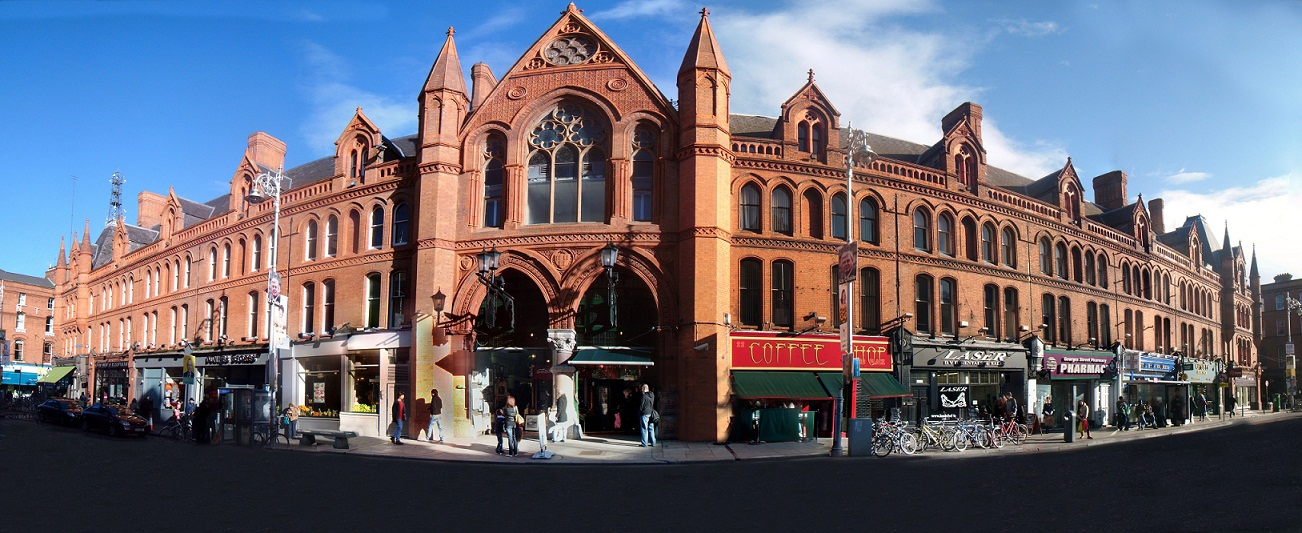
George's Street Arcade is a shopping centre on South Great George's Street in Dublin. It is a Victorian style red-bricked indoor market of stalls and stores. It opened in 1881 as the South City Markets. History The first purpose-built Victorian Shopping Centre in Dublin was South City Markets, commonly known now as George's Street Arcade. The City Market Company was incorporated in Dublin with a share capital of £200,000 and a loan capital of £50,000, for the establishment, maintenance and regulation of a market on the south side of the city in 1876. In order for the company to require the land necessary to develop the markets an act of parliament was needed and acquired, this gave the company not only the power to acquire the lands but also the responsibility to widen and generally improve the surrounding streets. Noted British architects Lockwood & Mauson won the contract to design and build the market complex. In 1881 South City Markets was officially opened by the Lord Ma ... [...More Info...] [...Related Items...] OR: [Wikipedia] [Google] [Baidu] |
Aungier Street
Aungier Street () is a street on the south side of Dublin, Republic of Ireland, Ireland. It runs north-south as a continuation of South Great George's Street. It is the location of both a Technological University Dublin and a Dublin Business School campus. History Formerly this area was waste ground near the Dublin Carmelite Friary. After the Dissolution of the Monasteries, the monastery's lands were granted to the Aungier family. The street was named after the family of Francis Aungier, 1st Baron Aungier of Longford who developed the street. His name is French and is correctly pronounced , but modern Dubliners pronounce the street name to rhyme with "danger." When the street was opened in 1661, it was wide, the widest in the city. Edward Lovett Pearce designed a theatre for the street, built 1733–34 and merged with the Smock Alley Theatre in 1743. The theatre held the title of theatre royal for a period before it was reclaimed by Smock Alley Theatre shortly after with the ... [...More Info...] [...Related Items...] OR: [Wikipedia] [Google] [Baidu] |
Stephen Street, Dublin
Stephen Street () is a street on the southside of Dublin, Republic of Ireland, Ireland. It is divided into Stephen Street Upper (western part), connecting Golden Lane, Dublin, Golden Lane to Aungier Street, and Stephen Street Lower (eastern part), running from Aungier Street to Johnson Place. History Medieval Dublin Stephen Street takes its name from the medieval church and later leper hospital of Saint Stephen, located on the site of present-day Mercer's Hospital which was converted from use as a poorhouse around 1709. It was referred to as being used as St Stephen's Hospital from at least 1612. Nearby St Stephen's Green also gets its name from the same source. The church and churchyard disappeared following the uniting of the parish of St Stephen with that of St Michael Le Pole and St. Bride's Church, Dublin, St. Bride's to form the new parish of St Brides in 1684. The street is believed to derive its curved shape from the Embankment (earthworks), embankment that stood o ... [...More Info...] [...Related Items...] OR: [Wikipedia] [Google] [Baidu] |
Filling Station
A filling station (also known as a gas station [] or petrol station []) is a facility that sells fuel and engine lubricants for motor vehicles. The most common fuels sold are gasoline (or petrol) and diesel fuel. Fuel dispensers are used to pump gasoline, diesel, compressed natural gas, compressed hydrogen, hydrogen compressed natural gas, liquefied petroleum gas, liquid hydrogen, kerosene, alcohol fuels (like methanol, ethanol, butanol, and propanol), biofuels (like straight vegetable oil and biodiesel), or other types of fuel into the tanks within vehicles and calculate the financial cost of the fuel transferred to the vehicle. Besides gasoline pumps, one other significant device which is also found in filling stations and can refuel certain (compressed-air) vehicles is an air compressor, although generally these are just used to inflate car tires. Many filling stations provide convenience stores, which may sell convenience food, beverages, tobacco produc ... [...More Info...] [...Related Items...] OR: [Wikipedia] [Google] [Baidu] |
Foundation Stock
Foundation stock or foundation bloodstock refers to animals that are the progenitors, or foundation, of a breed or of a given bloodline within such. Many modern breeds can be traced to specific, named foundation animals, but a group of animals may be referred to collectively as foundation bloodstock when one distinct population (including both landrace breeds or a group of animals linked to a deliberate and specific selective breeding program) provides part of the underlying genetic base for a new distinct population. Terminology The terms for foundation ancestors differ by sex, most commonly "foundation sire" for the father and "foundation dam" for the mother. Depending upon the species in question, more specialized terms may be used, such as ''foundation mare'' for female horses, ''foundation queen'' for female cats, or ''foundation bitch'' for female dogs. The offspring of genetically dissimilar parents or stock, whether of different species or different breeds are technically ... [...More Info...] [...Related Items...] OR: [Wikipedia] [Google] [Baidu] |
