|
Çuvaş
Çuvaş (also, Çüvaş, Chuash, and Chuvash) is a village in the Astara Rayon of Azerbaijan. The village forms part of the municipality of Rinə. The etymology of the name Çuvaş is believed to be derived from the Chuvash people, an ethnic group inhabiting the Chuvash Republic of European Russia European Russia is the western and most populated part of the Russia, Russian Federation. It is geographically situated in Europe, as opposed to the country's sparsely populated and vastly larger eastern part, Siberia, which is situated in Asia .... References * Populated places in Astara District {{Astara-geo-stub ... [...More Info...] [...Related Items...] OR: [Wikipedia] [Google] [Baidu] |
Rin…ô
Rinə (also, Reyna) is a village and municipality in the Astara Rayon of Azerbaijan. It has a population of 925. The municipality consists of the villages of Rinə, Vıləşə, Taxtakəran, and Çuvaş. References * Populated places in Astara District {{Astara-geo-stub ... [...More Info...] [...Related Items...] OR: [Wikipedia] [Google] [Baidu] |
Village
A village is a human settlement or community, larger than a hamlet but smaller than a town with a population typically ranging from a few hundred to a few thousand. Although villages are often located in rural areas, the term urban village is also applied to certain urban neighborhoods. Villages are normally permanent, with fixed dwellings; however, transient villages can occur. Further, the dwellings of a village are fairly close to one another, not scattered broadly over the landscape, as a dispersed settlement. In the past, villages were a usual form of community for societies that practice subsistence agriculture and also for some non-agricultural societies. In Great Britain, a hamlet earned the right to be called a village when it built a church.-4; we might wonder whether there's a point at which it's appropriate to talk of the beginnings of French, that is, when it wa ... ''village'', from Latin ''villāticus'', ultimately from Latin ''villa'' (English ''vi ... [...More Info...] [...Related Items...] OR: [Wikipedia] [Google] [Baidu] |
Administrative Divisions Of Azerbaijan
Azerbaijan is administratively divided into 67 districts () and 11 cities () that are subordinate to the Republic. Out of these districts and cities, 7 districts and 1 city are located within the Nakhchivan Autonomous Republic. The districts are further divided into Municipalities of Azerbaijan, municipalities (). Additionally, the districts of Azerbaijan are grouped into 14 Economic regions of Azerbaijan, Economic Regions (). On 7 July 2021, President of Azerbaijan Ilham Aliyev signed a decree "On the new division of economic regions in the Republic of Azerbaijan". Administrative divisions Contiguous Azerbaijan The list below represents the districts of contiguous Azerbaijan. For those of the Nakhchivan exclave, see further below. Nakhchivan Autonomous Republic The seven districts and one municipality of the Nakhchivan Autonomous Republic are listed below. Economic regions Nagorno-Karabakh The territory of former Nagorno-Karabakh Autonomous Oblast presently ... [...More Info...] [...Related Items...] OR: [Wikipedia] [Google] [Baidu] |
Astara Rayon
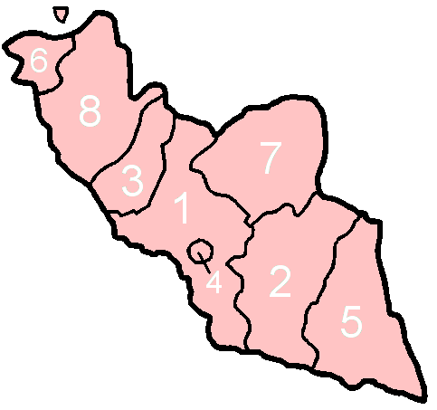
Astara District () is one of the 66 districts of Azerbaijan. It is located in the southeast of the country, in the Lankaran-Astara Economic Region. The district borders the districts of Lankaran and Lerik, as well as the Ardabil and Gilan provinces of Iran. Its capital and largest city is Astara. As of 2020, the district had a population of 110,000. History Ancient history A famous mathematician, astronomer and geographer Alexandria Claudius Ptolomey (AD 100 – c. 170) was one of the oldest researchers who also visited the territory of Azerbaijan. He compiled a map of the Caspian Sea in the second century, has given a clear overview on the geographical names, objects and settlements located on its shores. The names of many cities and villages belonging to Albania, as well as the name “Astara” (Greek: Astarata) are found on this map. Another scholar of the ancient world, Strabon also pointed out the name “Astara” in his "Historical Sketches" (Historicahypomne ... [...More Info...] [...Related Items...] OR: [Wikipedia] [Google] [Baidu] |
Azerbaijan Time
Azerbaijan Time () is the standard time zone in Azerbaijan, four hours ahead of UTC ( UTC+04:00). The daylight saving time adjustment, Azerbaijan Summer Time (), was one hour ahead at UTC+05:00; it was introduced in 1997 and discontinued in March 2016. Azerbaijan Time is the same as Samara Time (Russia), United Arab Emirates Standard Time, Georgia Time, Armenia Time and Seychelles Time. History Azerbaijan, formerly the Azerbaijan Soviet Socialist Republic (Azerbaijan SSR), adhered to timekeeping regulations instituted by the Soviet Union The Union of Soviet Socialist Republics. (USSR), commonly known as the Soviet Union, was a List of former transcontinental countries#Since 1700, transcontinental country that spanned much of Eurasia from 1922 until Dissolution of the Soviet .... In 1930, the Council of People’s Commissars of the USSR implemented " Decree Time," which mandated a one-hour advancement of standard time across the entire Soviet territory. This mov ... [...More Info...] [...Related Items...] OR: [Wikipedia] [Google] [Baidu] |
Azerbaijan
Azerbaijan, officially the Republic of Azerbaijan, is a Boundaries between the continents, transcontinental and landlocked country at the boundary of West Asia and Eastern Europe. It is a part of the South Caucasus region and is bounded by the Caspian Sea to the east, Russia's republic of Dagestan to the north, Georgia (country), Georgia to the northwest, Armenia and Turkey to the west, and Iran to the south. Baku is the capital and largest city. The territory of what is now Azerbaijan was ruled first by Caucasian Albania and later by various Persian empires. Until the 19th century, it remained part of Qajar Iran, but the Russo-Persian wars of Russo-Persian War (1804–1813), 1804–1813 and Russo-Persian War (1826–1828), 1826–1828 forced the Qajar Empire to cede its Caucasian territories to the Russian Empire; the treaties of Treaty of Gulistan, Gulistan in 1813 and Treaty of Turkmenchay, Turkmenchay in 1828 defined the border between Russia and Iran. The region north o ... [...More Info...] [...Related Items...] OR: [Wikipedia] [Google] [Baidu] |
Chuvash People
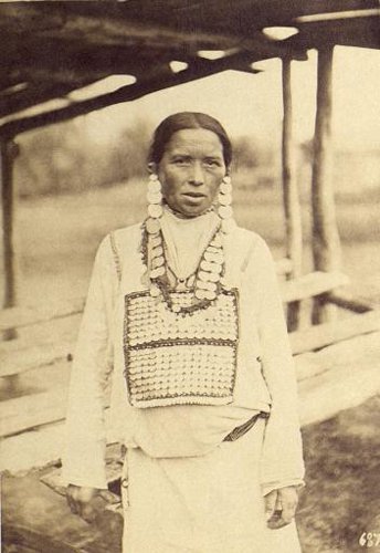
The Chuvash people (, ; , ) also called Chuvash Tatars, are a Turkic ethnic group, a branch of the Oğurs, inhabiting an area stretching from the Idel-Ural region to Siberia. Most of them live in the Russian republic of Chuvashia and the surrounding area, although Chuvash communities may be found throughout Russia as well as in Central Asia. They speak Chuvash, a Turkic language that diverged from other languages in the family more than a millennium ago. Among the Chuvash believers, the majority are Eastern Orthodox Christians although a minority follow Vattisen Yaly or Sunni Islam. Etymology There is no universally accepted etymology of the word ''Chuvash'', but there are two theories. One theory suggests that the word ''Chuvash'' may be derived from Common Turkic ''jăvaş'' ('friendly', 'peaceful'), as opposed to ''şarmăs'' ('warlike'). Another theory is that the word is derived from the '' Tabghach,'' an early medieval Xianbei clan and founders of the Northern ... [...More Info...] [...Related Items...] OR: [Wikipedia] [Google] [Baidu] |
Chuvashia
Chuvashia, officially known as Chuvash Republic — Chuvashia, is a republics of Russia, republic of Russia located in Eastern Europe. It is the homeland of the Chuvash people, a Turkic languages, Turkic ethnic group. Its capital city, capital is the types of inhabited localities in Russia, city of Cheboksary. As of the Russian Census (2010), 2010 Census, its population was 1,251,619. Geography The Chuvash Republic is located in the center of European Russia, in the heart of the Volga-Vyatka economic region, mostly to the west of the Volga River, in the Volga Upland. It borders with the Nizhny Novgorod Oblast in the west, Mari El Republic in the north, the Republic of Tatarstan in the east and southeast, Republic of Mordovia in the southwest, and the Ulyanovsk Oblast in the south. There are over two thousand rivers in the republic—with the major ones being the Volga, the Sura River, Sura, and the Tsivil River, Tsivil—as well as four hundred lakes. Some of the Volga River ... [...More Info...] [...Related Items...] OR: [Wikipedia] [Google] [Baidu] |
European Russia
European Russia is the western and most populated part of the Russia, Russian Federation. It is geographically situated in Europe, as opposed to the country's sparsely populated and vastly larger eastern part, Siberia, which is situated in Asia, encompassing the entire North Asia, northern region of the continent. The two parts of Russia are divided by the Ural Mountains and Ural (river), Ural river, bisecting the Eurasia, Eurasian supercontinent. European Russia covers the vast majority of Eastern Europe, and spans roughly 40% of Europe's total landmass, with over 15% of its total population, making Russia the List of European countries by area, largest and List of European countries by population, most populous country in Europe. The region is divided into five Federal districts of Russia, Federal districts. Area and demographics European Russia accounts for about 80% of Russia's total population. It covers an area of over , with a population of nearly 110 million—making R ... [...More Info...] [...Related Items...] OR: [Wikipedia] [Google] [Baidu] |


