|
ûiûÏekalan
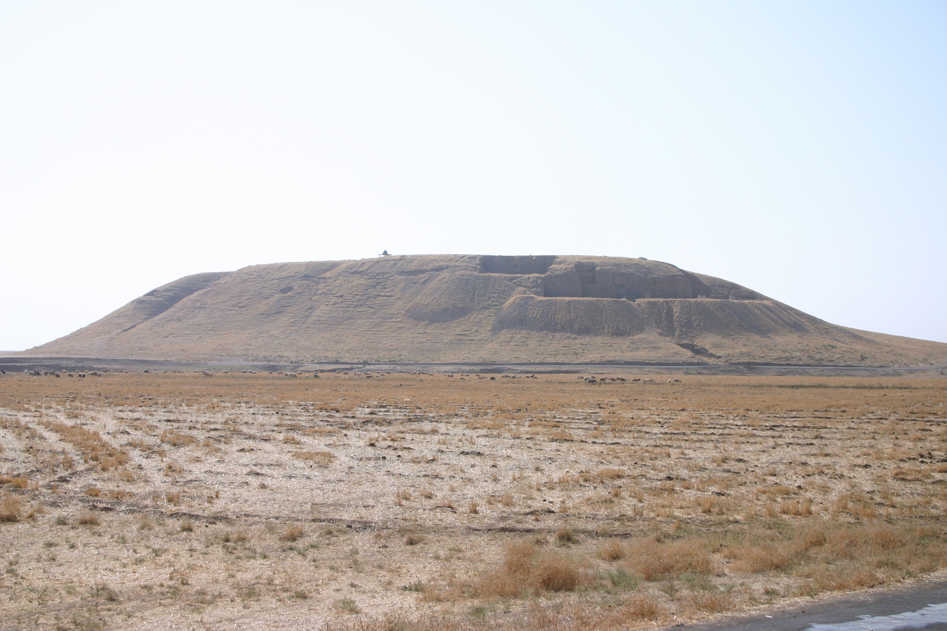
ûiûÏekalan is a neighbourhood of the municipality and district of Birecik, éanláÝurfa Province, Turkey. Its population is 238 (2022). It is located on the east bank of the Euphrates, very close to the Syrian border. Archaeology There are four archaeological mounds near the village: Deáirmen HûÑyû¥k, Kû¥ûÏû¥k Kale Tepe, Camuz Tepe, and Tiladir Tepe. *Deáirmen HûÑyû¥k has a surface area of 180x120 m and reaches a height of 20 m tall. First identified by G. Algaze et al. in 1994, it is estimated to be from the Early Bronze Age. *Kû¥ûÏû¥k Kale Tepe is a small mound dated to the Hellenistic and Roman periods. *Camuz Tepe has been dated to the early-Middle Paleolithic, the Iron Age, and the Roman period. *Tiladir Tepe is by far the largest, with a total surface area of 610x200 m and a height of 5 m. It has been dated to the Pottery Neolithic, late Chalcolithic, Bronze Age, Iron Age, and Byzantine periods. See also *KarkamáÝé Bridge The KarkamáÝé Bridge ( ... [...More Info...] [...Related Items...] OR: [Wikipedia] [Google] [Baidu] |
KarkamáÝé Bridge
The KarkamáÝé Bridge () is a Parker-truss bridge carrying the Baghdad Railway across the Euphrates in southeastern Turkey. The bridge was built by the Baghdad Railway between 1911 and 1913 in the Ottoman Empire and played an important role for transporting troops and supplies during World War I, as it was the only permanent crossing of the Euphrates in the area. After the war, the bridge and the railway fell under British military control until the Allies withdrew their forces from Turkey. The French-owned Chemins de fer de Cilicie Nord-Syrie, headquartered in French Syria (CNS) took over the railway in 1921 and operated the route until being sold to the Turkish-owned Southern Railway in 1933. This new company owned and operated the railway until being absorbed by the Turkish State Railways in 1948. When first completed, the structure was the second longest bridge in the Ottoman Empire and later Turkey, after UzunkûÑprû¥ Bridge in East Thrace East Thrace or Eastern Thra ... [...More Info...] [...Related Items...] OR: [Wikipedia] [Google] [Baidu] |
Birecik
Birecik is a municipality and district of éanláÝurfa Province, Turkey. Its area is 912 km2, and its population is 93,866 (2023). It lies on the Euphrates. Built on a limestone cliff 400 ft. high on the left/east bank of the Euphrates, "at the upper part of a reach of that river, which runs nearly north-south, and just below a sharp bend in the stream, where it follows that course after coming from a long reach flowing more from the west". Etymology The historical name of the town, ''al-Bá¨ra'' in Arabic and ''Bá¨reh'' in Syriac, derives from the Aramaic ''Bá¨rthá'', meaning fortress. It later evolved to ''Birecik'' with the addition of the Turkish diminutive suffix, ''cik''. It is called ''Belejik'' amongst the local population. In Ottoman times, the historical forms ''Bi'retû¥'l-FáÝrat'', ''Biárecik'', and ''Biárecek'' are also attested. Geography Birecik is located between Gaziantep to the west and the Urfa plateau to the east. The region's elevation varies bet ... [...More Info...] [...Related Items...] OR: [Wikipedia] [Google] [Baidu] |
éanláÝurfa Province
éanláÝurfa Province (; ), also known as Urfa Province, is a Provinces of Turkey, province and Metropolitan municipalities in Turkey, metropolitan municipality in southeastern Turkey. The city of éanláÝurfa is the capital of the province which bears its name. Its area is 19,242 km2, and its population is 2,170,110 (2022). The province is considered part of Turkish Kurdistan and has a Kurds, Kurdish majority with a significant Arabs, Arab and Turkish people, Turkish minority. Districts éanláÝurfa province is divided into 13 Districts of Turkey, districts, listed below with their populations as at 31 December 2022 according to the official government estimates: * AkûÏakale (123,721) * Birecik (93,613) * Bozova (52,680) * CeylanpáÝnar (90,440) * Eyyû¥biye (391,795) * Halfeti (41,662) * Haliliye (396,656) * Harran (96,072) * Hilvan (42,218) * KarakûÑprû¥ (265,035) * Siverek (267,942) * SuruûÏ (100,961) * Viranéehir (207,315) Geography With an area of , it is the larg ... [...More Info...] [...Related Items...] OR: [Wikipedia] [Google] [Baidu] |
Turkey
Turkey, officially the Republic of Tû¥rkiye, is a country mainly located in Anatolia in West Asia, with a relatively small part called East Thrace in Southeast Europe. It borders the Black Sea to the north; Georgia (country), Georgia, Armenia, Azerbaijan, and Iran to the east; Iraq, Syria, and the Mediterranean Sea to the south; and the Aegean Sea, Greece, and Bulgaria to the west. Turkey is home to over 85 million people; most are ethnic Turkish people, Turks, while ethnic Kurds in Turkey, Kurds are the Minorities in Turkey, largest ethnic minority. Officially Secularism in Turkey, a secular state, Turkey has Islam in Turkey, a Muslim-majority population. Ankara is Turkey's capital and second-largest city. Istanbul is its largest city and economic center. Other major cities include á¯zmir, Bursa, and Antalya. First inhabited by modern humans during the Late Paleolithic, present-day Turkey was home to List of ancient peoples of Anatolia, various ancient peoples. The Hattians ... [...More Info...] [...Related Items...] OR: [Wikipedia] [Google] [Baidu] |
Tûá¯K
Turkish Statistical Institute (commonly known as TurkStat; or Tûá¯K) is the Turkish government agency commissioned with producing official statistics on Turkey, its population, resources, economy, society, and culture. It was founded in 1926 and headquartered in Ankara. Formerly named as the State Institute of Statistics (Devlet á¯statistik Enstitû¥sû¥ (Dá¯E)), the institute was renamed as the Turkish Statistical Institute on November 18, 2005. See also * List of Turkish provinces by life expectancy References External linksOfficial website of the institute National statistical services Statistical Organizations established in 1926 Organizations based in Ankara {{Sci-org-stub ... [...More Info...] [...Related Items...] OR: [Wikipedia] [Google] [Baidu] |
Euphrates
The Euphrates ( ; see #Etymology, below) is the longest and one of the most historically important rivers of West Asia. TigrisãEuphrates river system, Together with the Tigris, it is one of the two defining rivers of Mesopotamia (). Originating in Turkey, the Euphrates flows through Syria and Iraq to join the Tigris in the Shatt al-Arab in Iraq, which empties into the Persian Gulf. The Euphrates is the List of longest rivers of Asia, fifteenth-longest river in Asia and the longest in West Asia, at about , with a drainage area of that covers six countries. Etymology The term ''Euphrates'' derives from the Koine Greek, Greek ''EuphrûÀtás'' (), adapted from , itself from . The Elamite name is ultimately derived from cuneiform ÞÞÞÈ; read as ''Buranun'' in Sumerian language, Sumerian and ''Purattu'' in Akkadian language, Akkadian; many cuneiform signs have a Sumerian pronunciation and an Akkadian pronunciation, taken from a Sumerian word and an Akkadian word that mean ... [...More Info...] [...Related Items...] OR: [Wikipedia] [Google] [Baidu] |
Tell (archaeology)
In archaeology, a tell (from , ', 'mound' or 'small hill') is an artificial topographical feature, a mound consisting of the accumulated and stratified debris of a succession of consecutive settlements at the same site, the refuse of generations of people who built and inhabited them and natural sediment. Tells are most commonly associated with the ancient Near East but are also found elsewhere, such as in Southern Europe, Southern and parts of Central Europe, from Greece and Bulgaria to Hungary and Spain,, see map. and in North Africa. Within the Near East they are concentrated in less arid regions, including Upper Mesopotamia, the Southern Levant, Anatolia and Iran, which had more continuous settlement. Eurasian tells date to the Neolithic, the Chalcolithic and the Bronze and Iron Ages. In the Southern Levant the time of the tells ended with the conquest by Alexander the Great, which ushered in the Hellenistic period with its own, different settlement-building patterns. Many t ... [...More Info...] [...Related Items...] OR: [Wikipedia] [Google] [Baidu] |
Bronze Age
The Bronze Age () was a historical period characterised principally by the use of bronze tools and the development of complex urban societies, as well as the adoption of writing in some areas. The Bronze Age is the middle principal period of the three-age system, following the Stone Age and preceding the Iron Age. Conceived as a global era, the Bronze Age follows the Neolithic, with a transition period between the two known as the Chalcolithic. The final decades of the Bronze Age in the Mediterranean basin are often characterised as a period of widespread societal collapse known as the Late Bronze Age collapse (), although its severity and scope are debated among scholars. An ancient civilisation is deemed to be part of the Bronze Age if it either produced bronze by smelting its own copper and alloying it with tin, arsenic, or other metals, or traded other items for bronze from producing areas elsewhere. Bronze Age cultures were the first to History of writing, develop writin ... [...More Info...] [...Related Items...] OR: [Wikipedia] [Google] [Baidu] |
Hellenistic Period
In classical antiquity, the Hellenistic period covers the time in Greek history after Classical Greece, between the death of Alexander the Great in 323 BC and the death of Cleopatra VII in 30 BC, which was followed by the ascendancy of the Roman Empire, as signified by the Battle of Actium in 31 BC and the Roman conquest of Ptolemaic Egypt the following year, which eliminated the last major Hellenistic kingdom. Its name stems from the Ancient Greek word ''Hellas'' (, ''HellûÀs''), which was gradually recognized as the name for Greece, from which the modern historiographical term ''Hellenistic'' was derived. The term "Hellenistic" is to be distinguished from "Hellenic" in that the latter refers to Greece itself, while the former encompasses all the ancient territories of the period that had come under significant Greek influence, particularly the Hellenized Middle East, after the conquests of Alexander the Great. After the Macedonian conquest of the Achaemenid Empire in ... [...More Info...] [...Related Items...] OR: [Wikipedia] [Google] [Baidu] |
Roman Empire
The Roman Empire ruled the Mediterranean and much of Europe, Western Asia and North Africa. The Roman people, Romans conquered most of this during the Roman Republic, Republic, and it was ruled by emperors following Octavian's assumption of effective sole rule in 27 BC. The Western Roman Empire, western empire collapsed in 476 AD, but the Byzantine Empire, eastern empire lasted until the fall of Constantinople in 1453. By 100 BC, the city of Rome had expanded its rule from the Italian peninsula to most of the Mediterranean Sea, Mediterranean and beyond. However, it was severely destabilised by List of Roman civil wars and revolts, civil wars and political conflicts, which culminated in the Wars of Augustus, victory of Octavian over Mark Antony and Cleopatra at the Battle of Actium in 31 BC, and the subsequent conquest of the Ptolemaic Kingdom in Egypt. In 27 BC, the Roman Senate granted Octavian overarching military power () and the new title of ''Augustus (title), Augustus'' ... [...More Info...] [...Related Items...] OR: [Wikipedia] [Google] [Baidu] |
Middle Paleolithic
The Middle Paleolithic (or Middle Palaeolithic) is the second subdivision of the Paleolithic or Old Stone Age as it is understood in Europe, Africa and Asia. The term Middle Stone Age is used as an equivalent or a synonym for the Middle Paleolithic in African archeology. The Middle Paleolithic broadly spanned from 300,000 to 50,000 years ago. There are considerable dating differences between regions. The Middle Paleolithic was succeeded by the Upper Paleolithic subdivision which first began between 50,000 and 40,000 years ago. Pettit and White date the Early Middle Paleolithic in Great Britain to about 325,000 to 180,000 years ago (late Marine Isotope Stage 9 to late Marine Isotope Stage 7), and the Late Middle Paleolithic as about 60,000 to 35,000 years ago. The Middle Paleolithic was in the geological Chibanian (Middle Pleistocene) and Late Pleistocene ages. According to the theory of the recent African origin of modern humans, anatomically modern humans began migrat ... [...More Info...] [...Related Items...] OR: [Wikipedia] [Google] [Baidu] |
Iron Age
The Iron Age () is the final epoch of the three historical Metal Ages, after the Chalcolithic and Bronze Age. It has also been considered as the final age of the three-age division starting with prehistory (before recorded history) and progressing to protohistory (before written history). In this usage, it is preceded by the Stone Age (subdivided into the Paleolithic, Mesolithic and Neolithic) and Bronze Age. These concepts originated for describing Iron Age Europe and the ancient Near East. In the archaeology of the Americas, a five-period system is conventionally used instead; indigenous cultures there did not develop an iron economy in the pre-Columbian era, though some did work copper and bronze. Indigenous metalworking arrived in Australia with European contact. Although meteoric iron has been used for millennia in many regions, the beginning of the Iron Age is defined locally around the world by archaeological convention when the production of Smelting, smelted iron (espe ... [...More Info...] [...Related Items...] OR: [Wikipedia] [Google] [Baidu] |


