National recreation areas of Colorado on:
[Wikipedia]
[Google]
[Amazon]
 This is a list of
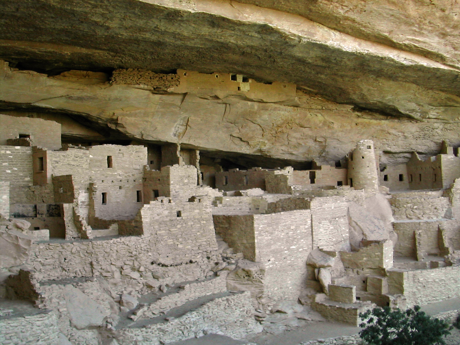 The four

 The nine National Monuments in Colorado are:
*
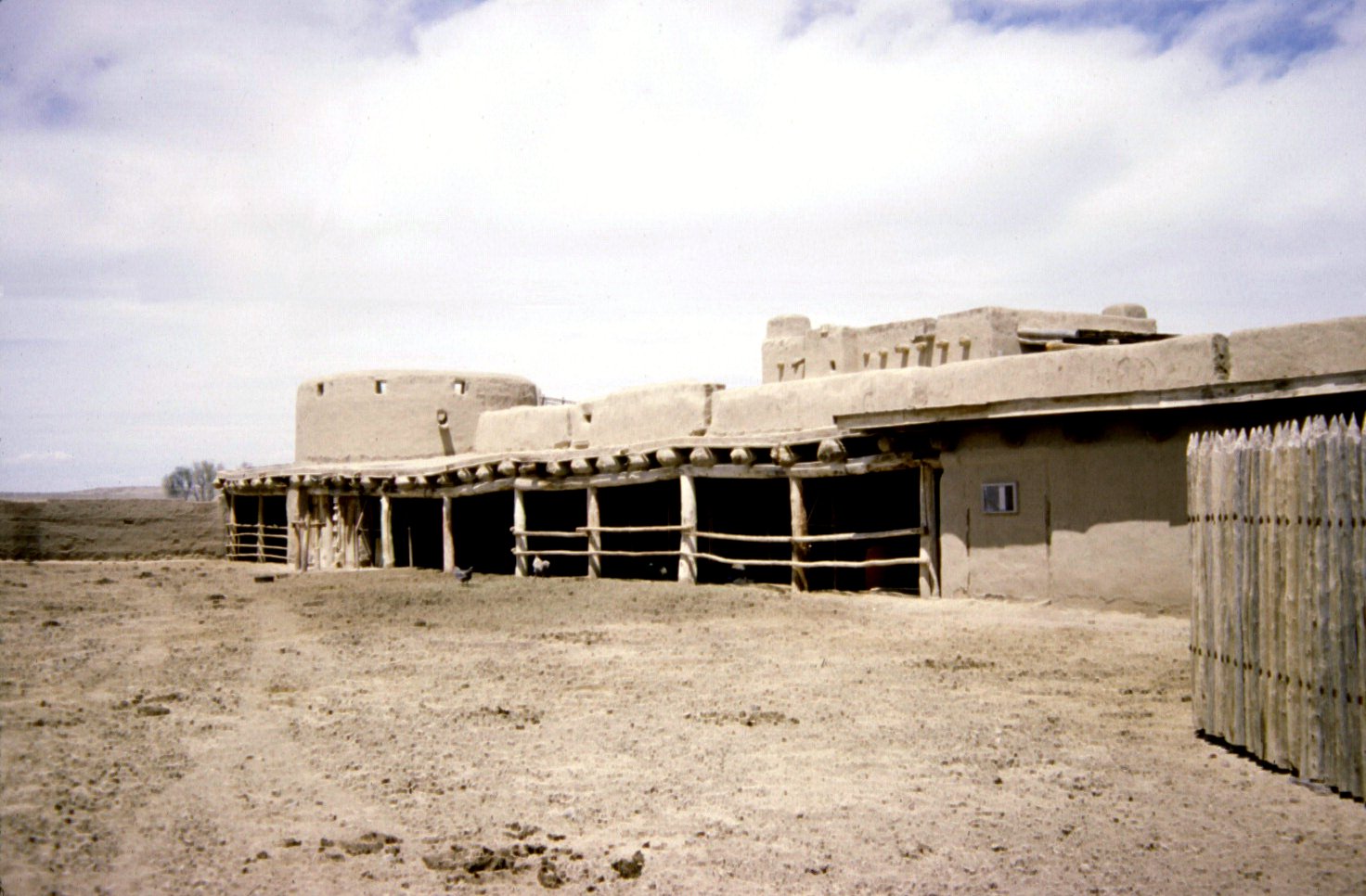 The three National Historic Sites within Colorado are:
*
 The two National Recreation Areas within Colorado are::
*
 The four National Historic Trails that pass through Colorado are:
*
 The
The
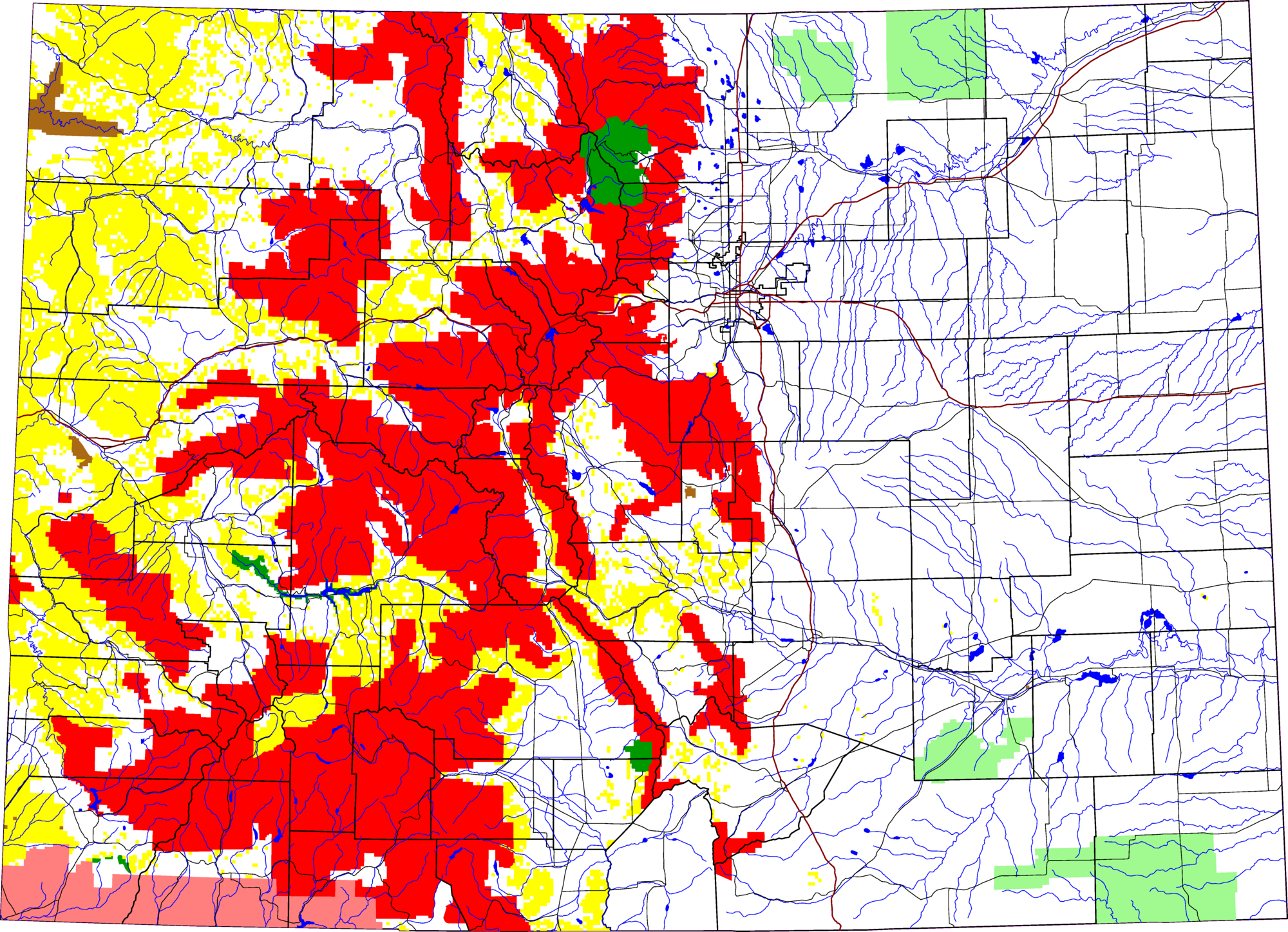 The
The
 This is a list of
 protected areas
Protected areas or conservation areas are locations which receive protection because of their recognized natural, ecological or cultural values. There are several kinds of protected areas, which vary by level of protection depending on the ena ...
of the U.S. state
In the United States, a state is a constituent political entity, of which there are 50. Bound together in a political union, each state holds governmental jurisdiction over a separate and defined geographic territory where it shares its sove ...
of Colorado
Colorado (, other variants) is a state in the Mountain West subregion of the Western United States. It encompasses most of the Southern Rocky Mountains, as well as the northeastern portion of the Colorado Plateau and the western edge of the ...
.
__TOC__
Federal lands
TheUnited States
The United States of America (U.S.A. or USA), commonly known as the United States (U.S. or US) or America, is a country Continental United States, primarily located in North America. It consists of 50 U.S. state, states, a Washington, D.C., ...
federal government owns 36.23% of Colorado's total land area.
National Park System
TheNational Park System
The National Park Service (NPS) is an agency of the United States federal government within the U.S. Department of the Interior that manages all national parks, most national monuments, and other natural, historical, and recreational propertie ...
includes 23 areas in Colorado. The National Park Service
The National Park Service (NPS) is an agency of the United States federal government within the U.S. Department of the Interior that manages all national parks, most national monuments, and other natural, historical, and recreational properti ...
manages 18 of these 23 areas plus five National Wildernesses.
National Parks
 The four
 National Parks
A national park is a natural park in use for conservation purposes, created and protected by national governments. Often it is a reserve of natural, semi-natural, or developed land that a sovereign state declares or owns. Although individua ...
within Colorado are:
*Black Canyon of the Gunnison National Park
Black Canyon of the Gunnison National Park is an American national park located in western Colorado and managed by the National Park Service. There are two primary entrances to the park: the south rim entrance is located east of Montrose, while ...
near Montrose
* Great Sand Dunes National Park and Preserve near Mosca
*Mesa Verde National Park
Mesa Verde National Park is an American national park and UNESCO World Heritage Site located in Montezuma County, Colorado. The park protects some of the best-preserved Ancestral Puebloan archaeological sites in the United States.
Established ...
and UNESCO
The United Nations Educational, Scientific and Cultural Organization is a List of specialized agencies of the United Nations, specialized agency of the United Nations (UN) aimed at promoting world peace and security through international coope ...
World Heritage Site
A World Heritage Site is a landmark or area with legal protection by an international convention administered by the United Nations Educational, Scientific and Cultural Organization (UNESCO). World Heritage Sites are designated by UNESCO for ...
near Cortez
*Rocky Mountain National Park
Rocky Mountain National Park is an American national park located approximately northwest of Denver in north-central Colorado, within the Front Range of the Rocky Mountains. The park is situated between the towns of Estes Park to the east and ...
near Estes Park
Estes Park is a statutory town in Larimer County, Colorado, United States. The town population was 5,904 at the 2020 United States Census. Estes Park is a part of the Fort Collins, CO Metropolitan Statistical Area and the Front Range Urban Co ...
and Grand Lake
National Monuments
 The nine National Monuments in Colorado are:
*
The nine National Monuments in Colorado are:
*Browns Canyon National Monument
Browns Canyon National Monument is a national monument in Chaffee County, Colorado, that was designated as such by President Barack Obama under the Antiquities Act on February 19, 2015. The site will be centered along the Arkansas River between B ...
near Nathrop (February 19, 2015, Obama
Barack Hussein Obama II ( ; born August 4, 1961) is an American politician who served as the 44th president of the United States from 2009 to 2017. A member of the Democratic Party, Obama was the first African-American president of the ...
)
*Camp Hale-Continental Divide National Monument
Camp Hale was a U.S. Army training facility in the western United States, constructed in 1942 for what became the 10th Mountain Division. Located in central Colorado between Red Cliff and Leadville in the Eagle River valley, it was named for G ...
between Red Cliff and Leadville
The City of Leadville is a statutory city that is the county seat, the most populous community, and the only incorporated municipality in Lake County, Colorado, United States. The city population was 2,602 at the 2010 census and an estimated ...
in the Eagle River valley (October 12, 2022, Biden)
*Canyons of the Ancients National Monument
Canyons of the Ancients National Monument is a national monument protecting an archaeologically-significant landscape located in the southwestern region of the U.S. state of Colorado. The monument's are managed by the Bureau of Land Management, ...
near Cortez (June 9, 2000, Clinton)
*Chimney Rock National Monument
Chimney Rock National Monument is a U.S. National Monument in San Juan National Forest in southwestern Colorado which includes an archaeological site. This area is located in Archuleta County, Colorado, between Durango and Pagosa Springs, and ...
near Pagosa Springs (September 21, 2012, Obama
Barack Hussein Obama II ( ; born August 4, 1961) is an American politician who served as the 44th president of the United States from 2009 to 2017. A member of the Democratic Party, Obama was the first African-American president of the ...
)
*Colorado National Monument
Colorado National Monument is a National Park Service unit near the city of Grand Junction, Colorado. Sheer-walled canyons cut deep into sandstone and granite–gneiss–schist rock formations. This is an area of desert land high on the Colorad ...
near Grand Junction and Fruita (May 24, 1911, Taft)
*Dinosaur National Monument
Dinosaur National Monument is an American national monument located on the southeast flank of the Uinta Mountains on the border between Colorado and Utah at the confluence of the Green and Yampa rivers. Although most of the monument area is i ...
near Dinosaur
Dinosaurs are a diverse group of reptiles of the clade Dinosauria. They first appeared during the Triassic period, between 243 and 233.23 million years ago (mya), although the exact origin and timing of the evolution of dinosaurs is t ...
(80 acres October 4, 1915, Wilson
Wilson may refer to:
People
*Wilson (name)
** List of people with given name Wilson
** List of people with surname Wilson
* Wilson (footballer, 1927–1998), Brazilian manager and defender
* Wilson (footballer, born 1984), full name Wilson R ...
, additional 200,000 acres July 14, 1938, Roosevelt
Roosevelt may refer to:
*Theodore Roosevelt (1858–1919), 26th U.S. president
* Franklin D. Roosevelt (1882–1945), 32nd U.S. president
Businesses and organisations
* Roosevelt Hotel (disambiguation)
* Roosevelt & Son, a merchant bank
* Rooseve ...
)
* Florissant Fossil Beds National Monument near Florissant (1969, Nixon
Richard Milhous Nixon (January 9, 1913April 22, 1994) was the 37th president of the United States, serving from 1969 to 1974. A member of the Republican Party, he previously served as a representative and senator from California and was ...
)
*Hovenweep National Monument
Hovenweep National Monument is located on land in southwestern Colorado and southeastern Utah, between Cortez, Colorado and Blanding, Utah on the Cajon Mesa of the Great Sage Plain. Shallow tributaries run through the wide and deep canyons into ...
near Cortez (March 2, 1923, Harding
Harding may refer to:
People
*Harding (surname)
*Maureen Harding Clark (born 1946), Irish jurist
Places Australia
* Harding River
Iran
* Harding, Iran, a village in South Khorasan Province
South Africa
* Harding, KwaZulu-Natal
United St ...
)
*Yucca House National Monument
Yucca House National Monument is a United States National Monument located in Montezuma County, Colorado between the towns of Towaoc (headquarters of the Ute Mountain Ute Tribe) and Cortez, Colorado. Yucca House is a large, unexcavated Ancestr ...
near Cortez (1919, Wilson
Wilson may refer to:
People
*Wilson (name)
** List of people with given name Wilson
** List of people with surname Wilson
* Wilson (footballer, 1927–1998), Brazilian manager and defender
* Wilson (footballer, born 1984), full name Wilson R ...
)
Two former National Monuments were reclassified due to their remoteness:
*Holy Cross Wilderness
The Holy Cross Wilderness is a U.S. Wilderness Area located in San Isabel and White River national forests near Leadville, Minturn, Avon, Edwards, Eagle, and Vail, Colorado. The wilderness with of trails was established in 1980. The wild ...
near Minturn
*Wheeler Geologic Area
The Wheeler Geologic Area is a highly eroded outcropping of layers of volcanic ash, in the La Garita Mountains of Mineral County, in southern Colorado in the western United States about 10 miles east north-east of Creede. The ash is the res ...
near Creede
National Historic Sites
 The three National Historic Sites within Colorado are:
*
The three National Historic Sites within Colorado are:
*Amache National Historic Site
The Amache National Historic Site, formally the Granada War Relocation Center but known to the internees as Camp Amache, was a concentration camp for Japanese Americans in Prowers County, Colorado. Following the Japanese attack on Pearl Harbor o ...
near Granada
Granada (,, DIN: ; grc, Ἐλιβύργη, Elibýrgē; la, Illiberis or . ) is the capital city of the province of Granada, in the autonomous community of Andalusia, Spain. Granada is located at the foot of the Sierra Nevada mountains, at the c ...
*Bent's Old Fort National Historic Site
Bent's Old Fort is an 1833 fort located in Otero County in southeastern Colorado, United States. A company owned by Charles Bent and William Bent and Ceran St. Vrain built the fort to trade with Southern Cheyenne and Arapaho Plains Indians a ...
near La Junta
*Sand Creek Massacre National Historic Site
Sand Creek Massacre National Historic Site is a National Historic Site in Kiowa County, Colorado, commemorating the Sand Creek Massacre that occurred here on November 29, 1864. The site is considered sacred after the unprovoked assault on an e ...
near Chivington
proposed:
National Recreation Areas
Arapaho National Recreation Area
The Arapaho National Recreation Area (ANRA) is a United States national recreation area located near the headwaters of the Colorado River in north central Colorado adjacent to Rocky Mountain National Park. ANRA is under the jurisdiction of the Ara ...
near Granby
*Curecanti National Recreation Area
Curecanti National Recreation Area(Pronounced (locally) or .) is a National Park Service unit located on the Gunnison River in western Colorado. Established in 1965, Curecanti National Recreation Area is responsible for developing and managing r ...
near Gunnison
National Historic Trails
California National Historic Trail
The California Trail was an emigrant trail of about across the western half of the North American continent from Missouri River towns to what is now the state of California. After it was established, the first half of the California Trail f ...
through Sedgwick County
* Old Spanish National Historic Trail through southwestern Colorado
* Pony Express National Historic Trail through Sedgwick County
*Santa Fe National Historic Trail
Santa Claus, also known as Father Christmas, Saint Nicholas, Saint Nick, Kris Kringle, or simply Santa, is a legendary figure originating in Western Christian culture who is said to bring children gifts during the late evening and overnigh ...
through southeastern Colorado
National Scenic Trail
 The
The National Scenic Trail
The National Trails System is a series of trails in the United States designated "to promote the preservation of, public access to, travel within, and enjoyment and appreciation of the open-air, outdoor areas and historic resources of the Nati ...
that passes through Colorado is:
*Continental Divide National Scenic Trail
The Continental Divide National Scenic Trail (in short Continental Divide Trail (CDT)) is a United States National Scenic Trail with a length measured by the Continental Divide Trail Coalition of between the U.S. border with Chihuahua, Mexico a ...
along the Continental Divide of the Americas
The Continental Divide of the Americas (also known as the Great Divide, the Western Divide or simply the Continental Divide; ) is the principal, and largely mountainous, hydrological divide of the Americas. The Continental Divide extends from t ...
National Forests
 The
The United States Forest Service
The United States Forest Service (USFS) is an agency of the United States Department of Agriculture, U.S. Department of Agriculture that administers the nation's 154 United States National Forest, national forests and 20 United States Nationa ...
manages the 11 National Forests within Colorado.
*Arapaho National Forest
Arapaho National Forest is a National Forest located in north-central Colorado, United States. The region is managed jointly with the Roosevelt National Forest and the Pawnee National Grassland from the United States Forest Service office in ...
*Grand Mesa National Forest
The Grand Mesa National Forest is a U.S. National Forest in Mesa, Delta and Garfield Counties in Western Colorado. It borders the White River National Forest to the north and the Gunnison National Forest to the east. The forest covers most of ...
*Gunnison National Forest
The Gunnison National Forest is a U.S. National Forest covering 1,672,136 acres (2,612.71 sq mi, or 6,766.89 km²) Pike National Forest
*
 The
The


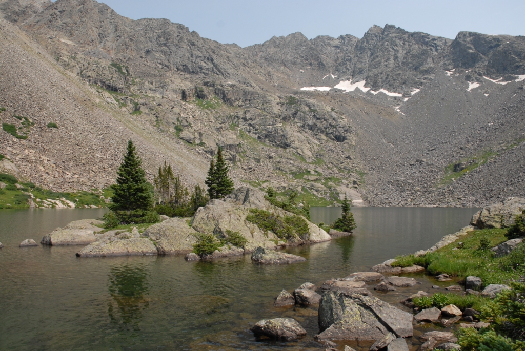
 There are 44 National Wildernesses within Colorado. The
 The
The
 The
The
 The three
 The 26

 The 16

 The 28 federally designated
 There are more than 1,500 Colorado sites on the
 The
The
 The
The




 The
The
Rio Grande National Forest
Rio Grande National Forest is a 1.86 million-acre (7,530 km²) U.S. National Forest located in southwestern Colorado. The forest encompasses the San Luis Valley, which is the world's largest agricultural alpine valley, as well as one of the ...
*Roosevelt National Forest
The Roosevelt National Forest is a National Forest located in north central Colorado. It is contiguous with the Colorado State Forest as well as the Arapaho National Forest and the Routt National Forest. The forest is administered jointly with ...
*Routt National Forest Routt may refer to:
;Places
In the United States:
* Routt, Louisville, Kentucky
*Routt County, Colorado
;People
*Joe Routt
*John Long Routt
John Long Routt (April 25, 1826 – August 13, 1907) was an American politician of the Republican Part ...
*San Isabel National Forest
San Isabel National Forest is located in central Colorado. The forest contains 19 of the state's 53 fourteeners, peaks over high, including Mount Elbert, the highest point in Colorado.
It is one of eleven national forests in the state of Colo ...
*San Juan National Forest
The San Juan National Forest is a U.S. National Forest covering over 1,878,846 acres (2,935.7 sq mi, or 7,603.42 km²) in western Colorado. The forest occupies land in Archuleta, Conejos, Dolores, Hinsdale, La Plata, Mineral, Montezu ...
* Uncompahgre National Forest
*White River National Forest
White River National Forest is a National Forest in northwest Colorado. It is named after the White River that passes through its northern section. It is the most visited National Forest in the United States, primarily from users of the twelv ...
National Grasslands
United States Forest Service
The United States Forest Service (USFS) is an agency of the United States Department of Agriculture, U.S. Department of Agriculture that administers the nation's 154 United States National Forest, national forests and 20 United States Nationa ...
manages the two National Grasslands within Colorado.
*Comanche National Grassland
Comanche National Grassland is a National Grassland located in southeastern Colorado, United States. It is the sister grassland of Cimarron National Grassland and contains both prairie grasslands and canyons. It is separated into two sections, ...
– southeastern Colorado
*Pawnee National Grassland
Pawnee National Grassland is a United States National Grassland located in northeastern Colorado on the Colorado Eastern Plains. The grassland is located in the South Platte River basin in remote northern and extreme northeastern Weld County be ...
– northeastern Colorado
National Wildernesses


 There are 44 National Wildernesses within Colorado. The
 United States Forest Service
The United States Forest Service (USFS) is an agency of the United States Department of Agriculture, U.S. Department of Agriculture that administers the nation's 154 United States National Forest, national forests and 20 United States Nationa ...
manages 34, the National Park Service
The National Park Service (NPS) is an agency of the United States federal government within the U.S. Department of the Interior that manages all national parks, most national monuments, and other natural, historical, and recreational properti ...
manages four, the Bureau of Land Management
The Bureau of Land Management (BLM) is an agency within the United States Department of the Interior responsible for administering federal lands. Headquartered in Washington DC, and with oversight over , it governs one eighth of the country's ...
manages three, the United States Forest Service and the Bureau of Land Management jointly manage two, and the United States Forest Service and the National Park Service jointly manage one National Wilderness.
*Black Canyon of the Gunnison Wilderness
Black Canyon of the Gunnison National Park is an American national park located in western Colorado and managed by the National Park Service. There are two primary entrances to the park: the south rim entrance is located east of Montrose, while ...
*Black Ridge Canyons Wilderness
The Black Ridge Canyons Wilderness (BRCW) is located in western Colorado with a small portion extending into eastern Utah, USA, within the arid Colorado Plateau region approximately west of Grand Junction, Colorado. The wilderness lies on the n ...
*Buffalo Peaks Wilderness
The Buffalo Peaks Wilderness is a U.S. Wilderness Area located in San Isabel and Pike National Forests in central Colorado. The wilderness was named after two highly eroded volcanic mountains, East Buffalo Peak and West Buffalo Peak, in the Mo ...
*Byers Peak Wilderness
The Byers Peak Wilderness is a U.S. Wilderness Area located in Arapaho National Forest in north central Colorado
Colorado (, other variants) is a state in the Mountain West subregion of the Western United States. It encompasses most of t ...
* Cache La Poudre Wilderness
*Collegiate Peaks Wilderness
The Collegiate Peaks Wilderness is a area located in central Colorado between Leadville and Buena Vista to the east and Aspen to the west and Crested Butte to the southwest. Most of the area is in the San Isabel and Gunnison National Forests, wi ...
*Comanche Peak Wilderness
The Comanche Peak Wilderness is a U.S. Wilderness Area located in the Roosevelt National Forest on the Canyon Lakes Ranger District in Colorado along the northern boundary of Rocky Mountain National Park. The wilderness named for its most prom ...
* Dominguez Canyon Wilderness
*Eagles Nest Wilderness
The Eagles Nest Wilderness is a U.S. Wilderness Area located in the Gore Range near Vail, Copper Mountain, Frisco, Silverthorne, and Heeney, in Summit and Eagle Counties, Colorado. Eagles Nest Wilderness falls within the jurisdiction of Dill ...
*Flat Tops Wilderness
Flat Tops Wilderness Area is the second largest U.S. Wilderness Area in Colorado. It is , with in Routt National Forest and in White River National Forest. It was designated a wilderness area in 1975. Trappers Lake, located in the north of the ...
*Fossil Ridge Wilderness
The Fossil Ridge Wilderness is a U.S. Wilderness Area located approximately northeast of Gunnison, Colorado in the Gunnison National Forest. The wilderness includes Fossil Ridge, a high, exposed ridge of Paleozoic carbonate rocks, carbonates th ...
* Great Sand Dunes Wilderness
*Greenhorn Mountain Wilderness
The Greenhorn Mountain Wilderness is a U.S. Wilderness Area located northwest of Walsenburg, Colorado in the San Isabel and Pike
Pike, Pikes or The Pike may refer to:
Fish
* Blue pike or blue walleye, an extinct color morph of the yellow wa ...
*Gunnison Gorge Wilderness
The Gunnison Gorge Wilderness is a U.S. Wilderness Area located immediately northwest of the Black Canyon of the Gunnison National Park. The wilderness area established in 1999 includes of the Gunnison River
The Gunnison River is located ...
*Hermosa Creek Wilderness
The Hermosa Creek Wilderness is a U.S. Wilderness Area in La Plata County, Colorado. It s located in the San Juan National Forest north of Durango. It was established by the Hermosa Creek Protection Act of 2014, which also created the adjacen ...
*Holy Cross Wilderness
The Holy Cross Wilderness is a U.S. Wilderness Area located in San Isabel and White River national forests near Leadville, Minturn, Avon, Edwards, Eagle, and Vail, Colorado. The wilderness with of trails was established in 1980. The wild ...
* Hunter-Fryingpan Wilderness
*Indian Peaks Wilderness
The Indian Peaks Wilderness is a wilderness area in north central Colorado managed jointly by the United States Forest Service and the National Park Service within the Arapaho and Roosevelt National Forests and small parts of the southern sectio ...
*James Peak Wilderness
The James Peak Wilderness is a U.S. Wilderness Area in north central Colorado in the Arapaho and Roosevelt national forests. The wilderness area borders Indian Peaks Wilderness to the north and the James Peak Protection Area to the west.
Geograp ...
*La Garita Wilderness
The La Garita Wilderness is a U.S. Wilderness Area located in the La Garita Mountains of southern Colorado. The wilderness established in 1964 in Gunnison and Rio Grande National Forests includes segments of the Colorado Trail and the Cont ...
*Lizard Head Wilderness
The Lizard Head Wilderness is a wilderness area in southwest Colorado. It contains and is jointly managed by the Uncompahgre and San Juan National Forests. It is southwest of the town of Telluride and is named for a prominent rock formation ...
*Lost Creek Wilderness
The Lost Creek Wilderness is a wilderness area located in central Colorado in Jefferson and Park counties, south of the town of Bailey. The area is situated entirely within the boundaries of the Pike National Forest.
The Lost Creek Scenic Are ...
*Maroon Bells-Snowmass Wilderness
Maroon ( US/ UK , Australia ) is a brownish crimson color that takes its name from the French word ''marron'', or chestnut. "Marron" is also one of the French translations for "brown".
According to multiple dictionaries, there are vari ...
* Mesa Verde Wilderness
*Mount Evans Wilderness
The Mount Evans Wilderness is a U.S. Wilderness Area in Arapaho National Forest and Pike National Forest about west of Denver, Colorado. The wilderness area is named after Mount Evans.
History
The first efforts to protect the Mount Evans area i ...
*Mount Massive Wilderness
The Mount Massive Wilderness is a federally designated wilderness area in the Sawatch Range, located in the U.S. state of Colorado. It is operated jointly by the United States Forest Service and the Fish and Wildlife Service as part of the San ...
*Mount Sneffels Wilderness
The Mount Sneffels Wilderness is a wilderness area in southwest Colorado managed by the Uncompahgre National Forest. It is about west of the town of Ouray. The area is named for Mt. Sneffels, which at is a prominent fourteener in the San Jua ...
*Mount Zirkel Wilderness
The Mount Zirkel Wilderness is a U.S. Wilderness Area located in Routt National Forest in northwest Colorado. The closest city is Steamboat Springs, Colorado. The wilderness is named after Mount Zirkel, the highest peak in the range at , which it ...
*Neota Wilderness
The Neota Wilderness is administered by the USDA Forest Service. It is located on the Canyon Lakes Ranger District of the Roosevelt National Forest in Colorado. This wilderness area encompasses and is bordered on the south by Rocky Mountain Na ...
* Never Summer Wilderness
* Platte River Wilderness
*Powderhorn Wilderness
The Powderhorn Wilderness is a U.S. Wilderness Area, wilderness area in Hinsdale County, Colorado, Hinsdale and Gunnison County, Colorado, Gunnison counties, Colorado, United States, located northeast of Lake City, Colorado, Lake City.
Descri ...
*Ptarmigan Peak Wilderness
The Ptarmigan Peak Wilderness is a U.S. Wilderness Area located north of Dillion, Colorado
Colorado (, other variants) is a state in the Mountain West subregion of the Western United States. It encompasses most of the Southern Rocky Mounta ...
*Raggeds Wilderness
The Raggeds Wilderness is a U.S. Wilderness Area located in the Elk Mountains northwest of Crested Butte, Colorado
Colorado (, other variants) is a state in the Mountain West subregion of the Western United States. It encompasses most o ...
*Rawah Wilderness
The Rawah Wilderness is administered by the USDA Forest Service. It is located on the Canyon Lakes Ranger District of the Roosevelt National Forest in Colorado, near the Wyoming border, and also in the Routt National Forest to its south. It enco ...
*Rocky Mountain National Park Wilderness
Rocky Mountain National Park is an American national park located approximately northwest of Denver in north-central Colorado, within the Front Range of the Rocky Mountains. The park is situated between the towns of Estes Park to the east and ...
*Sangre de Cristo Wilderness
The Sangre de Cristo Wilderness is a long and narrow wilderness area covering of the Sangre de Cristo Range centered about Saguache and Custer counties, Colorado. Smaller areas are located in Fremont, Alamosa, and Huerfano counties. The wilde ...
*Sarvis Creek Wilderness
The Sarvis Creek Wilderness is a U.S. Wilderness Area located south of Steamboat Springs, Colorado in the Routt National Forest. The area is named after the Sarvis Timber Company, which once logged the area. The area contains no alpine tundra ...
*South San Juan Wilderness
The South San Juan Wilderness is a U.S. Wilderness Area located in the San Juan National Forest, east of Pagosa Springs, in southern Colorado .
The last known grizzly bear in Colorado was killed in the wilderness in 1979. Some believe that it ...
*Spanish Peaks Wilderness
The Spanish Peaks Wilderness is a wilderness area in Huerfano County and Las Animas County, Colorado, United States, located southwest of Walsenburg. All of the wilderness area is located within San Isabel National Forest, which is managed by t ...
*Uncompahgre Wilderness
The Uncompahgre Wilderness (formerly called the Big Blue Wilderness) is a U.S. Wilderness Area in southwest Colorado comprising . Elevation in the Wilderness ranges from to , at the summit of Uncompahgre Peak.
Managed by the Uncompahgre Nati ...
*Vasquez Peak Wilderness
The Vasquez Peak Wilderness is a U.S. Wilderness Area located southwest of Winter Park, Colorado. The wilderness established in 1993 in the Arapaho
The Arapaho (; french: Arapahos, ) are a Native American people historically living on the ...
*Weminuche Wilderness
The Weminuche Wilderness is a wilderness area in southwest Colorado managed by the United States Forest Service as part of the San Juan National Forest on the west side of the Continental Divide and the Rio Grande National Forest on the east side ...
*West Elk Wilderness
The West Elk Wilderness is a U.S. Wilderness Area located northwest of Gunnison, Colorado in the West Elk Mountains.
History
The wilderness was established in 1964 and now protects within the Gunnison National Forest.
Geography
Elevati ...
National Conservation Areas
 The
The Bureau of Land Management
The Bureau of Land Management (BLM) is an agency within the United States Department of the Interior responsible for administering federal lands. Headquartered in Washington DC, and with oversight over , it governs one eighth of the country's ...
manages the three National Conservation Areas within Colorado.
* Dominguez–Escalante National Conservation Area
*Gunnison Gorge National Conservation Area
The Gunnison Gorge National Conservation Area is a National Conservation Area located in west-central Colorado near Montrose. It is managed by the Bureau of Land Management (BLM) as part of the National Landscape Conservation System
National ...
*McInnis Canyons National Conservation Area
The McInnis Canyons National Conservation Area (MCNCA) is a National Conservation Area located in Mesa County, west of Grand Junction, Colorado. The MCNCA has rugged sandstone canyons, natural arches, spires, and alcoves carved into the Colora ...
National Wildlife Refuges
United States Fish and Wildlife Service
The United States Fish and Wildlife Service (USFWS or FWS) is an agency within the United States Department of the Interior dedicated to the management of fish, wildlife, and natural habitats. The mission of the agency is "working with othe ...
manages the eight National Wildlife Refuge
National Wildlife Refuge System is a designation for certain protected areas of the United States managed by the United States Fish and Wildlife Service. The National Wildlife Refuge System is the system of public lands and waters set aside to ...
s within Colorado.
* Alamosa National Wildlife Refuge
*Arapaho National Wildlife Refuge
The Arapaho National Wildlife Refuge is a United States National Wildlife Refuge located in north-central Colorado. It is one of over 560 national wildlife refuges which manages and protects natural resources for future generations. The refuge is ...
* Baca National Wildlife Refuge
*Browns Park National Wildlife Refuge
Browns Park National Wildlife Refuge is a U.S. National Wildlife Refuge located in northwestern Colorado. It is located in Moffat County in the extreme northwestern corner of the state, in an isolated mountain valley of Browns Park on both sides ...
* Monte Vista National Wildlife Refuge
*Rocky Flats National Wildlife Refuge
The Rocky Flats National Wildlife Refuge is National Wildlife Refuge in the United States, located approximately northwest of Denver, Colorado. The refuge is situated west of the cities of Broomfield and Westminster and situated north of the ...
*Rocky Mountain Arsenal National Wildlife Refuge
The Rocky Mountain Arsenal National Wildlife Refuge is a National Wildlife Refuge located adjacent to Denver and Commerce City, Colorado, in the United States. It is approximately northeast of downtown Denver. The refuge is on the grounds of t ...
* Two Ponds National Wildlife Refuge
Federally designated areas
The following areas are designated by theNational Park Service
The National Park Service (NPS) is an agency of the United States federal government within the U.S. Department of the Interior that manages all national parks, most national monuments, and other natural, historical, and recreational properti ...
, but reside on a variety of federal, state, county, city, town, and private lands.
National Heritage Areas
National Heritage Area
In the United States, a National Heritage Area (NHA) is a site designated by Act of Congress, intended to encourage historic preservation of the area and an appreciation of the history and heritage of the site. There are currently 62 NHAs, som ...
s in Colorado are:
*Cache La Poudre River Corridor National Heritage Area
The Cache La Poudre River Corridor National Heritage Area extends along the flood plain of the Cache La Poudre River in Colorado, USA. It is a federally designated National Heritage Area, extending for from Larimer County, Colorado, Larimer County ...
*Sangre de Cristo National Heritage Area
Sangre de Cristo National Heritage Area is a federally designated National Heritage Area in the south central portion of the U.S. state of Colorado. The heritage area includes the San Luis Valley and portions of the Sangre de Cristo Range. The reg ...
*South Park National Heritage Area
South Park National Heritage Area is a U.S. National Heritage Area encompassing the South Park of Colorado. Established on March 30, 2009 by the Omnibus Public Land Management Act of 2009 (§7002), the South Park NHA is managed by the Park Count ...
National Historic Landmarks
 The 26
 National Historic Landmark
A National Historic Landmark (NHL) is a building, district, object, site, or structure that is officially recognized by the United States government for its outstanding historical significance. Only some 2,500 (~3%) of over 90,000 places liste ...
s in Colorado are:
* Bent's Old Fort
* Burlingon Carousel
* Central City/Black Hawk Historic District
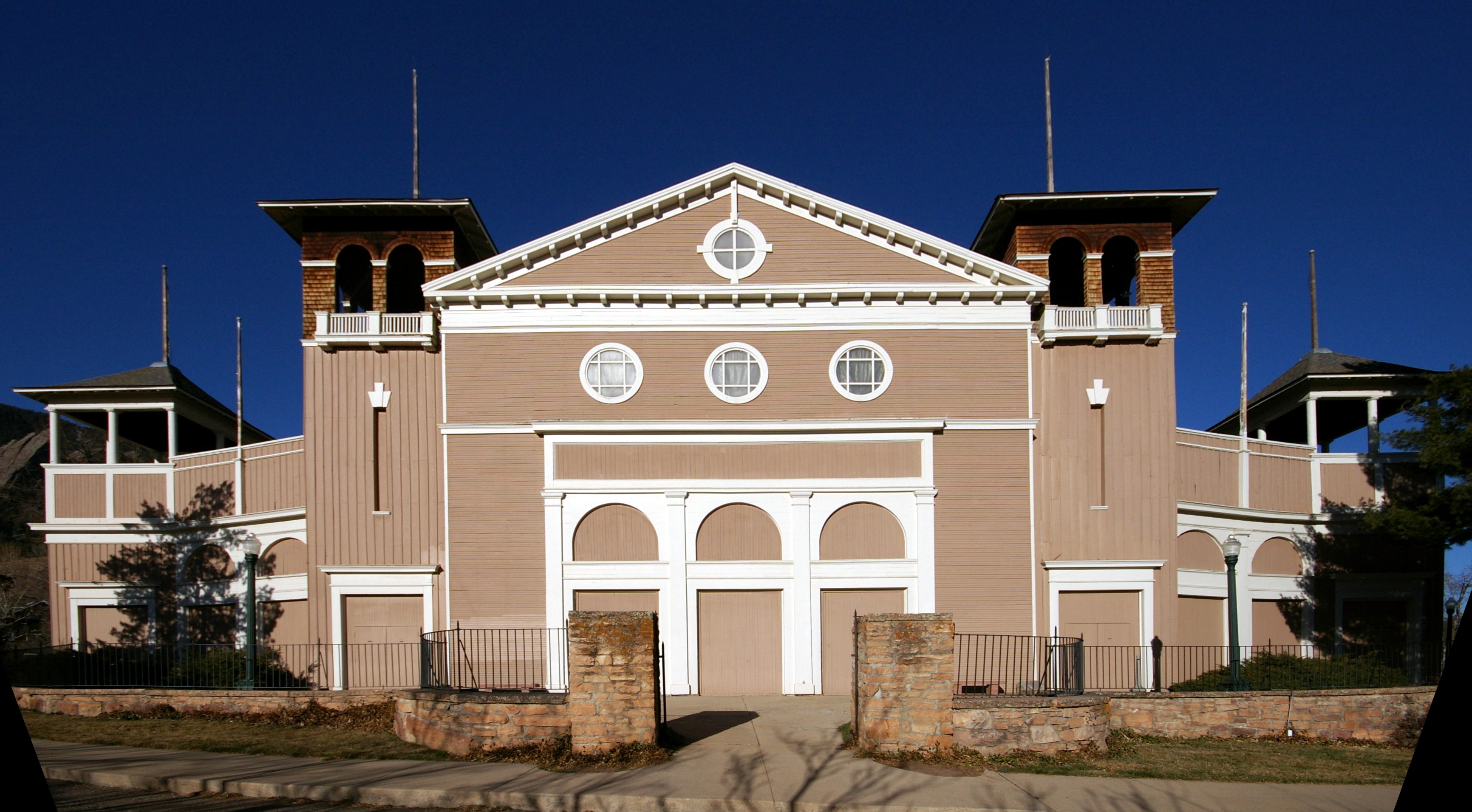
*Colorado Chautauqua
The Colorado Chautauqua, located in Boulder, Colorado, United States, and started in 1898, is the only Chautauqua west of the Mississippi River still continuing in unbroken operation since the heyday of the Chautauqua Movement in the 1920s. It i ...
* Colorado Fuel and Iron Company Administrative Complex
*Cripple Creek Historic District
Cripple Creek Historic District is a historic district including Cripple Creek, Colorado, United States and is significant for its gold mining era history. It developed as a gold mining center beginning in 1890, with a number of buildings from ...
*Cumbres and Toltec Scenic Railroad
The Cumbres and Toltec Scenic Railroad, often abbreviated as the C&TSRR, is a narrow-gauge heritage railroad that operates on of track between Antonito, Colorado, and Chama, New Mexico, in the United States. The railroad is named for two geogr ...
*Denver Civic Center
The Denver Civic Center is a civic center area that includes two parks surrounded by government and cultural buildings and spaces. Civic Center is located in central Denver, Colorado, on the south side of Downtown Denver. Much of the area is a his ...
*Durango-Silverton Narrow-Gauge Railroad
The Durango and Silverton Narrow Gauge Railroad, often abbreviated as the D&SNG, is a 3 ft (914 mm) narrow-gauge heritage railroad that operates on of track between Durango and Silverton, in the U.S. state of Colorado. The railway is a fed ...
* Georgetown-Silver Plume Historic District
* Granada War Relocation Center
*Leadville Historic District
The Leadville Historic District is in the mining town of Leadville, Colorado. The National Historic Landmark District includes 67 mines in the mining district east of the city up to the 12,000 foot (3658 m) level, and a defined portion of the vi ...
* Lindenmeier site
* Lowry Ruin
* Ludlow Tent Colony Site
* Mesa Verde Administrative District
*Pikes Peak
Pikes Peak is the highest summit of the southern Front Range of the Rocky Mountains, in North America. The ultra-prominent fourteener is located in Pike National Forest, west of downtown Colorado Springs, Colorado. The town of Manitou S ...
*Pike's Stockade
Pike's Stockade is a historic exploration campsite located near Sanford, Colorado. Set on the north bank of the Conejos River, it is where explorer Zebulon Pike raised the American flag on Spanish soil in 1807. The site, now managed by Historic ...
*Raton Pass
Ratón Pass is a 7,834 ft (2,388 m) elevation mountain pass on the Colorado–New Mexico border in the western United States. It is located on the eastern side of the Sangre de Cristo Mountains between Trinidad, Colorado and Raton, New ...
*Red Rocks Park
Red Rocks Park is a mountain park in Jefferson County, Colorado, owned and maintained by the city of Denver as part of the Denver Mountain Parks system. The park is known for its very large red sandstone outcrops. Many of these rock formations wi ...
*Rocky Mountain National Park Administration Building
Beaver Meadows Visitor Center, also known as Rocky Mountain National Park Administration Building, is the park headquarters and principal visitors center of Rocky Mountain National Park in central northern Colorado. Completed in 1967, it was desi ...
* Shenandoah-Dives (Mayflower) Mill
* Silverton Historic District
* Telluride Historic District
*Trujillo Homesteads
The Trujillo Homesteads are a historic ranch site near Mosca, Alamosa County, Colorado, not far from the Great Sand Dunes National Park. The area was first settled in the 1860s by Teofilo Trujillo, a Mexican sheep farmer. His son Pedro built a ...
* United States Air Force Academy, Cadet Area
National Natural Landmarks
 The 16
 National Natural Landmark
The National Natural Landmarks (NNL) Program recognizes and encourages the conservation of outstanding examples of the natural history of the United States. It is the only national natural areas program that identifies and recognizes the best ...
s in Colorado are:
* Big Spring Creek
*Garden of the Gods
Garden of the Gods (Arapaho: ''Ho3o’uu Niitko’usi’i'') is a public park located in Colorado Springs, Colorado, United States. It was designated a National Natural Landmark in 1971.
Name
The area now known as Garden of the Gods was f ...
*Garden Park Fossil Area Garden Park is a paleontological site in Fremont County, Colorado, known for its Jurassic dinosaurs and the role the specimens played in the infamous Bone Wars of the late 19th century. Located north of Cañon City, the name originates from the ar ...
* Hanging Lake
* Indian Springs Trace Fossil Site
*Lost Creek Scenic Area
The Lost Creek Wilderness is a wilderness area located in central Colorado in Jefferson and Park counties, south of the town of Bailey. The area is situated entirely within the boundaries of the Pike National Forest.
The Lost Creek Scenic Ar ...
* Morrison-Golden Fossil Areas
*Raton Mesa
Raton Mesa is the collective name of several mesas on the eastern side of Raton Pass in New Mexico and Colorado. The name Raton Mesa or Mesas has sometimes been applied to all the mesas that extend east for along the Colorado-New Mexico border ...
* Roxborough State Park
* Russell Lakes
* Sand Creek
*Slumgullion Earthflow
The Slumgullion Earthflow in the San Juan Mountains in Hinsdale County, Colorado has been a National Natural Landmark since 1983. It is also a Colorado Natural Area and an Area of Critical Environmental Concern.
The earthflow, a slow-moving lan ...
*Spanish Peaks
The Spanish Peaks are a pair of prominent mountains located in southwestern Huerfano County, Colorado. The Comanche people call them Huajatolla ( ) or Wa-to-yah meaning "double mountain".
The two peaks, East Spanish Peak at elevation and We ...
* Sulphur Cave and Spring
* Summit Lake
* West Bijou Site
National Recreation Trails

 The 28 federally designated
 National Recreation Trail
The National Trails System is a series of trails in the United States designated "to promote the preservation of, public access to, travel within, and enjoyment and appreciation of the open-air, outdoor areas and historic resources of the Nati ...
s in Colorado are:
* Apex National Recreation Trail near Golden
*Barr National Recreation Trail
Barr Trail is a trail in the Pike National Forest that begins in Manitou Springs, Colorado and ends at the Pikes Peak summit. The high elevation trail with a long sustained grade is rated more difficult by the U.S. Forest Service. With a eleva ...
between Manitou Springs
Manitou Springs is a home rule municipality located at the foot of Pikes Peak in western El Paso County, Colorado, United States. The town was founded for its natural mineral springs. The downtown area continues to be of interest to travelers ...
and Pikes Peak
Pikes Peak is the highest summit of the southern Front Range of the Rocky Mountains, in North America. The ultra-prominent fourteener is located in Pike National Forest, west of downtown Colorado Springs, Colorado. The town of Manitou S ...
* Bear Creek National Recreation Trail near Ouray
* Big Dry Creek National Recreation Trail through Westminster
Westminster is an area of Central London, part of the wider City of Westminster.
The area, which extends from the River Thames to Oxford Street, has many visitor attractions and historic landmarks, including the Palace of Westminster, B ...
* Calico National Recreation Trail near Dolores
* Crag Crest National Recreation Trail near Cedaredge
The Town of Cedaredge is a home rule municipality located in Delta County, Colorado, United States. The town population was 2,279 at the 2020 United States Census. Cedaredge sits in the Surface Creek Valley beneath the southern slopes of the Gra ...
*Devils Head National Recreation Trail
A devil is the personification of evil as it is conceived in many and various cultures and religious traditions.
Devil or Devils may also refer to:
* Satan
* Devil in Christianity
* Demon
* Folk devil
Art, entertainment, and media
Film and ...
near Sedalia
* Fish Creek Falls National Recreation Trail near Steamboat Springs
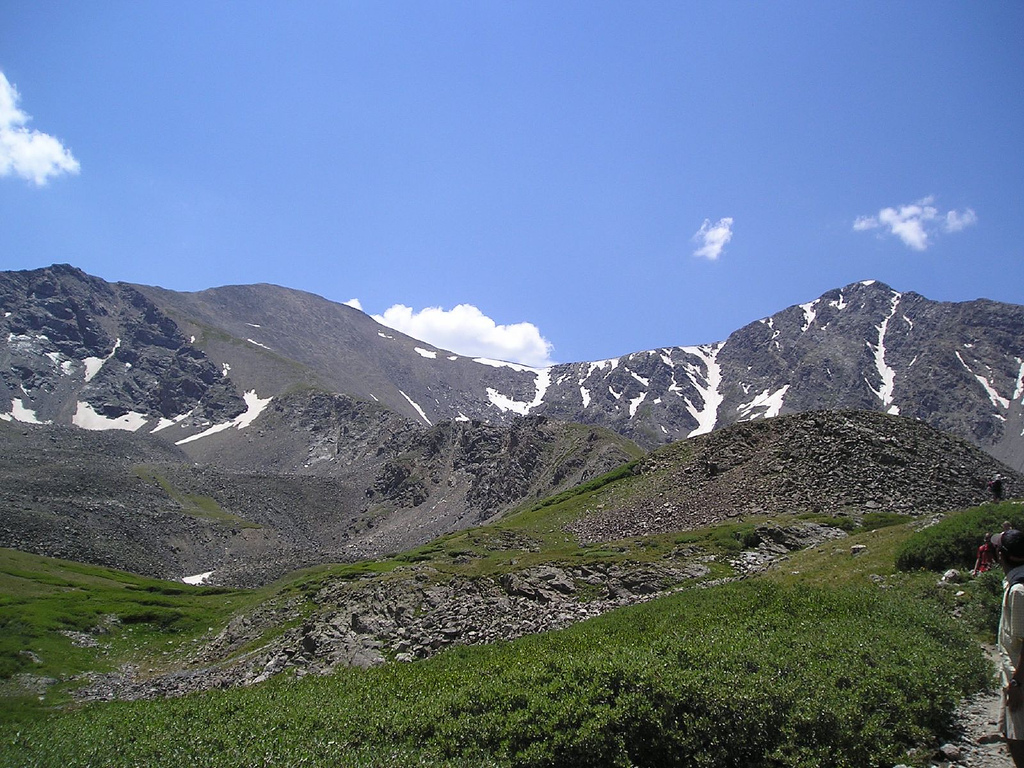
* Grays Peak National Recreation Trail near Silver Plume
* Greyrock Mountain National Recreation Trail near Laporte
*Highline Canal National Recreation Trail
The High Line Canal (HLC) is a man-made waterway, used for irrigation and recreation, that serves the Denver-Aurora metropolitan area. It begins at a diversion dam on the South Platte River, some above the mouth of Waterton Canyon. From its headg ...
through metropolitan Denver
Denver, Colorado, Denver is the central city of a conurbation region in the U.S. state of Colorado. The conurbation includes one continuous region consisting of the six central counties of Adams, Arapahoe, Broomfield, Denver, Douglas, and Jeffers ...
* Highline Loop National Recreation Trail near Dolores
*Lake Fork National Recreation Trail
A lake is an area filled with water, localized in a basin, surrounded by land, and distinct from any river or other outlet that serves to feed or drain the lake. Lakes lie on land and are not part of the ocean, although, like the much larg ...
near South Fork
* Mineral Belt National Recreation Trail near Leadville
The City of Leadville is a statutory city that is the county seat, the most populous community, and the only incorporated municipality in Lake County, Colorado, United States. The city population was 2,602 at the 2010 census and an estimated ...
* Mount Evans National Recreation Trail near Idaho Springs
The City of Idaho Springs is the Statutory City that is the most populous municipality in Clear Creek County, Colorado, United States. Idaho Springs is a part of the Denver–Aurora–Lakewood, CO Metropolitan Statistical Area. As of the 201 ...
* Mount McConnel National Recreation Trail near Laporte
* Petroglyph Point National Recreation Trail in Mesa Verde National Park
Mesa Verde National Park is an American national park and UNESCO World Heritage Site located in Montezuma County, Colorado. The park protects some of the best-preserved Ancestral Puebloan archaeological sites in the United States.
Established ...
*Platte River Greenway National Recreation Trail Platte may refer to:
Geography United States
* Platte, Minnesota, an unincorporated community
* Platte, South Dakota, a city
* Platte Canyon, Colorado
* Platte City, Missouri
* Platte Lake (disambiguation), also Lake Platte
* Platte River (disa ...
through metropolitan Denver
Denver, Colorado, Denver is the central city of a conurbation region in the U.S. state of Colorado. The conurbation includes one continuous region consisting of the six central counties of Adams, Arapahoe, Broomfield, Denver, Douglas, and Jeffers ...
* Poudre River National Recreation Trail between Greeley and Windsor
Windsor may refer to:
Places Australia
* Windsor, New South Wales
** Municipality of Windsor, a former local government area
* Windsor, Queensland, a suburb of Brisbane, Queensland
**Shire of Windsor, a former local government authority around Wi ...
* Rocky Mountain Arsenal National Recreation Trails near Denver
Denver () is a consolidated city and county, the capital, and most populous city of the U.S. state of Colorado. Its population was 715,522 at the 2020 census, a 19.22% increase since 2010. It is the 19th-most populous city in the Unit ...
* Round Mountain National Recreation Trail near Loveland
* Swamp Park National Recreation Trail near Steamboat Springs
*Two Elk National Recreation Trail
2 (two) is a number, numeral and digit. It is the natural number following 1 and preceding 3. It is the smallest and only even prime number. Because it forms the basis of a duality, it has religious and spiritual significance in many cultur ...
near Vail
Vail is a home rule municipality in Eagle County, Colorado, United States. The population of the town was 4,835 in 2020. Home to Vail Ski Resort, the largest ski mountain in Colorado, the town is known for its hotels, dining, and for the numer ...
* Two Ponds National Recreation Trail in Arvada
Arvada () is a home rule municipality located in Jefferson and Adams counties, Colorado, United States. The city population was 124,402 at the 2020 United States Census, with 121,510 residing in Jefferson County and 2,892 residing in Adams Cou ...
*Vail Pass National Recreation Trail
Vail is a home rule municipality in Eagle County, Colorado, United States. The population of the town was 4,835 in 2020. Home to Vail Ski Resort, the largest ski mountain in Colorado, the town is known for its hotels, dining, and for the numer ...
between Copper Mountain and Vail
Vail is a home rule municipality in Eagle County, Colorado, United States. The population of the town was 4,835 in 2020. Home to Vail Ski Resort, the largest ski mountain in Colorado, the town is known for its hotels, dining, and for the numer ...
* West Lost Trail Creek National Recreation Trail near Creede
*Wheeler Ten Mile National Recreation Trail
Wheeler may refer to:
Places United States
* Wheeler, Alabama, an unincorporated community
* Wheeler, Arkansas, an unincorporated community
* Wheeler, California, an unincorporated community
* Wheeler, Illinois, a village
* Wheeler, Indiana, a c ...
between Frisco and Copper Mountain
* White House Ranch National Recreation Trail in Colorado Springs
Colorado Springs is a home rule municipality in, and the county seat of, El Paso County, Colorado, United States. It is the largest city in El Paso County, with a population of 478,961 at the 2020 United States Census, a 15.02% increase since ...
National Register of Historic Places
 There are more than 1,500 Colorado sites on the
 National Register of Historic Places
The National Register of Historic Places (NRHP) is the United States federal government's official list of districts, sites, buildings, structures and objects deemed worthy of preservation for their historical significance or "great artistic ...
.
Wild and Scenic River
 The
The Wild and Scenic River
The National Wild and Scenic Rivers System was created by the Wild and Scenic Rivers Act of 1968 (Public Law 90-542), enacted by the U.S. Congress to preserve certain rivers with outstanding natural, cultural, and recreational values in a free- ...
in Colorado is:
* Cache la Poudre Wild and Scenic River
Areas of Critical Environmental Concern
 The
The Bureau of Land Management
The Bureau of Land Management (BLM) is an agency within the United States Department of the Interior responsible for administering federal lands. Headquartered in Washington DC, and with oversight over , it governs one eighth of the country's ...
has designated 88 Areas of Critical Environmental Concern
Areas of Critical Environmental Concern (ACEC) is a conservation ecology program in the Western United States, managed by the Bureau of Land Management (BLM). The ACEC program was conceived in the 1976 Federal Lands Policy and Management Act ( F ...
in western Colorado.
State lands
Colorado State Parks

Colorado Parks and Wildlife
Colorado Parks and Wildlife manages the state parks system and the wildlife of the U.S. state of Colorado. , the division managed the 42 state parks and 307 wildlife areas of Colorado.
, the Colorado Natural Areas Program had 93 designated s ...
manages the 43 Colorado State Parks.
*Arkansas Headwaters Recreation Area
The Arkansas Headwaters Recreation Area (AHRA) is one of the United States' most popular locations for whitewater rafting and kayaking on the Arkansas River. There is a total of 150 miles of water that extends from Leadville, Colorado to Pueblo ...
* Barr Lake State Park
* Boyd Lake State Park
* Castlewood Canyon State Park
*Chatfield State Park
Chatfield State Park is a state park located in Douglas and Jefferson counties of Colorado, United States. The park centers on Chatfield Reservoir, a 1,423 acre surface area lake fed by the South Platte River and two other creeks, including ...
*Cherry Creek State Park
Cherry Creek State Park is a state park in Arapahoe County, Colorado, United States. The park consists of a natural prairie and wetland environment with an reservoir at its center which is shared by powerboats, sailboats, and paddle craft. T ...
*Cheyenne Mountain State Park
Cheyenne Mountain State Park is a Colorado state park that was acquired in June 2000 through a partnership between the City of Colorado Springs, Colorado State Parks, Great Outdoors Colorado (GOCO), Colorado Lottery, El Paso County, and other l ...
*Crawford State Park (Colorado)
Crawford State Park is a Colorado State Park that encompasses Crawford Reservoir located about south of the town of Crawford in Delta County, Colorado. The north rim of the Black Canyon of the Gunnison National Park
Black Canyon of the Gu ...
*Eldorado Canyon State Park
Eldorado Canyon State Park is part of the Colorado State Park system. It was established in 1978 and is located in Boulder County near the city of Boulder. The park consists of two areas, the Inner Canyon (developed area) and Crescent Meadows (u ...
*Eleven Mile State Park
Eleven Mile State Park is a Colorado State Park located in Park County, south of Lake George, Colorado, United States. Established in 1970, the park surrounds , long Eleven Mile Reservoir. Facilities include a marina, a visitors center and ...
*Elkhead State Park
Elkhead Reservoir State Park is a Colorado state park located in Moffat and Routt counties in northwest Colorado, near Craig. The park surrounds and includes the 900 surface acre Elkhead Reservoir. It is referred to as Elkhead State Park. Elkh ...
*Fishers Peak State Park
Fishers Peak State Park is a Colorado state park in Las Animas County, Colorado, just south of Trinidad. Trinidad Lake State Park is nearby. The park opened on October 30, 2020, and is still being developed.
History
The land for the park, form ...
*Golden Gate Canyon State Park
Golden Gate Canyon State Park is a Colorado State Park located in Gilpin and Jefferson counties northwest of Golden, Colorado. The Front Range park established in 1960 has of hiking trails. Horse and bicycle travel is allowed on . Facil ...
*Harvey Gap State Park
Harvey Gap State Park, is a Colorado
Colorado (, other variants) is a state in the Mountain West subregion of the Western United States. It encompasses most of the Southern Rocky Mountains, as well as the northeastern portion of the Colo ...
* Highline Lake State Park
*Jackson Lake State Park (Colorado)
:''This is about the Colorado State park. For others, see Jackson Lake (disambiguation).''
Jackson Lake State Park is located northeast of Orchard, Colorado in western Morgan County, Colorado. It is situated on Jackson reservoir that was buil ...
* James M. Robb – Colorado River State Park
*John Martin Reservoir State Park
John Martin Reservoir State Park is a state park in Colorado. It contains John Martin Reservoir, which is the second largest body of water in Colorado by capacity. It is also known for being a prime birdwatching location. Bent County, Colorado ...
*Lake Pueblo State Park
Lake Pueblo State Park is a state park located in Pueblo County, Colorado. It includes of shoreline and of land. Activities it offers include two full-service marinas, recreational fishing, hiking, camping and swimming at a special swim beach. ...
*Lathrop State Park
Lathrop State Park is a Colorado state park located west of Walsenburg. The state purchased the property in 1962 and opened Colorado's first state park here later that same year. It is named after Harold Lathrop, the first director of state par ...
*Lone Mesa State Park
Lone Mesa State Park is a closed-access state park in Colorado. It is currently undergoing development and planning. The only allowed use is limited hunting
Hunting is the human activity, human practice of seeking, pursuing, capturing, or k ...
*Lory State Park
Lory State Park, is a state park located west of the city of Fort Collins, Colorado and is west of Horsetooth Reservoir and north of Horsetooth Mountain Park. Some of the park's more popular attractions include mountain biking, hiking, horsebac ...
*Mancos State Park
Mancos State Park is a Colorado state park. It is located near Mesa Verde National Park, the West Mancos Trail and the San Juan Skyway. The park is known to have been a dwelling place for Ancestral Puebloans
The Ancestral Puebloans, also ...
*Mueller State Park
Mueller State Park is a Colorado state park encompassing of land outside Divide, Colorado, west of Colorado Springs, Colorado. The park offers many outdoor activities. There are of trails, biking, camping year-round, hunting, hiking, and hor ...
*Navajo State Park
Navajo State Park is a state park of Colorado, USA, on the north shore of Navajo Lake. Touted as Colorado's answer to Lake Powell, this reservoir on the San Juan River begins in Colorado's San Juan Mountains and extends into New Mexico. Its ar ...
* North Sterling State Park
* Paonia State Park
*Pearl Lake State Park
Pearl Lake State Park, at the base of Hahn's Peak, is in Routt County, Colorado near the town of Hahn's Peak, Colorado and is north of Steamboat Springs. Pearl Lake is named for M. Pearl Hartt, the wife of pioneer sheep rancher, John Kelly Har ...
*Ridgway State Park
Ridgway State Park is a state park located in Ouray County, Colorado. The park is 21 miles southeast of Montrose, 14 miles northeast of Ouray, it is also 4 miles north of the town of Ridgway and 312 miles southwest of Denver. The current wildl ...
*Rifle Falls State Park
Rifle Falls State Park is a Colorado State Park located in Garfield County northeast of Rifle, Colorado. The central feature of the park is a triple waterfall flowing over a travertine dam on East Rifle Creek. Commonly seen wildlife include ...
*Rifle Gap State Park
Rifle Gap State Park is a Colorado State Park located in Garfield County near Rifle, Colorado. The park established in 1966 includes a reservoir. Plant communities are pinyon-juniper woodlands, sagebrush shrubland with deciduous riparian f ...
* Roxborough State Park
*Spinney Mountain State Park
Spinney Mountain State Park is a Colorado state park located in South Park in Park County, Colorado, United States.
The park centers on the Spinney Mountain Reservoir, which is popular with anglers. The reservoir and surrounding land is owned ...
* St. Vrain State Park
* Stagecoach State Park
* State Forest State Park
*Staunton State Park
Staunton State Park is a Colorado state park in Park and Jefferson counties, located west of Conifer, Colorado. The park, which opened on May 18, 2013, includes dramatic rock outcroppings, several streams and a waterfall. On December 4, 20 ...
*Steamboat Lake State Park
Steamboat Lake State Park is a Colorado state park located in Routt County north of Steamboat Springs, Colorado, and near the community of Hahns Peak Village. The park, established west of Hahns Peak in 1967, includes a reservoir. Park fac ...
* Sweitzer Lake State Park
* Sweetwater Lake State Park
* Sylvan Lake State Park
*Trinidad Lake State Park
Trinidad Lake State Park is a state park west of Trinidad, Colorado, United States. The park protects Trinidad Lake, a dammed reservoir. There are hiking trails, and camping and boating opportunities. The park features historical attractions suc ...
*Vega State Park
Vega State Park is a Colorado state park in Mesa County, Colorado in the United States. Vega Reservoir is a fishing destination and is located at an elevation of . Year-round recreational activities at Vega State Park include boating, hiking, s ...
*Yampa River State Park
Yampa River State Park is a Colorado state park located along the Yampa River in Routt and Moffat Counties in northwestern Colorado
Colorado (, other variants) is a state in the Mountain West subregion of the Western United States. It e ...
Colorado Wildlife Areas
Colorado Parks and Wildlife
Colorado Parks and Wildlife manages the state parks system and the wildlife of the U.S. state of Colorado. , the division managed the 42 state parks and 307 wildlife areas of Colorado.
, the Colorado Natural Areas Program had 93 designated s ...
manages the 307 Colorado State Wildlife Areas
The Colorado state wildlife areas are managed for hunting, fishing, observation, management, and preservation of wildlife.
The Colorado Parks and Wildlife division of the U.S. State of Colorado manages more than 300 state wildlife areas with a to ...
.
State designated areas
Colorado Natural Areas


 The
The Colorado Department of Natural Resources
The Colorado Department of Natural Resources is the principal department of the Colorado state government responsible for the development, protection, and enhancement Colorado natural resources for the use and enjoyment of the state's present and ...
has designated 95 Colorado Natural Areas.
* Aiken Canyon Natural Area
* Antero-Salt Creek Natural Area
* Arikaree River Natural Area
* Badger Wash Natural Area
*Blacks Gulch Natural Area
Black is a racialized classification of people, usually a political and skin color-based category for specific populations with a mid to dark brown complexion. Not all people considered "black" have dark skin; in certain countries, often in ...
* Blue Mountain Natural Area
* Bonny Prairie Natural Area
*Boulder Mountain Park Natural Area
In geology, a boulder (or rarely bowlder) is a rock fragment with size greater than in diameter. Smaller pieces are called cobbles and pebbles. While a boulder may be small enough to move or roll manually, others are extremely massive.
In c ...
in Boulder Mountain Park
In geology, a boulder (or rarely bowlder) is a rock fragment with size greater than in diameter. Smaller pieces are called cobbles and pebbles. While a boulder may be small enough to move or roll manually, others are extremely massive.
In c ...
*Brush Creek Fen Natural Area
A brush is a common tool with bristles, wire or other filaments. It generally consists of a handle or block to which filaments are affixed in either a parallel or perpendicular orientation, depending on the way the brush is to be gripped durin ...
* California Park Natural Area
* Castlewood Canyon Natural Area in Castlewood Canyon State Park
* Chalk Bluffs Natural Area
* Colorado Tallgrass Prairie Natural Area
*Comanche Grassland Lesser Prairie Chicken Natural Area
Comanche National Grassland is a National Grassland located in southeastern Colorado, United States. It is the sister grassland of Cimarron National Grassland and contains both prairie grasslands and canyons. It is separated into two sections, ...
in Comanche National Grassland
Comanche National Grassland is a National Grassland located in southeastern Colorado, United States. It is the sister grassland of Cimarron National Grassland and contains both prairie grasslands and canyons. It is separated into two sections, ...
*Copeland Willow Carr Natural Area Copeland or Copeland's may refer to:
Places
Australia
* Copeland, New South Wales
Canada
* Copeland Islands (Nunavut)
* Copeland Islands Marine Provincial Park, in the Strait of Georgia, British Columbia
* Mount Copeland, also Copeland Ridg ...
*Corral Bluffs Natural Area
A pen is an enclosure for holding livestock. It may also perhaps be used as a term for an enclosure for other animals such as pets that are unwanted inside the house. The term describes types of enclosures that may confine one or many animal ...
*Cross Mountain Canyon Natural Area
A cross is a geometrical figure consisting of two intersecting lines or bars, usually perpendicular to each other. The lines usually run vertically and horizontally. A cross of oblique lines, in the shape of the Latin letter X, is termed a sa ...
*Dakota Hogback Natural Area
Dinosaur Ridge is a segment of the Dakota Hogback in the Morrison Fossil Area National Natural Landmark located in Jefferson County, Colorado, near the town of Morrison and just west of Denver.
The Dinosaur Ridge area is one of the world's most ...
commonly known as Dinosaur Ridge
Dinosaur Ridge is a segment of the Dakota Hogback in the Morrison Fossil Area National Natural Landmark located in Jefferson County, Colorado, near the town of Morrison and just west of Denver.
The Dinosaur Ridge area is one of the world's mo ...
in Matthews/Winters Park
* Deer Gulch Natural Area
* Dome Rock Natural Area in Dome Rock State Wildlife Area
* Droney Gulch Natural Area
*Duck Creek Natural Area
Duck is the common name for numerous species of waterfowl in the family Anatidae. Ducks are generally smaller and shorter-necked than swans and geese, which are members of the same family. Divided among several subfamilies, they are a form t ...
* Dudley Bluffs Natural Area
* East Lost Park Natural Area in Pike National Forest
* East Sand Dunes Natural Area in State Forest State Park
* Elephant Rocks Natural Area
* Escalante Canyon Natural Area
* Fairview Natural Area
* Fourmile Creek Natural Area
* Fruita Paleontological Locality
*Garden Park Fossil Locality Garden Park is a paleontological site in Fremont County, Colorado, known for its Jurassic dinosaurs and the role the specimens played in the infamous Bone Wars of the late 19th century. Located north of Cañon City, the name originates from the ar ...
* Gateway Palisade Natural Area
* Geneva Basin Iron Fens Natural Area
* Gothic Research Natural Area in Gunnison National Forest
The Gunnison National Forest is a U.S. National Forest covering 1,672,136 acres (2,612.71 sq mi, or 6,766.89 km²) Gunnison Gravels Research Natural Area
* Haviland Lake Natural Area in Haviland Lake State Wildlife Area
* High Creek Fen Natural Area
* High Mesa Grassland Natural Area
* Hoosier Ridge Research Natural Area on the
Continental Divide
A continental divide is a drainage divide on a continent such that the drainage basin on one side of the divide feeds into one ocean or sea, and the basin on the other side either feeds into a different ocean or sea, or else is endorheic, not c ...
in Pike National Forest and White River National Forest
White River National Forest is a National Forest in northwest Colorado. It is named after the White River that passes through its northern section. It is the most visited National Forest in the United States, primarily from users of the twelv ...
* Hurricane Canyon Natural Area in Pike National Forest
* Indian Spring Natural Area
* Indian Springs Trace Fossil Locality
* Irish Canyon Natural Area
* Jimmy Creek Natural Area
* Ken-Caryl Ranch Natural Area
* Kremmling Cretaceous Ammonite Locality
* Limestone Ridge Natural Area
* Logan Wash Mine Natural Area
* Lookout Mountain Natural Area
*Lower Greasewood Creek Natural Area
Lower may refer to:
*Lower (surname)
*Lower Township, New Jersey
*Lower Receiver (firearms)
*Lower Wick Gloucestershire, England
See also
*Nizhny
Nizhny (russian: Ни́жний; masculine), Nizhnyaya (; feminine), or Nizhneye (russian: Ни́� ...
* McElmo Natural Area
* Mexican Cut Natural Area
* Mini-Wheeler Natural Area
* Miramonte Reservoir Natural Area in Dan Noble State Wildlife Area
* Mishak Lakes Natural Area
* Mount Callahan Natural Area
* Mount Callahan Saddle Natural Area
* Mount Emmons Iron Fen Natural Area in Gunnison National Forest
The Gunnison National Forest is a U.S. National Forest covering 1,672,136 acres (2,612.71 sq mi, or 6,766.89 km²) Mount Goliath Natural Area in
 The following transcontinental hiking trail was established by the
Colorado state government website
Colorado Department of Natural Resources website
*
Colorado Parks & Wildlife websiteColorado tourism websiteHistory Colorado websiteUnited States federal government website
United States Department of the Interior website
*
Bureau of Land Management website
*
National Park Service website
*
United States Fish and Wildlife Service website
United States Department of Agriculture website
*
United States Forest Service website
{{DEFAULTSORT:Protected areas of Colorado, List of Colorado geography-related lists Colorado history-related lists Tourism in Colorado Tourist attractions in Colorado Colorado, List of protected areas of
Arapaho National Forest
Arapaho National Forest is a National Forest located in north-central Colorado, United States. The region is managed jointly with the Roosevelt National Forest and the Pawnee National Grassland from the United States Forest Service office in ...
* Narraguinnep Natural Area in San Juan National Forest
The San Juan National Forest is a U.S. National Forest covering over 1,878,846 acres (2,935.7 sq mi, or 7,603.42 km²) in western Colorado. The forest occupies land in Archuleta, Conejos, Dolores, Hinsdale, La Plata, Mineral, Montezu ...
* Needle Rock Natural Area
* North Park Phacelia Natural Area
* Orient Mine Natural Area
* Owl Canyon Pinyon Grove Natural Area
* Pagosa Skyrocket Natural Area
*Paradise Park Natural Area
Paradise Park Natural Area is a natural area in Rocky Mountain National Park, Colorado, several miles east of Grand Lake. It protects the upper Paradise Creek basin, encompassing several alpine lakes, alpine meadows, and virgin spruce-fir forest. ...
in Rocky Mountain National Park
Rocky Mountain National Park is an American national park located approximately northwest of Denver in north-central Colorado, within the Front Range of the Rocky Mountains. The park is situated between the towns of Estes Park to the east and ...
* Park Creek Hogback Natural Area
*Pyramid Rock Natural Area
A pyramid (from el, πυραμίς ') is a Nonbuilding structure, structure whose outer surfaces are triangular and converge to a single step at the top, making the shape roughly a Pyramid (geometry), pyramid in the geometric sense. The base o ...
* Rabbit Valley Natural Area
* Rajadero Canyon Natural Area
* Raven Ridge Natural Area
* Redcloud Peak Natural Area
* Rough Canyon Natural Area
*Roxborough Natural Area
Roxborough State Park is a state park of Colorado, United States, known for dramatic red sandstone formations. Located in Douglas County south of Denver, Colorado, the park was established in 1975. In 1980 it was recognized as a National Na ...
in and near Roxborough State Park
*Ryan Gulch Natural Area
Ryan may refer to:
People and fictional characters
*Ryan (given name), a given name (including a list of people with the name)
*Ryan (surname), a surname (including a list of people with the name)
Places Australia
* Division of Ryan, an elector ...
*Saddle Mountain Natural Area
The saddle is a supportive structure for a rider of an animal, fastened to an animal's back by a girth. The most common type is equestrian. However, specialized saddles have been created for oxen, camels and other animals. It is not know ...
in Pike National Forest
* San Miguel River at Tabeguache Creek Natural Area
* Sand Creek Natural Area
* Shell Duck Creek Natural Area
*Shell Rock Natural Area
Shell may refer to:
Architecture and design
* Shell (structure), a thin structure
** Concrete shell, a thin shell of concrete, usually with no interior columns or exterior buttresses
** Thin-shell structure
Science Biology
* Seashell, a hard out ...
* Slumgullion Earthflow Natural Area in San Juan National Forest
The San Juan National Forest is a U.S. National Forest covering over 1,878,846 acres (2,935.7 sq mi, or 7,603.42 km²) in western Colorado. The forest occupies land in Archuleta, Conejos, Dolores, Hinsdale, La Plata, Mineral, Montezu ...
* South Beaver Creek Natural Area
* South Boulder Creek Natural Area
* South Cathedral Bluffs Natural Area
* Specimen Mountain Research Natural Area in Rocky Mountain National Park
Rocky Mountain National Park is an American national park located approximately northwest of Denver in north-central Colorado, within the Front Range of the Rocky Mountains. The park is situated between the towns of Estes Park to the east and ...
*Staunton Natural Area
Staunton State Park is a Colorado state park in Park and Jefferson counties, located west of Conifer, Colorado. The park, which opened on May 18, 2013, includes dramatic rock outcroppings, several streams and a waterfall. On December 4, 20 ...
in Staunton State Park
Staunton State Park is a Colorado state park in Park and Jefferson counties, located west of Conifer, Colorado. The park, which opened on May 18, 2013, includes dramatic rock outcroppings, several streams and a waterfall. On December 4, 20 ...
* Tamarack Ranch Natural Area in Tamarack Ranch State Wildlife Area
* Treasurevault Mountain Natural Area
* Trinidad K-T Boundary Natural Area in Trinidad Lake State Park
Trinidad Lake State Park is a state park west of Trinidad, Colorado, United States. The park protects Trinidad Lake, a dammed reservoir. There are hiking trails, and camping and boating opportunities. The park features historical attractions suc ...
* Two Buttes Natural Area
* Unaweep Seep Research Natural Area
* Wacker Ranch Natural Area
*West Creek Natural Area
West or Occident is one of the four cardinal directions or points of the compass. It is the opposite direction from east and is the direction in which the Sun sets on the Earth.
Etymology
The word "west" is a Germanic word passed into some ...
in Rocky Mountain National Park
Rocky Mountain National Park is an American national park located approximately northwest of Denver in north-central Colorado, within the Front Range of the Rocky Mountains. The park is situated between the towns of Estes Park to the east and ...
* Wheeler Geologic Natural Area in the La Garita Wilderness
The La Garita Wilderness is a U.S. Wilderness Area located in the La Garita Mountains of southern Colorado. The wilderness established in 1964 in Gunnison and Rio Grande National Forests includes segments of the Colorado Trail and the Cont ...
of Rio Grande National Forest
Rio Grande National Forest is a 1.86 million-acre (7,530 km²) U.S. National Forest located in southwestern Colorado. The forest encompasses the San Luis Valley, which is the world's largest agricultural alpine valley, as well as one of the ...
* White Rocks Natural Area
* Yanks Gulch/Upper Greasewood Creek Natural Area
* Zapata Falls Natural Area
Colorado Scenic and Historic Byways
TheColorado Scenic and Historic Byways Commission
Colorado Scenic and Historic Byways are highway and backroad routes in the U.S. state of Colorado designated by the Colorado Scenic and Historic Byways Commission for their scenic and historic values. These byways follow existing roads or highwa ...
has designated 26 Colorado Scenic and Historic Byways
Colorado Scenic and Historic Byways are highway and backroad routes in the U.S. state of Colorado designated by the Colorado Scenic and Historic Byways Commission for their scenic and historic values. These byways follow existing roads or highwa ...
:
*Alpine Loop Back Country Byway
The Alpine Loop Back Country Byway is a rugged Back Country Byway and Colorado Scenic and Historic Byway located in the high San Juan Mountains of Hindale, Ouray, and San Juan counties, Colorado, USA. The byway connects the mountain tow ...
* Cache la Poudre-North Park Scenic Byway
*Collegiate Peaks Scenic Byway
The Collegiate Peaks Scenic Byway is a Colorado Scenic and Historic Byway located in Chaffee and Lake counties, Colorado, US. The Byway follows the upper Arkansas River past the Collegiate Peaks, featuring eight of the highest peaks in the Roc ...
*Colorado River Headwaters National Scenic Byway
The Colorado River Headwaters National Scenic Byway is an National Scenic Byway and Colorado Scenic and Historic Byway located in Eagle and Grand counties, Colorado, US. The byway follows the upper Colorado River from Grand Lake down to State ...
* Dinosaur Diamond National Scenic Byway
* Flat Tops Trail Scenic Byway
* Frontier Pathways National Scenic Byway
*Gold Belt Tour Scenic and Historic Byway
The Gold Belt Tour Scenic and Historic Byway is a National Scenic Byway, a Back Country Byway, and a Colorado Scenic and Historic Byway located in Fremont and Teller counties, Colorado, USA. The byway is named for the Gold Belt mining region. ...
* Grand Mesa National Scenic Byway
*Guanella Pass Scenic Byway
The Guanella Pass Scenic Byway is a National Forest Scenic Byway and Colorado Scenic and Historic Byway located in Clear Creek and Park counties, Colorado, USA. The byway traverses Guanella Pass at elevation in Arapaho and Pike national fores ...
*Highway of Legends National Scenic Byway
The Highway of Legends National Scenic Byway is an National Scenic Byway, National Forest Scenic Byway, and Colorado Scenic and Historic Byway located in Huerfano and Las Animas counties, Colorado, USA. The byway explores the Spanish Peaks regi ...
* Lariat Loop Scenic and Historic Byway
*Los Caminos Antiguos Scenic and Historic Byway
The Los Caminos Antiguos Scenic and Historic Byway is a Bureau of Land Management Back Country Byway, Back Country Byway and Colorado Scenic and Historic Byway located in Alamosa County, Colorado, Alamosa, Conejos County, Colorado, Conejos, and C ...
* Mount Evans Scenic Byway
* Pawnee Pioneer Trails Scenic Byway
* Peak to Peak Scenic Byway
*San Juan Skyway Scenic and Historic Byway
The San Juan Skyway Scenic and Historic Byway is a All-American Road, National Forest Scenic Byway, and Colorado Scenic and Historic Byway located in Dolores, La Plata, Montezuma, San Juan, and San Miguel counties, Colorado, U ...
* Santa Fe Trail Scenic and Historic Byway
*Silver Thread Scenic and Historic Byway
Silver is a chemical element with the symbol Ag (from the Latin ', derived from the Proto-Indo-European ''h₂erǵ'': "shiny" or "white") and atomic number 47. A soft, white, lustrous transition metal, it exhibits the highest electrical cond ...
*South Platte River Trail Scenic and Historic Byway
The South Platte River Trail Scenic and Historic Byway is a Colorado Scenic and Historic Byway located in Sedgwick County, Colorado, USA. The byway follows the historic trails used during westward expansion. The route, which includes County Ro ...
*Top of the Rockies National Scenic Byway
The Top of the Rockies National Scenic Byway is a National Scenic Byway and Colorado Scenic and Historic Byway located in the high Rocky Mountains of Eagle County, Colorado, Eagle, Lake County, Colorado, Lake, Pitkin County, Colorado, Pitkin, Summ ...
*Tracks Across Borders Scenic and Historic Byway
The Tracks Across Borders Scenic and Historic Byway is an Colorado Scenic and Historic Byway located in La Plata and Archuleta counties, Colorado, USA. From Durango, Colorado, the southern terminal of the Durango and Silverton Narrow Gauge Ra ...
*Trail of the Ancients Scenic and Historic Byway
A trail, also known as a path or track, is an unpaved lane or small road usually passing through a natural area. In the United Kingdom and the Republic of Ireland, a path or footpath is the preferred term for a pedestrian or hiking trail. ...
*Trail Ridge Road/Beaver Meadow National Scenic Byway
The Trail Ridge Road/Beaver Meadow National Scenic Byway is a All-American Road and Colorado Scenic and Historic Byway located in Rocky Mountain National Park in Larimer and Grand counties, Colorado, USA. The byway consists of the Trail Ridg ...
*Unaweep Tabeguache Scenic Byway
The Unaweep Tabeguache Scenic Byway is a Colorado Scenic and Historic Byway located in Mesa, Montrose, and San Miguel counties, Colorado, USA. The byway explores the Colorado Plateau canyon country of far western Colorado.
The Unaweep ...
* West Elk Loop Scenic and Historic Byway
Regional trails
 The following transcontinental hiking trail was established by the
 American Discovery Trail Society
The American Discovery Trail is a system of recreational trails and roads that collectively form a coast-to-coast hiking and biking trail across the mid-tier of the United States. Horses can also be ridden on most of this trail. The coastal tra ...
.
*American Discovery Trail
The American Discovery Trail is a system of recreational trails and roads that collectively form a coast-to-coast hiking and biking trail across the mid-tier of the United States. Horses can also be ridden on most of this trail. The coastal tra ...
The following hiking trail across the Southern Rocky Mountains
The Southern Rocky Mountains are a major subregion of the Rocky Mountains of North America located in the southeastern portion of the U.S. state of Wyoming, the central and western portions of Colorado, the northern portion of New Mexico, and ...
is maintained by the Colorado Trail Foundation
The Colorado Trail is a long-distance trail running for from the mouth of Waterton Canyon southwest of Denver to Durango in Colorado, United States. Its highest point is above sea level, and most of the trail is above . Despite its high elevat ...
.
*Colorado Trail
The Colorado Trail is a long-distance trail running for from the mouth of Waterton Canyon southwest of Denver to Durango in Colorado, United States. Its highest point is above sea level, and most of the trail is above . Despite its high elevat ...
The following three single-track mountain bike
A mountain bike (MTB) or mountain bicycle is a bicycle designed for off-road cycling. Mountain bikes share some similarities with other bicycles, but incorporate features designed to enhance durability and performance in rough terrain, which m ...
trails are maintained by the Colorado Plateau Mountain Bike Trail Association and the Bureau of Land Management
The Bureau of Land Management (BLM) is an agency within the United States Department of the Interior responsible for administering federal lands. Headquartered in Washington DC, and with oversight over , it governs one eighth of the country's ...
.
* Kokopelli Trail
* Paradox Trail
* Tabeguache Trail
Bicycle routes
The following four bicycle touring routes through Colorado are regularly scouted by theAdventure Cycling Association
Adventure Cycling Association is a nonprofit member organization focused on travel by bicycle (bicycle touring). Headquartered in Missoula, Montana, Adventure Cycling develops cycling routes, publishes maps, provides guided trips, and advocates ...
.
* Great Divide Mountain Bike Route
*Great Parks Bicycle Route The Great Parks Bicycle Route is a two-part bicycle touring route developed and mapped by Adventure Cycling Association. Great Parks North runs 751.5 miles (1209.4 km) from Jasper, Alberta, Canada, to Missoula, Montana, U.S. Great Parks South extend ...
* TransAmerica Trail Bicycle Route
*Western Express Bicycle Route
List of cycleways — for all types of cycleways, bike path, bike route, or bikeway's transportation infrastructure and/or designated route, listed by continents and their countries.
Greenways and/or rail trails can include a cycleway−bike pa ...
See also
*Bibliography of Colorado
The location of the State of Colorado in the United States of America
This is a bibliography of the U.S. State of Colorado.
__TOC__
General history
*
*
*
*
*
*
*
*
*
*
*
*
*
*
*
*
*
*
*
*
*
*
*Sibley, George. ''Water Wranglers - The 75- ...
*Index of Colorado-related articles
This is an alphabetical list of articles related to the U.S. State of Colorado.
0–9
* .co.us – Internet second-level domain for the State of Colorado
* 4 Corners
** 4 Corners Monument
* 6th Principal Meridian
* 10-mile Range
* 10th ...
*Outline of Colorado
The following outline is provided as an overview of and topical guide to the U.S. state of Colorado:
Colorado – 22nd most populous, the eighth most extensive, and the highest in average elevation of the 50 United States. Colorado ...
*Protected areas of the United States
The protected areas of the United States are managed by an array of different federal, state, tribal and local level authorities and receive widely varying levels of protection. Some areas are managed as wilderness, while others are operated wi ...
* List of national conservation lands in Colorado
Notes
References
External links
Colorado state government website
Colorado Department of Natural Resources website
*
Colorado Parks & Wildlife website
United States Department of the Interior website
*
Bureau of Land Management website
*
National Park Service website
*
United States Fish and Wildlife Service website
United States Department of Agriculture website
*
United States Forest Service website
{{DEFAULTSORT:Protected areas of Colorado, List of Colorado geography-related lists Colorado history-related lists Tourism in Colorado Tourist attractions in Colorado Colorado, List of protected areas of