|
Scicli
Scicli is a town and municipality in the Province of Ragusa in the south east of Sicily, southern Italy. It is from Ragusa, and from Palermo, and has a population (2017) of 27,051. Alongside seven other cities in the Val di Noto, it has been listed as one of UNESCO's World Heritage Sites. The municipality borders with Modica and Ragusa. left, Church of San Matteo. History Settlements of the area of Scicli dates back to the Copper and Early Bronze Ages (3rd millennium BCE to the 15th century BCE). Scicli was founded by the Sicels (whence probably the name) around 300 BCE. In 864 CE, Scicli was conquered by the Arabs, as part of the Muslim conquest of Sicily. Under their rule it flourished as an agricultural and trade center. According to geographer Muhammad al-Idrisi, "shipping reached Scicli in Sicily from Calabria, Africa, Malta and many other places." In 1091, it was conquered from the Arabs by the Normans, under Roger I of Hauteville, after a fierce battle. Scicl ... [...More Info...] [...Related Items...] OR: [Wikipedia] [Google] [Baidu] |
San Bartolomeo, Scicli
San Bartolomeo is a late Baroque-style, Roman Catholic church in the town of Scicli, province of Ragusa, Sicily, Italy. History A church at the site was present by the 15th century, but the frequent earthquakes that afflict Sicily, including a local tremor in 1693, may have forced the reconstruction of the church to begin in 1752. The facade transitions from late-Baroque to Neoclassical, starting with 18th-century designs by Antonio Mazza, modified later by Salvatore Alì and with the top completed in 1815 by Father Ventura. The iron gate in the portal was designed by Alì in 1822. The facade presents a triangular front, with columns rising from Doric to Ionic to Corinthian, and culminating in a belfry with a ribbed dome. The roofline houses a statue of Madonna and Child, flanked by two pairs of saints, Peter, Paul del Marabitti, Bartholomew and William. The interior has a single nave, with a Latin cross plan. The entrance is flanked by tomb monuments of the Micciche family (1 ... [...More Info...] [...Related Items...] OR: [Wikipedia] [Google] [Baidu] |
Sant'Ignazio, Scicli
The Mother Church of Sant'Ignazio is a Baroque-style, Roman Catholic church in the town of Scicli, province of Ragusa, Sicily, Italy. History A church at the site was present here by the late 17th century, but destroyed by the earthquake of 1693. The adjacent Jesuit college was also destroyed, and both were completely rebuilt by 1751. The undulating façade has four statues in niches, and contains a town clock. Inside the church has a large central nave, and two aisles, with separating pilasters. It has three chapels, two dedicated to the town patrons, while the third honored the ''Madonna delle Milizie'', depicted in a canvas (1780) by Francesco Pascucci as draped with a blue mantle, astride a bucking white horse, and holding a sword. The horse tramples and scatters two Saracens. The canvas is found between the second and third chapel, it originated from the ''Eremo delle Milizie''. The derivation of this militant Marian iconography is attributed to the 11th century, when the Norm ... [...More Info...] [...Related Items...] OR: [Wikipedia] [Google] [Baidu] |
Sampieri
Sampieri ( scn, Sampèri) is a southern Italian fishing village and hamlet (''frazione'') of Scicli, a municipality in the Province of Ragusa, Sicily. In 2011 it had a population of 669. History Originally settled in the 6th century BC with the name of ''Apolline'', it was known as ''Marsa Siklah'' (Scicli Harbour) during the Arab domination of Sicily. Geography The village is located by the Mediterranean Coast, between Cava d'Aliga (3 km west) and Marina di Modica (4 km east). It is 10 km from Scicli, 11 from Pozzallo, 12 from Donnalucata, 22 from Marina di Ragusa and Ispica, 25 from Modica and Rosolini, and 38 from Ragusa. Sampieri railway station, located just outside the village, is part of the Canicattì-Gela-Ragusa-Syracuse railway. Main sights The Fornace Penna, a brickyard built in 1909 in the locality Pisciotto, represents an industrial archaeological monument. With the fictional name of ''Mànnara'', the furnace was filmed in several episodes of the Ital ... [...More Info...] [...Related Items...] OR: [Wikipedia] [Google] [Baidu] |
Cava D'Aliga
Cava d'Aliga is a southern Italian village and marine hamlet (''frazione'') of Scicli, a municipality part of the Province of Ragusa, Sicily. It has a population of 1600 circa. Geography Cava d'Aliga is located by the Mediterranean Sea coast of the island of Sicily and is from Scicli Scicli is a town and municipality in the Province of Ragusa in the south east of Sicily, southern Italy. It is from Ragusa, and from Palermo, and has a population (2017) of 27,051. Alongside seven other cities in the Val di Noto, it has been li .... References External links * {{DEFAULTSORT:Cava d'Aliga Frazioni of the Province of Ragusa Scicli ... [...More Info...] [...Related Items...] OR: [Wikipedia] [Google] [Baidu] |
Donnalucata
Donnalucata ( scn, Ronnalucata) is a southern Italian fishing village and hamlet (''frazione'') of Scicli, a municipality in the Province of Ragusa, Sicily. In 2011 it had a population of 3,172. History The area has been inhabited since Greek and Phoenician times. during the Roman era it was called ''Cymbe''. Etymology Donnalucata stems from the Arabic ''Ayn al-Awqat'', which means the "fountain of the hours." The name stems from the discovery by an Arab man of a spring in Donnalucata that only flowed five times a day at the same time as the Muslim prayers. Geography The village is located by the Mediterranean Coast, between Playa Grande (3 km west), Cava d'Aliga (8 km east) and Scicli (9 km south). It is 11 km from Marina di Ragusa, 12 from Sampieri, 18 from Modica and 30 from Ragusa Ragusa is the historical name of Dubrovnik. It may also refer to: Places Croatia * the Republic of Ragusa (or Republic of Dubrovnik), the maritime city-state of Ragusa * Cav ... [...More Info...] [...Related Items...] OR: [Wikipedia] [Google] [Baidu] |
Province Of Ragusa
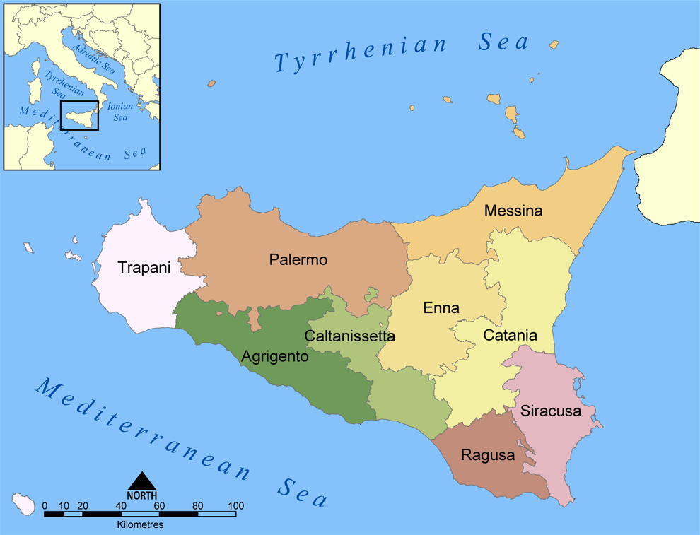
The Province of Ragusa ( it, Provincia di Ragusa; Sicilian: ''Pruvincia 'i Rausa'') was a province in the autonomous region of Sicily in southern Italy, located in the south-east of the island. Following the abolition of the Sicilian provinces, it was replaced in 2015 by the Free municipal consortium of Ragusa. Its capital is the city of Ragusa, which is the most southerly provincial capital in Italy. Geography From Scoglitti to Pozzallo, the Ragusan coastline is approximately long. Along the Ragusan coast are many fishing villages such as Kaukana, Punta Secca, Marina di Ragusa and Marina di Modica. The Hyblaean Mountains are dominating the north of the province and its highest peaks are Monte Lauro, Monte Casale and Monte Arcibessi. The rivers of the province are the Irminio, Dirillo and Ippari and the only lake in the province is the Lago di Santa Rosalia along the course of the Irminio river. The skyline of Ragusa is punctuated by the towers, domes and cupolas of the many ch ... [...More Info...] [...Related Items...] OR: [Wikipedia] [Google] [Baidu] |
Ragusa, Sicily
Ragusa (; scn, Rausa ; la, Ragusia) is a city and ''comune'' in southern Italy. It is the capital of the province of Ragusa, on the island of Sicily, with 73,288 inhabitants in 2016. It is built on a wide limestone hill between two deep valleys, Cava San Leonardo and Cava Santa Domenica. Together with seven other cities in the Val di Noto, it is part of a UNESCO World Heritage Site. History The origins of Ragusa can be traced back to the 2nd millennium BC, when there were several Sicel settlements in the area. The current district of Ragusa Ibla has been identified as Hybla Heraea. The ancient city, located on a hill, came into contact with nearby Greek colonies, and grew thanks to the nearby port of Camerina. After a short period of Carthaginian rule, it fell into the hands of the ancient Romans and the Byzantines, who fortified the city and built a large castle. Ragusa was occupied by the Arabs in 848 AD and remained under their rule until the 11th century, when ... [...More Info...] [...Related Items...] OR: [Wikipedia] [Google] [Baidu] |
Sicilian Baroque
Sicilian Baroque is the distinctive form of Baroque architecture which evolved on the island of Sicily, off the southern coast of Italy, in the , when it was part of the Spanish Empire. The style is recognisable not only by its typical Baroque curves and flourishes, but also by distinctive grinning masks and putti and a particular flamboyance that has given Sicily a unique architectural identity. The Sicilian Baroque style came to fruition during a major surge of rebuilding following the massive earthquake in 1693. Previously, the Baroque style had been used on the island in a naïve and parochial manner, having evolved from hybrid native architecture rather than being derived from the great Baroque architects of Rome. After the earthquake, local architects, many of them trained in Rome, were given plentiful opportunities to recreate the more sophisticated Baroque architecture that had become popular in mainland Italy; the work of these local architects – and the new genre of ... [...More Info...] [...Related Items...] OR: [Wikipedia] [Google] [Baidu] |
1693 Sicily Earthquake
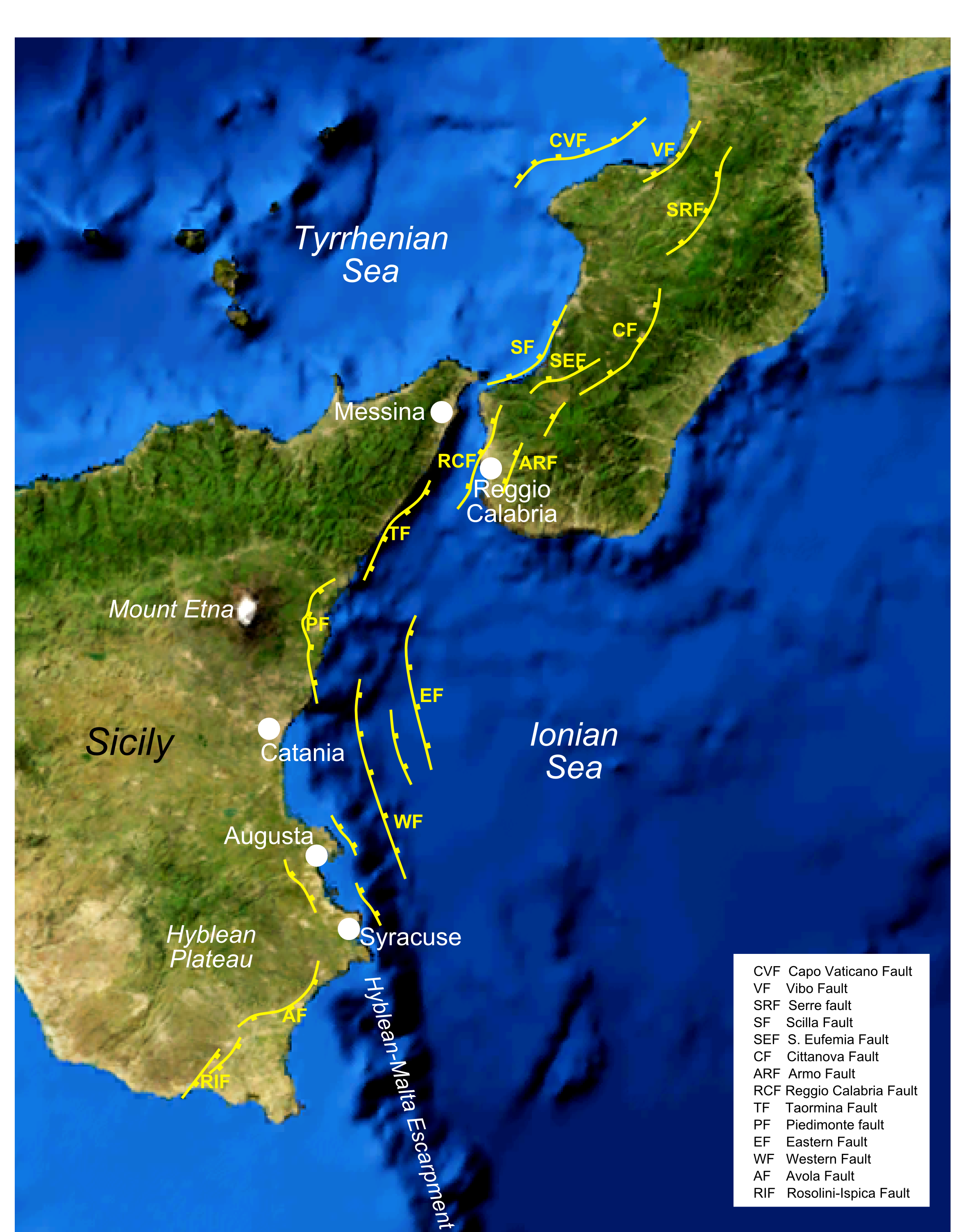
The 1693 Sicily earthquake struck parts of southern Italy near Sicily, Calabria, and Malta on January 11 at around 21:00 local time. This earthquake was preceded by a damaging foreshock on January 9. The main quake had an estimated magnitude of 7.4 on the moment magnitude scale, the most powerful in Italian recorded history, and a maximum intensity of XI (''Extreme'') on the Mercalli intensity scale, destroying at least 70 towns and cities, seriously affecting an area of and causing the death of about 60,000 people. The earthquake was followed by tsunamis that devastated the coastal villages on the Ionian Sea and in the Straits of Messina. Almost two-thirds of the entire population of Catania were killed. The epicentre of the disaster was probably close to the coast, possibly offshore, although the exact position remains unknown. The extent and degree of destruction caused by the earthquake resulted in the extensive rebuilding of the towns and cities of southeastern Sicily, partic ... [...More Info...] [...Related Items...] OR: [Wikipedia] [Google] [Baidu] |
County Of Modica
The County of Modica was a feudal territory within the Kingdom of Sicily from 1296 to 1812. Its capital was Modica, on the southern tip of the island, although the cities of Ragusa and Scicli housed some government offices for a period. Today it perpetuates as a title only held by the head of the House of Alba, Carlos Fitz-James Stuart, 19th Duke of Alba. History The Chiaramontes On 25 March 1296, the Aragonese King Frederick III of Sicily conceded the great County of Modica to Manfredi I Chiaramonte, who fought the Angevin and their king, Charles, and married Isabella Mosca, daughter of the rebel count Federico Mosca. The king gave the first dynasty of counts many fiefdoms in Agrigento, Caccamo, Licata and Palermo, where they built the Palazzo Chiaramonte, also known as Palazzo Steri; once the residence of the Aragonese-Spanish viceroys of Sicily and later the tribunal of the Inquisition, it now belongs to the University of Palermo. On its ceilings is one of the most importan ... [...More Info...] [...Related Items...] OR: [Wikipedia] [Google] [Baidu] |
Sicily
(man) it, Siciliana (woman) , population_note = , population_blank1_title = , population_blank1 = , demographics_type1 = Ethnicity , demographics1_footnotes = , demographics1_title1 = Sicilian , demographics1_info1 = 98% , demographics1_title2 = , demographics1_info2 = , demographics1_title3 = , demographics1_info3 = , timezone1 = CET , utc_offset1 = +1 , timezone1_DST = CEST , utc_offset1_DST = +2 , postal_code_type = , postal_code = , area_code_type = ISO 3166 code , area_code = IT-82 , blank_name_sec1 = GDP (nominal) , blank_info_sec1 = €89.2 billion (2018) , blank1_name_sec1 = GDP per capita , blank1_info_sec1 ... [...More Info...] [...Related Items...] OR: [Wikipedia] [Google] [Baidu] |
Ragusa, Italy
Ragusa (; scn, Rausa ; la, Ragusia) is a city and ''comune'' in southern Italy. It is the capital of the province of Ragusa, on the island of Sicily, with 73,288 inhabitants in 2016. It is built on a wide limestone hill between two deep valleys, Cava San Leonardo and Cava Santa Domenica. Together with seven other cities in the Val di Noto, it is part of a World Heritage Site, UNESCO World Heritage Site. History The origins of Ragusa can be traced back to the 2nd millennium BC, when there were several Sicel settlements in the area. The current district of Ragusa Ibla has been identified as Hybla Heraea. The ancient city, located on a hill, came into contact with nearby Greek colonies, and grew thanks to the nearby port of Camerina. After a short period of Carthago, Carthaginian rule, it fell into the hands of the ancient Romans and the Byzantine Empire, Byzantines, who fortified the city and built a large castle. Ragusa was occupied by the Arabs in 848 Common Era, AD an ... [...More Info...] [...Related Items...] OR: [Wikipedia] [Google] [Baidu] |


.jpg)


