|
Indian Reserve (1763)
"Indian Reserve" is a historical term for the largely uncolonized land in North America that was claimed by France, ceded to Great Britain through the Treaty of Paris (1763) at the end of the Seven Years' War—also known as the French and Indian War—and set aside for the First Nations in the Royal Proclamation of 1763. The British government had contemplated establishing an Indian barrier state in the portion of the reserve west of the Appalachian Mountains, and bounded by the Ohio and Mississippi rivers and the Great Lakes. British officials aspired to establish such a state even after the region was assigned to the United States in the Treaty of Paris (1783) ending the American Revolutionary War, but abandoned their efforts in 1814 after losing military control of the region during the War of 1812. In the present-day United States, it consisted of all the territory north of Florida and New Orleans that was east of the Mississippi River and west of the Eastern Continental ... [...More Info...] [...Related Items...] OR: [Wikipedia] [Google] [Baidu] |
Henderson Purchase
The Transylvania Colony, also referred to as the Transylvania Purchase, was a short-lived, extra-legal colony founded in early 1775 by North Carolina land speculator Richard Henderson, who formed and controlled the Transylvania Company. Henderson and his investors had reached an agreement to purchase a vast tract of Cherokee lands west of the southern and central Appalachian Mountains through the acceptance of the Treaty of Sycamore Shoals with most leading Cherokee chieftains then controlling these lands. In exchange for the land the tribes received goods worth, according to the estimates of some scholars, about 10,000 British pounds ($1.5 million U.S. in 2016). To further complicate matters, this early American frontier land was also claimed by both the Virginia Colony (particularly following Lord Dunmore's War) and Province of North Carolina. The Transylvania Colony was located in what is now the central and western parts of Kentucky, and a chunk of north central Tennessee. T ... [...More Info...] [...Related Items...] OR: [Wikipedia] [Google] [Baidu] |
State (polity)
A state is a centralized political organization that imposes and enforces rules over a population within a territory. There is no undisputed definition of a state. One widely used definition comes from the German sociologist Max Weber: a "state" is a polity that maintains a monopoly on the legitimate use of violence, although other definitions are not uncommon.Cudworth et al., 2007: p. 95Salmon, 2008p. 54 Absence of a state does not preclude the existence of a society, such as stateless societies like the Haudenosaunee Confederacy that "do not have either purely or even primarily political institutions or roles". The level of governance of a state, government being considered to form the fundamental apparatus of contemporary states, is used to determine whether it has failed. In a federal union, the term "state" is sometimes used to refer to the federated polities that make up the federation. (Other terms that are used in such federal systems may include “ province� ... [...More Info...] [...Related Items...] OR: [Wikipedia] [Google] [Baidu] |
Treaty Of Easton
The Treaty of Easton was a colonial agreement in North America signed in October 1758 during the French and Indian War (Seven Years' War) between British colonials and the chiefs of 13 Native American nations, representing tribes of the Iroquois, Lenape (Delaware), and Shawnee. Negotiations over more than a week were concluded on October 26, 1758, at a ceremony held in Easton, Pennsylvania between the British colonial governors of the provinces of Pennsylvania and New Jersey, and representatives of 13 Indian nations, including the Iroquois, who sent chiefs of three of their nations to ensure their continued domination of their Ohio Country region; the eastern and western Lenape (Delaware), represented by two chiefs and headmen; Shawnee and others. More than 500 Native Americans attended the outdoor ceremony, after lengthy negotiations to bring peace to the regions of Pennsylvania, New Jersey and the Ohio Country. Conrad Weiser served as an interpreter and arbitrator for the B ... [...More Info...] [...Related Items...] OR: [Wikipedia] [Google] [Baidu] |
West Florida
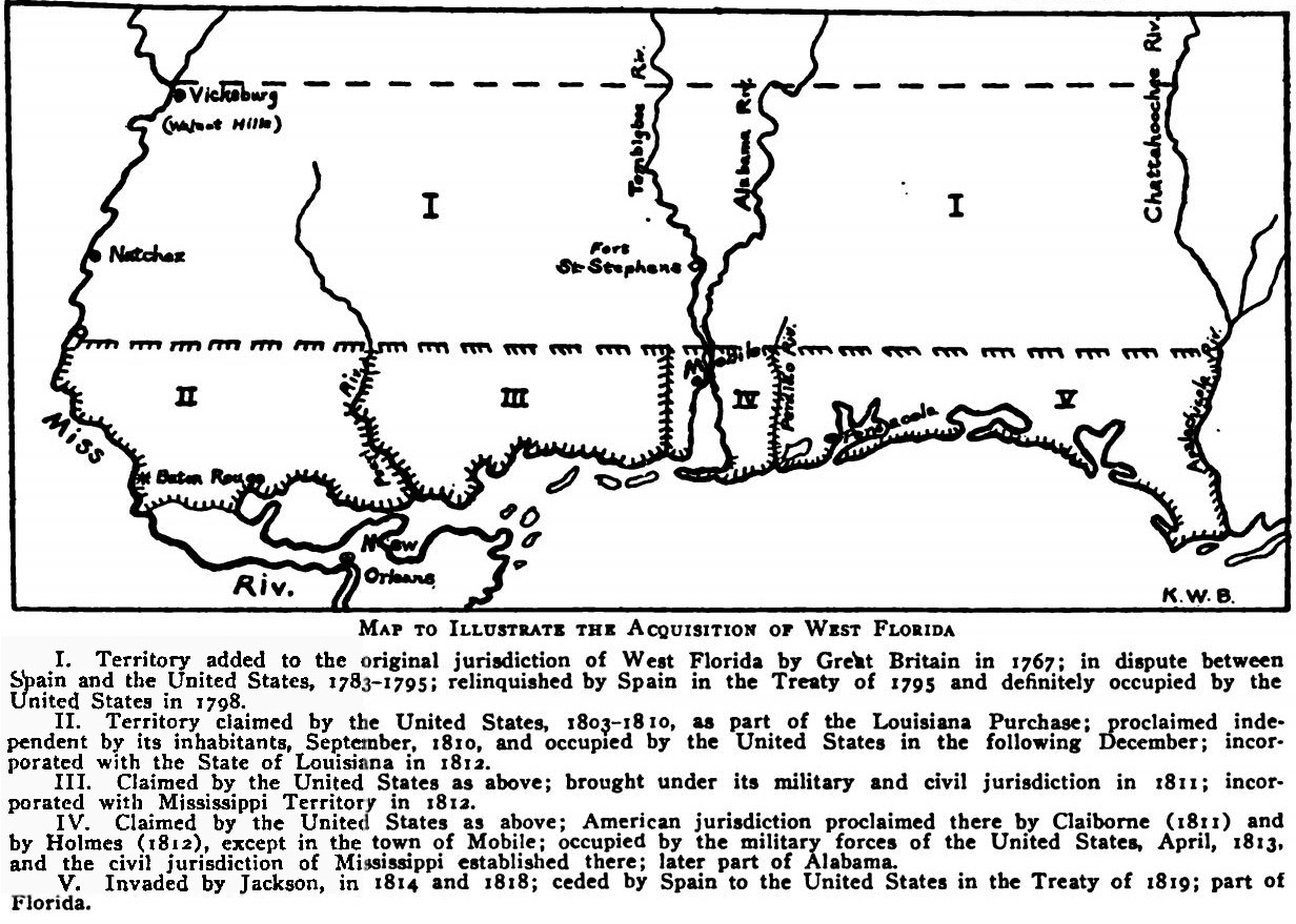
West Florida ( es, Florida Occidental) was a region on the northern coast of the Gulf of Mexico that underwent several boundary and sovereignty changes during its history. As its name suggests, it was formed out of the western part of former Spanish Florida (East Florida formed the eastern part, with the Apalachicola River as the border), along with lands taken from French Louisiana; Pensacola became West Florida's capital. The colony included about two thirds of what is now the Florida Panhandle, as well as parts of the modern U.S. states of Louisiana, Mississippi, and Alabama. Great Britain established West and East Florida in 1763 out of land acquired from France and Spain after the Seven Years' War. As the newly acquired territory was too large to govern from one administrative center, the British divided it into two new colonies separated by the Apalachicola River. British West Florida included the part of formerly Spanish Florida which lay west of the Apalachicola, as w ... [...More Info...] [...Related Items...] OR: [Wikipedia] [Google] [Baidu] |
East Florida
East Florida ( es, Florida Oriental) was a colony of Great Britain from 1763 to 1783 and a province of Spanish Florida from 1783 to 1821. Great Britain gained control of the long-established Spanish colony of ''La Florida'' in 1763 as part of the treaty ending the French and Indian War (as the Seven Years' War was called in North America). Deciding that the territory was too large to administer as a single unit, Britain divided Florida into two colonies separated by the Apalachicola River: East Florida with its capital in St. Augustine and West Florida with its capital in Pensacola. East Florida was much larger and comprised the bulk of the former Spanish territory of Florida and most of the current state of Florida. It had also been the most populated region of Spanish Florida, but before control was transferred to Britain, most residents – including virtually everyone in St. Augustine – left the territory, with most migrating to Cuba. Britain tried to attract settlers ... [...More Info...] [...Related Items...] OR: [Wikipedia] [Google] [Baidu] |
Newfoundland (island)
Newfoundland (, ; french: link=no, Terre-Neuve, ; ) is a large island off the east coast of the North American mainland and the most populous part of the Canadian province of Newfoundland and Labrador. It has 29 percent of the province's land area. The island is separated from the Labrador Peninsula by the Strait of Belle Isle and from Cape Breton Island by the Cabot Strait. It blocks the mouth of the Saint Lawrence River, creating the Gulf of Saint Lawrence, the world's largest estuary. Newfoundland's nearest neighbour is the French overseas collectivity of Saint Pierre and Miquelon. With an area of , Newfoundland is the world's 16th-largest island, Canada's fourth-largest island, and the largest Canadian island outside the North. The provincial capital, St. John's, is located on the southeastern coast of the island; Cape Spear, just south of the capital, is the easternmost point of North America, excluding Greenland. It is common to consider all directly neighb ... [...More Info...] [...Related Items...] OR: [Wikipedia] [Google] [Baidu] |
Lake Nipissing
Lake Nipissing (; french: lac Nipissing, oj, Gichi-nibiinsing-zaaga’igan) is a lake in the Canadian province of Ontario. It has a surface area of , a mean elevation of above sea level, and is located between the Ottawa River and Georgian Bay. Lake Nipissing is the third-largest lake entirely in Ontario. It is relatively shallow for a large lake, with an average depth of only . The shallowness of the lake makes for many sandbars along the lake's irregular shoreline. The lake reaches a maximum depth of 64 m (210 ft) near the mouth of the French River, off the shore of Blueberry Island. The lake has many islands most of which are protected under the Protection of Significant Wetlands scheme, controlled by the Ministry of Natural Resources and Forestry. The largest population centre on the lake's shoreline is the city of North Bay. North Bay sits along the lake's northeastern shoreline. Other notable towns include Callander (south of North Bay along Highway 11). The ... [...More Info...] [...Related Items...] OR: [Wikipedia] [Google] [Baidu] |
Province Of Quebec (1763–1791)
The Province of Quebec (french: Province de Québec) was a colony in British North America which comprised the former French colony of Canada. It was established by the Kingdom of Great Britain in 1763, following the conquest of New France by British forces during the Seven Years' War. As part of the Treaty of Paris, France gave up its claim to the colony; it instead negotiated to keep the small profitable island of Guadeloupe. Following the Royal Proclamation of 1763, Canada was renamed the Province of Quebec, and extended from the coast of Labrador on the Atlantic Ocean, southwest through the Saint Lawrence River Valley to the Great Lakes and beyond to the confluence of the Ohio and Mississippi Rivers. Portions of its southwest, those areas south of the Great Lakes, were later ceded to the newly established United States in the Treaty of Paris (1783) at the conclusion of the American Revolution; although the British maintained a military presence there until 1796. In 1791, ... [...More Info...] [...Related Items...] OR: [Wikipedia] [Google] [Baidu] |
Hudson's Bay Company
The Hudson's Bay Company (HBC; french: Compagnie de la Baie d'Hudson) is a Canadian retail business group. A fur trading business for much of its existence, HBC now owns and operates retail stores in Canada. The company's namesake business division is Hudson's Bay, commonly referred to as The Bay ( in French). After incorporation by English royal charter in 1670, the company functioned as the ''de facto'' government in parts of North America for nearly 200 years until the HBC sold the land it owned (the entire Hudson Bay drainage basin, known as Rupert's Land) to Canada in 1869 as part of the Deed of Surrender, authorized by the Rupert's Land Act 1868. At its peak, the company controlled the fur trade throughout much of the English- and later British-controlled North America. By the mid-19th century, the company evolved into a mercantile business selling a wide variety of products from furs to fine homeware in a small number of sales shops (as opposed to trading posts) ... [...More Info...] [...Related Items...] OR: [Wikipedia] [Google] [Baidu] |
Rupert's Land
Rupert's Land (french: Terre de Rupert), or Prince Rupert's Land (french: Terre du Prince Rupert, link=no), was a territory in British North America which comprised the Hudson Bay drainage basin; this was further extended from Rupert's Land to the Pacific coast in December 1821. It was established to be a commercial monopoly by the Hudson's Bay Company (HBC), based at York Factory. The territory operated for 200 years from 1670 to 1870. Its namesake was Prince Rupert of the Rhine, who was a nephew of Charles I and the first governor of HBC. The areas formerly belonging to Rupert's Land lie mostly within what is today Canada, and included the whole of Manitoba, most of Saskatchewan, southern Alberta, southern Nunavut, and northern parts of Ontario and Quebec. Additionally, it also extended into areas that would eventually become part of Minnesota, North Dakota, and Montana. The southern border west of Lake of the Woods to the Rocky Mountains was the drainage divide between th ... [...More Info...] [...Related Items...] OR: [Wikipedia] [Google] [Baidu] |
Louisiana (New France)
Louisiana (french: La Louisiane; ''La Louisiane Française'') or French Louisiana was an administrative district of New France. Under French control from 1682 to 1769 and 1801 (nominally) to 1803, the area was named in honor of King Louis XIV, by French explorer René-Robert Cavelier, Sieur de la Salle. It originally covered an expansive territory that included most of the drainage basin of the Mississippi River and stretched from the Great Lakes to the Gulf of Mexico and from the Appalachian Mountains to the Rocky Mountains. Louisiana included two regions, now known as Upper Louisiana (), which began north of the Arkansas River, and ''Lower Louisiana'' (). The U.S. state of Louisiana is named for the historical region, although it is only a small part of the vast lands claimed by France.La Louisiane française 1682-1803 ... [...More Info...] [...Related Items...] OR: [Wikipedia] [Google] [Baidu] |
Eastern Continental Divide
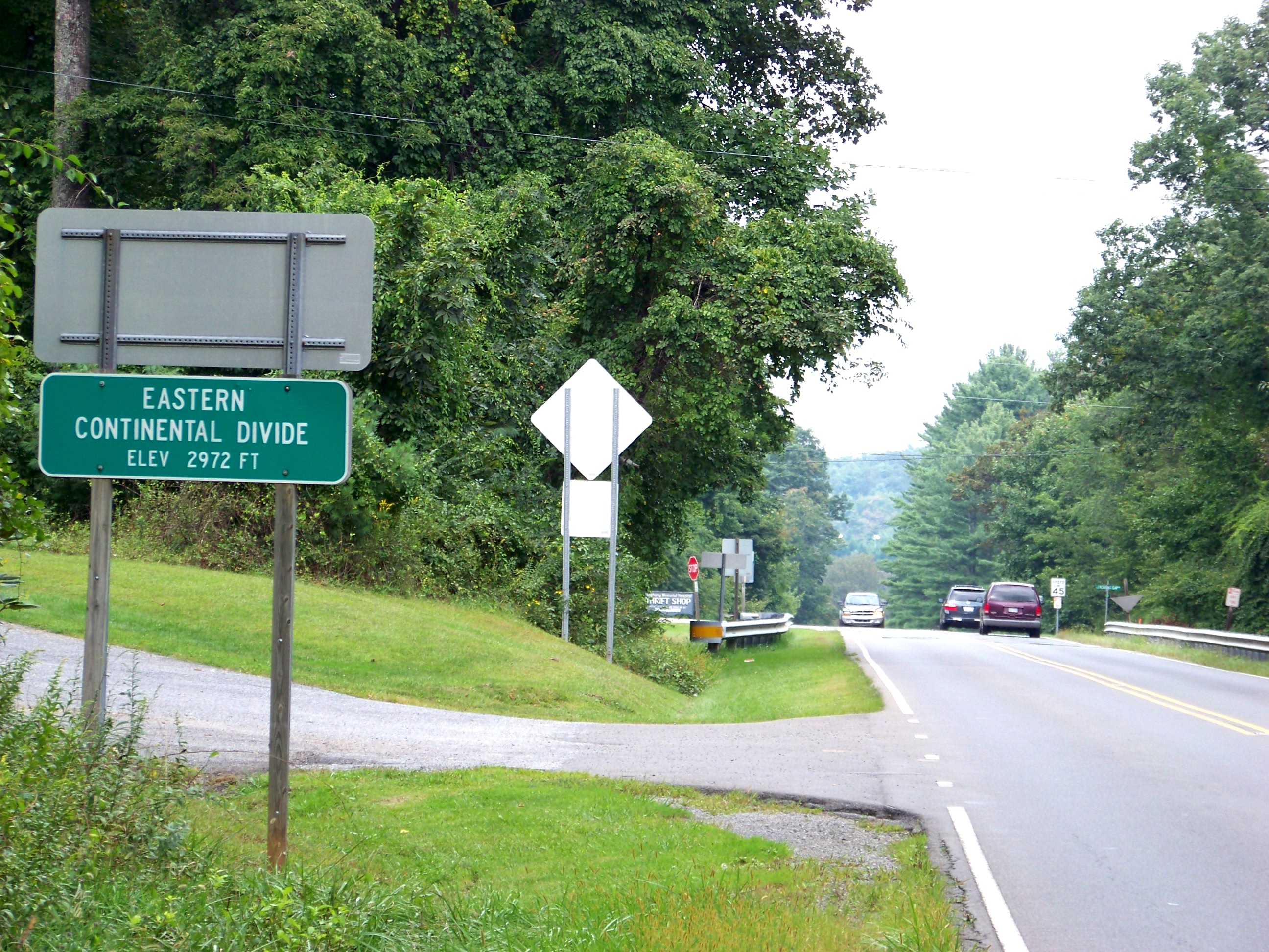
The Eastern Continental Divide, Eastern Divide or Appalachian Divide is a hydrographic divide in eastern North America that separates the easterly Atlantic Seaboard watershed from the westerly Gulf of Mexico watershed. The divide nearly spans the United States from south of Lake Ontario through the Florida peninsula, and consists of raised terrain including the Appalachian Mountains to the north, the southern Piedmont Plateau and lowland ridges in the Atlantic Coastal Plain to the south. Water including rainfall and snowfall, lakes, streams and rivers on the eastern/southern side of the divide drains to the Atlantic Ocean; water on the western/northern side of the divide drains to the Gulf of Mexico. The ECD is one of six continental hydrographic divides of North America which define several drainage basins, each of which drains to a particular body of water. __TOC__ Course The Eastern Triple Divide is the northern terminus of the Eastern Continental Divide where it int ... [...More Info...] [...Related Items...] OR: [Wikipedia] [Google] [Baidu] |


