|
Ellora Caves
Ellora is a UNESCO World Heritage Site located in the Aurangabad district of Maharashtra, India. It is one of the largest rock-cut Hindu temple cave complexes in the world, with artwork dating from the period 600–1000 CE., Quote: "These 34 monasteries and temples, extending over more than 2 km, were dug side by side in the wall of a high basalt cliff, not far from Aurangabad, in Maharashtra. Ellora, with its uninterrupted sequence of monuments dating from A.D. 600 to 1000, brings the civilization of ancient India to life. Not only is the Ellora complex a unique artistic creation and a technological exploit but, with its sanctuaries devoted to Hinduism, it illustrates the spirit of tolerance that was characteristic of ancient India." Cave 16 features the largest single monolithic rock excavation in the world, the Kailash temple, a chariot-shaped monument dedicated to the god Shiva. The Kailash temple excavation also features sculptures depicting various Hindu deities as well as ... [...More Info...] [...Related Items...] OR: [Wikipedia] [Google] [Baidu] |
Aurangabad District, Maharashtra
Aurangabad district (Marathi pronunciation: �u̯ɾəŋɡaːbaːd̪ Urdu pronunciation: �ːɾəŋɡaːbaːd̪ is one of the 36 districts of the state of Maharashtra in western India. It borders the districts of Nashik to the west, Jalgaon to the north, Jalna to the east, and Ahmednagar to the south. The city of Aurangabad houses the district's administrative headquarters. The district has an area of 10,100 km, of which 37.55% is urban and the rest is rural. Aurangabad District is a major tourism region in Marathwada. Officer Members of Parliament *Imtiyaz Jaleel (MIM) *Raosaheb Danve (BJP) Guardian Minister list of Guardian Minister District Magistrate/Collector list of District Magistrate / Collector Geography Aurangabad District is located mainly in the Godavari River Basin and partly in the Tapti River Basin. The district is located between 19 and 20 degrees north longitude and between 74 and 76 degrees east latitude, covering an area of 1 ... [...More Info...] [...Related Items...] OR: [Wikipedia] [Google] [Baidu] |
Marathwada
Marathwada () is a proposed state and geographical region of the Indian state of Maharashtra. It was formed during the Nizam's rule and was part of the then Hyderabad State. The region coincides with the Aurangabad division of Maharashtra. It borders the states of Karnataka and Telangana, and it lies to the west of the Vidarbha and east of North Maharashtra regions of Maharashtra. The largest city of Marathwada is Aurangabad. Its people speak Marathi and Urdu. Etymology The term ''Marathwada'' means ''the house of Marathi speaking people'', that is land occupied by the Marathi-speaking population of the former Hyderabad state during the period of Nizam's rule. The term can be traced to 18th century state records of the Nizam of Hyderabad. Demography Marathwada has total area of 64590 km2 and had a population of 18,731,872 at the 2011 census of India. At the time of the 2011 census, the territory making up Marathwada had a variety of languages. 77.98% of the populati ... [...More Info...] [...Related Items...] OR: [Wikipedia] [Google] [Baidu] |
Kalachuri
The Kalachuris (IAST: Kalacuri), also known as Kalachuris of Mahishmati, were an Indian dynasty that ruled in west-central India between 6th and 7th centuries. They are also known as the Haihayas or as the Early Kalachuris to distinguish them from their later namesakes, especially the Kalachuris of Tripuri. The Kalachuri territory included parts of present-day Gujarat, Madhya Pradesh, and Maharashtra. Their capital was probably located at Mahishmati. Epigraphic and numismatic evidence suggests that the earliest of the Ellora and Elephanta cave monuments were built during the Kalachuri rule. The origin of the dynasty is uncertain. In the 6th century, the Kalachuris gained control of the territories formerly ruled by the Guptas, the Vakatakas and the Vishnukundinas. Only three Kalachuri kings are known from inscriptional evidence: Shankaragana, Krishnaraja, and Buddharaja. The Kalachuris lost their power to the Chalukyas of Vatapi in the 7th century. One theory connects ... [...More Info...] [...Related Items...] OR: [Wikipedia] [Google] [Baidu] |
Vakataka
The Vakataka dynasty () was an ancient Indian dynasty that originated from the Deccan in the mid-3rd century CE. Their state is believed to have extended from the southern edges of Malwa and Gujarat in the north to the Tungabhadra River in the south as well as from the Arabian Sea in the west to the edges of Chhattisgarh in the east. They were the most important successors of the Satavahanas in the Deccan and contemporaneous with the Guptas in northern India. Little is known about Vindhyashakti (), the founder of the family. Territorial expansion began in the reign of his son Pravarasena I. It is generally believed that the Vakataka dynasty was divided into four branches after Pravarasena I. Two branches are known, and two are unknown. The known branches are the Pravarapura-Nandivardhana branch and the Vatsagulma branch. Gupta Emperor Chandragupta II married his daughter into Vakataka royal family and, with their support, annexed Gujarat from the Saka Satraps in 4th centu ... [...More Info...] [...Related Items...] OR: [Wikipedia] [Google] [Baidu] |
Traikutakas
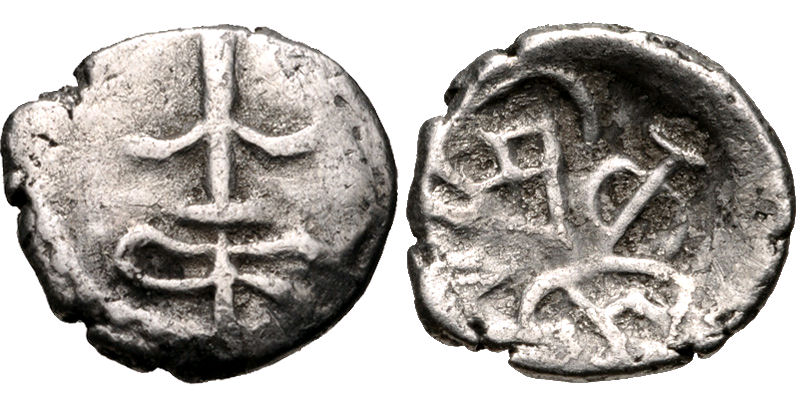
The Traikutakas were a dynasty of Indian kings who ruled between 388 and 456. The name "Traikutakas" seems to be derived from the words for a three-peaked mountain ("Tri-kuta"). The Traikutakas are mentioned in Kalidasa's Raghuvamsa, in which they are located in the area of northern Konkan. The dominions of the Traikutakas further included Aparanta and northern Maharashtra. The coins of the Traikutaras are found extensively in southern Gujarat, and southern Maharashtra beyond the Ghats. Their design is very close to that of the Western Satraps, from which they probably inherited some territories, and traces of the obverse legend with Greek letters can still be seen. Traikuta rule of Aparanta or Konkan begins in A.D. 248 (Traikuta era) exactly the time of Abhira Ishwarsena rule, hence Traikutas are identified with the dynasty of Abhiras. The Traikutakas reckoned in a specific era, known as the Traikutaka era, or usually the Kalachuri or Chedi era, starting in 249. History ... [...More Info...] [...Related Items...] OR: [Wikipedia] [Google] [Baidu] |
Cretaceous
The Cretaceous ( ) is a geological period that lasted from about 145 to 66 million years ago (Mya). It is the third and final period of the Mesozoic Era, as well as the longest. At around 79 million years, it is the longest geological period of the entire Phanerozoic. The name is derived from the Latin ''creta'', "chalk", which is abundant in the latter half of the period. It is usually abbreviated K, for its German translation ''Kreide''. The Cretaceous was a period with a relatively warm climate, resulting in high eustatic sea levels that created numerous shallow inland seas. These oceans and seas were populated with now- extinct marine reptiles, ammonites, and rudists, while dinosaurs continued to dominate on land. The world was ice free, and forests extended to the poles. During this time, new groups of mammals and birds appeared. During the Early Cretaceous, flowering plants appeared and began to rapidly diversify, becoming the dominant group of plants across the Ear ... [...More Info...] [...Related Items...] OR: [Wikipedia] [Google] [Baidu] |
Deccan Traps
The Deccan Traps is a large igneous province of west-central India (17–24°N, 73–74°E). It is one of the largest volcanic features on Earth, taking the form of a large shield volcano. It consists of numerous layers of solidified flood basalt that together are more than about thick, cover an area of about , and have a volume of about . Originally, the Deccan Traps may have covered about ,"What really killed the dinosaurs?" Jennifer Chu, MIT News Office, 11 December 2014 with a correspondingly larger original volume. This volume overlies the age |
Grishneshwar Temple
Grishneshwar Jyotirlinga Temple, sometimes referred to as the Ghrneshwar or Ghushmeshwar Temple, is one of the shrines dedicated to Lord Shiva that is referenced in the Shiva Purana. The word ''Ghrneshwara'' means "lord of compassion". The temple is an important pilgrimage site in the Shaiva tradition of Hinduism, which considers it as the twelfth Jyotirlinga (linga of light). This pilgrimage site is located in Ellora (also called Verul), less than a kilometer from Ellora Caves – a UNESCO World Heritage Site. It is about north-west of the city of Aurangabad, and about east-northeast from Mumbai, Maharashtra, India. Maharashtra has three Jyotirlingas, Bhimashankar, Trimbakeshwar and Girishneshwar. History The temple structure was destroyed by the Delhi Sultanate in 13th and 14th-century. The temple went through several rounds of rebuilding followed by re-destruction during the Mughal-Maratha conflict. It was rebuilt in the current form in the 18th century under the spon ... [...More Info...] [...Related Items...] OR: [Wikipedia] [Google] [Baidu] |
Pune
Pune (; ; also known as Poona, ( the official name from 1818 until 1978) is one of the most important industrial and educational hubs of India, with an estimated population of 7.4 million As of 2021, Pune Metropolitan Region is the largest in Maharashtra by area, with a geographical area of 7,256 sq km. It has been ranked "the most liveable city in India" several times. Pune is also considered to be the cultural and educational capital of Maharashtra. Along with the municipal corporation area of PCMC, PMC and the three cantonment towns of Camp, Khadki, and Dehu Road, Pune forms the urban core of the eponymous Pune Metropolitan Region (PMR). Situated {{convert, 560, m, 0, abbr=off above sea level on the Deccan plateau, on the right bank of the Mutha river,{{cite web , last=Nalawade , first=S.B. , url=http://www.ranwa.org/punealive/pageog.htm , title=Geography of Pune Urban Area , publisher=Ranwa , access-date=4 April 2008 , archive-url=https://web.archive.org/web/200712 ... [...More Info...] [...Related Items...] OR: [Wikipedia] [Google] [Baidu] |
Aurangabad, Maharashtra
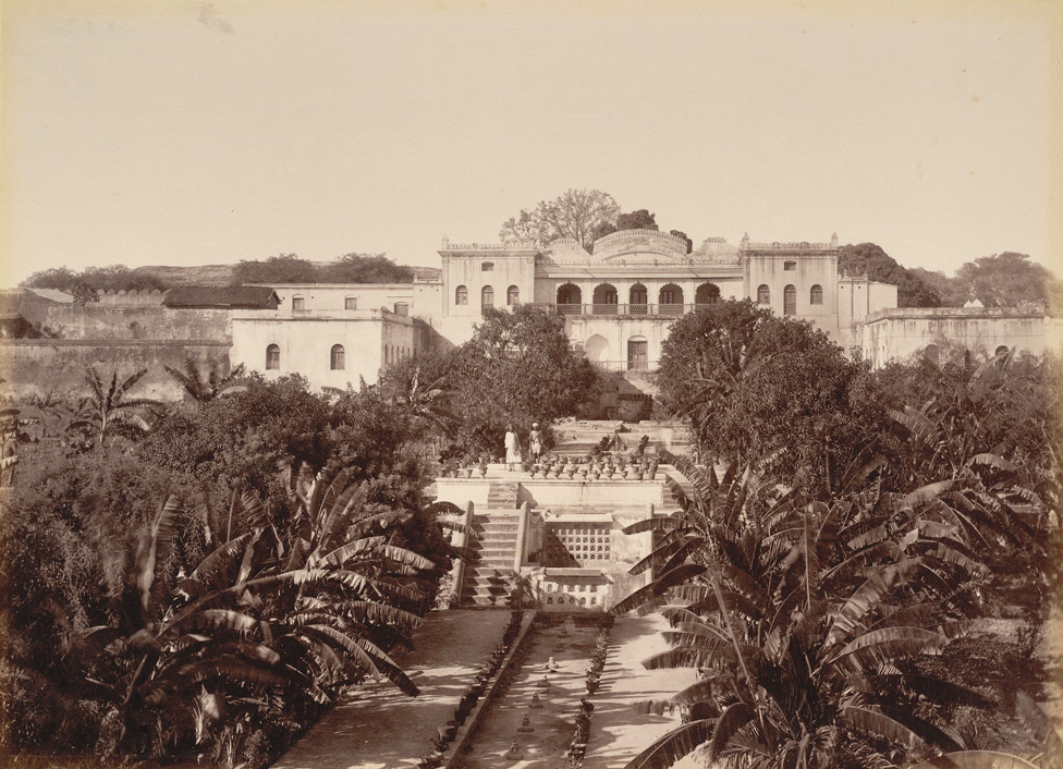
Aurangabad ( is a city in the Indian state of Maharashtra. It is the administrative headquarters of Aurangabad district and is the largest city in the Marathwada region. Located on a hilly upland terrain in the Deccan Traps, Aurangabad is the fifth-most populous urban area in Maharashtra with a population of 1,175,116. The city is known as a major production center of cotton textile and artistic silk fabrics. Several prominent educational institutions, including Dr. Babasaheb Ambedkar Marathwada University, are located in the city. The city is also a popular tourism hub, with tourist destinations like the Ajanta and Ellora caves lying on its outskirts, both of which have been designated as UNESCO World Heritage Sites since 1983. Other tourist attractions include the Aurangabad Caves, Devagiri Fort, Grishneshwar Temple, Jama Mosque, Bibi Ka Maqbara, Himayat Bagh, Panchakki and Salim Ali Lake. Historically, there were 52 Gates in Aurangabad, some of them extant, because of w ... [...More Info...] [...Related Items...] OR: [Wikipedia] [Google] [Baidu] |


