|
Avallon
Avallon () is a commune in the Yonne department in Bourgogne-Franche-Comté in central-eastern France. Name Avallon, Latin ''Aballō'', ablative ''Aballone'', is ultimately derived from Gaulish ''*Aballū'', oblique ''*Aballon-'' meaning "Apple-tree (place)" or "(place of the) "Apple Tree Goddess" (from Proto-Celtic ''*abalnā'', cf. Old Irish ''aball'', Welsh ''afall'', Old Breton ''aball(en)'', "apple tree"). Geography Avallon is located 50 km south-southeast of Auxerre, served by a branch of the Paris–Lyon railway and by exit 22 of the A6 motorway. The old town, with many winding cobblestone streets flanked by traditional stone and woodwork buildings, is situated on a flat promontory, the base of which is washed on the south by the river Cousin, on the east and west by small streams. History Chance finds of coins and pottery fragments and a fine head of Minerva are reminders of the Roman settlement carrying the Celtic name Aballo, a ''mutatio'' or post where f ... [...More Info...] [...Related Items...] OR: [Wikipedia] [Google] [Baidu] |
Isle Of Avalon
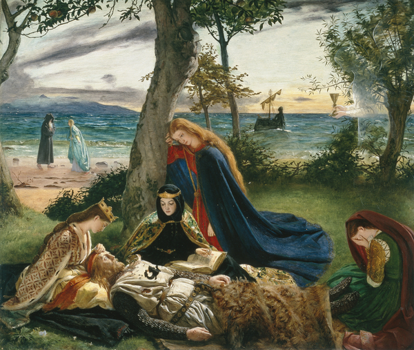
Avalon (; la, Insula Avallonis; cy, Ynys Afallon, Ynys Afallach; kw, Enys Avalow; literally meaning "the isle of fruit r appletrees"; also written ''Avallon'' or ''Avilion'' among various other spellings) is a mythical island featured in the Arthurian legend that first appeared in Geoffrey of Monmouth's influential 1136 ''Historia Regum Britanniae'' as a place of magic where King Arthur's sword Excalibur was made and later where Arthur was taken to recover from being gravely wounded at the Battle of Camlann. Since then, the island has become a symbol of Arthurian mythology, similar to Arthur's castle of Camelot. Avalon was associated from an early date with mystical practices and magical figures such as King Arthur's half-sister Morgan, cast as the island's ruler by Geoffrey and some of the later authors inspired by him. Certain Briton traditions maintain that Arthur is an eternal king who had never truly died but would return, and the particular motif of his rest in Mo ... [...More Info...] [...Related Items...] OR: [Wikipedia] [Google] [Baidu] |
Yonne
Yonne () is a department in the Bourgogne-Franche-Comté region in France. It is named after the river Yonne, which flows through it, in the country's north-central part. One of Bourgogne-Franche-Comté's eight constituent departments, it is located in its northwestern part, bordering Île-de-France. It was created in 1790 during the French Revolution. Its prefecture is Auxerre, with subprefectures in Avallon and Sens. Its INSEE and postcode number is 89. Yonne is Bourgogne-Franche-Comté's fourth-most populous department, with a population of 335,707 (2019).Populations légales 2019: 89 Yonne INSEE Its largest city is its prefecture Auxerre, with a population of about 35,000 within city limits and 68,000 in the urban area. History The first evidence of occupation in thi ...[...More Info...] [...Related Items...] OR: [Wikipedia] [Google] [Baidu] |
Riothamus
Riothamus (also spelled Riutimus or Riotimus) was a Romano-British military leader, who was active circa AD 470. He fought against the Goths in alliance with the declining Western Roman Empire. He is called " King of the Britons" by the 6th-century historian Jordanes, but the extent of his realm is unclear. Some Arthurian scholars identify Riothamus as one of the possible sources of the legendary King Arthur. Name Riothamus is a Latinization of the Brythonic ''*Rigotamos'', meaning 'Great King', 'Kingliest'. Alternatively, it may come from Brittonic ''*Riotamos'', meaning 'Freest" The Brittonic form survived into Old Welsh as ''Riatav'' (Modern Welsh ''Rhiadaf'') and Old Breton ''Riat(h)am''. Realm It is not clear whether Jordanes' "Britons" refers to the Britons of Great Britain itself, or of Armorica, which was undergoing significant British settlement and later came to be known as Brittany. The Old Breton name ''Riatam'', which (like Riothamus) is derived from Brittonic ... [...More Info...] [...Related Items...] OR: [Wikipedia] [Google] [Baidu] |
Auxerre
Auxerre ( , ) is the capital of the Yonne department and the fourth-largest city in Burgundy. Auxerre's population today is about 35,000; the urban area (''aire d'attraction'') comprises roughly 113,000 inhabitants. Residents of Auxerre are referred to as ''Auxerrois''. Auxerre is a commercial and industrial centre, with industries including food production, woodworking and batteries. It is also noted for its production of Burgundy wine, including Chablis. In 1995 Auxerre was named "Town of Art and History". Geography Auxerre lies on the river Yonne and the Canal du Nivernais, about 150 km southeast of Paris and 120 km northwest of Dijon. The A6 autoroute (Paris–Lyon) passes northeast of the city. Auxerre-Saint-Gervais station has rail connections to Dijon, Paris, Corbigny and Avallon. History Auxerre was a flourishing Gallo-Roman centre, then called Autissiodorum, through which passed one of the main roads of the area, the Via Agrippa (1st century AD) ... [...More Info...] [...Related Items...] OR: [Wikipedia] [Google] [Baidu] |
A6 Autoroute (France)
The A6, also known as the Autoroute du Soleil, ''Motorway of the Sun'', (along with the A7), is an Autoroute in France, linking Paris to Lyon. The motorway starts at Paris's Porte d'Orléans and Porte d'Italie with two branches, numbered A6a and A6b respectively, that join south of Paris. The motorway is favoured by holidaymakers as it is the main link to the South of France and the French Riviera. At 455 km long it is France's third longest autoroute after the A10 autoroute and the A4 autoroute. The A6 motorway used to be prone to severe traffic jams around Fourvière Tunnel near Lyon prior to the opening in 1992 of and in 2011 of the [...More Info...] [...Related Items...] OR: [Wikipedia] [Google] [Baidu] |
Subprefectures In France
In France, a subprefecture (french: sous-préfecture) is the commune which is the administrative centre of a departmental arrondissement that does not contain the prefecture for its department. The term also applies to the building that houses the administrative headquarters for an arrondissement. Senate (in French). The civil servant in charge of a subprefecture is the , assisted by a [...More Info...] [...Related Items...] OR: [Wikipedia] [Google] [Baidu] |
Minerva
Minerva (; ett, Menrva) is the Roman goddess of wisdom, justice, law, victory, and the sponsor of arts, trade, and strategy. Minerva is not a patron of violence such as Mars, but of strategic war. From the second century BC onward, the Romans equated her with the Greek goddess Athena.''Larousse Desk Reference Encyclopedia'', Book People, Haydock, 1995, p. 215. Minerva is one of the three Roman deities in the Capitoline Triad, along with Jupiter and Juno. She was the virgin goddess of music, poetry, medicine, wisdom, commerce, weaving, and the crafts. She is often depicted with her sacred creature, an owl usually named as the "owl of Minerva", which symbolised her association with wisdom and knowledge as well as, less frequently, the snake and the olive tree. Minerva is commonly depicted as tall with an athletic and muscular build, as well as wearing armour and carrying a spear. As the most important Roman goddess, she is highly revered, honored, and respected. Marcus Ter ... [...More Info...] [...Related Items...] OR: [Wikipedia] [Google] [Baidu] |
Antonine Itinerary
The Antonine Itinerary ( la, Itinerarium Antonini Augusti, "The Itinerary of the Emperor Antoninus") is a famous ''itinerarium'', a register of the stations and distances along various roads. Seemingly based on official documents, possibly from a survey carried out under Augustus, it describes the roads of the Roman Empire. Owing to the scarcity of other extant records of this type, it is a valuable historical record. Almost nothing is known of its date or author. Scholars consider it likely that the original edition was prepared at the beginning of the 3rd century. Although it is traditionally ascribed to the patronage of the 2nd-century Antoninus Pius, the oldest extant copy has been assigned to the time of Diocletian and the most likely imperial patron—if the work had one—would have been Caracalla. ''Iter Britanniarum'' The British section is known as the ''Iter Britanniarum'', and can be described as the ' road map' of Roman Britain. There are 15 such itiner ... [...More Info...] [...Related Items...] OR: [Wikipedia] [Google] [Baidu] |
Tabula Peutingeriana
' (Latin for "The Peutinger Map"), also referred to as Peutinger's Tabula or Peutinger Table, is an illustrated ' (ancient Roman road map) showing the layout of the '' cursus publicus'', the road network of the Roman Empire. The map is a 13th-century parchment copy of a possible Roman original. It covers Europe (without the Iberian Peninsula and the British Isles), North Africa, and parts of Asia, including the Middle East, Persia, and India. According to one hypothesis, the existing map is based on a document of the 4th or 5th century that contained a copy of the world map originally prepared by Agrippa during the reign of the emperor Augustus (27 BC – AD 14). However, Emily Albu has suggested that the existing map could instead be based on an original from the Carolingian period. The map was likely stolen by the renowned humanist Conrad Celtes, who bequeathed it to his friend, the economist and archaeologist Konrad Peutinger, who gave it to Emperor Maximilian I, as part o ... [...More Info...] [...Related Items...] OR: [Wikipedia] [Google] [Baidu] |
Charles The Bold
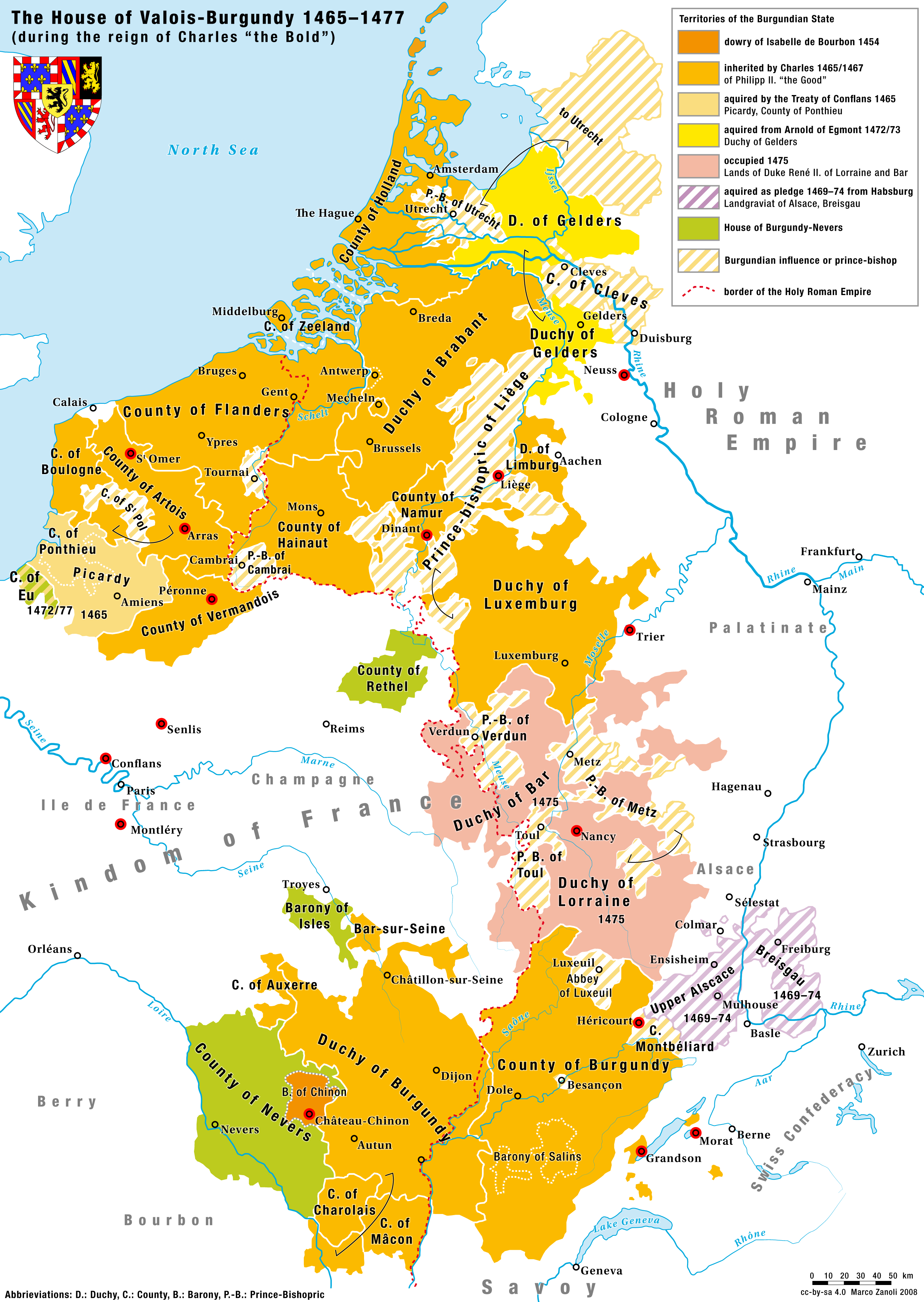
Charles I (Charles Martin; german: Karl Martin; nl, Karel Maarten; 10 November 1433 – 5 January 1477), nicknamed the Bold (German: ''der Kühne''; Dutch: ''de Stoute''; french: le Téméraire), was Duke of Burgundy from 1467 to 1477. Charles's main objective was to be crowned king by turning the growing Burgundian State into a territorially continuous kingdom. He declared himself and his lands independent, bought Upper Alsace and conquered Zutphen, Guelders and Lorraine, uniting at last Burgundian northern and southern possessions. This caused the enmity of several European powers and triggered the Burgundian Wars. Charles's early death at the Battle of Nancy at the hands of Swiss mercenaries fighting for René II, Duke of Lorraine, was of great consequence in European history. The Burgundian domains, long wedged between the Kingdom of France and the Habsburg Empire, were divided, but the precise disposition of the vast and disparate territorial possessions ... [...More Info...] [...Related Items...] OR: [Wikipedia] [Google] [Baidu] |
Christianization
Christianization ( or Christianisation) is to make Christian; to imbue with Christian principles; to become Christian. It can apply to the conversion of an individual, a practice, a place or a whole society. It began in the Roman Empire, continued through the Middle Ages in Europe, and in the twenty-first century has spread around the globe. Historically, there are four stages of Christianization beginning with individual conversion, followed by the translation of Christian texts into local vernacular language, establishing education and building schools, and finally, social reform that sometimes emerged naturally and sometimes included politics, government, coercion and even force through colonialism. The first countries to make Christianity their state religion were Armenia, Georgia, Ethiopia and Eritrea. In the fourth to fifth centuries, multiple tribes of Germanic barbarians converted to either Arian or orthodox Christianity. The Frankish empire begins during this same pe ... [...More Info...] [...Related Items...] OR: [Wikipedia] [Google] [Baidu] |


