|
Arradoul
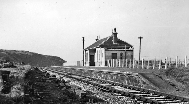
Arradoul is a small village in Scotland, in the traditional county of Banffshire, and in the Moray council area. It is a ribbon settlement on the south side of main A98 road between Cullen and Fochabers, near to the Buckpool turn off to the town of Buckie. To the south of the village are the farms of Arradoul Mains, Walkerdales and Cairnfield. Arradoul Mains is owned by Christies of Fochabers Fochabers (; gd, Fachabair or Fothabair) is a village in the Parish of Bellie, in Moray, Scotland, east of the cathedral city of Elgin and located on the east bank of the River Spey. 1,728 people live in the village, which enjoys a rich musi ... and grows sapling trees for the forestry industry across the UK. The Cairnfield Estate is an arable farm growing oats and barley. References Villages in Moray {{Moray-geo-stub ... [...More Info...] [...Related Items...] OR: [Wikipedia] [Google] [Baidu] |
Buckie
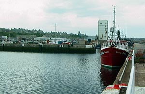
Buckie ( gd, Bucaidh) is a burgh town (defined as such in 1888) on the Moray Firth coast of Scotland. Historically in Banffshire, Buckie was the largest town in the county until the administrative area was abolished in 1975. The town is the third largest in the Moray council area after Elgin and Forres and within the definitions of statistics published by the General Register Office for Scotland was ranked at number 75 in the list of population estimates for settlements in Scotland mid-year 2006. Buckie is virtually equidistant to Banff to the east and Elgin to the west, with both approximately distant whilst Keith lies to the south by road. Etymology The origin of the name of the town is not entirely clear. Although the folk etymology is that Buckie is named after a seashell (genus ''buccinum'') the reality is that the shared marine background is a coincidence. The name Buckie would not have originally identified a place immediately adjacent to the sea, so alternative et ... [...More Info...] [...Related Items...] OR: [Wikipedia] [Google] [Baidu] |
Moray
Moray () gd, Moireibh or ') is one of the 32 local government council areas of Scotland. It lies in the north-east of the country, with a coastline on the Moray Firth, and borders the council areas of Aberdeenshire and Highland (council area), Highland. Between 1975 and 1996 Moray, with similar boundaries, was a districts of Scotland, district of the then Grampian Region. History The name, first attested around 970 as ', and in Latinised form by 1124 as ', derives from the earlier Celtic forms *''mori'' 'sea' and *''treb'' 'settlement' (c.f. Welsh language, Welsh ''môr-tref''). During the Middle Ages, the Province of Moray was much larger than the modern council area, also covering much of what is now Highland (council area), Highland and Aberdeenshire. During this period Moray may for a time have been either an independent kingdom or a highly autonomous vassal of Kingdom of Alba, Alba. In the early 12th century, Moray was defeated by David I of Scotland following a conflict ... [...More Info...] [...Related Items...] OR: [Wikipedia] [Google] [Baidu] |
Banffshire
Banffshire ; sco, Coontie o Banffshire; gd, Siorrachd Bhanbh) is a historic county, registration county and lieutenancy area of Scotland. The county town is Banff, although the largest settlement is Buckie to the west. It borders the Moray Firth to the north, Morayshire and Inverness-shire to the west, and Aberdeenshire to the east and south. Local government council Between 1890 and 1975 the County of Banff, also known as Banffshire, had its own county council. Banffshire County Council was based at the Sheriff Court and County Hall. In 1975 Banffshire was abolished for the purpose of local government and its territory divided between the local government districts of Moray and Banff and Buchan, which lay within the Grampian region. In 1996, the Grampian region was abolished, and the area now lies within the council areas of Moray and Aberdeenshire (note that both these polities have different boundaries to the historic counties of the same names). Geography ... [...More Info...] [...Related Items...] OR: [Wikipedia] [Google] [Baidu] |
Moray (UK Parliament Constituency)
Moray ( ; sco, Moray; gd, Moireibh or ') is a county constituency of the House of Commons of the Parliament of the United Kingdom. It elects one Member of Parliament (MP) by the first past the post system of election. A rural constituency, Elgin is the main town, with the rest of the population sprinkled across several small fishing and farming communities. The constituency voted against Scottish independence in a referendum held in 2014 on an above-average margin of 57.6% "No" 42.4% "Yes", and had the highest percentage for "Leave" of any council area in Scotland at the 2016 United Kingdom European Union membership referendum at 50.1% "Remain" 49.9% "Leave". Boundaries 1983–1997: Moray District. 1997–2005: The Moray District electoral divisions of Buckie, Burghsea, Elgin North East, Elgin South West, Ernedal, Innes-Heldon, Rathford-Lennox, and Speyside-Glenlivet. 2005–present: The Moray council area. The constituency covers the whole of the Moray council area ... [...More Info...] [...Related Items...] OR: [Wikipedia] [Google] [Baidu] |
Banffshire And Buchan Coast (Scottish Parliament Constituency)
Banffshire and Buchan Coast ( Gaelic: ''Siorrachd Bhanbh agus Oirthir Bhùchainn'') is a constituency of the Scottish Parliament ( Holyrood) covering parts of the council areas of Aberdeenshire and Moray. It elects one Member of the Scottish Parliament (MSP) by the first past the post method of election. It is one also of ten constituencies in the North East Scotland electoral region, which elects seven additional members, in addition to ten constituency MSPs, to produce a form of proportional representation for the region as a whole. The seat was created for the 2011 Scottish Parliament election, and covers areas that were formerly in the seats of Banff and Buchan, Gordon and Moray. It has been held by Karen Adam of the Scottish National Party since the 2021 Scottish Parliament election. Electoral region The other nine constituencies of the North East Scotland region are: Aberdeen Central, Aberdeen Donside, Aberdeen South and North Kincardine, Aberdeenshire East, A ... [...More Info...] [...Related Items...] OR: [Wikipedia] [Google] [Baidu] |
Scotland
Scotland (, ) is a Countries of the United Kingdom, country that is part of the United Kingdom. Covering the northern third of the island of Great Britain, mainland Scotland has a Anglo-Scottish border, border with England to the southeast and is otherwise surrounded by the Atlantic Ocean to the north and west, the North Sea to the northeast and east, and the Irish Sea to the south. It also contains more than 790 Islands of Scotland, islands, principally in the archipelagos of the Hebrides and the Northern Isles. Most of the population, including the capital Edinburgh, is concentrated in the Central Belt—the plain between the Scottish Highlands and the Southern Uplands—in the Scottish Lowlands. Scotland is divided into 32 Subdivisions of Scotland, administrative subdivisions or local authorities, known as council areas. Glasgow, Glasgow City is the largest council area in terms of population, with Highland (council area), Highland being the largest in terms of area. Limi ... [...More Info...] [...Related Items...] OR: [Wikipedia] [Google] [Baidu] |
Cullen, Moray
Cullen ( gd, Inbhir Cuilinn) is a village and former royal burgh in Moray, Scotland, on the North Sea coast east of Elgin. The village had a population of 1,327 in 2001.United Kingdom Census 2001Cullen census data Cullen is noticeably busier in summer than winter due to the number of holiday homes owned. The organs of the wife of are said to have been buried in its old (church) after her death in Cullen Castle.Coventry, Martin (2001). ''The Castle ... [...More Info...] [...Related Items...] OR: [Wikipedia] [Google] [Baidu] |
Fochabers
Fochabers (; gd, Fachabair or Fothabair) is a village in the Parish of Bellie, in Moray, Scotland, east of the cathedral city of Elgin and located on the east bank of the River Spey. 1,728 people live in the village, which enjoys a rich musical and cultural history. The village is also home to Baxters, the family-run manufacturer of foodstuffs. The present village owes its existence to Alexander Gordon, 4th Duke of Gordon (1743–1827). During the late-eighteenth century, during the Scottish Enlightenment, it was fashionable for landowners to found new towns and villages; these can be recognised all over Scotland, because unlike their predecessors they all have straight, wide streets in mainly rectangular layouts, a central square, and the houses built with their main elevations parallel to the street. The tenants benefited from more spacious homes, and the Duke, it has to be said, benefited from not having the ''hoi polloi'' living in hovels right on the doorstep of Gordon C ... [...More Info...] [...Related Items...] OR: [Wikipedia] [Google] [Baidu] |
Buckpool
Buckpool is a village on the coast of Moray, Scotland. Originally known as Nether Buckie, it is now effectively a part of the town of Buckie as the nearby fishing settlements merged as they expanded. Buckpool Harbour was built in 1857 by local laird, Sir Robert Gordon of Cluny. It was unpopular due to silting, hence fishermen moved to the larger Cluny Harbour in Buckie once it was completed by 1877. Buckpool Harbour was filled in with stones from the neighbouring Yardie beach in the 1970s and landscaped into a park. The Harbour now is the start/end of the Speyside Way walking route. Buckpool Golf Club Buckpool Golf Club Buckpool Golf Club is located in Buckie, Moray on the Moray Firth coast of Scotland. This 18 hole course is set out on a clifftop location at the extreme western end of Buckpool. UK Golf Guide describes it as a ''links course with superlative vi ...'s 18 hole links-style course was created in the 1930s. Part of the purpose of the project was to create jobs i ... [...More Info...] [...Related Items...] OR: [Wikipedia] [Google] [Baidu] |

.jpg)


Aug1990.jpg)
