|
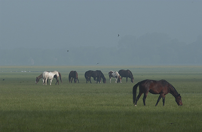
Flood-meadow
A flood-meadow (or floodmeadow) is an area of grassland or pasture beside a river, subject to seasonal flooding.Huhta, Ari‐Pekka, Rautio, Pasi (2014). Flood meadows in Finland - their development during the past century. '' Nordic Journal of Botany'' 32 (6): 858–70 Flood-meadows are distinct from water-meadows in that the latter are artificially created and maintained, with flooding controlledEmma Rothero, Sophie Lake, David Gowing, eds. Floodplain Meadows – Beauty and Utility: A Technical Handbook'' (Floodplain Meadows Partnership; 2016) on a seasonal and even daily basis. Examples Austria: * Hohenau an der March Bosnia and Herzegovina: * List of karst polje in Bosnia and Herzegovina Estonia: * Emajõe flood-meadow * Kasari, Matsalu National Park Finland: * Mattholmsfladan, Pargas * Levänluhta, Isokyrö Ireland: * Shannon Callows United Kingdom: * Angel & Greyhound Meadow, Oxford * Christchurch Meadows, Reading * Christ Church Meadow, Oxford * Mill Mea ... [...More Info...] [...Related Items...] OR: [Wikipedia] [Google] [Baidu] [Amazon] |
Flood-meadow Near Hohenau
A flood-meadow (or floodmeadow) is an area of grassland or pasture beside a river, subject to seasonal flooding.Huhta, Ari‐Pekka, Rautio, Pasi (2014). Flood meadows in Finland - their development during the past century. ''Nordic Journal of Botany'' 32 (6): 858–70 Flood-meadows are distinct from water-meadows in that the latter are artificially created and maintained, with flooding controlledEmma Rothero, Sophie Lake, David Gowing, eds. Floodplain Meadows – Beauty and Utility: A Technical Handbook'' (Floodplain Meadows Partnership; 2016) on a seasonal and even daily basis. Examples Austria: * Hohenau an der March Bosnia and Herzegovina: * List of karst polje in Bosnia and Herzegovina Estonia: * Emajõgi, Emajõe flood-meadow * Kasari River, Kasari, Matsalu National Park Finland: * Mattholmsfladan, Pargas * Levänluhta, Isokyrö Ireland: * Shannon Callows United Kingdom: * Angel & Greyhound Meadow, Oxford * Christchurch Meadows, Reading, Christchurch Meadows, Reading, Be ... [...More Info...] [...Related Items...] OR: [Wikipedia] [Google] [Baidu] [Amazon] |
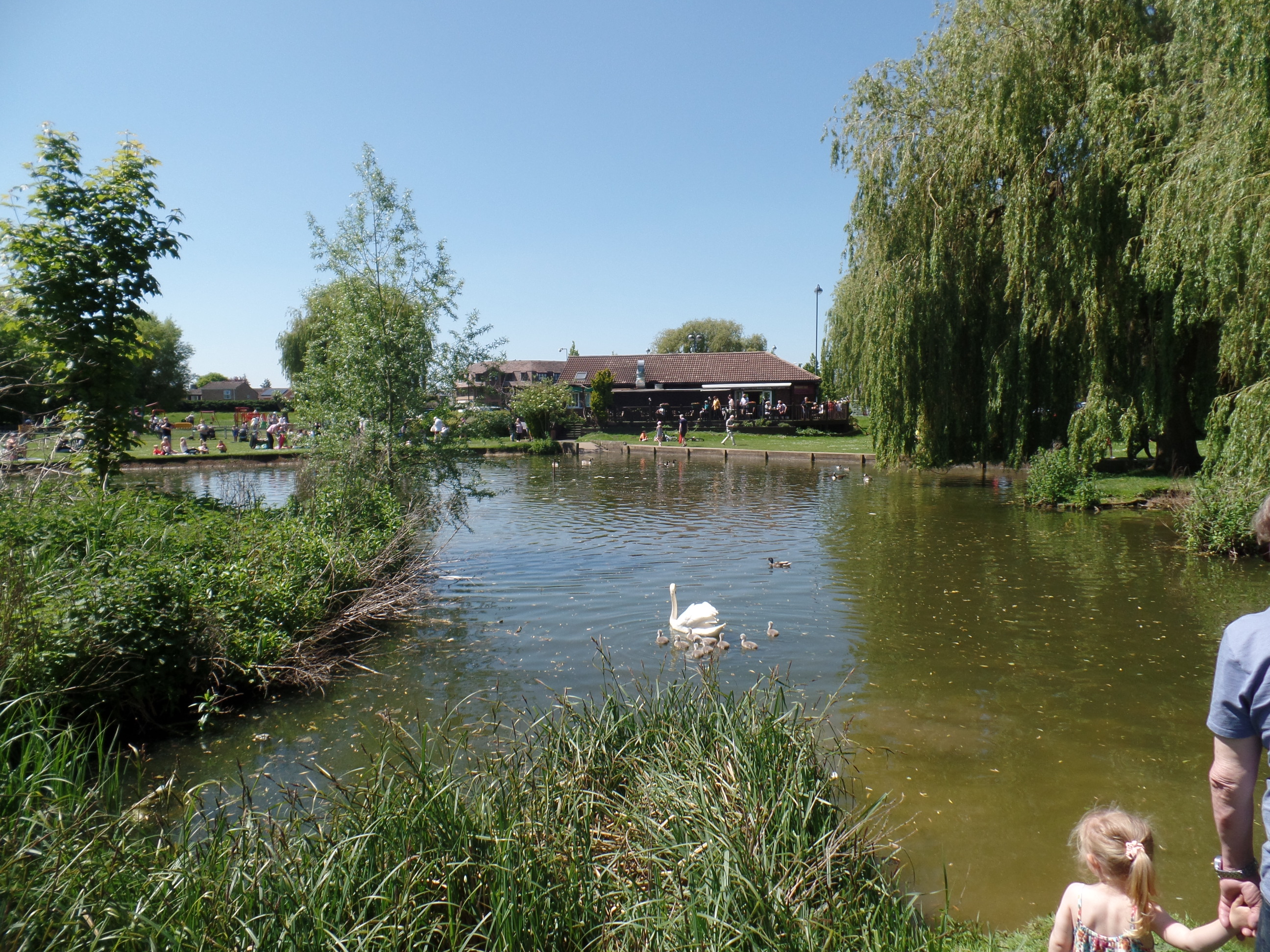
St Neots
St NeotsPronunciation of the town name: Most commonly, but variations that ''saint'' is said as in most English non-georeferencing speech, the ''t'' is by a small minority of the British pronounced and higher traces of in the final syllable of the town's name are common. is a town and civil parish in the Huntingdonshire district of Cambridgeshire, England. It is west of Cambridge. The areas of Eynesbury, Eaton Ford, Eaton Socon, Love's Farm and Wintringham form part of the town. The town centre lies on the eastern bank of the River Great Ouse. The town is close to the A1 road (north-south), as well as the A421 and A428 roads which link Cambridge to Bedford and Milton Keynes. St Neots railway station is on the Great Northern route between London and Peterborough. St Neots had a population of 33,410 in 2021. Toponymy The town is named after the ninth century monk Saint Neot, whose bones were brought to St Neots Priory from Cornwall in around 980AD, resulting in pilgr ... [...More Info...] [...Related Items...] OR: [Wikipedia] [Google] [Baidu] [Amazon] |
Port Meadow, Oxford
Port Meadow is a large meadow of open common land beside the River Thames to the north and west of Oxford, England. Overview The meadow is an ancient area of grazing land, still used for horses and cattle, and according to legend has never been ploughed, at least for around 4,000 years. It is said that in return for helping to defend the kingdom against the marauding Danes (Germanic tribe), Danes, the Freedom of the City, Freemen of Oxford were given the of pasture next to the River Thames by Alfred the Great who, legend has it, founded the city in the 10th century (although Alfred actually died in the 9th century). The Freemen's collective right to graze their animals free of charge is recorded in the Domesday Book of 1086 and has been exercised ever since. The name may come from Portman (burgess), Portman, an earlier term for Freeman. The meadow runs from Jericho, Oxford, Jericho to Wolvercote (where north of the Shiplake Ditch it becomes Wolvercote Common) along the east ( ... [...More Info...] [...Related Items...] OR: [Wikipedia] [Google] [Baidu] [Amazon] |
Water-meadow
A water-meadow (also water meadow or watermeadow) is an area of grassland subject to controlled irrigation to increase agricultural productivity. Water-meadows were mainly used in Europe from the 16th to the early 20th centuries. Working water-meadows have now largely disappeared, but the field patterns and water channels of derelict water-meadows remain common in areas where they were used, such as parts of Northern Italy, Switzerland and England. Derelict water-meadows are often of importance as wetland wildlife habitats. Water-meadows should not be confused with flood-meadows, which are naturally covered in shallow water by seasonal flooding from a river. "Water-meadow" is sometimes used more loosely to mean any level grassland beside a river. Types Two main types of water-meadow were used. Catchwork water-meadow The simplest form of downward floated water meadow is the catchwork (also known as a 'catch meadow' or 'field gutter'system). Catchworks used spring water or ... [...More Info...] [...Related Items...] OR: [Wikipedia] [Google] [Baidu] [Amazon] |
Shannon Callows
The Shannon Callows () are areas of flat land along the shores of the River Shannon. These areas lie between Athlone in County Westmeath, where the river flows out of Lough Ree, and Portumna in County Galway, where it enters Lough Derg, in central Ireland. The shallow grade of the river here results in occasional flooding of the callows. Etymology The Hiberno-English word "callow" is an anglicisation of the Irish word ''caladh'', which means " flood-meadow". Protection The Shannon Callows are a classified as a Special Area of Conservation (SAC). The Irish Wildlife Trust has a "callow reserve" on Bullock Island in County Offaly. The SAC covers an area of . Wildlife The Shannon Callows are subject to protection owing to the many species of birds occurring on the site. Recorded are, amongst others, black-tailed godwit, corncrake, curlew, golden plover, lapwing, mute swan, redshank, common sandpiper, whooper swan and wigeon. Mammals recorded include American mink, fox and ... [...More Info...] [...Related Items...] OR: [Wikipedia] [Google] [Baidu] [Amazon] |
Oxford
Oxford () is a City status in the United Kingdom, cathedral city and non-metropolitan district in Oxfordshire, England, of which it is the county town. The city is home to the University of Oxford, the List of oldest universities in continuous operation, oldest university in the English-speaking world; it has buildings in every style of Architecture of England, English architecture since late History of Anglo-Saxon England, Anglo-Saxon. Oxford's industries include motor manufacturing, education, publishing, science, and information technologies. Founded in the 8th century, it was granted city status in 1542. The city is located at the confluence of the rivers Thames (locally known as the Isis) and River Cherwell, Cherwell. It had a population of in . It is north-west of London, south-east of Birmingham and north-east of Bristol. History The history of Oxford in England dates back to its original settlement in the History of Anglo-Saxon England, Saxon period. The name � ... [...More Info...] [...Related Items...] OR: [Wikipedia] [Google] [Baidu] [Amazon] |
Christ Church Meadow, Oxford
Christ Church Meadow is a flood-meadow and popular walking and picnic spot in Oxford, England. Roughly triangular in shape, it is bounded by the River Thames (the stretch through Oxford being known as "The Isis"), the River Cherwell, and Christ Church, Oxford, Christ Church. The meadow provides access to many of the college boathouses, which are on an island at the confluence of the two rivers. The lower sections of the meadow, close to the Thames, are grazed by cattle (including English Longhorn, Longhorn cows) while the upper sections have sports fields. Broad Walk is at the northern edge with Merton Field to the north and Merton College, dominated by the tower of Merton College Chapel, beyond that. Christ Church Meadow is owned by Christ Church, Oxford, Christ Church, and is thus the private property of the college; however, access is allowed during the day. Access starts very early to allow rowers to go to the boathouses. Eights Week and Torpids, Oxford University's two ... [...More Info...] [...Related Items...] OR: [Wikipedia] [Google] [Baidu] [Amazon] |


