|
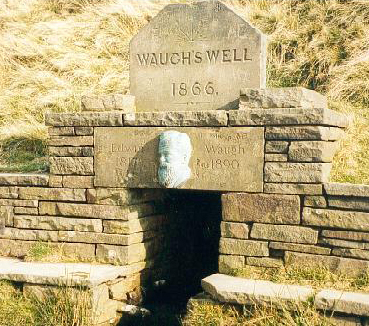
Waterfoot, Lancashire
Waterfoot is a historic mill town in the Borough of Rossendale between Rawtenstall and Bacup in Lancashire, England. The B6238 road from Burnley meets the A681 road, and Whitewell Brook the River Irwell. History Like the majority of the industrial communities in East Lancashire, Waterfoot expanded rapidly in the nineteenth century with the growth of industrialisation; it became a centre for felt-making, a process related to the predominant textile industry of the region. Before that, the main centre was Newchurch-in-Rossendale, that sits above Waterfoot to the north. The township of Newchurch stretched from Bacup to Rawtenstall, and in 1511 it was recorded as having a population of 1,000 people, served by the monks of Whalley Abbey. Waterfoot was on the Lancashire and Yorkshire Railway line between Bury and Bacup. This was dismantled in 1972 and the route is now hard to trace, although the tunnels can be seen in Thrutch Gorge or The Glen, a cutting to the east of the vil ... [...More Info...] [...Related Items...] OR: [Wikipedia] [Google] [Baidu] |
Borough Of Rossendale
Rossendale () is a district with borough status in Lancashire, England, located along the River Irwell and spanning a large valley. It is located south of Burnley and east of Blackburn. The borough borders Greater Manchester to the south and borders the boroughs of Bolton, Bury and Rochdale. In the 2001 census the population of Rossendale was 65,652, spread between the towns of Bacup, Haslingden, Whitworth and Rawtenstall; the villages of Crawshawbooth, Edenfield, Helmshore and Waterfoot; and as well as Britannia, Broadclough, Chatterton, Cloughfold, Cowpe, Irwell Vale, Loveclough, Newchurch, Shawforth, Stacksteads, Stubbins, Turn and Weir. The population at the 2011 Census had risen to 67,922. The district was formed on 1 April 1974 under the Local Government Act 1972, from the municipal boroughs of Bacup, Haslingden, Rawtenstall, part of Ramsbottom Urban District and Whitworth Urban District. Rossendale is twinned with the German town of Bocholt, locate ... [...More Info...] [...Related Items...] OR: [Wikipedia] [Google] [Baidu] |
Slipper
Slippers are light footwear that are easy to put on and off and are intended to be worn indoors, particularly at home. They provide comfort and protection for the feet when walking indoors. History The recorded history of slippers can be traced back to the 12th century. In the West, the record can only be traced to 1478. Slippers in China date from 4700 BCE. They were made of cotton or woven rush, had leather linings, and featured symbols of power, such as dragons. Native American moccasins were also highly decorative. Such moccasins depicted nature scenes and were embellished with beadwork and fringing, their soft sure-footedness made them suitable for indoors appropriation. Inuit and Aleut people made shoes from smoked hare-hide to protect their feet against the frozen ground inside their homes. Fashionable Orientalism saw the introduction into the West of designs like the baboosh. Victorian people needed such shoes to keep the dust and gravel outside their homes. For ... [...More Info...] [...Related Items...] OR: [Wikipedia] [Google] [Baidu] |
Mary Towneley Loop
The Mary Towneley Loop is a circular route that forms part of the Pennine Bridleway National Trail, along the borders of Lancashire and Yorkshire. The loop was opened in 2002, the first section of the Pennine Bridleway. It is named in memory of Mary, Lady Towneley, who drew attention to the poor state of England's bridleways and the need for a long-distance route for horse-riders by riding with two friends in September 1986 from Hexham in Northumberland to Ashbourne in Derbyshire. She died in 2001. The route joins the main Pennine Bridleway at two points, one near the village of Summit between Littleborough and Todmorden, and one just east of Worsthorne. Heading west from Summit the Loop climbs to Top of Leach at . The trail then passes through the town of Waterfoot in the Rossendale Valley and follows new tracks via Lumb before entering the Cliviger Gorge and then climbing up to the Long Causeway. It then heads north to rejoin the main Pennine Bridleway just east o ... [...More Info...] [...Related Items...] OR: [Wikipedia] [Google] [Baidu] |


