|
Walney
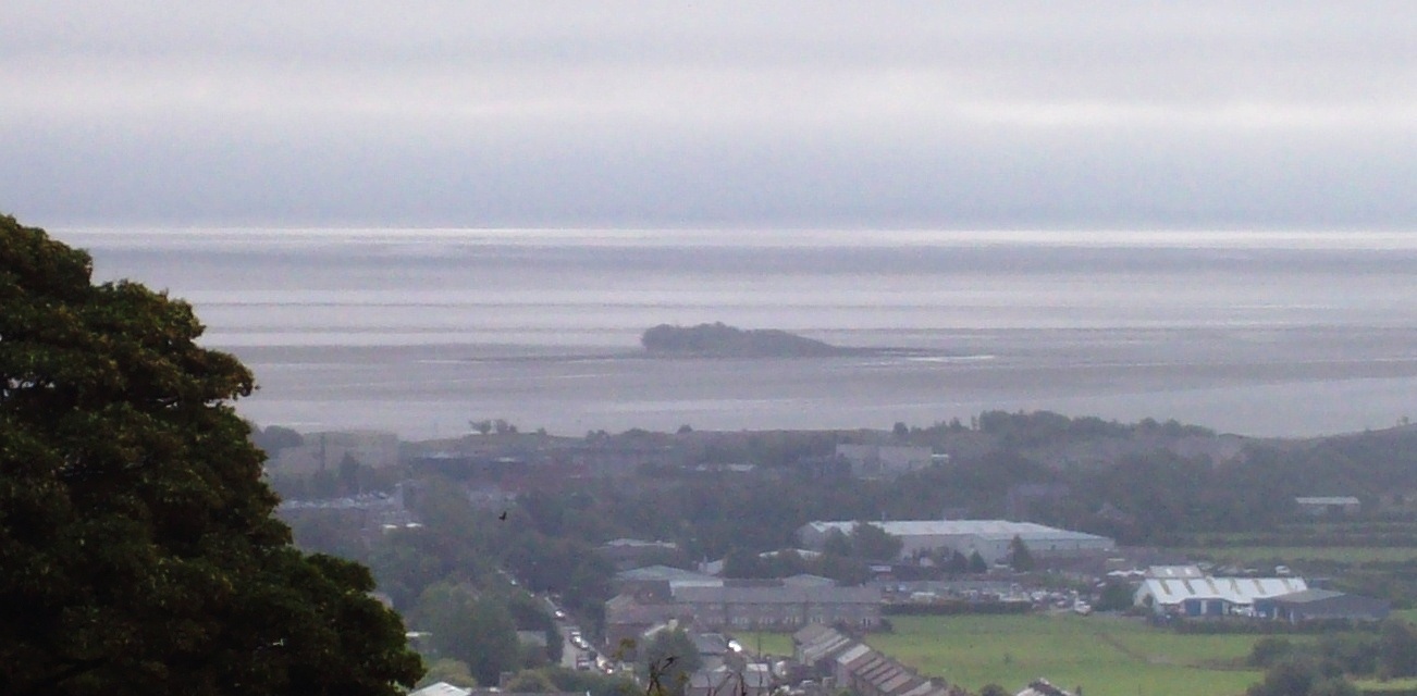
Walney Island, also known as the Isle of Walney, is an island off the west coast of England, at the western end of Morecambe Bay in the Irish Sea. It is part of Barrow-in-Furness, separated from the mainland by Walney Channel, which is spanned by the Jubilee Bridge. Walney is the largest island of the Furness Islands group, both in population and size, as well as the largest English island in the Irish Sea. Its population at the 2011 UK Census was 10,651, distributed evenly across the island's two Wards of Walney North and Walney South. Walney Island formed during the last glacial period, when the River Duddon was a large glacial lake, depositing till at its mouth, which became Walney. Some evidence of neolithic inhabitants has been found in the island's sand dunes, though its name is likely of Norse origin.Walney Island ... [...More Info...] [...Related Items...] OR: [Wikipedia] [Google] [Baidu] |
Barrow-in-Furness
Barrow-in-Furness is a port town in Cumbria, England. Historic counties of England, Historically in Lancashire, it was incorporated as a municipal borough in 1867 and merged with Dalton-in-Furness Urban District in 1974 to form the Borough of Barrow-in-Furness. In 2023 the borough will merge with Eden and South Lakeland districts to form a new unitary authority; Westmorland and Furness. At the tip of the Furness, Furness peninsula, close to the Lake District, it is bordered by Morecambe Bay, the Duddon Estuary and the Irish Sea. In 2011, Barrow's population was 56,745, making it the second largest urban area in Cumbria after Carlisle, Cumbria, Carlisle. Natives of Barrow, as well as the local dialect, are known as Barrovian. In the Middle Ages, Barrow was a small hamlet (place), hamlet within the parish of Dalton-in-Furness with Furness Abbey, now on the outskirts of the town, controlling the local economy before its Dissolution of the Monasteries, dissolution in 1537. The iron ... [...More Info...] [...Related Items...] OR: [Wikipedia] [Google] [Baidu] |
Walney Bridge
Walney Bridge, officially Jubilee Bridge, is a bascule bridge in Barrow-in-Furness, Cumbria, England. Completed in 1908, it spans Walney Channel, linking Barrow Island to Walney Island. The bridge carries the A590 trunk road, which has its western terminus on Walney. History Talks began in 1897 to how feasible the construction of a bridge connecting Barrow to Walney would be. At the time, Walney residents were frustrated by the fact that they had to use a ferry to traverse the Walney Channel, and they also saw it as an opportunity to commemorate the Diamond Jubilee of Queen Victoria. When the bridge was finally approved many companies fought for the building contract, with Sir William Arrol & Co. winning it. Construction of the £175,000 (in that time) bridge began in mid-1905 and it was finally opened by Barrow mayor Mrs. T.F. Taylor on 30 July 1908. For 27 years Walney bridge was a toll bridge until 4 April 1935, when the late Queen Mother officially renamed it Jubilee Brid ... [...More Info...] [...Related Items...] OR: [Wikipedia] [Google] [Baidu] |
Vickerstown
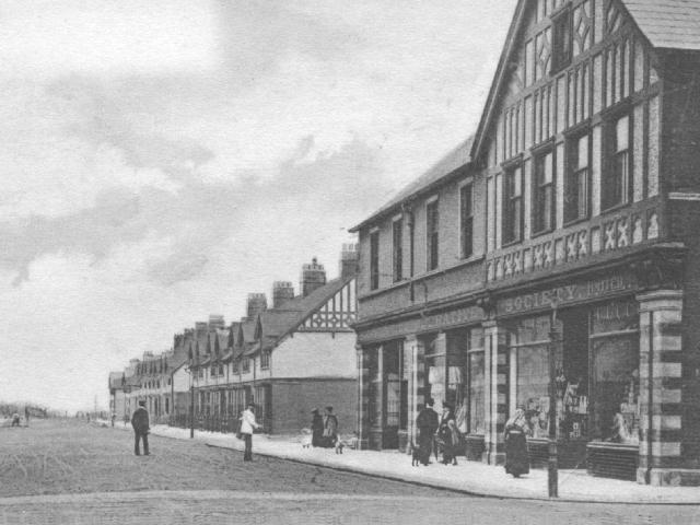
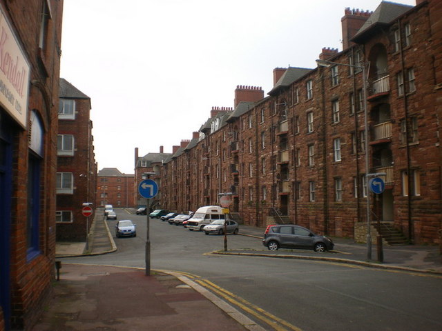
Vickerstown is an area of Barrow-in-Furness, Cumbria, England, covered by the wards of Walney North and Walney South. It is an example of a model village built for workers by a company needing to expand, having been constructed in the early 20th century by Vickers Shipbuilding and Engineering. Vickerstown contains two Conservation Areas and is home to the majority of the population of Walney Island. History Beginnings Its construction was prompted by a lack of housing available for the workers at Barrow's shipyard, owned at the time by Vickers. Some workers were forced to live on board the Atlantic liner , which was moored in the docks. Plans for its development were begun in 1898 and Vickers bought out the ''Isle of Walney Estates Company'' to handle the construction. Homes were designed to last, with the houses in a Tudor Revival terrace style. Larger houses overlooking Walney Channel were reserved for managers' families. The good construction of this estate meant that W ... [...More Info...] [...Related Items...] OR: [Wikipedia] [Google] [Baidu] |
Walney North
Walney North is one of two wards on Walney Island in the Borough of Barrow-in-Furness, North West England. The 2001 UK census showed 5,604 people were living in the area, reducing to 5,304 at the 2011 Census. Walney North consists of several settlements including North Walney, North Scale and the northern area of Vickerstown. The ward is also home to Barrow/Walney Island Airport. The ward will be combined with Walney South ward in April 2023 following formation of the new Westmorland and Furness Westmorland and Furness is a future unitary authority area in north-west England, which will come into being on 1 April 2023 on the abolition of Cumbria County Council, together with Cumberland. The council will cover the areas currently served ... Local Authority and be named simply 'Walney Island'. References {{Barrow-in-Furness Wards of Barrow-in-Furness ... [...More Info...] [...Related Items...] OR: [Wikipedia] [Google] [Baidu] |
Morecambe Bay
Morecambe Bay is a large estuary in northwest England, just to the south of the Lake District National Park. It is the largest expanse of intertidal mudflats and sand in the United Kingdom, covering a total area of . In 1974, the second largest gas field in the UK was discovered west of Blackpool, with original reserves of over 7 trillion cubic feet (tcf) (200 billion cubic metres). At its peak, 15% of Britain's gas supply came from the bay but production is now in decline. It is also one of the homes of the high brown fritillary butterfly. Natural features The rivers Leven, Kent, Keer, Lune and Wyre drain into the Bay, with their various estuaries making a number of peninsulas within the bay. Much of the land around the bay is reclaimed, forming salt marshes used in agriculture. Morecambe Bay is also an important wildlife site, with abundant birdlife and varied marine habitats, and there is a bird observatory at Walney Island. The bay has rich cockle beds, which have ... [...More Info...] [...Related Items...] OR: [Wikipedia] [Google] [Baidu] |
Walney South
Walney South is one of two wards on Walney Island in the Borough of Barrow-in-Furness, North West England. The 2001 UK census showed 5,784 people were living in the area, reducing to 5,307 at the 2011 Census. There are two main settlements within the ward: Biggar and Vickerstown. Walney Bridge connects Walney South and, in fact, the whole island to mainland Barrow. The ward will be combined with Walney North ward in April 2023 following formation of the new Westmorland and Furness Westmorland and Furness is a future unitary authority area in north-west England, which will come into being on 1 April 2023 on the abolition of Cumbria County Council, together with Cumberland. The council will cover the areas currently served ... Local Authority and be named simply 'Walney Island'. References {{Barrow-in-Furness Wards of Barrow-in-Furness ... [...More Info...] [...Related Items...] OR: [Wikipedia] [Google] [Baidu] |
Irish Sea
The Irish Sea or , gv, Y Keayn Yernagh, sco, Erse Sie, gd, Muir Èireann , Ulster-Scots: ''Airish Sea'', cy, Môr Iwerddon . is an extensive body of water that separates the islands of Ireland and Great Britain. It is linked to the Celtic Sea in the south by St George's Channel and to the Inner Seas off the West Coast of Scotland in the north by the North Channel. Anglesey, North Wales, is the largest island in the Irish Sea, followed by the Isle of Man. The term ''Manx Sea'' may occasionally be encountered ( cy, Môr Manaw, ga, Muir Meann gv, Mooir Vannin, gd, Muir Mhanainn). On its shoreline are Scotland to the north, England to the east, Wales to the southeast, Northern Ireland and the Republic of Ireland to the west. The Irish Sea is of significant economic importance to regional trade, shipping and transport, as well as fishing and power generation in the form of wind power and nuclear power plants. Annual traffic between Great Britain and Ireland amount ... [...More Info...] [...Related Items...] OR: [Wikipedia] [Google] [Baidu] |
Barrow-in-Furness (borough)
Barrow-in-Furness is a local government district with borough status in Cumbria, England. It is named after its main town, Barrow-in-Furness. Other settlements include Dalton-in-Furness and Askam-in-Furness. It is the smallest district in the county, but is the most densely populated, with 924 people per square kilometre. The population was 71,980 in 2001, reducing to 69,087 at the 2011 Census. In July 2021 the Ministry of Housing, Communities and Local Government announced that in April 2023, Cumbria will be reorganised into two unitary authorities. Barrow-in-Furness Borough Council is to be abolished and its functions transferred to a new authority, to be known as Westmorland and Furness, which will cover the current districts of Barrow-in-Furness, Eden and South Lakeland. In April 2022 Gareth Davies became the first person to run every single street in the Borough of Barrow-In-Furness. Covering all 1,026 streets over an end to end distance of 201 miles. Background The ... [...More Info...] [...Related Items...] OR: [Wikipedia] [Google] [Baidu] |
Furness Islands
The Islands of Furness are situated to the south-west and east of the Furness Peninsula. Within England, they are the third biggest collection of islands. They are generally quite small, though at 12.99 km2 Walney Island is the eighth biggest in England. Of these, only Walney Island, Barrow Island, Roa Island and Piel Island are inhabited. The majority of the islands lie within the boundary of the Borough of Barrow-in-Furness, with some 15,000 residents constituting 20% of the district's population. They are the largest group of islands between Anglesey in Wales and the Firth of Clyde in Scotland. The main islands are: *Walney Island - Population 10,651 (Settlements include Biggar, North Scale, North Walney and Vickerstown) *Barrow Island - Population 2,616 * Sheep Island - Population 0 *Roa Island - Population ~100 *Piel Island - Population ~10 *Foulney Island - Population 0 *Chapel Island - Population 0 As well as these, the small islets of Dova Haw, also known a ... [...More Info...] [...Related Items...] OR: [Wikipedia] [Google] [Baidu] |
Cumbria
Cumbria ( ) is a ceremonial and non-metropolitan county in North West England, bordering Scotland. The county and Cumbria County Council, its local government, came into existence in 1974 after the passage of the Local Government Act 1972. Cumbria's county town is Carlisle, in the north of the county. Other major settlements include Barrow-in-Furness, Kendal, Whitehaven and Workington. The administrative county of Cumbria consists of six districts ( Allerdale, Barrow-in-Furness, Carlisle, Copeland, Eden and South Lakeland) and, in 2019, had a population of 500,012. Cumbria is one of the most sparsely populated counties in England, with 73.4 people per km2 (190/sq mi). On 1 April 2023, the administrative county of Cumbria will be abolished and replaced with two new unitary authorities: Westmorland and Furness ( Barrow-in-Furness, Eden, South Lakeland) and Cumberland ( Allerdale, Carlisle, Copeland). Cumbria is the third largest ceremonial county in England by ... [...More Info...] [...Related Items...] OR: [Wikipedia] [Google] [Baidu] |
Barrow Island, England
Barrow Island is an area and electoral ward of Barrow-in-Furness, Cumbria, England. Originally separate from the British mainland, land reclamation in the 1860s saw the northern fringes of the island connected to Central Barrow. Barrow Island is also bound to the south and east by the town's dock system and to the west by Walney Channel. The Ward population taken at the 2011 census was 2,616. The ward itself will be combined with Central and Hindpool wards in April 2023 following formation of the new Westmorland and Furness Local Authority and be named 'Old Barrow'. Background and history The name of the town of Barrow-in-Furness is believed to derive from the Norse word ''Barrae'', meaning ''Bare Island'', which actually referred to Barrow Island. Since the 1860s the island has been connected to the mainland as its channel was modified to form two docks, the Buccleuch Dock and the Devonshire Dock. The remainder of its channel has also now been developed as part of the doc ... [...More Info...] [...Related Items...] OR: [Wikipedia] [Google] [Baidu] |
Low Furness
Furness ( ) is a peninsula and region of Cumbria in northwestern England. Together with the Cartmel Peninsula it forms North Lonsdale, historically an exclave of Lancashire. The Furness Peninsula, also known as Low Furness, is an area of villages, agricultural land and low-lying moorland, with the industrial town of Barrow at its head. The peninsula is bordered by the estuaries of the River Duddon to the west and the River Leven in Morecambe Bay to the east. The wider region of Furness consists of the peninsula and the area known as ''High Furness'', which is a relatively mountainous and sparsely populated part of England, extending inland into the Lake District and containing the Furness Fells. The inland boundary of the region is formed by the rivers Leven, Brathay and Duddon, and the lake of Windermere. Off the southern tip of Furness is Walney Island, long, as well as several smaller islands. The Borough of Barrow-in-Furness, which developed when the Furness iron indu ... [...More Info...] [...Related Items...] OR: [Wikipedia] [Google] [Baidu] |


