|
Willow Palisade
Willow Palisade (; mnc, m=, v=Biregen Jase, ᠠ=Biregen Jase) was a system of ditches and embankments that was planted with willows, was intended to restrict movement into Manchuria (including Northeast China and Outer Manchuria), and was built by the Qing dynasty of China during the late 17th century. It is often conveniently divided into three connected sections: the western and eastern sections, forming the Inner Willow Palisade around Liaodong Peninsula, and the northern section, also known as the Outer Willow Palisade, separating the traditionally Manchu areas (to the east) from the traditionally-Mongol area (to the west) north of the Inner Palisade. Layout Manchuria borders Mongolia in the west, the Russian Far East in the north, China proper to the south and Korea in the southeast. Manchuria has access to the Yellow Sea and the Bohai Sea to the south, while Outer Manchuria (Primorsky Krai, Khabarovsk Krai and Amur Oblast in Russia) has access to the Sea of Japan and the Se ... [...More Info...] [...Related Items...] OR: [Wikipedia] [Google] [Baidu] |
Primorsky Krai
Primorsky Krai, informally known as Primorye, is a federal subjects of Russia, federal subject (a krais of Russia, krai) of Russia, part of the Far Eastern Federal District in the Russian Far East. The types of inhabited localities in Russia, city of Vladivostok on the southern coast of the krai is its administrative center, and the second largest city in the Russian Far East, behind Khabarovsk in the neighbouring Khabarovsk Krai. Primorsky Krai has the largest economy among the federal subjects in the Russian Far East, and a list of federal subjects of Russia by population, population of 1,845,165 as of the Russian Census (2021), 2021 Census. The krai has Russia's only North Korea–Russia border, border with North Korea, along the Tumen River in Khasansky District in the southwestern corner of the krai. Peter the Great Gulf, the largest gulf in the Sea of Japan, is on the south coast. The territory of the krai was historically part of Manchuria. It was Convention of Pek ... [...More Info...] [...Related Items...] OR: [Wikipedia] [Google] [Baidu] |
Liaodong Wall
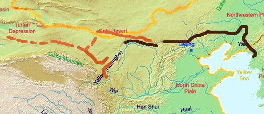
The Great Wall of China (, literally "ten thousand ''li'' long wall") is a series of fortifications in China. They were built across the historical northern borders of ancient Chinese states and Imperial China as protection against various nomadic groups from the Eurasian Steppe. The first walls date to the 7th century BC; these were joined together in the Qin dynasty. Successive dynasties expanded the wall system; the best-known sections were built by the Ming dynasty (1368–1644). To aid in defense, the Great Wall utilized watchtowers, troop barracks, garrison stations, signaling capabilities through the means of smoke or fire, and its status as a transportation corridor. Other purposes of the Great Wall have included border controls (allowing control of immigration and emigration, and the imposition of duties on goods transported along the Silk Road), and the regulation of trade. The collective fortifications constituting the Great Wall stretch from Liaodong in the ea ... [...More Info...] [...Related Items...] OR: [Wikipedia] [Google] [Baidu] |
Yalu River
The Yalu River () or Amnok River () is a river on the border between China and North Korea. Together with the Tumen River to its east, and a small portion of Paektu Mountain, the Yalu forms the border between China and North Korea. Its valley has been the scene of several military conflicts in the past centuries. It borders North Korea to the south and China to the north. Name The Chinese name ''Yalu'' ("duck-green") was first attested during the Tang dynasty. According to the '' Tongdian'' (8th century), the river was named after its color, which resembled that of a mallard's head. The Korean name "Amnok" follows the Sino-Korean reading of the same name. In ancient times, the river was known as ''Peishui'' (''Paesu'', 浿水) or ''Mazishui'' (''Majasu'', 馬訾水). Historically, it was also known by the Korean name of ''Arinarye'' (아리나례강, 阿利那禮江). ''Ari'', a word from Old Korean used to refer to the 'spirituality (신령성; 神靈性) of the sun'. Th ... [...More Info...] [...Related Items...] OR: [Wikipedia] [Google] [Baidu] |
Kaiyuan, Liaoning
Kaiyuan () is a county-level city in the northeast of Liaoning, People's Republic of China, bordering Jilin for a small section to the north. It is under the administration of Tieling City, the centre of which lies to the southwest. Administrative divisions There are 3 subdistricts, 9 towns, and 9 townships under the city's administration. Subdistricts: * Xincheng Subdistrict (), Laocheng Subdistrict (), Xingkai Subdistrict () Towns: *Babao (), Qingyunbao (), Kaoshan (), Yemin (), Jingouzi (), Zhonggu (), Bakeshu (), Lianhua (), Weiyuanbao () Townships: * Chengdong Township (), Sanjiazi Township (), Songshanbao Township (), Majiazhai Township (), Lijiatai Township (), Shangbadi Manchu Ethnic Township (), Xiabadi Manchu Ethnic Township (), Huangqizhai Manchu Ethnic Township (), Linfeng Manchu Ethnic Township () Geography and climate Kaiyuan is situated in northeastern Liaoning in the southeastern part of Tieling City on the eastern bank of the middle re ... [...More Info...] [...Related Items...] OR: [Wikipedia] [Google] [Baidu] |
Shanhaiguan District
Shanhaiguan District is a district of the city of Qinhuangdao, Hebei Province, China, named after the pass of the Great Wall within the district, Shanhai Pass. It is located east of the city centre. Administrative divisions There are five subdistricts, three towns, and one township, Bohai Township (), in the district. Subdistricts * Nanguan Subdistrict () * Dongjie Subdistrict () * Xijie Subdistrict () *[...More Info...] [...Related Items...] OR: [Wikipedia] [Google] [Baidu] |
Great Wall Of China
The Great Wall of China (, literally "ten thousand ''li'' long wall") is a series of fortifications in China. They were built across the historical northern borders of ancient Chinese states and Imperial China as protection against various nomadic groups from the Eurasian Steppe. The first walls date to the 7th century BC; these were joined together in the Qin dynasty. Successive dynasties expanded the wall system; the best-known sections were built by the Ming dynasty (1368–1644). To aid in defense, the Great Wall utilized watchtowers, troop barracks, garrison stations, signaling capabilities through the means of smoke or fire, and its status as a transportation corridor. Other purposes of the Great Wall have included border controls (allowing control of immigration and emigration, and the imposition of duties on goods transported along the Silk Road), and the regulation of trade. The collective fortifications constituting the Great Wall stretch from Liaodong in ... [...More Info...] [...Related Items...] OR: [Wikipedia] [Google] [Baidu] |
Eight Banners
The Eight Banners (in Manchu language, Manchu: ''jakūn gūsa'', , ) were administrative and military divisions under the Later Jin (1616–1636), Later Jin and Qing dynasty, Qing dynasties of China into which all Manchu people, Manchu households were placed. In war, the Eight Banners functioned as armies, but the banner system was also the basic organizational framework of all of Manchu society. Created in the early 17th century by Nurhaci, the banner armies played an instrumental role in his unification of the fragmented Jurchen people (who would later be renamed the "Manchu" under Nurhaci's son Hong Taiji) and in the Qing dynasty's Ming–Qing transition, conquest of the Ming dynasty. As Mongols, Mongol and Han Chinese, Han forces were incorporated into the growing Qing military establishment, the Mongol Eight Banners and Han Eight Banners were created alongside the original Manchu banners. The banner armies were considered the elite forces of the Qing military, while the rem ... [...More Info...] [...Related Items...] OR: [Wikipedia] [Google] [Baidu] |
Heilongjiang
Heilongjiang is a province in northeast China. It is the northernmost and easternmost province of the country and contains China's northernmost point (in Mohe City along the Amur) and easternmost point (at the confluence of the Amur and Ussuri rivers). The province is bordered by Jilin to the south and Inner Mongolia to the west. It also shares a border with Russia ( Amur Oblast, Jewish Autonomous Oblast, Khabarovsk Krai, Primorsky Krai and Zabaykalsky Krai) to the north and east. The capital and the largest city of the province is Harbin. Among Chinese provincial-level administrative divisions, Heilongjiang is the sixth-largest by total area, the 20th-most populous, and the second-poorest by GDP per capita after only Gansu province. The province takes its name from the Amur river which marks the border between the People's Republic of China and Russia. Heilongjiang has significant agricultural production, and raw materials, such as timber, oil, and coal. Etymology ... [...More Info...] [...Related Items...] OR: [Wikipedia] [Google] [Baidu] |
Han Chinese
The Han Chinese, alternatively the Han people, are an East Asian people, East Asian ethnic group native to Greater China. With a global population of over 1.4 billion, the Han Chinese are the list of contemporary ethnic groups, world's largest ethnic group, making up about 17.5% of the world population. The Han Chinese represent 91.11% of the population in China and 97% of the population in Taiwan. Han Chinese are also a significant Overseas Chinese, diasporic group in Southeast Asian countries such as Thailand, Malaysia, and Indonesia. In Singapore, people of Han Chinese or Chinese descent make up around 75% of the country's population. The Han Chinese have exerted a primary formative influence in the development and growth of Chinese civilization. Originating from Zhongyuan, the Han Chinese trace their ancestry to the Huaxia people, a confederation of agricultural tribes that lived along the middle and lower reaches of the Yellow River in the north central plains of Chin ... [...More Info...] [...Related Items...] OR: [Wikipedia] [Google] [Baidu] |
Jilin
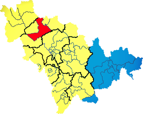
) , image_skyline = Changbaishan Tianchi from western rim.jpg , image_alt = , image_caption = View of Heaven Lake , image_map = Jilin in China (+all claims hatched).svg , mapsize = 275px , map_alt = Map showing the location of Jilin Province , map_caption = Map showing the location of Jilin Province , coordinates = , subdivision_type = Country , subdivision_name = China , named_for = from ''girin ula'', a Manchu language, Manchu phrase meaning "along the river" , seat_type = Capital , seat = , seat1_type = , seat1 = , parts_type = Divisions , parts_style = para , p1 = 9 Prefectures of China, prefectures , p2 = 60 Counties of China, counties , p3 = 1006 Townships of China, townships , government_type = Provinces of China, Province , governing_body = Jilin Provinci ... [...More Info...] [...Related Items...] OR: [Wikipedia] [Google] [Baidu] |
Sea Of Okhotsk
The Sea of Okhotsk; Historically also known as , or as ; ) is a marginal sea of the western Pacific Ocean. It is located between Russia's Kamchatka Peninsula on the east, the Kuril Islands on the southeast, Japan's island of Hokkaido on the south, the island of Sakhalin along the west, and a stretch of eastern Siberian coast along the west and north. Its northeast corner is the Shelikhov Gulf. The sea is named for the port of Okhotsk, itself named for the Okhota River. Geography The Sea of Okhotsk covers an area of , with a mean depth of and a maximum depth of . It is connected to the Sea of Japan on either side of Sakhalin: on the west through the Sakhalin Gulf and the Gulf of Tartary; on the south through the La Pérouse Strait. In winter, navigation on the Sea of Okhotsk is impeded by ice floes. Ice floes form due to the large amount of freshwater from the Amur River, lowering the salinity of upper levels, often raising the freezing point of the sea surface. The ... [...More Info...] [...Related Items...] OR: [Wikipedia] [Google] [Baidu] |


