|
Widdington
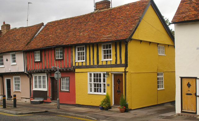
Widdington is a village and a civil parish near Saffron Walden, in the Uttlesford district, in the county of Essex, England. The population of the parish at the 2011 census was 504. The village is located near the M11 motorway. Widdington has a church dedicated to St Mary the Virgin. Prior's Hall, now a private residence, is a rare survival of a stone-built structure from the late tenth or early eleventh centuries; Prior's Hall barn, from the fourteenth-century, is nearby. Widdington was recorded in the Domesday Book of 1086 as ''Widituna''. The entry reads: ''Widi(n)tuna: St Valery Abbey; Robert from Robert Gernon; Ranulf Peverel.'' Location grid See also * The Hundred Parishes The Hundred Parishes is an area of the East of England with no formal recognition or status, albeit that the concept has the blessing of county and district authorities. It encompasses around 450 square miles (1,100 square kilometres) of northwes ... References External links Widdington Vill ... [...More Info...] [...Related Items...] OR: [Wikipedia] [Google] [Baidu] |
Hamperden End
Hamperden End is a hamlet located to the east of the village of Widdington, in the Uttlesford district, in the county of Essex, England. Another nearby village is Debden Green. Hamperden End has a Caravan Site. Location grid References External links Hamlets in Essex Uttlesford {{essex-geo-stub ... [...More Info...] [...Related Items...] OR: [Wikipedia] [Google] [Baidu] |
The Hundred Parishes
The Hundred Parishes is an area of the East of England with no formal recognition or status, albeit that the concept has the blessing of county and district authorities. It encompasses around 450 square miles (1,100 square kilometres) of northwest Essex, northeast Hertfordshire and southern Cambridgeshire. The area comprises just over 100 administrative parishes, hence its name. It contains over 6,000 listed buildings and many conservation areas, village greens, ancient hedgerows, protected features and a historical pattern of small rural settlements in close proximity to one another. Origins The idea of recognising the area for its special heritage characteristics was originally conceived by local historian and author David Heathcote. A steering group of local historians, conservationists and a local authority representative, spearheaded by the Essex branch of the Campaign to Protect Rural England (CPRE), progressed the idea and defined a boundary. The name arose in response ... [...More Info...] [...Related Items...] OR: [Wikipedia] [Google] [Baidu] |
Saffron Walden
Saffron Walden is a market town in the Uttlesford district of Essex, England, north of Bishop's Stortford, south of Cambridge and north of London. It retains a rural appearance and some buildings of the medieval period. The population was 15,504 at the 2011 census. History Archaeological evidence suggests continuous settlement on or near the site of Saffron Walden from at least the Neolithic period. It is believed that a small Romano-British settlement and fort – possibly in the area round Abbey Lane – existed as an outpost of the much larger settlement of Cestreforda to the north. After the Norman invasion of 1066, a stone church was built. Walden Castle, dating from about 1140, may have been built on pre-existing fortifications. A priory, Walden Abbey, was founded under the patronage of Geoffrey de Mandeville, 1st Earl of Essex about 1136, on the site of what is now Audley End House. The abbey was separated from Walden by Holywell Field. After the dissolution of the m ... [...More Info...] [...Related Items...] OR: [Wikipedia] [Google] [Baidu] |
Uttlesford
Uttlesford is a local government district in Essex, England. Its council is based in the market town of Saffron Walden. At the 2011 Census, the population of the district was 79,443. Other notable settlements include Great Dunmow, Elmdon, Stebbing, Stansted Mountfitchet, Thaxted, Debden, Little Chesterford and Felstead among other settlements. History Its name is derived from its location within the ancient hundred of Uttlesford,Open Domesday: Hundred of Uttlesford. Accessed 6 January 2022. usually spelled ''Vdelesford'' Open Domesday: Saffron Walden. Accessed 6 January 2022. or ''Wdelesford'' [...More Info...] [...Related Items...] OR: [Wikipedia] [Google] [Baidu] |
Essex
Essex () is a county in the East of England. One of the home counties, it borders Suffolk and Cambridgeshire to the north, the North Sea to the east, Hertfordshire to the west, Kent across the estuary of the River Thames to the south, and Greater London to the south and south-west. There are three cities in Essex: Southend, Colchester and Chelmsford, in order of population. For the purposes of government statistics, Essex is placed in the East of England region. There are four definitions of the extent of Essex, the widest being the ancient county. Next, the largest is the former postal county, followed by the ceremonial county, with the smallest being the administrative county—the area administered by the County Council, which excludes the two unitary authorities of Thurrock and Southend-on-Sea. The ceremonial county occupies the eastern part of what was, during the Early Middle Ages, the Anglo-Saxon Kingdom of Essex. As well as rural areas and urban areas, it forms ... [...More Info...] [...Related Items...] OR: [Wikipedia] [Google] [Baidu] |
M11 Motorway
The M11 is a motorway that runs north from the North Circular Road (A406) in South Woodford to the A14, northwest of Cambridge, England. Originally proposed as a trunk road as early as 1915, various plans were considered throughout the 1960s, with final construction being undertaken between 1975 and 1980. The motorway was opened in stages, with the first stage between junctions 7 and 8 opening in June 1975, and the completed motorway becoming fully operational in February 1980. Running from Woodford to Girton, the motorway provides direct access to Harlow, Cambridge and since 2002, greatly improved access to London Stansted Airport. Route The M11 starts in South Woodford in northeast London, just north of Redbridge Roundabout, crosses the North Circular (A406) at junction 4, it then heads NNE, passing east of Loughton and Theydon Bois as well as Epping Forest, meeting the M25 motorway at junction 6, and then veering approximately north, passing to the east of Harlo ... [...More Info...] [...Related Items...] OR: [Wikipedia] [Google] [Baidu] |
Domesday Book
Domesday Book () – the Middle English spelling of "Doomsday Book" – is a manuscript record of the "Great Survey" of much of England and parts of Wales completed in 1086 by order of King William I, known as William the Conqueror. The manuscript was originally known by the Latin name ''Liber de Wintonia'', meaning "Book of Winchester", where it was originally kept in the royal treasury. The '' Anglo-Saxon Chronicle'' states that in 1085 the king sent his agents to survey every shire in England, to list his holdings and dues owed to him. Written in Medieval Latin, it was highly abbreviated and included some vernacular native terms without Latin equivalents. The survey's main purpose was to record the annual value of every piece of landed property to its lord, and the resources in land, manpower, and livestock from which the value derived. The name "Domesday Book" came into use in the 12th century. Richard FitzNeal wrote in the '' Dialogus de Scaccario'' ( 1179) that the bo ... [...More Info...] [...Related Items...] OR: [Wikipedia] [Google] [Baidu] |
Henham
__NOTOC__ Henham, or Henham-on-the-Hill is a village and civil parish in the Uttlesford district of Essex, England. The village is situated north from London Stansted Airport. The parish includes the hamlets of Little Henham and Pledgdon Green. Parish population at the 2011 Census was 1,233. Henham's parish church is dedicated to St Mary the Virgin. The community Village Shop & Post Office situated opposite the Village ponds is run totally by volunteers. The local public house is The Cock Inn. A dragon legend at Henham began with the 1669 pamphlet ''The Flying Serpent or Strange News Out of Essex'', which promoted further alleged sightings of the dragon. Today, many signs in the village contain dragon motifs. Henham was a station on the Elsenham to Thaxted branch line. The village holds a bi-annual 10 kilometre run in the final weeks of May. There is a Tennis Club, Village Hall and OSCA (Hall & rooms for local activities). A monthly magazine "The Dragon" is distributed fre ... [...More Info...] [...Related Items...] OR: [Wikipedia] [Google] [Baidu] |
Rickling, Essex
Rickling is a village and former civil parish, now in the parish of Quendon and Rickling, in the Uttlesford district of Essex, England. The village is situated approximately north from the town of Bishop's Stortford. Saffron Walden, at , and the larger village of Newport, at , lie to the north-east. In 1931 the parish had a population of 378. Rickling is north-west from the village of Quendon. Rickling is the site of the parish church, All Saints, and a few houses. Rickling Green, from Rickling, is conjoined to Quendon. History The name Rickling is found in the '' Domesday Book'' as ''Richelinga''. It is recorded as having quite a large population of 34 households, and it paid substantial taxes of eight geld units. ''Richelinga'' or Rickling derives from an Old English personal name ''Ricula'' and ''inga'', thus ‘followers of the people of Ricula’. The wife of Sledda King of the East Saxons (c.587-604) and sister of Æthelberht of Kent was named Ricula, though an ... [...More Info...] [...Related Items...] OR: [Wikipedia] [Google] [Baidu] |
Villages In Essex
A village is a clustered human settlement or community, larger than a hamlet but smaller than a town (although the word is often used to describe both hamlets and smaller towns), with a population typically ranging from a few hundred to a few thousand. Though villages are often located in rural areas, the term urban village is also applied to certain urban neighborhoods. Villages are normally permanent, with fixed dwellings; however, transient villages can occur. Further, the dwellings of a village are fairly close to one another, not scattered broadly over the landscape, as a dispersed settlement. In the past, villages were a usual form of community for societies that practice subsistence agriculture, and also for some non-agricultural societies. In Great Britain, a hamlet earned the right to be called a village when it built a church. [...More Info...] [...Related Items...] OR: [Wikipedia] [Google] [Baidu] |
Civil Parishes In Essex
Civil may refer to: *Civic virtue, or civility *Civil action, or lawsuit * Civil affairs *Civil and political rights *Civil disobedience *Civil engineering *Civil (journalism), a platform for independent journalism *Civilian, someone not a member of armed forces *Civil law (other), multiple meanings * Civil liberties *Civil religion *Civil service *Civil society *Civil war A civil war or intrastate war is a war between organized groups within the same state (or country). The aim of one side may be to take control of the country or a region, to achieve independence for a region, or to change government polic ... * Civil (surname) {{disambiguation ... [...More Info...] [...Related Items...] OR: [Wikipedia] [Google] [Baidu] |


