|
White Mountains (New Hampshire)
The White Mountains are a mountain range covering about a quarter of the state of New Hampshire and a small portion of western Maine in the United States. They are a subrange of the northern Appalachian Mountains and the most rugged mountains in New England. Several of the higher peaks contain an Alpine tundra. The range is heavily visited due to its proximity to Boston, New York City, and Montreal. Most of the area is public land, including the White Mountain National Forest and a number of state parks. Its most famous mountain is Mount Washington, which is the highest peak in the Northeastern U.S. and for 76 years held the record for fastest surface wind gust in the world ( in 1934). Mount Washington is part of a line of summits, the Presidential Range, that are named after U.S. presidents and other prominent Americans. The White Mountains also include the Franconia Range, Sandwich Range, Carter-Moriah Range and Kinsman Range in New Hampshire, and the Mahoosuc Range str ... [...More Info...] [...Related Items...] OR: [Wikipedia] [Google] [Baidu] [Amazon] |
Mount Clay
Mount Clay is a peak located in Thompson and Meserve's Purchase in Coos County in the Presidential Range of the White Mountains of New Hampshire. It is a rise about long and a few hundred feet tall, with summit elevation of ; it lies on the ridge joining the summits of Mount Washington, about to the south-southeast, with that of Mount Jefferson, about north. The Appalachian Trail, coinciding there with the Gulfside Trail, rises about a hundred feet approaching it northbound, and passes from the summit, below it. The Mt. Clay Loop passes over the summit. The Jewell Trail is a popular choice as a relatively less strenuous route to Mt. Washington's summit; hikers ascending it, eastbound, from the vicinity of the cog rail base station join the Gulfside Trail about from Clay's summit and about below, and give up about in descending the southern tail of Clay, before resuming the ascent of Washington. The mountain is named for Henry Clay, 19th-century senator and U.S ... [...More Info...] [...Related Items...] OR: [Wikipedia] [Google] [Baidu] [Amazon] |
List Of New Hampshire State Parks
This is a list of New Hampshire state parks. State parks in the U.S. state of New Hampshire are overseen by the New Hampshire Division of Parks and Recreation. New Hampshire state parks State historic sites Other state protected areas Other areas of note still owned by the state but not maintained. See also *List of U.S. national parks *List of New Hampshire state forests References External links New Hampshire Division of Parks and Recreation New Hampshire Department of Natural and Cultural Resources {{Lists of state parks by U.S. state State parks of New Hampshire, Lists of state parks of the United States, New Hampshire state parks New Hampshire geography-related lists ... [...More Info...] [...Related Items...] OR: [Wikipedia] [Google] [Baidu] [Amazon] |
Mica
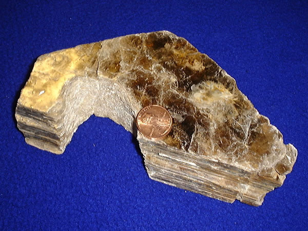
Micas ( ) are a group of silicate minerals whose outstanding physical characteristic is that individual mica crystals can easily be split into fragile elastic plates. This characteristic is described as ''perfect basal cleavage''. Mica is common in igneous and metamorphic rock and is occasionally found as small flakes in sedimentary rock. It is particularly prominent in many granites, pegmatites, and schists, and "books" (large individual crystals) of mica several feet across have been found in some pegmatites. Micas are used in products such as drywalls, paints, and fillers, especially in parts for automobiles, roofing, and in electronics. The mineral is used in cosmetics and food to add "shimmer" or "frost". Properties and structure The mica group comprises 37 phyllosilicate minerals. All crystallize in the monoclinic system, with a tendency towards pseudohexagonal crystals, and are similar in structure but vary in chemical composition. Micas are translucent to opa ... [...More Info...] [...Related Items...] OR: [Wikipedia] [Google] [Baidu] [Amazon] |
Piscataqua River
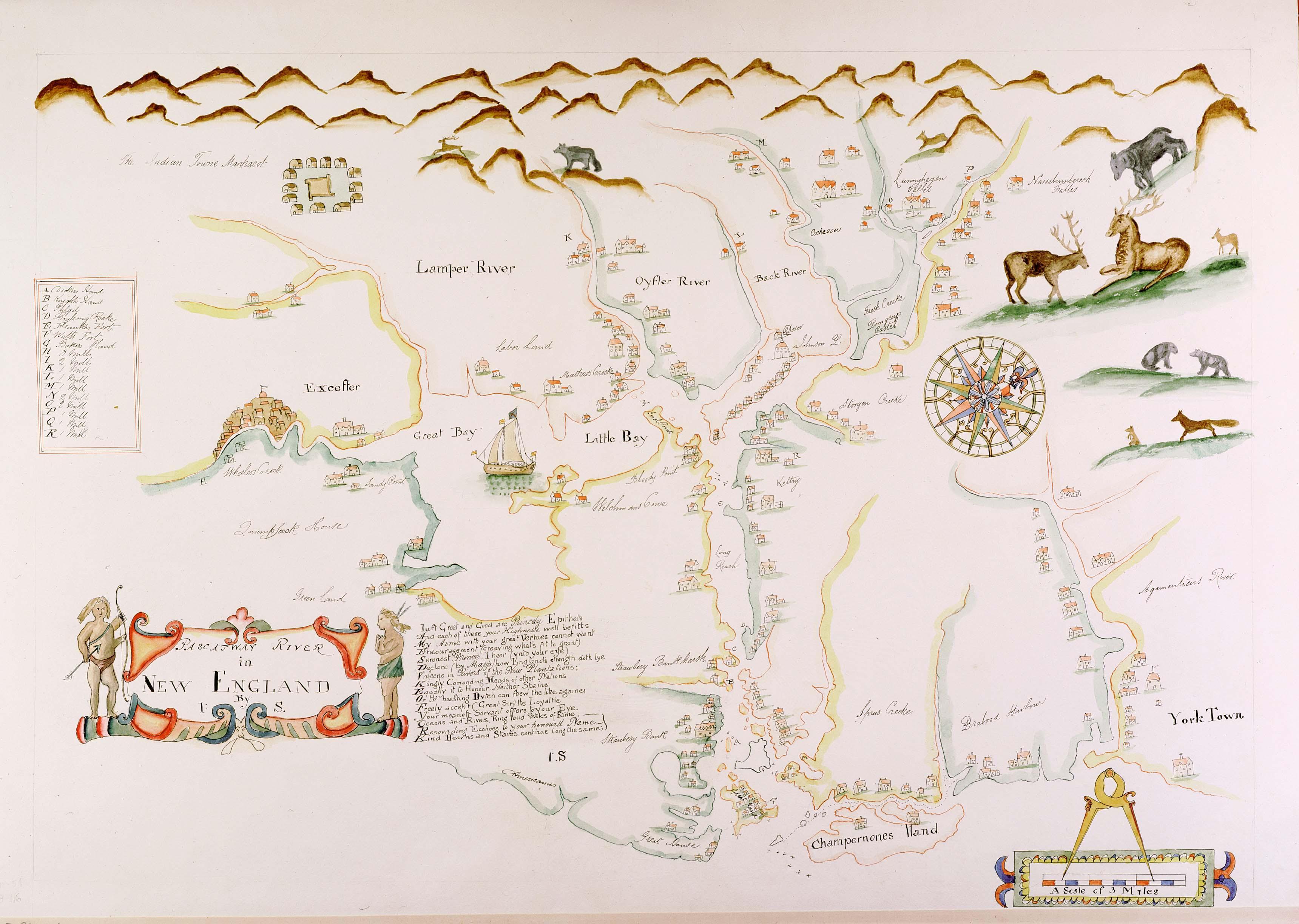
The Piscataqua River (Abenaki language, Abenaki: ''Pskehtekwis'') is a tidal river forming the boundary of the U.S. states of New Hampshire and Maine from its origin at the confluence of the Salmon Falls River and Cochecho River to the Atlantic Ocean. The drainage basin of the river is approximately , including the subwatersheds of the Great Works River and the five rivers flowing into Great Bay (New Hampshire), Great Bay: the Bellamy River, Bellamy, Oyster River (New Hampshire), Oyster, Lamprey River, Lamprey, Squamscott River, Squamscott, and Winnicut River, Winnicut. The river runs southeastward, with New Hampshire to the south and west and Maine to the north and east, and empties into the Gulf of Maine east of Portsmouth, New Hampshire. The last before the sea are known as Portsmouth Harbor and have a tidal current of around . Beyond the tidal currents, the river has a flood current speed of 12 knots, making it the fastest river on the eastern seaboard of the United State ... [...More Info...] [...Related Items...] OR: [Wikipedia] [Google] [Baidu] [Amazon] |
Appalachian Trail
The Appalachian Trail, also called the A.T., is a hiking trail in the Eastern United States, extending almost between Springer Mountain in Georgia and Mount Katahdin in Maine, and passing through 14 states.Gailey, Chris (2006)"Appalachian Trail FAQs" Outdoors.org (accessed September 14, 2006) The Appalachian Trail Conservancy claims the Appalachian Trail to be the world's longest hiking-only trail. More than three million people hike segments of it each year. The trail was first proposed in 1921 and completed in 1937. Improvements and changes have continued since then. It became the Appalachian National Scenic Trail under the National Trails System, National Trails System Act of 1968. The trail is maintained by 31 trail clubs and multiple partnerships and managed by the National Park Service, United States Forest Service, and the nonprofit Appalachian Trail Conservancy. Most of the trail is in forest or wild lands, but some parts traverse towns, roads, and farms. From south t ... [...More Info...] [...Related Items...] OR: [Wikipedia] [Google] [Baidu] [Amazon] |
Appalachian Mountain Club
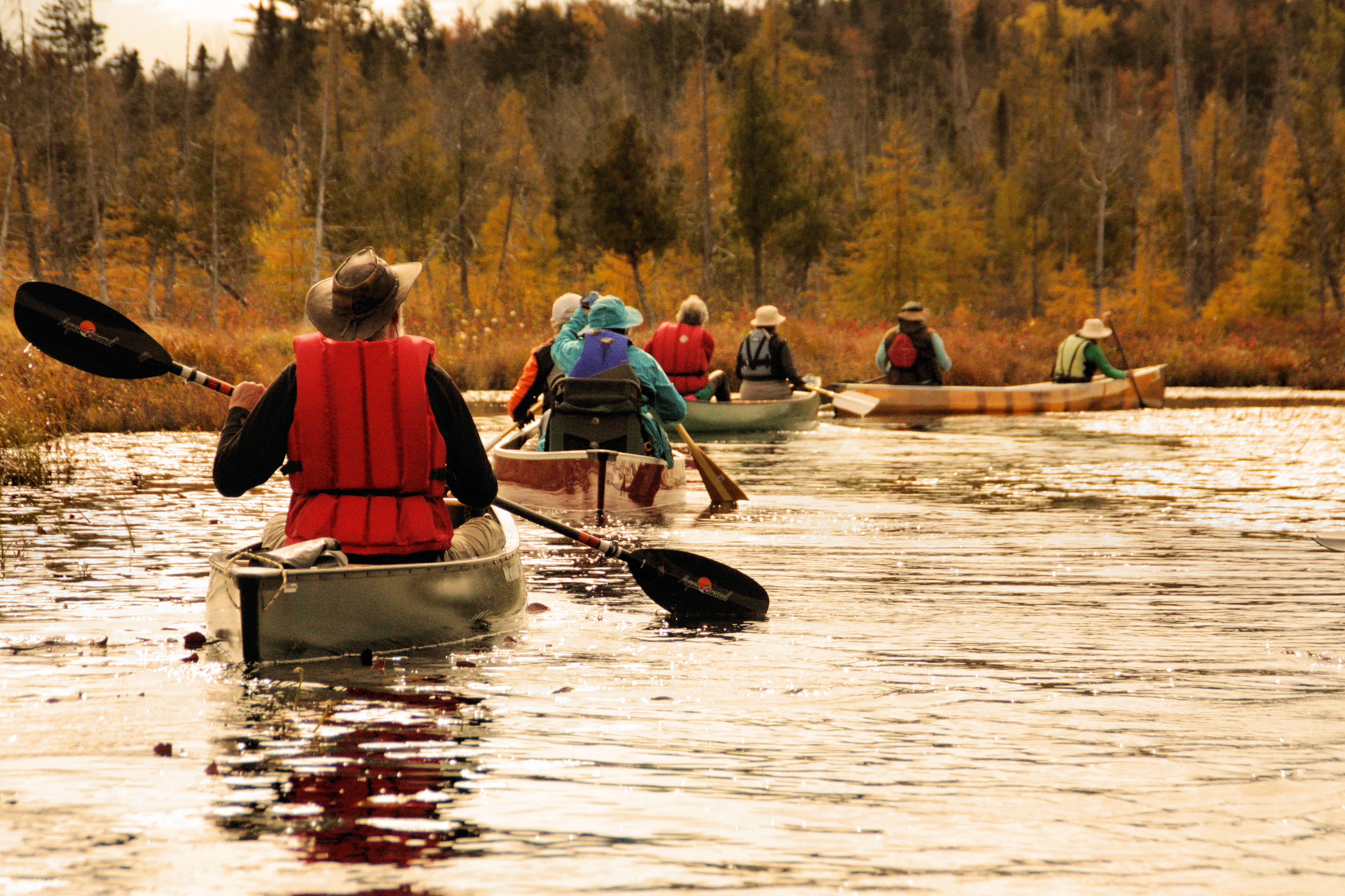
Appalachian Mountain Club (AMC) is the oldest outdoor group in the United States. Created in 1876 to explore and preserve the White Mountains (New Hampshire), White Mountains in New Hampshire, it has expanded throughout the northeastern U.S., with 12 chapters stretching from Maine to Washington, D.C. The AMC's 90,000 members, its advocates, and supporters () mix outdoor recreation, particularly hiking and backpacking, with environmentalism, environmental activism. Additional activities include cross-country skiing, whitewater and flatwater canoeing and kayaking, sea kayaking, sailing, rock climbing and bicycle riding. The Club has about 2,700 volunteers, who lead roughly 7,000 trips and activities per year. The organization publishes a number of books, guides, and trail maps. History Appalachian Mountain Club was organized in 1876, incorporated in 1878, and authorized by legislative act of 1894 to hold mountain and forest lands as historic sites. The club was formed by the effo ... [...More Info...] [...Related Items...] OR: [Wikipedia] [Google] [Baidu] [Amazon] |
High Huts Of The White Mountains
The High Huts of the White Mountains are eight mountain huts in the White Mountains (New Hampshire), White Mountains of New Hampshire, owned and maintained by the Appalachian Mountain Club. They are modeled after similar huts in the Alps and positioned at intervals along the Appalachian Trail, allowing "thru-hiking, thru-hikers" who hike the entire Appalachian Trail to benefit from their services. They are generally separated by six to eight miles, about a day's hike. Hikers can reserve overnight bunks at the huts, which hold from 36 to 96 people each. They offer full service from June through late-October, serving dinner and breakfast. Three huts stay open the rest of the year as self service, allowing guests to cook their own food in the kitchen. The huts are staffed by a team of four to ten caretakers—often called "the croo"—during full-service season. Each crew member works eleven days on, three days off. During the eleven working days, they must make four trips back dow ... [...More Info...] [...Related Items...] OR: [Wikipedia] [Google] [Baidu] [Amazon] |
Four-thousand Footers
The Four-thousand footers (sometimes abbreviated 4ks) are a group of forty-eight mountains in New Hampshire at least above sea level. To qualify for inclusion a peak must also meet the more technical criterion of topographic prominence important in the mountaineering sport of peak-bagging. The White Mountains Four Thousand Footers List was established by the Appalachian Mountain Club in 1957. The AMC calls it the White Mountains List, but others call it the New Hampshire List because it does not include Old Speck Mountain (4,170 ft) in Maine, which is outside the White Mountain National Forest but within the White Mountains. The AMC has also maintained a list of New England 4000 Footers, all falling within Vermont, New Hampshire, and Maine, since 1964. Other lists of 4000-footers not maintained by the AMC include the original set of 4,000-foot mountains for peak-bagging: the 46 High Peaks in the Adirondacks. The AMC has revised its 4000-footer lists as surveying became ... [...More Info...] [...Related Items...] OR: [Wikipedia] [Google] [Baidu] [Amazon] |
Old Speck Mountain
Old Speck Mountain, also known as Old Speckle Mountain, is a mountain located in Oxford County, Maine, United States. The mountain, the fourth-highest in the state, is the northeasternmost and highest of the Mahoosuc Range, the northeasternmost part of the White Mountains. Old Speck is flanked to the southwest by Mahoosuc Arm, and faces Baldpate Mountain to the northeast across Grafton Notch. Old Speck is within the watershed of the Androscoggin River, which drains into Merrymeeting Bay, the estuary of the Kennebec River, and then into the Gulf of Maine. The north and east faces of Old Speck drain into the Bear River, then into the Androscoggin. The southeast and southwest faces drain into the Bull Branch of Goose Eye Brook, then into the Sunday River and the Androscoggin. The northwest face drains into Silver Stream, then into Chickwolnepy Stream and the Androscoggin. The summit of Old Speck is on the southern boundary of Grafton Notch State Park. The Appalachian Trail, a ... [...More Info...] [...Related Items...] OR: [Wikipedia] [Google] [Baidu] [Amazon] |
Mahoosuc Range
The Mahoosuc Range, a northern extension of the White Mountains, straddles the border between New Hampshire and Maine. The range's highest peak, Old Speck Mountain, is the fifth-highest peak in Maine. Substantial parts of the range are publicly owned as parts of the National Park Service Appalachian Trail corridor and Grafton Notch State Park in Maine. The range is a subrange of the Appalachian Mountains. The Appalachian Trail traverses the main ridge of the Mahoosucs between Shelburne, New Hampshire and Grafton Notch in Maine. Mahoosuc Notch, considered one of the most difficult sections of the Appalachian Trail, cuts a deep cleft in the middle of the range between Mahoosuc Mountain and Fulling Mill Mountain. The exact origins of the word are unknown. One possibility is that it comes from the Abenaki phrase meaning “abode of hungry animals”. It is also plausible that the name corresponds to the Massachusett for “mountain peak”.https://www.google.com/books/editi ... [...More Info...] [...Related Items...] OR: [Wikipedia] [Google] [Baidu] [Amazon] |
Kinsman Range
The Kinsman Range, also known as the Cannon–Kinsman Range,Steven D. Smith and Mike Dickerman, eds. ''White Mountain Guide'', 29th ed. Appalachian Mountain Club, 2012, p.255 is a north–south range in the White Mountains of New Hampshire in the United States. Its highest point is Kinsman Mountain, followed by the North Peak of Kinsman, and Cannon Mountain, one of the richest in rock climbing routes in the Whites. All are official "Four-thousand footers". Mount Wolf is on the crest of the range south of Kinsman Mountain. Rounding out the range are Bald Peak on the west side of Kinsman Mountain and Mount Pemigewasset on the east side, overlooking Franconia Notch. To the northeast, the range is connected by The Cannon Balls ridge to Cannon Mountain. The southwest end of the range is at Kinsman Notch, a mountain pass and westernmost of the White Mountains' four major notches. The Kinsman Ridge Trail traverses the entire range from Kinsman Notch to the north base of Canno ... [...More Info...] [...Related Items...] OR: [Wikipedia] [Google] [Baidu] [Amazon] |
Carter-Moriah Range
The Carter-Moriah Range of mountains is located in the White Mountains (New Hampshire), White Mountains, in Coös County, New Hampshire, Coös County, New Hampshire. The mountain range, range forms the northern east side of Pinkham Notch, opposite the northern Presidential Range. The range is also referred to as the Carter Range. Summits From north to south: : While not strictly part of the range, Wildcat Mountain (New Hampshire), Wildcat Mountain (1,345 m / 4,422 ft) * stands southwest of Carter Dome, facing it across Carter Notch. The summits marked with an asterisk (*) are included on the Appalachian Mountain Club's peak-bagging list of "four-thousand footers" in New Hampshire; the others are excluded, in some cases because of insufficient elevation and in others because of insufficient topographic prominence. Watersheds The Carter-Moriah Range drains to the northwest into the Peabody River and to the southeast into the Wild River (New Hampshire), Wild River ... [...More Info...] [...Related Items...] OR: [Wikipedia] [Google] [Baidu] [Amazon] |


