|
Westhay
Westhay is a village in Somerset, England. It is situated in the parish of Meare, north-west of Glastonbury on the Somerset Levels. The name means 'The west field that is enclosed by hedges' from the Old English ''west'' and ''haga''. The 'g' in haga is silent. Westhay is a marshland village on the River Brue in typical Somerset rhyne country, standing on the site of pre-historic lake dwellings. The site of the lake-village is marked by groups of mounds. The nearby Avalon Marshes Partnership, Avalon Marshes Centre, where the Royal Society for the Protection of Birds, RSPB, Natural England, Somerset Wildlife Trust and The Hawk and Owl Trust have offices and work bases to manage the local wildlife reserves, has replaced the old Peat Moors Centre which closed down in the autumn of 2009. It also includes a craft centre, cafe, several historic reconstructions and information about the local archeology. The prehistoric Sweet Track and Post Track run from the village southwards towards ... [...More Info...] [...Related Items...] OR: [Wikipedia] [Google] [Baidu] |
Westhay Moor
Westhay Moor (sometimes, historically, referred to as West Hay Moor) is a biological Site of Special Scientific Interest north-east of Westhay village and from Wedmore in Somerset, England, SSSI notification, notified in 1971. Westhay Moor is also notified as part of the Somerset Levels and Moors Special Protection Area under the European Union, EU Birds Directive and as a Ramsar site, and a National Nature Reserve. The low-lying swampy area of Westhay Moor has had peat laid down over older rocks for the last 10,000 years. The Neolithic people lived on the areas of slightly higher ground but exploited the reed beds for materials and built wooden trackways to cross the raised bog. Peat extraction on the Somerset Levels has occurred since the area was first drained by the Roman Britain, Romans. Measures to improve the drainage were carried out in the Middle Ages largely by Glastonbury Abbey. In the 17th and 18th centuries further drainage work was undertaken including digging a s ... [...More Info...] [...Related Items...] OR: [Wikipedia] [Google] [Baidu] |
Avalon Marshes Partnership
The Avalon Marshes Partnership is a group of conservation organisations working together in the Somerset Levels. The members are Natural England, the Royal Society for the Protection of Birds (RSPB), the Somerset Wildlife Trust, the Hawk and Owl Trust, Historic England, South West Heritage Trust and the Environment Agency. Between 2012 and 2016 the scheme was supported by a Heritage Lottery Fund grant of £1,772,500 with additional investment of £920,080 from other sources. The Avalon Marshes Centre, run by Natural England, is near the Shapwick Heath reserve. The network of reserves and private land managed for conservation in the Avalon marshes means that wetland management can be carried out on a landscape scale. Landscape At the end of the last glacial period, about 10,000 years ago, the river valley that would eventually form the Somerset Levels gradually became salt marsh as the melting glaciers caused sea levels to rise. By around 6,500 to 6,000 years ago the marshes had be ... [...More Info...] [...Related Items...] OR: [Wikipedia] [Google] [Baidu] |
Somerset Levels
The Somerset Levels are a coastal plain and wetland area of Somerset, England, running south from the Mendips to the Blackdown Hills. The Somerset Levels have an area of about and are bisected by the Polden Hills; the areas to the south are drained by the River Parrett, and the areas to the north by the rivers Axe and Brue. The Mendip Hills separate the Somerset Levels from the North Somerset Levels. The Somerset Levels consist of marine clay "levels" along the coast and inland peat-based "moors"; agriculturally, about 70 per cent is used as grassland and the rest is arable. Willow and teazel are grown commercially and peat is extracted. A Palaeolithic flint tool found in West Sedgemoor is the earliest indication of human presence in the area. The Neolithic people exploited the reed swamps for their natural resources and started to construct wooden trackways, including the world's oldest known timber trackway, the Post Track, dating from about 3800 BC. The Le ... [...More Info...] [...Related Items...] OR: [Wikipedia] [Google] [Baidu] |
River Brue
The River Brue originates in the parish of Brewham in Somerset, England, and reaches the sea some west at Burnham-on-Sea. It originally took a different route from Glastonbury to the sea, but this was changed by Glastonbury Abbey in the twelfth century. The river provides an important drainage route for water from a low-lying area which is prone to flooding which man has tried to manage through rhynes, canals, artificial rivers and sluices for centuries. The Brue Valley Living Landscape is an ecological Conservation biology, conservation project based on the Somerset Levels, Somerset Levels and Moors and managed by the Somerset Wildlife Trust. The valley includes several Site of Special Scientific Interest, Sites of Special Scientific Interest including Westhay Moor, Shapwick Heath and Shapwick Moor. Much of the area has been at the centre of peat extraction on the Somerset Levels. The Brue Valley Living Landscape project commenced in January 2009 to restore and reconnect habita ... [...More Info...] [...Related Items...] OR: [Wikipedia] [Google] [Baidu] |
Westhay Heath
Westhay Heath () is a 25.9 hectare (64.0 acre) biological Site of Special Scientific Interest 2km west of Westhay village in Somerset, notified in 1990. Westhay Heath, which is managed by the Somerset Wildlife Trust is an area of tall fen vegetation containing scrub, marshy grassland, ditches and small ponds in the heart of the peat moors on the Somerset Levels. This mosaic of habitats has developed on areas previously used for peat Peat is an accumulation of partially Decomposition, decayed vegetation or organic matter. It is unique to natural areas called peatlands, bogs, mires, Moorland, moors, or muskegs. ''Sphagnum'' moss, also called peat moss, is one of the most ... extraction. The site is of importance for the presence of a nationally rare fen community, including a diverse assemblage of breeding and wintering birds. References External links * {{SSSIs Somerset biological Sites of Special Scientific Interest in Somerset Sites of Special Scientific Inter ... [...More Info...] [...Related Items...] OR: [Wikipedia] [Google] [Baidu] |
Peat Moors Centre
The Peat Moors Centre lay on the road between Shapwick and Westhay in Somerset, England. The centre was run by the Somerset Historic Environment Service, but Somerset County Council closed it in October 2009 in the course of budget cuts. The museum was dedicated to the archaeology, history and geology of the Somerset Levels. It also included reconstructions of some of the archaeological discoveries, including a number of Iron Age round houses from Glastonbury Lake Village, and the world's oldest engineered highway, the Sweet Track. From time to time the centre offered courses in a number of ancient technologies in subjects including textiles, clothing and basket making, as well as staging various open days, displays and demonstrations. Somerset County Council, the owners of the Peat Moors Centre, closed the centre for budgetary reasons on 31 October 2009. The former staff hoped to launch a successor to the centre, run by a community interest company, to be known as the ' ... [...More Info...] [...Related Items...] OR: [Wikipedia] [Google] [Baidu] |
Sweet Track
The Sweet Track is an ancient trackway, or causeway, in the Somerset Levels, England, named after its finder, Ray Sweet. It was built in 3807 BC (determined using dendrochronology – tree-ring dating) and is the second-oldest timber trackway discovered in the British Isles, dating to the Neolithic British Isles, Neolithic. The Sweet Track was predominantly built along the course of an earlier structure, the Post Track. The track extended across the now largely drained marsh between what was then an island at Westhay and a ridge of high ground at Shapwick, Somerset, Shapwick, a distance close to or around . The track is one of a network that once crossed the Somerset Levels. Various artifacts and prehistoric finds, including a jadeitite ceremonial axe head, have been found in the peat bogs along its length. Construction was of crossed wooden poles, driven into the waterlogged soil to support a walkway that consisted mainly of planks of oak, laid end-to-end. The track was ... [...More Info...] [...Related Items...] OR: [Wikipedia] [Google] [Baidu] |
Somerset Wildlife Trust
Somerset Wildlife Trust (SWT) is a wildlife trust covering the county of Somerset, England. The trust, which was established in 1964, aims to safeguard the county's wildlife and wild places for this and future generations and manages almost 80 nature reserves. Examples include Westhay Moor, Long Wood and Langford Heathfield. It has over 20,500 members and 500 volunteers. The Somerset Wildlife Trust is part of the Wildlife Trusts partnership of 46 wildlife trusts in the United Kingdom. In 2010 the organisation won a Biffa Award for their "Restoring Habitat for Dormice in Somerset" scheme. In 2011 the Trust appealed for £100,000 from local residents and businesses to restore former peat diggings on the Somerset Levels The Somerset Levels are a coastal plain and wetland area of Somerset, England, running south from the Mendips to the Blackdown Hills. The Somerset Levels have an area of about and are bisected by the Polden Hills; the areas to the south .... Natur ... [...More Info...] [...Related Items...] OR: [Wikipedia] [Google] [Baidu] |
Honeygar Farm
Honeygar Farm, or Honeygar, is a rewilding project of Somerset Wildlife Trust, near Westhay on the Somerset Levels of Somerset, England."Honeygar" ''Somerset Wildlife Trust''. Retrieved 27 April 2024. History and description The Trust announced in August 2021 the purchase of the site, a former dairy farm near the , by the ; this would be repaid by the Trust through fundraising. The farm, together with adjacent parcels of land purchased, has an area of .[...More Info...] [...Related Items...] OR: [Wikipedia] [Google] [Baidu] |
Glastonbury
Glastonbury ( , ) is a town and civil parish in Somerset, England, situated at a dry point on the low-lying Somerset Levels, south of Bristol. The town had a population of 8,932 in the 2011 census. Glastonbury is less than across the River Brue from Street, Somerset, Street, which is now larger than Glastonbury. Evidence from timber trackways such as the Sweet Track show that the town has been inhabited since Neolithic times. Glastonbury Lake Village was an Iron Age village, close to the old course of the River Brue and Sharpham, Sharpham Park approximately west of Glastonbury, that dates back to the Bronze Age. Centwine of Wessex, Centwine was the first Saxon patron of Glastonbury Abbey, which dominated the town for the next 700 years. One of the most important abbeys in England, it was the site of Edmund Ironside's coronation as King of England in 1016. Many of the oldest surviving buildings in the town, including the The Tribunal, Glastonbury, Tribunal, George Hotel and ... [...More Info...] [...Related Items...] OR: [Wikipedia] [Google] [Baidu] |
Meare
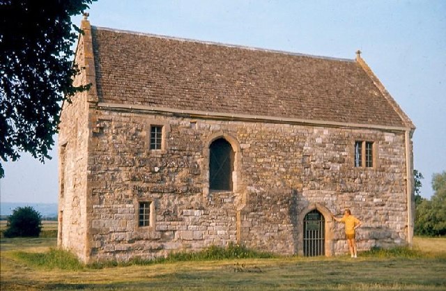
Meare is a village and civil parish in Somerset, England, north-west of Glastonbury on the Somerset Levels. The parish includes the village of Westhay. History Meare is a marshland village in typical Somerset "rhyne" country, standing on the site of pre-historic lake dwellings. The site of the Meare Lake Village is marked by groups of mounds. It has been occupied for thousands of years and some of the archaeological finds are now being reported. A 14th-century fish house at Meare was once the abode of Glastonbury Abbey fishermen, who fished the, now drained, Meare Pool. The Manor Farmhouse was built at the same time as the summer residence of the Abbots from Glastonbury Abbey and is now a farmhouse. Along with its outbuildings the farmhouse has been designated as a Grade I listed building. The parish was part of the hundred of Glaston Twelve Hides. Governance The parish council has responsibility for local issues, including setting an annual precept (local rate) to cover ... [...More Info...] [...Related Items...] OR: [Wikipedia] [Google] [Baidu] |
Peat Gatherers
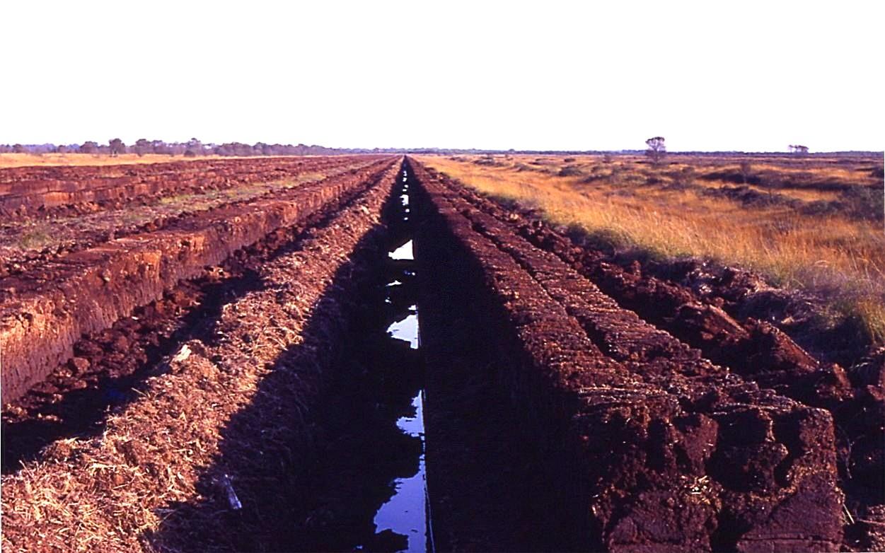
Peat is an accumulation of partially decayed vegetation or organic matter. It is unique to natural areas called peatlands, bogs, mires, moors, or muskegs. ''Sphagnum'' moss, also called peat moss, is one of the most common components in peat, although many other plants can contribute. The biological features of sphagnum mosses act to create a habitat aiding peat formation, a phenomenon termed 'habitat manipulation'. Soils consisting primarily of peat are known as histosols. Peat forms in wetland conditions, where flooding or stagnant water obstructs the flow of oxygen from the atmosphere, slowing the rate of decomposition. Peat properties such as organic matter content and saturated hydraulic conductivity can exhibit high spatial heterogeneity. Peatlands, particularly bogs, are the primary source of peat; although less common, other wetlands, including fens, pocosins and peat swamp forests, also deposit peat. Landscapes covered in peat are home to specific kinds of pla ... [...More Info...] [...Related Items...] OR: [Wikipedia] [Google] [Baidu] |


