|
Vesubiani
The Vesubiani or Vesubianii were a Gallic tribe dwelling in the valley of the Vésubie river during the Iron Age. Name They are mentioned as ''Vesubiani'' by Pliny (1st c. AD),Pliny. ''Naturalis Historia''3:20 and as ''Vesubianorum'' and ''(V)esubiani'' on inscriptions., s.v. ''Vesubiani''. Guy Barruol noted that the loss of initial ''V''- is common in Gaulish proper names, especially in Provence, and proposed to see the name as a variant of the personal name ''Esubiani''. He suggested that the name may have the same root as ''Esubii'', the name of a tribe in Brittany itself traditionally derived from the Celtic god ''Esus''. Alternatively, if the ''V''- was present in the original form, the name can be derived form the Gaulish root ''uesu''- ('valid, good, worthy'). Geography The Vesubiani dwelled in the valley of the Vésubie. Their territory was located southeast of the Ecdinii, north of the Nerusii and Vediantii, and northwest of the Intimilii., Map 16: Col. Forum Iulii ... [...More Info...] [...Related Items...] OR: [Wikipedia] [Google] [Baidu] |
Ecdinii
The Ecdinii or Ecdini were a Gallic tribe dwelling in the valley of the Tinée ( Alpes-Maritimes) during the Iron Age. Name They are mentioned as ''Ecdini'' by Pliny (1st c. AD), and as ''Ecdiniorum'' on the Arc of Susa., s.v. ''Ecdinii''. The meaning of the ethnonym remains obscure. If Celtic, ''Ecdinii'' is possibly formed with the prefix ''ec(s)''- ('out of, without') attached to -''dīn(i)''- ('shelter, protection'). Xavier Delamarre has thus proposed to translate *''Ec(s)-dīni-oi'' as the 'Homeless'. If this interpretation is correct, the name was probably an exonym given by a neighbouring tribe. Guy Barruol suggested that the name ''Tinius'' might be related. Geography The Ecdinii lived in the valley of the Tinée, a tributary of the Var river. Their territory was located west of the Vesubiani and Tyrii, east of the Nemeturii, north of the Nerusii and Vediantii, and south of the Savincates and Caturiges., Map 16: Col. Forum Iulii-Albingaunum, Map 17: Lugdunum. Ac ... [...More Info...] [...Related Items...] OR: [Wikipedia] [Google] [Baidu] |
Vediantii
The Vediantii were a Celto-Ligurian tribe dwelling on the Mediterranean coast, near present-day Nice, during the Iron Age and the Roman period. Name They are mentioned as ''Ou̓ediantíōn'' (Οὐεδιαντίων) by Ptolemy (2nd c. AD), and an ''oppidum Vediantiorum civitatis'' is documented by Pliny (1st c. AD)., s.v. ''Vediantii''. The ethnonym ''Vediantii'' is probably Celtic. It has been interpreted as 'pertaining to the praying ones' (from the root ''wed''- 'to pray' extended by a present participial formation -''ie-nt''-), as the 'Leaders' (from *''wedʰ-yā'' 'guidance, leadership'), or else as the 'Sages' (from *''weid-yā'' 'knowledge, doctrine'). Geography The Vediantii dwelled on the Mediterranean coast, between the river Var and the Mont Agel, around the Massaliote colony of Nikaea (modern Nice). Their territory was located east of the Deciates and Nerusii, west of the Intimilii, and south of the Vesubiani., Map 16: Col. Forum Iulii-Albingaunum. Their chief ... [...More Info...] [...Related Items...] OR: [Wikipedia] [Google] [Baidu] |
Arch Of Augustus (Susa)
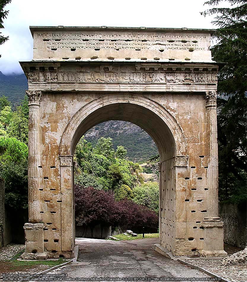
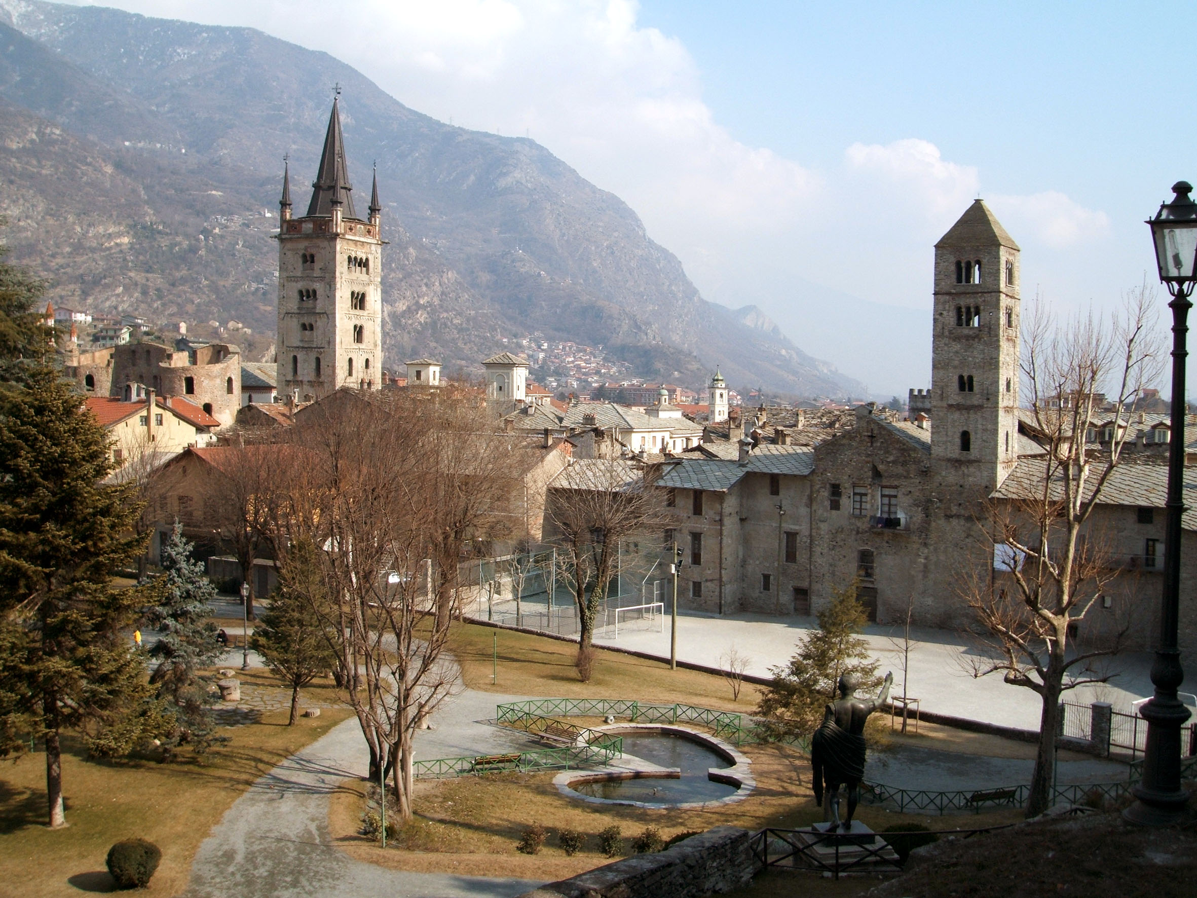
The Arch of Augustus is an important monument constructed in the city of Susa, Piedmont, in the province of Turin. It was originally built at the end of the 1st century BC to record the renewed alliance between Emperor Augustus and Marcus Julius Cottius, a Celto-Ligurian ruler who had been made king and Roman prefect of the Cottian Alps. The arch, together with other remains from the period, such as the Roman amphitheatre and a Roman aqueduct, underscore the importance that the city of Susa had during the Roman period. Description From above, the arch forms a rectangle 11.93 metres long and 7.3 metres wide. It rests on two large bases and there is only one archway. The white marble of the arch was sourced from a nearby quarries at Fornesto and Tre Piloni. The arch has a unique arcade, in which the archivolt is supported by pilasters. The entablature rests on four Corinthian columns placed at the extremities of each corner, such that a quarter of each drum is embedded in the m ... [...More Info...] [...Related Items...] OR: [Wikipedia] [Google] [Baidu] |
Tropaeum Alpium
The Tropaeum Alpium (Latin 'Trophy of the Alps', French: ''Trophée des Alpes''), is a Roman trophy (''tropaeum'') celebrating the emperor Augustus's decisive victory over the tribes who populated the Alps. The monument's ruins are in La Turbie (France), a few kilometers from the Principality of Monaco. Construction The Trophy was built c. 6 BC in honor of Augustus to celebrate his definitive victory over the 45 tribes who populated the Alps. The Alpine populations were defeated during the military campaign to subdue the Alps conducted by the Romans between 16 and 7 BC. The monument was built of stone from the Roman quarry located about 800 metres away, where traces of sections of carved columns are visible in the stone. The monument as partially restored is 35 meters high. When built, according to the architect, the base measured 35 meters in length, the first platform 12 meters in height, and the rotunda of 24 columns with its statue of an enthroned Augustus is 49 metres hi ... [...More Info...] [...Related Items...] OR: [Wikipedia] [Google] [Baidu] |
Gauls
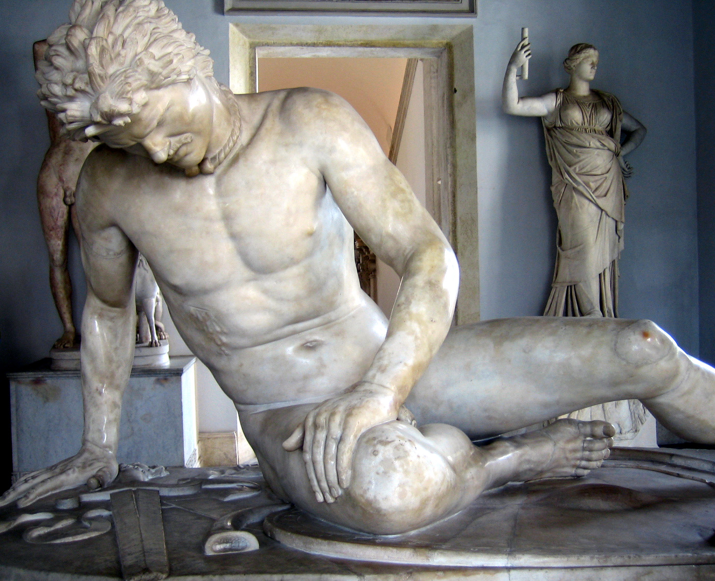
The Gauls ( la, Galli; grc, Γαλάται, ''Galátai'') were a group of Celtic peoples of mainland Europe in the Iron Age and the Roman period (roughly 5th century BC to 5th century AD). Their homeland was known as Gaul (''Gallia''). They spoke Gaulish, a continental Celtic language. The Gauls emerged around the 5th century BC as bearers of La Tène culture north and west of the Alps. By the 4th century BC, they were spread over much of what is now France, Belgium, Switzerland, Southern Germany, Austria, and the Czech Republic, by virtue of controlling the trade routes along the river systems of the Rhône, Seine, Rhine, and Danube. They reached the peak of their power in the 3rd century BC. During the 4th and 3rd centuries BC, the Gauls expanded into Northern Italy ( Cisalpine Gaul), leading to the Roman–Gallic wars, and into the Balkans, leading to war with the Greeks. These latter Gauls eventually settled in Anatolia, becoming known as Galatians. After the ... [...More Info...] [...Related Items...] OR: [Wikipedia] [Google] [Baidu] |
Cottius
Marcus Julius Cottius was King of the Celtic and Ligurian inhabitants of the mountainous Roman province then known as '' Alpes Taurinae'' and now as the Cottian Alps early in the 1st century BC. Son and successor to King Donnus, he negotiated a dependent status with Emperor Augustus that preserved considerable autonomy for his country, making him a Roman governor, and adopted Roman citizenship. Early relationship with Rome The friendship between Cottius's realm and Rome goes back at least to the reign of his father King Donnus; there is numismatic evidence which suggests that Donnus established friendly relations with Julius Caesar. As Caesar needed to cross the Cottii Regnum in 58 BC on his way to Gaul, he made an agreement with King Donnus to have his troops transported on his road as well as having a new paved road being built.Cornwell, H., Alpine Reactions to Roman Power, in Varga, R., Rusu-Bolindeț, V., (eds) Official Power and Local Elites in the Roman Provinces, p. ... [...More Info...] [...Related Items...] OR: [Wikipedia] [Google] [Baidu] |
Alpes Cottiae
The Alpes Cottiae (; English: 'Cottian Alps') were a small province of the Roman Empire founded in 63 AD by Emperor Nero. It was one of the three provinces straddling the Alps between modern France and Italy, along with the Alpes Graiae et Poeninae and Alpes Maritimae. The capital of the province was Segusio (modern Susa, Piedmont). Other important settlements were located at Eburodunum and Brigantio (Briançon). Named after the 1st-century BC ruler of the region, Marcus Julius Cottius, the toponym survives today in the Cottian Alps. History The province had its origin in a local chiefdom controlled by the enfranchised king Marcus Julius Donnus, who ruled over Ligurian tribes of the region by the middle of the 1st century BC. He was succeeded by his son, Marcus Julius Cottius, who offered no opposition to the integration of his realm into the Roman imperial system under Emperor Augustus in 15–14 BC, then kept on ruling on native tribes as a ''praefectus civitatium'' of ... [...More Info...] [...Related Items...] OR: [Wikipedia] [Google] [Baidu] |
Cemenelum
Cimiez (; Italian: ''Cimella'') is an upper class neighborhood in Nice, Southern France. The area contains the Musée Matisse and the ruins of ''Cemenelum'', capital of the Ancient Roman province Alpes Maritimae on the Ligurian coast. ''Cemenelum'' was an important rival of Nice, continuing to exist as a separate city till the time of the Lombard invasions. The ruins include an arena, amphitheater, thermal baths, and paleochristian basilica. During the Belle Epoque, Cimiez became a favourite holiday resort of European royalty: Victoria, Edward VII, George V, and Leopold II stayed in Cimiez. Close to the ruins is the Excelsior Régina Palace where Queen Victoria spent part of her long visits to the French Riviera. From 1974 to 2010, the Nice Jazz Festival was held on the grounds of the Roman Ruins in July each year (since 2011 the festival moved to the Place Masséna). Also here can be found the Cimiez Monastery and church that have been used by the Franciscan fr ... [...More Info...] [...Related Items...] OR: [Wikipedia] [Google] [Baidu] |
Intimilii
The Intimilii or Intemelii were a Ligurian tribe dwelling on the Mediterranean The Mediterranean Sea is a sea connected to the Atlantic Ocean, surrounded by the Mediterranean Basin and almost completely enclosed by land: on the north by Western and Southern Europe and Anatolia, on the south by North Africa, and on ... coast, around present-day Ventimiglia, during the Iron Age Europe, Iron Age and the Roman period. Name They are mentioned as ''Intimilii'' by Caelius Rufus (49 BC), ''Intemelii'' by Livy (late 1st c. BC), and as ''Intemélioi'' (Ἰντεμέλιοι) by Strabo (early 1st c. AD). The modern city of Ventimiglia, attested as ''oppidum Album Intimilium'' by Pliny the Elder, Pliny (1st c. AD) and as ''Álbion Intemélion'' (Ἄλβιον Ἰντεμέλιον) by Strabo, is named after the Ligurian tribe. The ethnic name ''Intimilii'' appears to be of Indo-European origin. Patrizia de Bernardo Stempel has proposed to interpret their chief town, ''Album In ... [...More Info...] [...Related Items...] OR: [Wikipedia] [Google] [Baidu] |
Vésubie
The Vésubie is a river in the southeast of France. It is a left tributary of the Var in the Maritime Alps. It is long. Its drainage basin is .Bassin versant : Vésubie (La) Observatoire Régional Eau et Milieux Aquatiques en PACA The source is in the Mercantour National park near the border with . The river flows through the town of which is a major center for hiking. It flows into the Var near [...More Info...] [...Related Items...] OR: [Wikipedia] [Google] [Baidu] |


