|
Vics Peak Fire
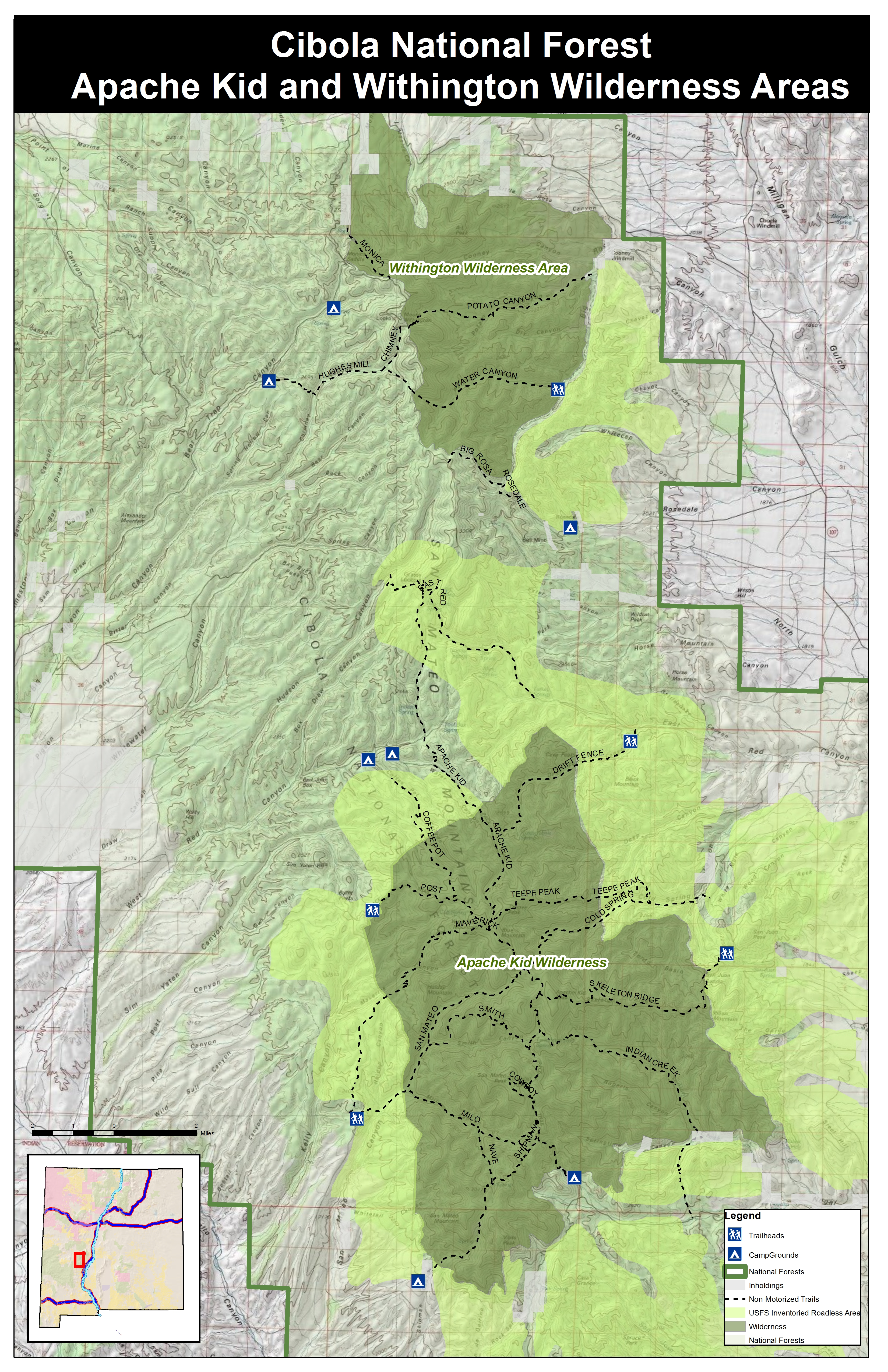
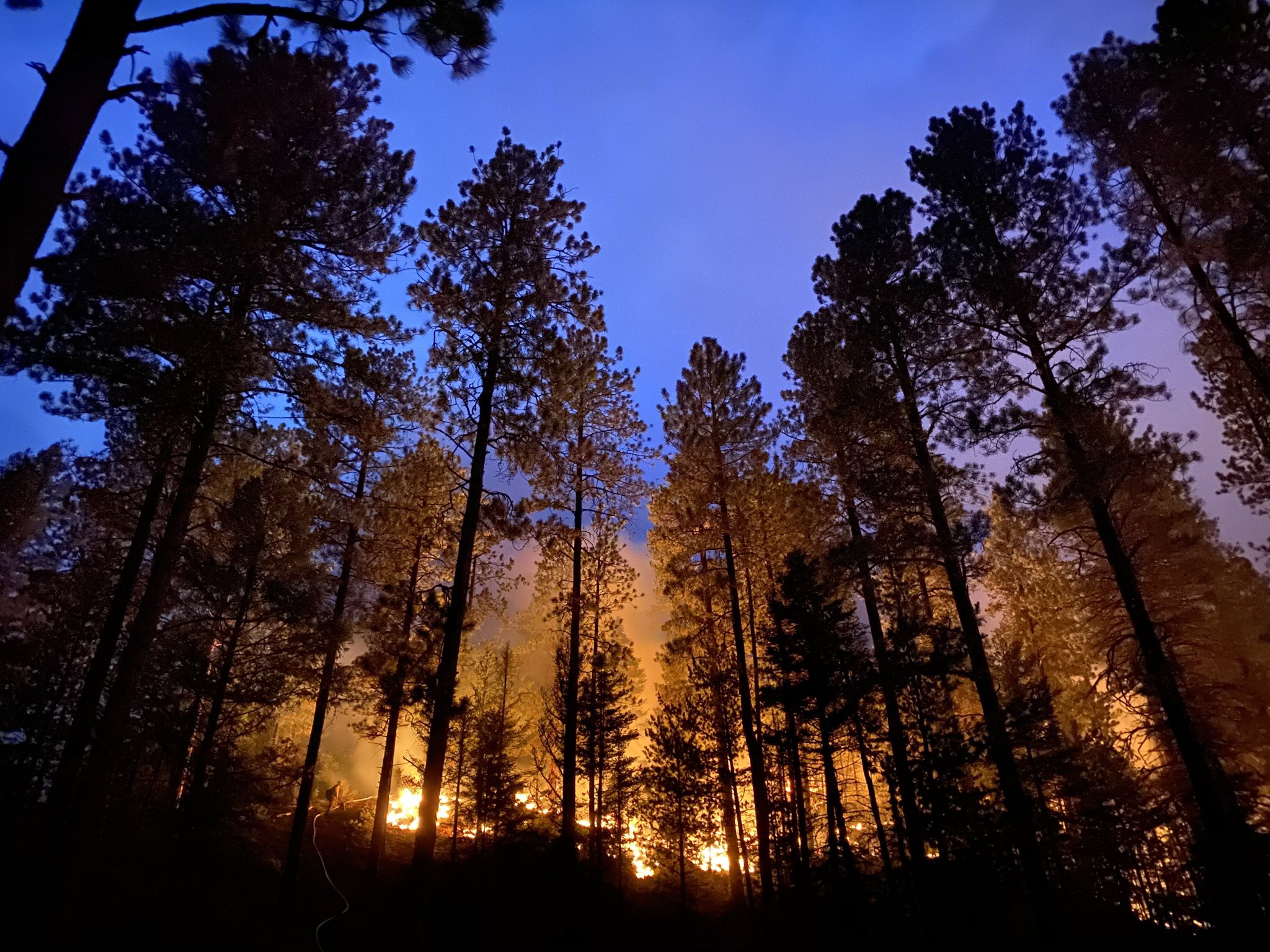
Vics Peak Fire was wildfire that burned in the Apache Kid Wilderness in the Cibola National Forest in New Mexico, United States. First reported on June 15, 2020, the fire was started by a lightning strike. The fire burned . It was contained on August 4, 2020. The fire threatened private property, utilities infrastructure, and natural resources in the area, including the habitat of the Mexican spotted owl. It also impacted recreational activities in the area due to trail and campground closures. Events June The Vics Peak Fire was first reported burning in a remote area of the Apache Kid Wilderness in Cibola National Forest on June 15, 2020. Started by a lightning strike, the fire grew moderately and was monitored by fire crews. However, on June 18, unexpected fire behavior caused the fire to grow in size and two days later it had burned . Fueled by mixed conifer, ponderosa pine, pinyon-juniper and mahogany, smoke was visible from Interstate 40, Highway 1, and Highway 107. ... [...More Info...] [...Related Items...] OR: [Wikipedia] [Google] [Baidu] |
Apache Kid Wilderness
Apache Kid Wilderness is a Wilderness area located within the Magdalena Ranger District of the Cibola National Forest in the state of New Mexico.Apache Kid Wilderness - Wilderness.net Straddling a southern portion of the San Mateo Mountains of southwestern , the area is characterized by rugged, narrow, and steep canyons bisecting high mountain peaks exceeding . The highest peak is [...More Info...] [...Related Items...] OR: [Wikipedia] [Google] [Baidu] |
Temporary Flight Restriction
The Federal Aviation Regulations (FARs) are rules prescribed by the Federal Aviation Administration (FAA) governing all aviation activities in the United States. The FARs comprise Title 14 of the Code of Federal Regulations (CFR). A wide variety of activities are regulated, such as aircraft design and maintenance, typical airline flights, pilot training activities, hot-air ballooning, lighter-than-air aircraft, man-made structure heights, obstruction lighting and marking, model rocket launches, commercial space operations, model aircraft operations, Unmanned Aircraft Systems (UAS) and kite flying. The rules are designed to promote safe aviation, protecting pilots, flight attendants, passengers and the general public from unnecessary risk. FAR vs. 14 CFR Since 1958, these rules have typically been referred to as "FARs", short for Federal Aviation Regulations. However, another set of regulations (Title 48) is titled "Federal Acquisitions Regulations", and this has led to confu ... [...More Info...] [...Related Items...] OR: [Wikipedia] [Google] [Baidu] |
June 2020 Events In The United States
June is the sixth month of the year in the Julian and Gregorian calendars and is the second of four months to have a length of 30 days, and the third of five months to have a length of less than 31 days. June contains the summer solstice in the Northern Hemisphere, the day with the most daylight hours, and the winter solstice in the Southern Hemisphere, the day with the fewest daylight hours (excluding polar regions in both cases). June in the Northern Hemisphere is the seasonal equivalent to December in the Southern Hemisphere and vice versa. In the Northern Hemisphere, the beginning of the traditional astronomical summer is 21 June (meteorological summer begins on 1 June). In the Southern Hemisphere, meteorological winter begins on 1 June. At the start of June, the sun rises in the constellation of Taurus; at the end of June, the sun rises in the constellation of Gemini. However, due to the precession of the equinoxes, June begins with the sun in the astrological sign of G ... [...More Info...] [...Related Items...] OR: [Wikipedia] [Google] [Baidu] |
2020 New Mexico Wildfires
The 2020 New Mexico wildfire season began in May 2020. At least 543 wildfires burned across the state, with fires burning as late as October 2020. The season was a part of the 2020 Western United States wildfire season. List of wildfires The following is a list of fires that burned more than , or produced significant structural damage or casualties. References 2020 New Mexico wildfires, 2020 in New Mexico, Wildfires Wildfires in New Mexico Lists of wildfires in the United States, New Mexico {{NewMexico-geo-stub ... [...More Info...] [...Related Items...] OR: [Wikipedia] [Google] [Baidu] |
Pankey Mine
Pankey is an Americanized form of French Panetier: occupational name for a pantryman from ''panetier''an agent derivative of ''pain'' ‘bread’. Alteration of the French ending ''-tier'' to English ''-key'' is typical for American French surnames. The American version originated with two French brothers who emigrated to Virginia in 1700, Jean and Etienne Panetier. /sup> It is also a North American last name and the Anglicized form of the German-language surname Pahnke, which in itself is derived from the diminutive form ''pank/panek'' of the Lower Sorbian/Upper Sorbian/Polish word '' pan'' for "man", "master" or "mister" (and can thus roughly be translated as "little gentleman", “young noble” or "junker").Rosa und Volker Kohlheim, ''Duden Familiennamen: Herkunft und Bedeutung von 20.000 Nachnamen, 495''Horst Naumann, ''Das große Buch der Familiennamen'', 209Hans Bahlow, ''Deutsches Namenlexikon: Familien- und Vornamen nach Ursprung und Sinn erklärt'', 372 Notable pe ... [...More Info...] [...Related Items...] OR: [Wikipedia] [Google] [Baidu] |
Burn Area Emergency Response
Burned area emergency response (BAER) is an emergency risk management reaction to post wildfire conditions that pose risks to human life and property or could further destabilize or degrade the burned lands. Even though wildfires are natural events, the presence of people and man-made structures in and adjacent to the burned area frequently requires continued emergency risk management actions. High severity wildfires pose a continuing flood, debris flow and mudflow risk to people living within and downstream from a burned watershed as well as a potential loss of desirable watershed values. The burned area emergency response risk management process begins during or shortly after wildfire containment with risk assessments evaluating the effects of the wildfire against values needing protection. These risk assessments can range from simple to complex. An organized interdisciplinary team of subject matter experts (e.g., hydrologists, soil scientists, botanists, cultural resource s ... [...More Info...] [...Related Items...] OR: [Wikipedia] [Google] [Baidu] |
Monsoon
A monsoon () is traditionally a seasonal reversing wind accompanied by corresponding changes in precipitation but is now used to describe seasonal changes in atmospheric circulation and precipitation associated with annual latitudinal oscillation of the Intertropical Convergence Zone (ITCZ) between its limits to the north and south of the equator. Usually, the term monsoon is used to refer to the rainy phase of a seasonally changing pattern, although technically there is also a dry phase. The term is also sometimes used to describe locally heavy but short-term rains. The major monsoon systems of the world consist of the West African, Asia–Australian, the North American, and South American monsoons. The term was first used in English in British India and neighboring countries to refer to the big seasonal winds blowing from the Bay of Bengal and Arabian Sea in the southwest bringing heavy rainfall to the area. Etymology The etymology of the word monsoon is not w ... [...More Info...] [...Related Items...] OR: [Wikipedia] [Google] [Baidu] |
Endangered Species List
On 29 January 2010, the IUCN Red List of Threatened Species identified 5220 (2754 animals, 1 fungus, 2464 plant, 1 protist) endangered species, subspecies and varieties, stocks and sub-populations. For IUCN lists of endangered species by kingdom, see: *Animals (kingdom Animalia) — IUCN Red List endangered species (Animalia) **Amphibians — List of endangered amphibians **Birds — List of endangered birds **Fish — List of endangered fishes **Invertebrates — List of endangered invertebrates ***Arthropods — List of endangered arthropods ****Insects — List of endangered insects ***Molluscs List of endangered molluscs **Mammals — List of endangered mammals **Reptiles — List of endangered reptiles *Fungi (kingdom Fungi) — IUCN Red List endangered species (Fungi) *Plants (kingdom Plantae Plants are predominantly photosynthetic eukaryotes of the kingdom Plantae. Historically, the plant kingdom encompassed all living things that were not animals, ... [...More Info...] [...Related Items...] OR: [Wikipedia] [Google] [Baidu] |
COVID-19
Coronavirus disease 2019 (COVID-19) is a contagious disease caused by a virus, the severe acute respiratory syndrome coronavirus 2 (SARS-CoV-2). The first known case was identified in Wuhan, China, in December 2019. The disease quickly spread worldwide, resulting in the COVID-19 pandemic. The symptoms of COVID‑19 are variable but often include fever, cough, headache, fatigue, breathing difficulties, loss of smell, and loss of taste. Symptoms may begin one to fourteen days after exposure to the virus. At least a third of people who are infected do not develop noticeable symptoms. Of those who develop symptoms noticeable enough to be classified as patients, most (81%) develop mild to moderate symptoms (up to mild pneumonia), while 14% develop severe symptoms ( dyspnea, hypoxia, or more than 50% lung involvement on imaging), and 5% develop critical symptoms ( respiratory failure, shock, or multiorgan dysfunction). Older people are at a higher risk of developing ... [...More Info...] [...Related Items...] OR: [Wikipedia] [Google] [Baidu] |
New Mexico State Road 107
State Road 107 (NM 107) is a state highway located entirely within Socorro County in the U.S. state of New Mexico. NM 107's southern terminus is at NM 1 southwest of the City of Socorro, and the northern terminus is at U.S. Route 60 (US 60) in the community of Magdalena. Major intersections See also * * References {{reflist 107 107 may refer to: *107 (number), the number *AD 107, a year in the 2nd century AD *107 BC, a year in the 2nd century BC *107 (New Jersey bus) See also *10/7 (other) *Bohrium Bohrium is a synthetic chemical element with the symbol Bh a ... Transportation in Socorro County, New Mexico ... [...More Info...] [...Related Items...] OR: [Wikipedia] [Google] [Baidu] |
Cibola National Forest
The Cibola National Forest (pronounced SEE-bo-lah) is a 1,633,783 acre (6,611.7 km2) United States National Forest in New Mexico, USA. The name Cibola is thought to be the original Zuni Indian name for their pueblos or tribal lands. The name was later interpreted by the Spanish to mean "buffalo." The forest is disjointed with lands spread across central and northern New Mexico, west Texas and Oklahoma. The Cibola National Forest is divided into four Ranger Districts: the Sandia, Mountainair, Mt. Taylor, and Magdalena. The Forest includes the San Mateo, Magdalena, Datil, Bear, Gallina, Manzano, Sandia, Mt. Taylor, and Zuni Mountains of west-central New Mexico. The Forest also manages four National Grasslands that stretch from northeastern New Mexico eastward into the Texas Panhandle and western Oklahoma. The Cibola National Forest and Grassland is administered by Region 3 of the United States Forest Service from offices in Albuquerque, New Mexico. Elevation ranges from 5,00 ... [...More Info...] [...Related Items...] OR: [Wikipedia] [Google] [Baidu] |
New Mexico State Road 1
State Road 1 (NM 1) is a state highway in New Mexico, that runs north from Mitchell Point to Socorro. Mostly paralleling Interstate 25 (I-25) throughout its entire length, it has a total length of , and is maintained by the New Mexico Department of Transportation (NMDOT). After an intersection with NM 107, NM 1 passes dirt roads leading to Fort Craig and San Marcial. It then goes through the Bosque del Apache National Wildlife Refuge, as well as the communities of San Antonio, where it intersects U.S. Route 380 (US 380), and Luis Lopez, before ending in Socorro. Route description State Road 1 begins at an interchange with Interstate 25, in Mitchell Point. It then quickly turns to parallel I-25, and travels alongside the freeway through barren terrain. The route begins to turn away from I-25 near the Sierra–Socorro county line, and connects to I-25 Exit 100 via a spur. In Socorro County, State Road 1 continues to parallel ... [...More Info...] [...Related Items...] OR: [Wikipedia] [Google] [Baidu] |


.jpg)


