|
Urnäsch
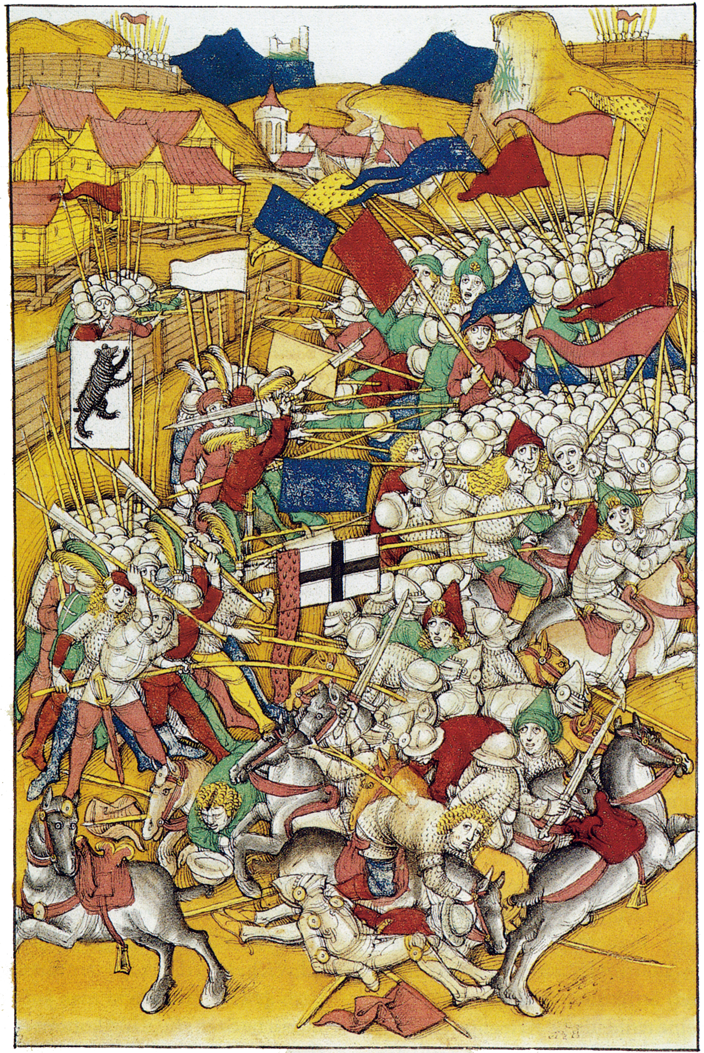
Urnäsch is a municipality in the canton of Appenzell Ausserrhoden, Switzerland. History In 831 AD a part of Urnäsch known as ''Färchen'' was first mentioned. In 1344 the village is sold to the German Earl ''Werdenberg'', but later the Abbey of St. Gall acquired the land. After the battles in ''Vögelinsegg'' (1403) and ''Stoss'' (1405) the land gained independence as part of Appenzell. In 1417 a church was built. This is considered the formal establishment of Urnäsch. There was a devastating fire in 1641. Geography Urnäsch has an area, , of . Of this area, 53.9% is used for agricultural purposes, while 41.1% is forested. Of the rest of the land, 3.4% is settled (buildings or roads) and the remainder (1.7%) is non-productive (rivers, glaciers or mountains). The elevation of the village is . The lowest elevation is the ''Murbach'' which is , while the highest point is the ''Petersalp'' which is . Demographics Urnäsch has a population () of 2,268, of which about 11.6% ... [...More Info...] [...Related Items...] OR: [Wikipedia] [Google] [Baidu] |
Gossau–Wasserauen Railway Line
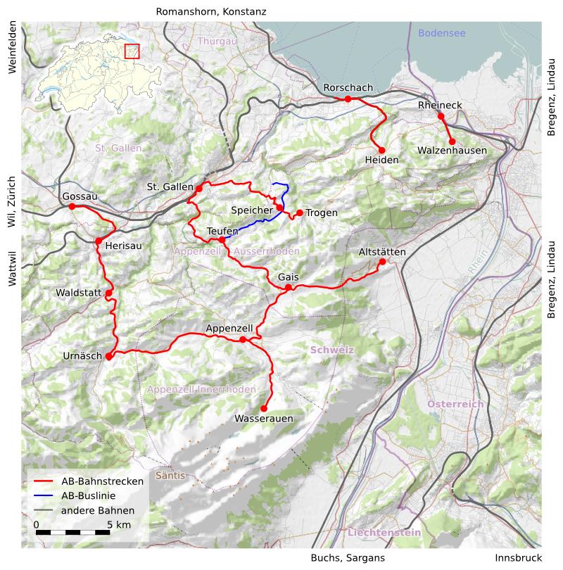
The Gossau–Wasserauen railway line is a metre-gauge adhesion railway of the Appenzell Railways (Appenzeller Bahnen; AB). It runs from Gossau via Appenzell to Wasserauen in Switzerland and is given the abbreviation of ''GAW'' by the operator. The connection was built and electrified in several stages by different companies and has been operating continuously since 1949. History The line was developed in the following stages: * Gossau SG–Herisau, opened on 1 October 1913 by the Appenzell Railway (''Appenzeller Bahn'', which has been called the ''Appenzeller Bahnen'' since 1988), replacing the St. Gallen Winkeln–Herisau section, opened on 12 April 1875 * Herisau–Urnäsch, opened on 21 September 1875 by the ''Schweizerische Gesellschaft für Localbahnen'' (Swiss company for local railways; called the Appenzell Railway from 1885) * Urnäsch–Appenzell, opened on 16 August (to Gontenbad) and 29 October 1886 by the Appenzell Railway * Gossau–Appenzell has been operated e ... [...More Info...] [...Related Items...] OR: [Wikipedia] [Google] [Baidu] |
Appenzell Railways
Appenzell Railways (german: Appenzeller Bahnen, AB) is a Swiss railway company with headquarters in Herisau. It operates a network of railways in the cantons of Appenzell Innerrhoden, Appenzell Ausserrhoden, St. Gallen and Thurgau. History The origins of the Appenzeller Bahnen company lies in a number of formerly independent companies and railway lines: * The Rorschach–Heiden-Bergbahn (RHB), which opened its line from Rorschach to Heiden in 1875. * The Appenzellerbahn (AB), which opened its line from Winkeln to Urnäsch via Herisau in 1875, with an extension from Urnäsch to Appenzell in 1886. In 1913, the line from Herisau to Winkeln was replaced by a new line to Gossau. * The Frauenfeld–Wil railway (FW) in 1887 * The St. Gallen–Gais–Appenzell-Bahn (SGA), which opened between St. Gallen and Gais in 1889, and was extended to Appenzell in 1904. * The Rheineck–Walzenhausen-Bergbahn (RhW), which opened between Rheineck and Walzenhausen in 1896. * The Trogen ... [...More Info...] [...Related Items...] OR: [Wikipedia] [Google] [Baidu] |
Nesslau-Krummenau
Nesslau is a municipality in the Toggenburg district of the canton of St. Gallen, Switzerland. The current municipality was formed in 2013 and includes the villages of Nesslau, Krummenau and Stein. History The area was incorporated into the domains of the counts of Toggenburg and the Abbey of St. Gall from the 12th century. Nesslau is first mentioned in 1178 as ''Mezellouo''. In 1261 it was mentioned as ''Nesselove'' and ''ze dem Wassere''. In 912 the hamlet of Lutenwil was mentioned as ''Lutherraheimara''. Krummenau is first mentioned in 1266 as ''Crumbenowe''. Sidwald developed into a regional cattle market from the 16th century. After a series of fires in the benedictine abbey of St. John's in the upper Toggenburg, the monastery was moved to ''Neu St. Johann'' near Sidwald in 1626. From 1831 to 2002, Nesslau was the administrative center of the constituency of '' Obertoggenburg''. The railway connecting Ebnat-Kappel to Nesslau-Neu St. Johann was opened in 1912, resultin ... [...More Info...] [...Related Items...] OR: [Wikipedia] [Google] [Baidu] |
Schönengrund
Schönengrund is a municipality in the canton of Appenzell Ausserrhoden in Switzerland. Geography Schönengrund has an area, , of . Of this area, 65.5% is used for agricultural purposes, while 30.1% is forested. The rest of the land, (4.4%) is settled. Demographics Schönengrund has a population () of 488, of which about 3.4% are foreign nationals.Brief Statistics for the half-canton accessed 15 September 2009 Over the last 10 years the population has decreased at a rate of -0.6%. Most of the population () speaks German (97.8%), with Serbo-Croatian being second most common ( 0.9%) and Spanish being third ( 0.4%). [...More Info...] [...Related Items...] OR: [Wikipedia] [Google] [Baidu] |
Schwellbrunn
Schwellbrunn is a municipality in the canton of Appenzell Ausserrhoden in Switzerland. History Schwellbrunn is first mentioned in 1268 as ''Schwellbrunnen''. Geography Schwellbrunn has an area, , of . Of this area, 61.5% is used for agricultural purposes, while 33.3% is forested. Of the rest of the land, 5.1% is settled (buildings or roads) and the remainder (0.1%) is non-productive (rivers, glaciers or mountains). The municipality is located in the former District of Hinterland. It consists of the linear village of Schwellbrunn and a number of scattered farm houses. Schwellbrunn is the highest elevated village in the canton at . The village overviews mountains and the Lake Constance (''Bodensee''). Demographics Schwellbrunn has a population () of 1,475, of which about 4.4% are foreign nationals. [...More Info...] [...Related Items...] OR: [Wikipedia] [Google] [Baidu] |
Waldstatt
Waldstatt is a municipality in the canton of Appenzell Ausserrhoden in Switzerland. History Waldstatt is first mentioned in 1374 as ''Ober Walstatt''. In 1415 it was mentioned as ''Wallstatt''. Geography Waldstatt has an area, , of . Of this area, 62.1% is used for agricultural purposes, while 25.9% is forested. Of the rest of the land, 10.6% is settled (buildings or roads) and the remainder (1.3%) is non-productive (rivers, glaciers or mountains). The municipality is located in the former District of Hinterland. It consists of the village of Waldstatt and a number of hamlets and farm houses. Demographics Waldstatt has a population () of 1,755, of which about 11.5% are foreign nationals. [...More Info...] [...Related Items...] OR: [Wikipedia] [Google] [Baidu] |
Appenzell Ausserrhoden
Appenzell Ausserrhoden (; in English sometimes Appenzell Outer Rhodes) (german: Kanton Appenzell Ausserrhoden; rm, Chantun Appenzell Dadora; french: Canton d'Appenzell Rhodes-Extérieures; it, Canton Appenzello Esterno) is one of the 26 cantons forming the Swiss Confederation. It is composed of twenty municipalities. The seat of the government and parliament is Herisau, and the seat of judicial authorities are in Trogen. It is traditionally considered a "half-canton", the other half being Appenzell Innerrhoden. Appenzell Ausserrhoden is located in the north east of Switzerland. Together with the canton of Appenzell Innerrhoden, it forms an enclave within the canton of St. Gallen. The canton is essentially located in the Alpine foothills of the Alpstein massif, culminating at the Säntis. Appenzell Ausserrhoden was part of the historical canton of Appenzell, which was divided into Appenzell Innerrhoden (Catholic) and Appenzell Ausserrhoden (Protestant) in 1597 as a result ... [...More Info...] [...Related Items...] OR: [Wikipedia] [Google] [Baidu] |
Appenzell
Appenzell is a historic canton in the northeast of Switzerland, and entirely surrounded by the canton of St. Gallen. Appenzell became independent of the Abbey of Saint Gall in 1403 and entered a league with the Old Swiss Confederacy in 1411, becoming a full member in 1513. It has been divided since into Appenzell Innerrhoden and Appenzell Ausserrhoden since 1597 as a result of the Swiss Reformation. The territory of Appenzell as a geographical entity is known as ''Appenzellerland'' while in political contexts, the two cantons (until 1999 half-cantons) are referred to as ''beide Appenzell'' ("both Appenzells"). History Foundation The name ''Appenzell'' derives from la, abbatis cella 'cell (i.e., estate) of the abbot'. This refers to the Abbey of St. Gall, which exerted a great influence on the area. By the middle of the 11th century the abbots of St Gall had established their power in the land later called Appenzell, which by that time was thoroughly Alemannic. By a ... [...More Info...] [...Related Items...] OR: [Wikipedia] [Google] [Baidu] |
Hundwil
Hundwil is a municipality in the canton of Appenzell Ausserrhoden in Switzerland. History Hundwil is first mentioned in 921 as ''Huntwilare''. Geography Hundwil has an area, , of . Of this area, 58.5% is used for agricultural purposes, while 31.2% is forested. Of the rest of the land, 3.2% is settled (buildings or roads) and the remainder (7.1%) is non-productive (rivers, glaciers or mountains). Hundwil was a capital of the former district Hinterland. It lies on the road between Herisau and Appenzell. The Landsgemeinde square and the ''Kronenplatz'', as well as the Protestant church are listed as heritage sites of national significance.Swiss inventory of cultural property of national and regional significance (1995), p. 55. It consists of the village of Hundwil, a number of hamlets, numerous individual farm houses and alpine herding camps. Until 1749, the municipality of Stein was part of Hundwil. The Hundwiler Höhi is a recreational destination at . The most well-k ... [...More Info...] [...Related Items...] OR: [Wikipedia] [Google] [Baidu] |
Precipitation (meteorology)
In meteorology, precipitation is any product of the condensation of atmospheric water vapor that falls under gravitational pull from clouds. The main forms of precipitation include drizzle, rain, sleet, snow, ice pellets, graupel and hail. Precipitation occurs when a portion of the atmosphere becomes saturated with water vapor (reaching 100% relative humidity), so that the water condenses and "precipitates" or falls. Thus, fog and mist are not precipitation but colloids, because the water vapor does not condense sufficiently to precipitate. Two processes, possibly acting together, can lead to air becoming saturated: cooling the air or adding water vapor to the air. Precipitation forms as smaller droplets coalesce via collision with other rain drops or ice crystals within a cloud. Short, intense periods of rain in scattered locations are called showers. Moisture that is lifted or otherwise forced to rise over a layer of sub-freezing air at the surface may be conden ... [...More Info...] [...Related Items...] OR: [Wikipedia] [Google] [Baidu] |


