|
United States Pacific Island Wildlife Refuges
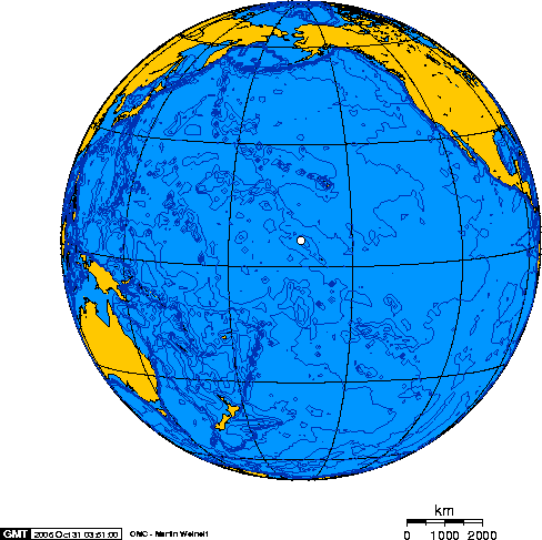
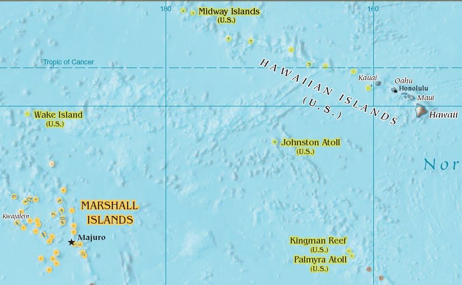
The Pacific Remote Islands Marine National Monument is a group of unorganized, mostly unincorporated United States Pacific Island territories managed by the United States Fish and Wildlife Service of the United States Department of the Interior and the National Oceanic and Atmospheric Administration (NOAA) of the United States Department of Commerce.Weekly Compilation of Presidential Documents: Monday, January 12, 2009 Volume 45—Number 1, Page 14 These remote refuges are "the most widespread collection of marine- and terrestrial-life protected areas on the planet under a single country's jurisdiction". They protect many |
Chelonia Mydas
The green sea turtle (''Chelonia mydas''), also known as the green turtle, black (sea) turtle or Pacific green turtle, is a species of large sea turtle of the family Cheloniidae. It is the only species in the genus ''Chelonia''. Its range extends throughout tropical and subtropical seas around the world, with two distinct populations in the Atlantic and Pacific Oceans, but it is also found in the Indian Ocean. The common name refers to the usually green fat found beneath its carapace, not to the color of its carapace, which is olive to black. The dorsoventrally flattened body of ''C. mydas'' is covered by a large, teardrop-shaped carapace; it has a pair of large, paddle-like flippers. It is usually lightly colored, although in the eastern Pacific populations, parts of the carapace can be almost black. Unlike other members of its family, such as the hawksbill sea turtle, ''C. mydas'' is mostly herbivorous. The adults usually inhabit shallow lagoons, feeding mostly on various spe ... [...More Info...] [...Related Items...] OR: [Wikipedia] [Google] [Baidu] |
Seabird
Seabirds (also known as marine birds) are birds that are adapted to life within the marine environment. While seabirds vary greatly in lifestyle, behaviour and physiology, they often exhibit striking convergent evolution, as the same environmental problems and feeding niches have resulted in similar adaptations. The first seabirds evolved in the Cretaceous period, and modern seabird families emerged in the Paleogene. In general, seabirds live longer, breed later and have fewer young than other birds do, but they invest a great deal of time in their young. Most species nest in colonies, which can vary in size from a few dozen birds to millions. Many species are famous for undertaking long annual migrations, crossing the equator or circumnavigating the Earth in some cases. They feed both at the ocean's surface and below it, and even feed on each other. Seabirds can be highly pelagic, coastal, or in some cases spend a part of the year away from the sea entirely. Seabird ... [...More Info...] [...Related Items...] OR: [Wikipedia] [Google] [Baidu] |
National Wildlife Refuge
National Wildlife Refuge System is a designation for certain protected areas of the United States managed by the United States Fish and Wildlife Service. The National Wildlife Refuge System is the system of public lands and waters set aside to conserve America's fish, wildlife, and plants. Since President Theodore Roosevelt designated Florida's Pelican Island National Wildlife Refuge as the first wildlife refuge in 1903, the system has grown to over 568 national wildlife refuges and 38 wetland management districts encompassing more than . Background The mission of the refuge system is "To administer a national network of lands and waters for the conservation, management, and where appropriate, restoration of fish, wildlife, and plant resources and their habitats within the United States for the benefit of the present and future generations of Americans" (National Wildlife Refuge System Improvement Act of 1997). The system maintains the biological integrity, diversity, and envi ... [...More Info...] [...Related Items...] OR: [Wikipedia] [Google] [Baidu] |
Wake Island
Wake Island ( mh, Ānen Kio, translation=island of the kio flower; also known as Wake Atoll) is a coral atoll in the western Pacific Ocean in the northeastern area of the Micronesia subregion, east of Guam, west of Honolulu, southeast of Tokyo and north of Majuro. The island is an unorganized, unincorporated territory belonging to (but not a part of) the United States that is also claimed by the Republic of the Marshall Islands. Wake Island is one of the most isolated islands in the world. The nearest inhabited island is Utirik Atoll in the Marshall Islands, to the southeast. The United States took possession of Wake Island in 1899. One of 14 U.S. insular areas, Wake Island is administered by the United States Air Force under an agreement with the U.S. Department of the Interior. The center of activity on the atoll is at Wake Island Airfield, which is primarily used as a mid-Pacific refueling stop for military aircraft and as an emergency landing area. The runway is ... [...More Info...] [...Related Items...] OR: [Wikipedia] [Google] [Baidu] |
Kingman Reef
Kingman Reef is a largely submerged, uninhabited, triangle-shaped reef, geologically an atoll, east-west and north-south, in the North Pacific Ocean, roughly halfway between the Hawaiian Islands and American Samoa. It has an area of 3 hectares (0.03 km2; 7.4 acres) and is one of the unincorporated territories of the United States in Oceania. The reef is administered by the United States Fish and Wildlife Service as the Kingman Reef National Wildlife Refuge. History Kingman Reef was discovered on June 14, 1798, by the American captain Edmund Fanning, of the ship ''Betsey''. It was first described by Captain W. E. Kingman (whose name the island bears) on November 29, 1853. It was claimed in 1860 by the United States Guano Company, under the name "Danger Reef". This claim was made under the United States’ Guano Islands Act of 1856 (although there is no evidence that guano existed or was ever mined on Kingman Reef). On May 10, 1922, Lorrin A. Thurston became the first ... [...More Info...] [...Related Items...] OR: [Wikipedia] [Google] [Baidu] |
Johnston Atoll
Johnston Atoll is an unincorporated territory of the United States, currently administered by the United States Fish and Wildlife Service (USFWS). Johnston Atoll is a National Wildlife Refuge and part of the Pacific Remote Islands Marine National Monument. It is closed to public entry, and limited access for management needs is only granted by Letter of Authorization from the United States Air Force and a Special Use Permit from the U.S. Fish and Wildlife Service. For nearly 70 years, the isolated atoll was under the control of the U.S. military. During that time, it was variously used as a naval refueling depot, an airbase, a testing site for nuclear and biological weapons, a secret missile base, and a site for the storage and disposal of chemical weapons and Agent Orange. Those activities left the area environmentally contaminated, and monitoring continues. The island is home to thriving communities of nesting seabirds and has significant marine biodiversity. USFWS teams ... [...More Info...] [...Related Items...] OR: [Wikipedia] [Google] [Baidu] |
Jarvis Island
Jarvis Island (; formerly known as Bunker Island or Bunker's Shoal) is an uninhabited coral island located in the South Pacific Ocean, about halfway between Hawaii and the Cook Islands. It is an unincorporated, unorganized territory of the United States, administered by the United States Fish and Wildlife Service of the United States Department of the Interior as part of the National Wildlife Refuge system. Unlike most coral atolls, the lagoon on Jarvis is wholly dry. Jarvis is one of the Line Islands and for statistical purposes is also grouped as one of the United States Minor Outlying Islands. Jarvis Island is the largest of three U.S. equatorial possessions, which include Baker Island and Howland Island. Geography and ecology While a few offshore anchorage spots are marked on maps, Jarvis island has no ports or harbors, and swift currents are a hazard. There is a boat landing area in the middle of the western shoreline near a crumbling day beacon, and another near the ... [...More Info...] [...Related Items...] OR: [Wikipedia] [Google] [Baidu] |
Howland Island
Howland Island () is an uninhabited coral island located just north of the equator in the central Pacific Ocean, about southwest of Honolulu. The island lies almost halfway between Hawaii and Australia and is an unorganized, unincorporated territory of the United States. Together with Baker Island it forms part of the Phoenix Islands. For statistical purposes, Howland is grouped as one of the United States Minor Outlying Islands. The island has an elongated cucumber-shape on a north–south axis, , and covers . Howland Island National Wildlife Refuge consists of the entire island and the surrounding of submerged land. The island is managed by the U.S. Fish and Wildlife Service as an insular area under the U.S. Department of the Interior and is part of the Pacific Remote Islands Marine National Monument. The atoll has no economic activity. It is perhaps best known as the island Amelia Earhart was searching for but never reached when her airplane disappeared on , during her pla ... [...More Info...] [...Related Items...] OR: [Wikipedia] [Google] [Baidu] |
Baker Island
Baker Island, formerly known as New Nantucket, is an uninhabited atoll just north of the Equator in the central Pacific Ocean about southwest of Honolulu. The island lies almost halfway between Hawaii and Australia. Its nearest neighbor is Howland Island, to the north-northwest; both have been claimed as territories of the United States since 1857, though the United Kingdom considered them part of the British Empire between 1897 and 1936. The island covers , with of coastline. The climate is equatorial, with little rainfall, constant wind, and strong sunshine. The terrain is low-lying and sandy: a coral island surrounded by a narrow fringing reef with a depressed central area devoid of a lagoon with its highest point being above sea level. The island now forms the Baker Island National Wildlife Refuge and is an unincorporated and unorganized territory of the U.S. which vouches for its defense. It is visited annually by the U.S. Fish and Wildlife Service. For statisti ... [...More Info...] [...Related Items...] OR: [Wikipedia] [Google] [Baidu] |
Barack Obama
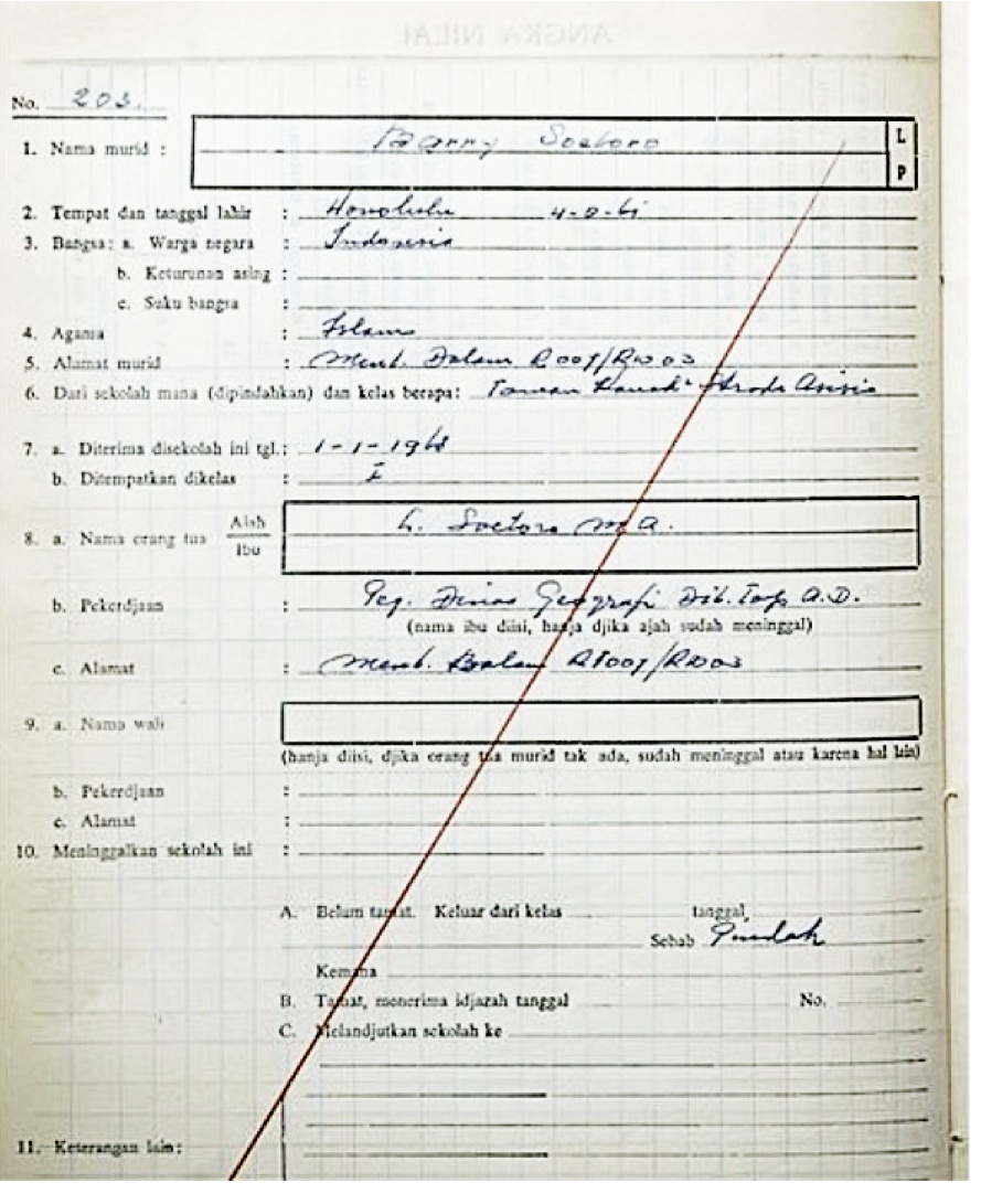
Barack Hussein Obama II ( ; born August 4, 1961) is an American politician who served as the 44th president of the United States from 2009 to 2017. A member of the Democratic Party (United States), Democratic Party, Obama was the first African-American president of the United States. He previously served as a U.S. senator from Illinois from 2005 to 2008 and as an Illinois state senator from 1997 to 2004, and previously worked as a civil rights lawyer before entering politics. Obama was born in Honolulu, Hawaii. After graduating from Columbia University in 1983, he worked as a Community organizing, community organizer in Chicago. In 1988, he enrolled in Harvard Law School, where he was the first black president of the ''Harvard Law Review''. After graduating, he became a civil rights attorney and an academic, teaching constitutional law at the University of Chicago Law School from 1992 to 2004. Turning to elective politics, he Illinois Senate career of Barack Obama, repre ... [...More Info...] [...Related Items...] OR: [Wikipedia] [Google] [Baidu] |
Northwestern Hawaiian Islands
The Northwestern Hawaiian Islands or Leeward Hawaiian Islands are a series of islands and atolls in the Hawaiian island chain located northwest (in some cases, far to the northwest) of the islands of Kauai and Niihau. Politically, they are all part of Honolulu County in the U.S. state of Hawaii, except Midway Atoll, which is a territory distinct from the State of Hawaii, and grouped as one of the United States Minor Outlying Islands. The United States Census Bureau defines this area, except Midway, as Census Tract 114.98 of Honolulu County. Its total land area is . All the islands except Nihoa are north of the Tropic of Cancer, making them the only islands in Hawaii that lie outside the tropics. The Northwestern or Leeward Hawaiian Islands include: *Nihoa (Moku Manu) at * Necker (Mokumanamana) at * French Frigate Shoals (Kānemilohai) at *Gardner Pinnacles (Pūhāhonu) at * Maro Reef (Nalukākala) at * Laysan (Kauō) at * Lisianski (Papaāpoho) at * Pearl and Hermes Ato ... [...More Info...] [...Related Items...] OR: [Wikipedia] [Google] [Baidu] |
Papahānaumokuākea Marine National Monument
The Papahānaumokuākea Marine National Monument (PMNM) (roughly ) is a World Heritage listed U.S. National Monument encompassing of ocean waters, including ten islands and atolls of the Northwestern Hawaiian Islands. It was created in June 2006 with and expanded in August 2016 by moving its border to the limit of the exclusive economic zone, making it one of the world's largest protected areas. It is internationally known for its cultural and natural values as follows: The area has deep cosmological and traditional significance for living Native Hawaiian culture, as an ancestral environment, as an embodiment of the Hawaiian concept of kinship between people and the natural world, and as the place where it is believed that life originates and to where the spirits return after death. On two of the islands, Nihoa and Mokumanamana, there are archaeological remains relating to pre-European settlement and use. Much of the monument is made up of pelagic and deepwater habita ... [...More Info...] [...Related Items...] OR: [Wikipedia] [Google] [Baidu] |


