|
Uynarey
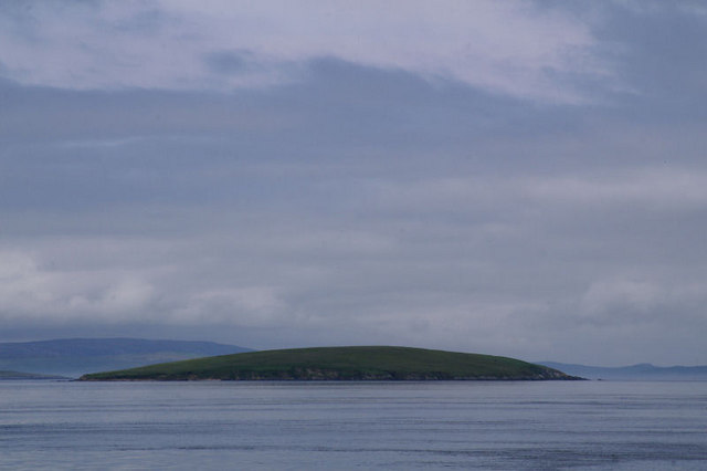
Uynarey is one of the Shetland islands in Yell Sound, just to the north of Bigga, and east of Brother Island. It is an RSPB reserve.Haswell-Smith, Hamish. (2004) The Scottish Islands. Edinburgh. Canongate. The name comes from the Norse for "venerated island", and this may reflect a Culdee connection. Geology and geography There is a small bay in the east - Haa Geo, and a cave in the west. The North end is called "the Niv". It is approximately long. The geology is moine gneiss and quartzite. It has steep sides, and is over tall. File:View over Uynarey - geograph.org.uk - 1744904.jpg, View over Uynarey looking across the islands of Uynarey and Brother Isle in Yell Sound towards Ronas Hill. File:North end of Uynarey - geograph.org.uk - 873714.jpg, North end of Uynarey File:South end of Uynarey - geograph.org.uk - 873710.jpg, :South end of Uynarey See also * List of islands of Scotland This is a list of islands of Scotland, the mainland of which is part of the island ... [...More Info...] [...Related Items...] OR: [Wikipedia] [Google] [Baidu] |
List Of Islands Of Scotland
This is a list of islands of Scotland, the mainland of which is part of the island of Great Britain. Also included are various other related tables and lists. The definition of an offshore island used in this list is "land that is surrounded by seawater on a daily basis, but not necessarily at all stages of the tide, excluding human devices such as bridges and causeways". Scotland has over 790 offshore islands, most of which are to be found in four main groups: Shetland, Orkney, and the Hebrides, sub-divided into the Inner Hebrides and Outer Hebrides. There are also clusters of islands in the Firth of Clyde, Firth of Forth, and Solway Firth, and numerous small islands within the many bodies of fresh water in Scotland including Loch Lomond and Loch Maree. The largest island is Lewis and Harris which extends to 2,179 square kilometres, and there are a further 200 islands which are greater than 40 hectares in area. Of the remainder, several such as Staffa and the Flannan ... [...More Info...] [...Related Items...] OR: [Wikipedia] [Google] [Baidu] |
Shetland
Shetland, also called the Shetland Islands and formerly Zetland, is a subarctic archipelago in Scotland lying between Orkney, the Faroe Islands and Norway. It is the northernmost region of the United Kingdom. The islands lie about to the northeast of Orkney, from mainland Scotland and west of Norway. They form part of the border between the Atlantic Ocean to the west and the North Sea to the east. Their total area is ,Shetland Islands Council (2012) p. 4 and the population totalled 22,920 in 2019. The islands comprise the Shetland constituency of the Scottish Parliament. The local authority, the Shetland Islands Council, is one of the 32 council areas of Scotland. The islands' administrative centre and only burgh is Lerwick, which has been the capital of Shetland since 1708, before which time the capital was Scalloway. The archipelago has an oceanic climate, complex geology, rugged coastline, and many low, rolling hills. The largest island, known as " the Mainland", ... [...More Info...] [...Related Items...] OR: [Wikipedia] [Google] [Baidu] |
Bigga, Shetland
Bigga is an uninhabited island in the Yell Sound between the Mainland and Yell in Shetland, Scotland. Geography and geology Just over long, Bigga is in size, and is tall at its highest point. Bigga is a long thin island with a "head" and a "torso". The neck is formed by the bays of Wester Hevda Wick and Easter Hevda Wick, "hevda wick" being an anglicisation of the Norn/Old Norse for "seaweed bay". Cattle and sheep were formerly farmed here. The island belongs at the same time in common to the civil parishes of Delting and Yell. Bigga consists of Moine bedrock of coarsely-crystalline gneiss and quartzite. History It is thought that the name comes from the Old Norse ''bygðey'' meaning "island of the building", which may refer to an old structure. In the southern part of the island, there is an old well, chapel and burial ground. There is a small prehistoric cairn in the north of the island. In the north is the remains of Norrabister, the island's "settlement". The ''Pr ... [...More Info...] [...Related Items...] OR: [Wikipedia] [Google] [Baidu] |
Brother Isle
Brother Isle ( non, breiðare øy meaning broad beach island) is a small, uninhabited island in Shetland, Scotland. It lies between the islands of Yell and Shetland Mainland. It is in size. Geography and geology The island's rock is "undifferentiated moine gneiss and quartzite." History It is sometimes assumed that the "Brother" in the name refers to Culdees/'' papar'' who were frequent inhabitants of the smaller islands, however, in this case there is no apparent evidence for this claim, and it would appear to be merely folk etymology. At only 40 hectares in size (about 1/6 of a sq. mile) and surrounded by tidal rips Rips may refer to: Places * Rips, Sarandë, location in Albania on the border with Greece * De Rips, a village in the Netherlands People * Eliyahu Rips (born 1948), Israeli mathematician * Lance Rips (born 1948), American psychologist * Nicolaia ... which make landing difficult, it would seem unlikely that the island has ever been inhabited. Howeve ... [...More Info...] [...Related Items...] OR: [Wikipedia] [Google] [Baidu] |
RSPB
The Royal Society for the Protection of Birds (RSPB) is a charitable organisation registered in England and Wales and in Scotland. It was founded in 1889. It works to promote conservation and protection of birds and the wider environment through public awareness campaigns, petitions and through the operation of nature reserves throughout the United Kingdom. In 2020/21 the RSPB had an income of £117 million, 2,000 employees, 12,000 volunteers and 1.1 million members (including 195,000 youth members), making it one of the world's largest wildlife conservation organisations. The RSPB has many local groups and maintains 222 nature reserves. As founders, chief officers and presidents, women have been at the helm of the RSPB for over 85 years. History The origins of the RSPB lie with two groups of women, both formed in 1889: * The Plumage League was founded by Emily Williamson at her house in Didsbury, Manchester, as a protest group campaigning against the use of great creste ... [...More Info...] [...Related Items...] OR: [Wikipedia] [Google] [Baidu] |
Culdee
The Culdees ( ga, Céilí Dé, "Spouses of God") were members of ascetic Christian monastic and eremitical communities of Ireland, Scotland, Wales and England in the Middle Ages. Appearing first in Ireland and subsequently in Scotland, attached to cathedral or collegiate churches, they lived in monastic fashion though not taking monastic vows.D'Alton, Edward Alfred (1908). " Culdees". In ''Catholic Encyclopedia''. 4. New York: Robert Appleton Company. Etymology According to the Swiss theologian Philip Schaff, the term Culdee or Ceile De, or Kaledei, first appeared in the 8th century. While "giving rise to much controversy and untenable theories", it probably means servants or worshippers of God. The term was applied to anchorites, who, in entire seclusion from society, sought the perfection of sanctity. They afterward associated themselves into communities of hermits and were finally brought under canonical rule along with the secular clergy. It was at the time the name Culd ... [...More Info...] [...Related Items...] OR: [Wikipedia] [Google] [Baidu] |
Geo (landscape)
A geo or gio ( , from Old Norse gjá) is an inlet, a gully or a narrow and deep cleft in the face of a cliff. Geos are common on the coastline of the Shetland and Orkney islands. They are created by the wave driven erosion of cliffs along faults and bedding planes in the rock. Geos may have sea caves at their heads. Such sea caves may collapse, extending the geo, or leaving depressions inland from the geo. Geos can also be created from this process. See also *, a place in the Faroes * *Sea cave A sea cave, also known as a littoral cave, is a type of cave formed primarily by the wave action of the sea. The primary process involved is erosion. Sea caves are found throughout the world, actively forming along present coastlines and as reli ... References External linksShetlopedia Geo Coastal and oceanic landforms Landforms of Shetland {{Shetland-geo-stub ... [...More Info...] [...Related Items...] OR: [Wikipedia] [Google] [Baidu] |
Moine Supergroup
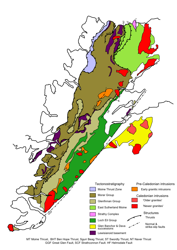
The Moine Supergroup is a sequence of Neoproterozoic metamorphic rocks that form the dominant outcrop of the Scottish Highlands between the Moine Thrust Belt to the northwest and the Great Glen Fault to the southeast. The sequence is metasedimentary in nature and was metamorphosed and deformed in a series of tectonic events during the Late Proterozoic and Early Paleozoic. It takes its name from '' A' Mhòine'', a peat bog in northern Sutherland. Distribution The main outcrop of the Moine series lies northwest of the Great Glen Fault, structurally above the Moine Thrust to the west forming what is known as the Northern Highlands Terrane. A smaller area of similar rocks that are correlated with these, outcrop within the 'Grampian Terrane' to the southeast of the Great Glen. Moinian rocks are also recognised on Mull, Orkney and Shetland. Stratigraphy The Moine Supergroup has been subdivided into different groups or divisions. The relationship between individual groups in terms ... [...More Info...] [...Related Items...] OR: [Wikipedia] [Google] [Baidu] |
Gneiss
Gneiss ( ) is a common and widely distributed type of metamorphic rock. It is formed by high-temperature and high-pressure metamorphic processes acting on formations composed of igneous or sedimentary rocks. Gneiss forms at higher temperatures and pressures than schist. Gneiss nearly always shows a banded texture characterized by alternating darker and lighter colored bands and without a distinct cleavage. Gneisses are common in the ancient crust of continental shields. Some of the oldest rocks on Earth are gneisses, such as the Acasta Gneiss. Description Orthogneiss from the Czech Republic In traditional English and North American usage, a gneiss is a coarse-grained metamorphic rock showing compositional banding ( gneissic banding) but poorly developed schistosity and indistinct cleavage. In other words, it is a metamorphic rock composed of mineral grains easily seen with the unaided eye, which form obvious compositional layers, but which has only a weak tendency to fra ... [...More Info...] [...Related Items...] OR: [Wikipedia] [Google] [Baidu] |
Quartzite
Quartzite is a hard, non- foliated metamorphic rock which was originally pure quartz sandstone.Essentials of Geology, 3rd Edition, Stephen Marshak, p 182 Sandstone is converted into quartzite through heating and pressure usually related to tectonic compression within orogenic belts. Pure quartzite is usually white to grey, though quartzites often occur in various shades of pink and red due to varying amounts of hematite. Other colors, such as yellow, green, blue and orange, are due to other minerals. The term ''quartzite'' is also sometimes used for very hard but unmetamorphosed sandstones that are composed of quartz grains thoroughly cemented with additional quartz. Such sedimentary rock has come to be described as orthoquartzite to distinguish it from metamorphic quartzite, which is sometimes called metaquartzite to emphasize its metamorphic origins. Quartzite is very resistant to chemical weathering and often forms ridges and resistant hilltops. The nearly pure silica co ... [...More Info...] [...Related Items...] OR: [Wikipedia] [Google] [Baidu] |


