|
Tir-Phil
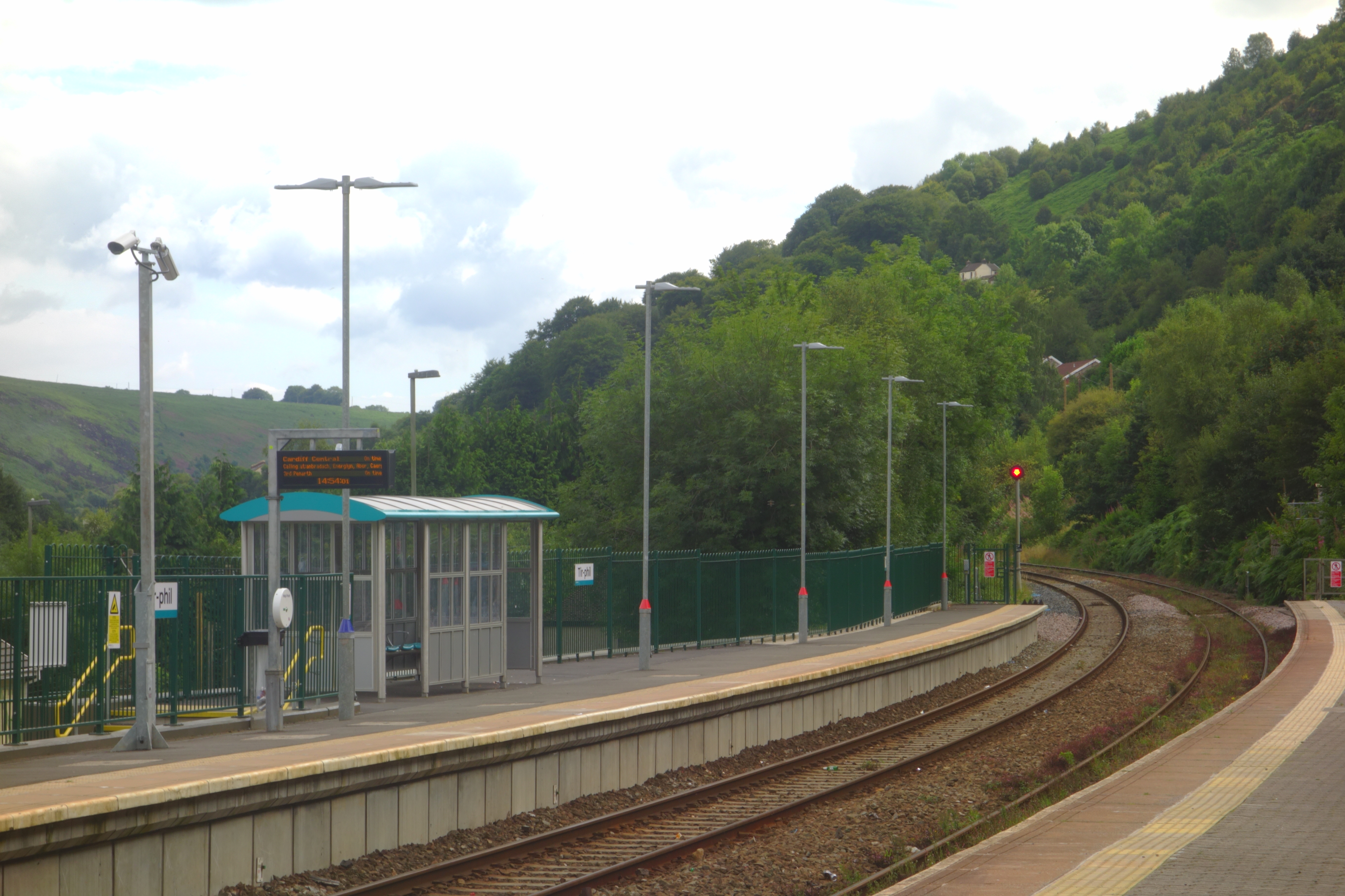
Tir-Phil is a village near the town of New Tredegar in the Caerphilly county borough of south Wales. The village of Tir-Phil and New Tredegar itself are served by Tir-Phil railway station , symbol_location = gb , symbol = rail , image = NNW through Tirphil railway station (geograph 6419901).jpg , borough = Tir-Phil, Caerphilly , country = Wales , coordinates = , .... Tir-Phil was also an electoral ward to Rhymney Valley District Council between 1973 and the council's dissolution in 1996. References Villages in Caerphilly County Borough {{Caerphilly-geo-stub ... [...More Info...] [...Related Items...] OR: [Wikipedia] [Google] [Baidu] |
Tir-Phil Railway Station
, symbol_location = gb , symbol = rail , image = NNW through Tirphil railway station (geograph 6419901).jpg , borough = Tir-Phil, Caerphilly , country = Wales , coordinates = , grid_name = Grid reference , grid_position = , manager = Transport for Wales , platforms = 2 , code = TIR , classification = DfT category F2 , opened = 1858 , mpassengers = , footnotes = Passenger statistics from the Office of Rail and Road , mapframe=yes , mapframe-zoom = 13 Tir-Phil railway station is a railway station serving the village of Tir-Phil and the town of New Tredegar, south Wales. It is a stop on the Rhymney Line of the Valley Lines network. Work to extend the platform to take the proposed six car trains has now been completed. History Tir-Phil station was opened in 1858 by the Rhymney Railway on the line from Cardiff to Rhy ... [...More Info...] [...Related Items...] OR: [Wikipedia] [Google] [Baidu] |
Caerphilly (county Borough)
Caerphilly County Borough ( cy, Bwrdeistref Sirol Caerffili) is a county borough in the south-east of Wales. It is governed by Caerphilly County Borough Council. Its main and largest town is Caerphilly. Other towns in the county borough are Bedwas, Risca, Ystrad Mynach, Newbridge, Blackwood, Bargoed, New Tredegar and Rhymney. Geography Caerphilly County Borough is in southeast Wales and straddles the border between the historic counties of Glamorgan and Monmouthshire. It is bordered by Cardiff to the southwest, Newport to the southeast, Torfaen to the east, Blaenau Gwent to the northeast, Powys to the north, Merthyr Tydfil to the northwest and Rhondda Cynon Taf to the west. The northern part of the borough is formed by the broad expanse of the Rhymney Valley. The Rhymney River rises in the hills in the north and flows southwards for about thirty miles, looping round to the east just to the north of Caerphilly before reaching the Bristol Channel. Some of the large ... [...More Info...] [...Related Items...] OR: [Wikipedia] [Google] [Baidu] |
New Tredegar
New Tredegar ( cy, Tredegar Newydd) is a former mining town and community in the Rhymney Valley, Caerphilly county borough, Wales, within the historic boundaries of Monmouthshire. New Tredegar is now home to 'The Winding House', a county museum which opened in 2008. It is controlled by CCBC Museums service and the Friends of the Winding House community group. The area is rich in the mining heritage of the South Wales mining industry. The area is supported by two primary schools; White Rose Primary school and Phillipstown Primary school. The area also contains a number of religious buildings including; Saint Dingat's Church and the Presbyterian Church of Wales. Along with other parts of Rhymney, New Tredegar had Welsh speakers in the community the Welsh-only monuments in the local cemetery testify to the strength of the language locally in the first quarter of the 20th century. Sport Capel Golf Club, New Tredegar, (now defunct) first appeared in the mid 1930s and continued int ... [...More Info...] [...Related Items...] OR: [Wikipedia] [Google] [Baidu] |
Wales
Wales ( cy, Cymru ) is a country that is part of the United Kingdom. It is bordered by England to the east, the Irish Sea to the north and west, the Celtic Sea to the south west and the Bristol Channel to the south. It had a population in 2021 of 3,107,500 and has a total area of . Wales has over of coastline and is largely mountainous with its higher peaks in the north and central areas, including Snowdon (), its highest summit. The country lies within the north temperate zone and has a changeable, maritime climate. The capital and largest city is Cardiff. Welsh national identity emerged among the Celtic Britons after the Roman withdrawal from Britain in the 5th century, and Wales was formed as a kingdom under Gruffydd ap Llywelyn in 1055. Wales is regarded as one of the Celtic nations. The conquest of Wales by Edward I of England was completed by 1283, though Owain Glyndŵr led the Welsh Revolt against English rule in the early 15th century, and briefly re-establis ... [...More Info...] [...Related Items...] OR: [Wikipedia] [Google] [Baidu] |
Electoral Ward
A ward is a local authority area, typically used for electoral purposes. In some countries, wards are usually named after neighbourhoods, thoroughfares, parishes, landmarks, geographical features and in some cases historical figures connected to the area (e.g. William Morris Ward in the London Borough of Waltham Forest, England). It is common in the United States for wards to simply be numbered. Origins The word “ward”, for an electoral subdivision, appears to have originated in the Wards of the City of London, where gatherings for each ward known as “wardmotes” have taken place since the 12th century. The word was much later applied to divisions of other cities and towns in England and Wales and Ireland. In parts of northern England, a ''ward'' was an administrative subdivision of a county, very similar to a hundred in other parts of England. Present day In Australia, Canada, New Zealand, Sri Lanka, South Africa, the United Kingdom, and the United States, wards are ... [...More Info...] [...Related Items...] OR: [Wikipedia] [Google] [Baidu] |

