|
Theodore Bent
James Theodore Bent (30 March 1852 – 5 May 1897) was an English explorer, archaeologist, and author. Biography James Theodore Bent was born in Liverpool on 30 March 1852, the son of James (1807-1876) and Eleanor (née Lambert, c.1811-1873) Bent of Baildon House, Baildon, near Bradford, Yorkshire, where Bent lived in his boyhood. He was educated at Malvern Wells preparatory school, Repton School, and Wadham College, Oxford, where he graduated in 1875. His paternal grandparents were William (1769-1820) and Sarah (née Gorton) Bent; it was this William Bent who founded Bent's Breweries, a successful business which, in various guises, was still in existence into the 1970s, and which helped generate the family's wealth. One of Bent's uncles, Sir John Bent, the brewer, was Liverpool mayor in 1850–51. In 1877, Bent married Mabel Hall-Dare (1847-1929) who became his companion, photographer, and diarist on all his travels. From the time of their marriage, they went abroad nearly e ... [...More Info...] [...Related Items...] OR: [Wikipedia] [Google] [Baidu] |
Liverpool
Liverpool is a city and metropolitan borough in Merseyside, England. With a population of in 2019, it is the 10th largest English district by population and its metropolitan area is the fifth largest in the United Kingdom, with a population of 2.24 million. On the eastern side of the Mersey Estuary, Liverpool historically lay within the ancient hundred of West Derby in the county of Lancashire. It became a borough in 1207, a city in 1880, and a county borough independent of the newly-created Lancashire County Council in 1889. Its growth as a major port was paralleled by the expansion of the city throughout the Industrial Revolution. Along with general cargo, freight, and raw materials such as coal and cotton, merchants were involved in the slave trade. In the 19th century, Liverpool was a major port of departure for English and Irish emigrants to North America. It was also home to both the Cunard and White Star Lines, and was the port of registry of the ocean lin ... [...More Info...] [...Related Items...] OR: [Wikipedia] [Google] [Baidu] |
Aegean Sea
The Aegean Sea ; tr, Ege Denizi (Greek: Αιγαίο Πέλαγος: "Egéo Pélagos", Turkish: "Ege Denizi" or "Adalar Denizi") is an elongated embayment of the Mediterranean Sea between Europe and Asia. It is located between the Balkans and Anatolia, and covers an area of some 215,000 square kilometres. In the north, the Aegean is connected to the Marmara Sea and the Black Sea by the straits of the Dardanelles and the Bosphorus. The Aegean Islands are located within the sea and some bound it on its southern periphery, including Crete and Rhodes. The sea reaches a maximum depth of 2,639m to the west of Karpathos. The Thracian Sea and the Sea of Crete are main subdivisions of the Aegean Sea. The Aegean Islands can be divided into several island groups, including the Dodecanese, the Cyclades, the Sporades, the Saronic islands and the North Aegean Islands, as well as Crete and its surrounding islands. The Dodecanese, located to the southeast, includes the islands of R ... [...More Info...] [...Related Items...] OR: [Wikipedia] [Google] [Baidu] |
East Africa
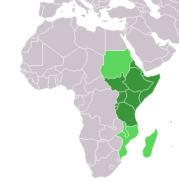
East Africa, Eastern Africa, or East of Africa, is the eastern subregion of the African continent. In the United Nations Statistics Division scheme of geographic regions, 10-11-(16*) territories make up Eastern Africa: Due to the historical Omani Empire and colonial territories of the British East Africa Protectorate and German East Africa, the term ''East Africa'' is often (especially in the English language) used to specifically refer to the area now comprising the three countries of Kenya, Tanzania, and Uganda. However, this has never been the convention in many other languages, where the term generally had a wider, strictly geographic context and therefore typically included Djibouti, Eritrea, Ethiopia, and Somalia.Somaliland is not included in the United Nations geoscheme, as it is internationally recognized as a part of Somalia. *Tanzania, Kenya, Uganda, Rwanda, Burundi, Democratic Republic of Congo and South Sudan are members of the East African Community. The f ... [...More Info...] [...Related Items...] OR: [Wikipedia] [Google] [Baidu] |
Mashonaland
Mashonaland is a region in northern Zimbabwe. Currently, Mashonaland is divided into four provinces, * Mashonaland West * Mashonaland Central * Mashonaland East * Harare The Zimbabwean capital of Harare, a province unto itself, lies entirely in Mashonaland. Provincial history It was originally one of the regions that the country was divided into following occupation by the Pioneer Column in 1890 and designated the extent of territory under administration of the British South Africa Company as distinct from the remainder of the territory that was directly under the control of the Matabele king, Lobengula, which was named Matabeleland when it was occupied in 1893. The two had separate administrations for part of the BSA Company colonial period. Revolt broke out against the British South Africa Company in 1896, led by priests of the Mwari religion. The British prevailed, executed some leaders, and tried to reform the system. In 1923, the territory became part of the self-go ... [...More Info...] [...Related Items...] OR: [Wikipedia] [Google] [Baidu] |
South Africa
South Africa, officially the Republic of South Africa (RSA), is the Southern Africa, southernmost country in Africa. It is bounded to the south by of coastline that stretch along the Atlantic Ocean, South Atlantic and Indian Oceans; to the north by the neighbouring countries of Namibia, Botswana, and Zimbabwe; and to the east and northeast by Mozambique and Eswatini. It also completely Enclave and exclave, enclaves the country Lesotho. It is the southernmost country on the mainland of the Old World, and the List of countries and dependencies by population, second-most populous country located entirely south of the equator, after Tanzania. South Africa is a biodiversity hotspot, with unique biomes, plant and animal life. With over Demographics of South Africa, 60 million people, the country is the world's List of countries and dependencies by population, 24th-most populous nation and covers an area of . South Africa has three capital cities, with the executive, judicial and le ... [...More Info...] [...Related Items...] OR: [Wikipedia] [Google] [Baidu] |
Cilicia Trachea
Cilicia (); el, Κιλικία, ''Kilikía''; Middle Persian: ''klkyʾy'' (''Klikiyā''); Parthian language, Parthian: ''kylkyʾ'' (''Kilikiyā''); tr, Kilikya). is a geographical region in southern Anatolia in Turkey, extending inland from the northeastern coasts of the Mediterranean Sea. Cilicia has a population ranging over six million, concentrated mostly at the Cilicia plain. The region includes the provinces of Mersin Province, Mersin, Adana Province, Adana, Osmaniye Province, Osmaniye, along with parts of Hatay Province, Hatay and Antalya Province, Antalya. Geography Cilicia is extended along the Mediterranean Sea, Mediterranean coast east from Pamphylia to the Nur Mountains, which separates it from Syria. North and east of Cilicia lie the rugged Taurus Mountains that separate it from the high central plateau of Anatolia, which are pierced by a narrow gorge called in antiquity the Cilician Gates. Ancient Cilicia was naturally divided into Cilicia Trachea and Cilicia Pedi ... [...More Info...] [...Related Items...] OR: [Wikipedia] [Google] [Baidu] |
Naser Al-Din Shah Qajar
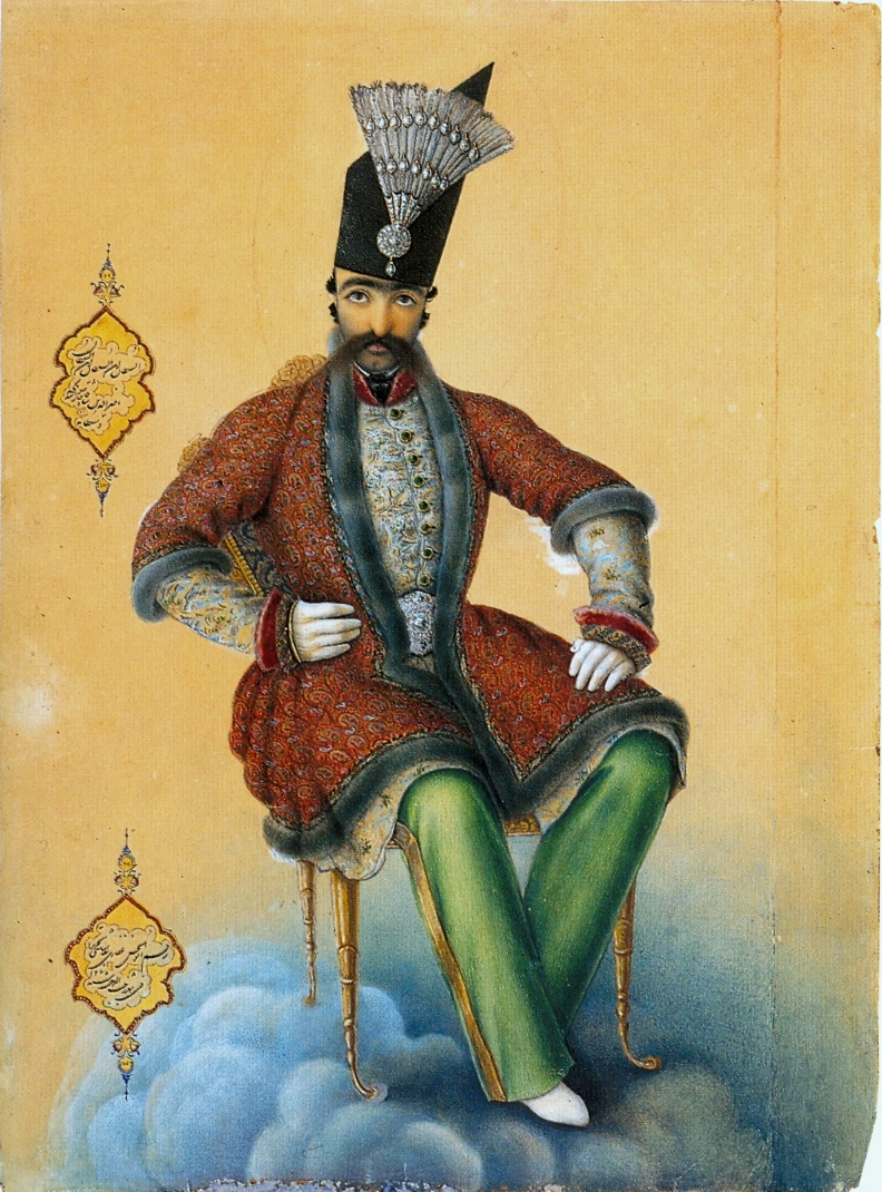
Naser al-Din Shah Qajar ( fa, ناصرالدینشاه قاجار; 16 July 1831 – 1 May 1896) was the fourth Shah of Qajar Iran from 5 September 1848 to 1 May 1896 when he was assassinated. He was the son of Mohammad Shah Qajar and Malek Jahan Khanom and the third longest reigning monarch in Iranian history after Shapur II of the Sassanid dynasty and Tahmasp I of the Safavid dynasty. Nasser al-Din Shah had sovereign power for close to 51 years. He was the first modern Persian monarch who formally visited Europe and wrote of his travels in his memoirs. A modernist, he allowed the establishment of newspapers in the country and made use of modern forms of technology such as telegraphs, photography and also planned concessions for railways and irrigation works. Despite his modernizing reforms on education, his tax reforms were abused by people in power, and the government was viewed as corrupt and unable to protect commoners from abuse by the upper class which led to in ... [...More Info...] [...Related Items...] OR: [Wikipedia] [Google] [Baidu] |
Phoenicia
Phoenicia () was an ancient thalassocratic civilization originating in the Levant region of the eastern Mediterranean, primarily located in modern Lebanon. The territory of the Phoenician city-states extended and shrank throughout their history, and they possessed several enclaves such as Arwad and Tell Sukas (modern Syria). The core region in which the Phoenician culture developed and thrived stretched from Tripoli and Byblos in northern Lebanon to Mount Carmel in modern Israel. At their height, the Phoenician possessions in the Eastern Mediterranean stretched from the Orontes River mouth to Ashkelon. Beyond its homeland, the Phoenician civilization extended to the Mediterranean from Cyprus to the Iberian Peninsula. The Phoenicians were a Semitic-speaking people of somewhat unknown origin who emerged in the Levant around 3000 BC. The term ''Phoenicia'' is an ancient Greek exonym that most likely described one of their most famous exports, a dye also known as Tyrian ... [...More Info...] [...Related Items...] OR: [Wikipedia] [Google] [Baidu] |
Persian Gulf
The Persian Gulf ( fa, خلیج فارس, translit=xalij-e fârs, lit=Gulf of Fars, ), sometimes called the ( ar, اَلْخَلِيْجُ ٱلْعَرَبِيُّ, Al-Khalīj al-ˁArabī), is a mediterranean sea in Western Asia. The body of water is an extension of the Indian Ocean located between Iran and the Arabian Peninsula.United Nations Group of Experts on Geographical NameWorking Paper No. 61, 23rd Session, Vienna, 28 March – 4 April 2006. accessed October 9, 2010 It is connected to the Gulf of Oman in the east by the Strait of Hormuz. The Shatt al-Arab river delta forms the northwest shoreline. The Persian Gulf has many fishing grounds, extensive reefs (mostly rocky, but also coral), and abundant pearl oysters, however its ecology has been damaged by industrialization and oil spills. The Persian Gulf is in the Persian Gulf Basin, which is of Cenozoic origin and related to the subduction of the Arabian Plate under the Zagros Mountains. The current f ... [...More Info...] [...Related Items...] OR: [Wikipedia] [Google] [Baidu] |
Bahrein Islands
This is a list of islands of the ''Kingdom of Bahrain'', which includes most of the archipelago known as the . The Kingdom consists of 33 natural islands and a number of man-made ones. Islands In addition to the Bahrain Islands, the Kingdom consists of: * The Amwaj Islands, an artificial island chain which is already settled and in the final phase of construction. * The Hawar Islands, split between Bahrain and Qatar, most of which were granted to Bahrain by an international court in 2001. * The Jidda Islands consist of three deserted islands. This island is situated in the west side of Bahrain. * The Nurana Islands consist of two islets. This island is situated in the east north side of Bahrain. * The Reef Islands consist of 16 islands. Former islands Islands that once existed but which now, because of land reclamation, are no longer separated from larger land masses: * Arad Island, including Arad Fort, now joined to Muharraq. * Halat Bu Maher, now joined to Muharraq * ... [...More Info...] [...Related Items...] OR: [Wikipedia] [Google] [Baidu] |
Antiparos
Antiparos ( ell, Αντίπαρος; grc, Ὠλίαρος, Oliaros; la, Oliarus; is a small island in the southern Aegean, at the heart of the Cyclades, which is less than one nautical mile (1.9 km) from Paros, the port to which it is connected with a local ferry. Saliagos island is the most ancient settlement in the Cyclades, and Despotiko, an uninhabited island in the southwest of Antiparos, is a place of great archaeological importance. The Community of Antiparos was founded in 1914 and was promoted to a municipality in 2010 with the implementation of the Law "Kallikrates", under the principle of "each island a municipality". It occupies an area of 45.182 square km, including the island of Antiparos and Despotiko. It has, according to the 2011 census, 1,211 permanent residents and a density of 27 inhabitants per km². The island's economy is based on tourism, fishing, farming and less on agriculture in the plains. It is known for its white houses, cobbled streets and the ... [...More Info...] [...Related Items...] OR: [Wikipedia] [Google] [Baidu] |
Anatolia
Anatolia, tr, Anadolu Yarımadası), and the Anatolian plateau, also known as Asia Minor, is a large peninsula in Western Asia and the westernmost protrusion of the Asian continent. It constitutes the major part of modern-day Turkey. The region is bounded by the Turkish Straits to the northwest, the Black Sea to the north, the Armenian Highlands to the east, the Mediterranean Sea to the south, and the Aegean Sea to the west. The Sea of Marmara forms a connection between the Black and Aegean seas through the Bosporus and Dardanelles straits and separates Anatolia from Thrace on the Balkan peninsula of Southeast Europe. The eastern border of Anatolia has been held to be a line between the Gulf of Alexandretta and the Black Sea, bounded by the Armenian Highlands to the east and Mesopotamia to the southeast. By this definition Anatolia comprises approximately the western two-thirds of the Asian part of Turkey. Today, Anatolia is sometimes considered to be synonymous w ... [...More Info...] [...Related Items...] OR: [Wikipedia] [Google] [Baidu] |


