|
The Archaeological Conservancy
The Archaeological Conservancy is a 501(c)3 non-profit organization that acquires and preserves archaeological sites in the United States. Whereas nearly every other nation protects all archaeological sites within its borders as part of its national patrimony, in the United States archaeological resources on private land are the private property of the landowner.Michel, Mark,Private Property-National Legacy, ''The SAA Archaeological Record'', May 2003 As a result, archaeological sites in the United States are subject to destruction by urban development and sprawl, mechanized agricultural and land-leveling, and commercial looting to fuel the antiquities trade.Davis, Hester,The Crisis in American Archeology, ''Science'' 175:267-272 (1972). By the 1970s the extent of archaeological site loss was increasing recognized as a crisis for the scientific study of the nation's past. History, organization and means of operation The Conservancy was established in 1979 by Mark Michel, who cont ... [...More Info...] [...Related Items...] OR: [Wikipedia] [Google] [Baidu] |
Non-profit Organization
A nonprofit organization (NPO) or non-profit organisation, also known as a non-business entity, not-for-profit organization, or nonprofit institution, is a legal entity organized and operated for a collective, public or social benefit, in contrast with an entity that operates as a business aiming to generate a Profit (accounting), profit for its owners. A nonprofit is subject to the non-distribution constraint: any revenues that exceed expenses must be committed to the organization's purpose, not taken by private parties. An array of organizations are nonprofit, including some political organizations, schools, business associations, churches, social clubs, and consumer cooperatives. Nonprofit entities may seek approval from governments to be Tax exemption, tax-exempt, and some may also qualify to receive tax-deductible contributions, but an entity may incorporate as a nonprofit entity without securing tax-exempt status. Key aspects of nonprofits are accountability, trustworth ... [...More Info...] [...Related Items...] OR: [Wikipedia] [Google] [Baidu] |
El Malpais National Monument
El Malpais National Monument is a National Monument located in western New Mexico, in the Southwestern United States. The name El Malpais is from the Spanish term '' Malpaís'', meaning ''badlands'', due to the extremely barren and dramatic volcanic field that covers much of the park's area. It is on the Trails of the Ancients Byway, one of the designated New Mexico Scenic Byways.Trail of the Ancients. New Mexico Tourism Department. Retrieved August 14, 2014. Geography and geology |
National Register Of Historic Places
The National Register of Historic Places (NRHP) is the United States federal government's official list of districts, sites, buildings, structures and objects deemed worthy of preservation for their historical significance or "great artistic value". A property listed in the National Register, or located within a National Register Historic District, may qualify for tax incentives derived from the total value of expenses incurred in preserving the property. The passage of the National Historic Preservation Act (NHPA) in 1966 established the National Register and the process for adding properties to it. Of the more than one and a half million properties on the National Register, 95,000 are listed individually. The remainder are contributing resources within historic districts. For most of its history, the National Register has been administered by the National Park Service (NPS), an agency within the U.S. Department of the Interior. Its goals are to help property owners an ... [...More Info...] [...Related Items...] OR: [Wikipedia] [Google] [Baidu] |
Royal Blockhouse
Royal Blockhouse is a historic archaeological site located near Moreau, Saratoga County, New York. It was the site of a three-story, 90-feet square, blockhouse constructed in 1758 as part of the Fort Edward / Rogers Island complex. It was built during the French and Indian War and was part of England's largest fortification in North America during the war. The property was acquired by the Archaeological Conservancy of Albuquerque, New Mexico in 2011. It was listed on the National Register of Historic Places The National Register of Historic Places (NRHP) is the United States federal government's official list of districts, sites, buildings, structures and objects deemed worthy of preservation for their historical significance or "great artistic ... in 2012. References Archaeological sites on the National Register of Historic Places in New York (state) Buildings and structures completed in 1758 Buildings and structures in Saratoga County, New York National Re ... [...More Info...] [...Related Items...] OR: [Wikipedia] [Google] [Baidu] |
Poverty Point Culture
The Poverty Point culture is the archaeological culture of a prehistoric indigenous peoples who inhabited a portion of North America's lower Mississippi Valley and surrounding Gulf coast from about 1730 – 1350 BC. Archeologists have identified more than 100 sites belonging to this mound-builder culture, who also formed a large trading network throughout much of the eastern part of what is now the United States. History Preceding the Poverty Point Culture is the Watson Brake site in present-day Ouachita Parish, Louisiana, where eleven earthwork mounds were built beginning about 3500 BC. Watson Brake is one of the earliest mound complexes in the Americas. Next oldest is the Poverty Point Culture, which thrived from 1730 - 1350 BC, during the late Archaic period in North America. Evidence of this mound builder culture has been found at more than 100 sites, including the Jaketown Site near Belzoni, Mississippi. The largest and best-known site is at Poverty Point, located on ... [...More Info...] [...Related Items...] OR: [Wikipedia] [Google] [Baidu] |
Jaketown Site
Jaketown Site ( 22 HU 505) is an archaeological site with two prehistoric earthwork mounds in Humphreys County, Mississippi, United States. While the mounds have not been excavated, distinctive pottery shards found in the area lead scholars to date the mounds' construction and use to the Mississippian culture period, roughly 1100 CE to 1500 CE. The site was a complex regional trade center that developed and was inhabited much earlier, from 2000-600 BCE, during the Poverty Point culture within the Late Archaic period of the United States. This culture is seen in more than 100 sites on both sides of the Mississippi River, from present-day Louisiana to Mississippi; it also was linked to more distant areas through a trading network. The site has evidence of trade in raw materials and manufacture of finished items that were distributed through the network throughout the Eastern United States. The largest and most elaborate earthwork complex of the period is at Poverty Point, Lou ... [...More Info...] [...Related Items...] OR: [Wikipedia] [Google] [Baidu] |
New Philadelphia Town Site
The New Philadelphia National Historic Site is the original site of the now-vanished town of New Philadelphia, Illinois. It is located near the city of Barry, in Pike County. Founded in 1836, New Philadelphia was the first town in the United States platted and registered by an African American before the American Civil War. The founder, Free Frank McWorter (1777–1854), was a former slave who was able to save money from work and his own business to purchase the freedom of himself, his wife, and over-time, 13 members of his family in Kentucky. Several of his freedom purchases were funded by the sale of New Philadelphia lots. The town was integrated and reached a population of about 160 near the close of the Civil War in 1865. A few years later, the town was bypassed by the railroad leading to its eventual decline; the town lots were generally turned into farmland in the late 19th century, although some survived into the 1920s. The town site was listed on the National Regis ... [...More Info...] [...Related Items...] OR: [Wikipedia] [Google] [Baidu] |
Silver Mound Archeological District
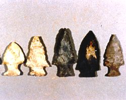
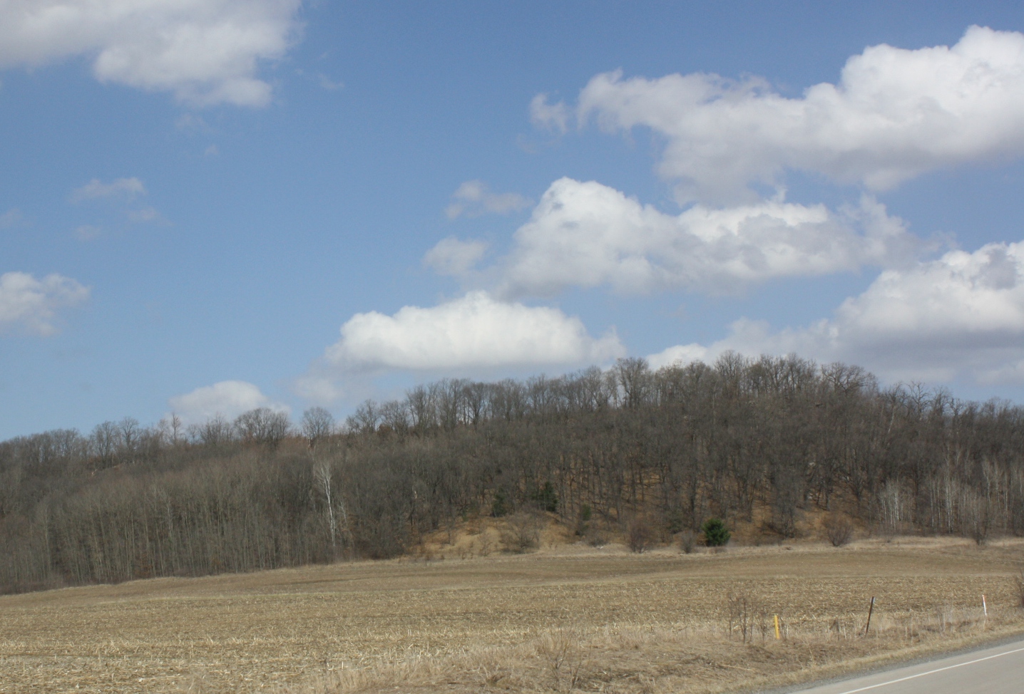
Silver Mound is a sandstone hill in Wisconsin where American Indians quarried quartzite for stone tools. Tools made from Silver Mound's quartzite have been found as far away as Kentucky. The oldest have been dated to around 11,000 years ago, so they provide clues about the first people in Wisconsin. Silver Mound Archeological District was declared a National Historic Landmark in 2006. Geography and geology Silver Mound is in the Hixton, Wisconsin, town of Hixton, Jackson County, Wisconsin. Its sandstone was laid down long ago in the Cambrian Period, like many other bluffs in the area. But in this sandstone a layer of very hard stone called silicated quartzite or orthoquartzite formed. Stone like this is fairly uncommon. With simple tools it can be broken into pieces and shaped into points through a process called knapping. And this quartzite from Silver Mound can be distinguished by technical analyses from similar orthoquartzite from other locations. Human use The earliest kno ... [...More Info...] [...Related Items...] OR: [Wikipedia] [Google] [Baidu] |
Lamoka Site
The Lamoka site, or simply Lamoka, is an archaeological site near Tyrone, in Schuyler County, New York that was named a National Historic Landmark in 1961. According to the National Park Service, "This site provided the first clear evidence of an Archaic hunting and gathering culture in the Northeastern United States (c.3500 BC)". More properly known as the Lamoka Lake Site, after the lake of the same name located nearby, this archaeological site, occupied by Late Archaic hunter-gatherers approximately 4,500 years before present, is one of the most important Archaic Period sites in North America due to its seminal role in the identification and naming of a hunting and gathering culture subsequent to Paleo-Indian culture and preceding pottery-using Woodland cultures. As such, the Lamoka Lake site is often considered the type site of the Archaic Period of North American prehistory. The first professional excavations at the site were conducted between 1925 and 1928 by the Rochest ... [...More Info...] [...Related Items...] OR: [Wikipedia] [Google] [Baidu] |
Tumacácori National Historical Park
Tumacácori National Historical Park is located in the upper Santa Cruz River Valley in Santa Cruz County, southern Arizona. The park consists of in three separate units. The park protects the ruins of three Spanish mission communities, two of which are National Historic Landmark sites. It also contains the landmark 1937 Tumacácori Museum building, also a National Historic Landmark. History The first Spanish Colonial Jesuit missions in the locale were established in 1691, Mission San Cayetano de Tumacácori (at Tumacácori) and Mission Los Santos Ángeles de Guevavi, are the two oldest missions in southern Arizona. The Franciscan church of Mission San José de Tumacácori, across the river from and replacing Mission San Cayetano de Tumacácori, was built in the 1750s. The third mission was established in 1756, Mission San Cayetano de Calabazas. The Mission San José de Tumacácori complex is open to the public. Nearby are the park's visitor center and the Tumacácori M ... [...More Info...] [...Related Items...] OR: [Wikipedia] [Google] [Baidu] |
Mission Los Santos Ángeles De Guevavi
Mission Los Santos Ángeles de Guevavi ( ood, Geʼe Wawhia) was founded by Jesuit missionary Fathers Kino and Salvatierra in 1691 as La Misión de San Gabriel de Guevavi, a district headquarters in what is now Arizona, near Tumacácori. Subsequent missionaries called it San Rafael and San Miguel, resulting in the common historical name of Los Santos Ángeles de Guevavi. History Father Juan de San Martín was assigned as the first resident priest (he left in 1703), with construction of a small chapel in 1701. Guevavi was designated as ''cabecera'' (headquarters) that same year. The ruins of the mission church are situated amidst a native Sobaipuri or O'odham (Upper Pima) settlement. Fathers Agustín de Campos and Luis Xavier Velarde visited occasionally after that. Father Grazhoffer reestablished a second church Guevavi in 1732. In 1751, Father Garrucho contracted the building of a new and larger 15 foot by 50 foot church, the ruins of which still exist today. The mother of Jua ... [...More Info...] [...Related Items...] OR: [Wikipedia] [Google] [Baidu] |


