|
The Alban Way
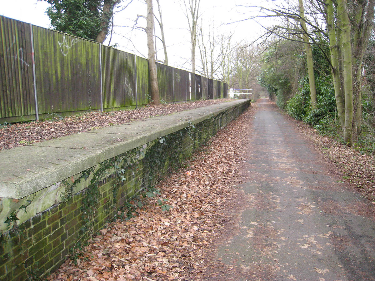
The Alban Way is a traffic free multi-user route along a former railway line in Hertfordshire, England, that has been constructed along the route of the former Hatfield to St Albans railway line. It runs from St Albans, close to St Albans Abbey railway station and the site of Roman Verulamium, through Fleetville and Smallford to Hatfield, ending close to Hatfield railway station. It is long. Part of National Cycle Network Route 61, which runs from the River Thames at Maidenhead to the River Lea in Ware, the Alban Way is fully tarmacked throughout making it usable all year round. It can be linked to a separate section of Route 61, also along a disused railway route, runs from Welwyn Garden City to Hertford and is called the Cole Green Way. The remains of most of the station platforms still exist along the route, with many as of 2017 having recently been refurbished along with signage and street names painted into the tarmac. A station building still stands at the London Ro ... [...More Info...] [...Related Items...] OR: [Wikipedia] [Google] [Baidu] |
Hertfordshire
Hertfordshire ( or ; often abbreviated Herts) is one of the home counties in southern England. It borders Bedfordshire and Cambridgeshire to the north, Essex to the east, Greater London to the south, and Buckinghamshire to the west. For government statistical purposes, it forms part of the East of England region. Hertfordshire covers . It derives its name – via the name of the county town of Hertford – from a hart (stag) and a ford, as represented on the county's coat of arms and on the flag. Hertfordshire County Council is based in Hertford, once the main market town and the current county town. The largest settlement is Watford. Since 1903 Letchworth has served as the prototype garden city; Stevenage became the first town to expand under post-war Britain's New Towns Act of 1946. In 2013 Hertfordshire had a population of about 1,140,700, with Hemel Hempstead, Stevenage, Watford and St Albans (the county's only ''city'') each having between 50,000 and 10 ... [...More Info...] [...Related Items...] OR: [Wikipedia] [Google] [Baidu] |
River Lea
The River Lea ( ) is in South East England. It originates in Bedfordshire, in the Chiltern Hills, and flows southeast through Hertfordshire, along the Essex border and into Greater London, to meet the River Thames at Bow Creek. It is one of the largest rivers in London and the easternmost major tributary of the Thames. The river's significance as a major east–west barrier and boundary has tended to obscure its importance as north–south trade route. Below Hertford the river has since medieval times had alterations made to make it more navigable for boats between the Thames and eastern Hertfordshire and Essex, known as the Lee Navigation. This stimulated much industry along its banks. The navigable River Stort, the main tributary, joins it at Hoddesdon. While the lower Lea remains somewhat polluted, its upper stretch and tributaries, classified as chalk streams, are a major source of drinking water for London. An artificial waterway known as the New River, opened in 1 ... [...More Info...] [...Related Items...] OR: [Wikipedia] [Google] [Baidu] |
Welwyn Hatfield
The Borough of Welwyn Hatfield is a Non-metropolitan district, local government district in southern Hertfordshire, England, governed by Welwyn Hatfield Borough Council. It covers the two towns of Welwyn Garden City and Hatfield, Hertfordshire, Hatfield, along with numerous smaller settlements from Woolmer Green in the north to Little Heath in the south. Each of the towns has a railway station on the East Coast Main Line and they are close to the A1 road (Great Britain), A1 road. It borders the London Borough of Enfield. The district was formed on 1 April 1974, as a merger of the Welwyn Garden City Urban district (Great Britain and Ireland), urban district, with the Hatfield Rural District, Hatfield and Welwyn Rural Districts. It petitioned for borough status in 2005, which was agreed to by the Privy Council of the United Kingdom, Privy Council on 15 November 2005. In April 2006 a charter conferring borough status was granted, and the title of the council officially changed to W ... [...More Info...] [...Related Items...] OR: [Wikipedia] [Google] [Baidu] |
Ayot Greenway
The Ayot Greenway is a rail trail which extends from Ayot St Peter, just west of Welwyn Garden City and the A1(M) Motorway to Wheathampstead in Hertfordshire. Part of National Cycle Network Route 57, it runs for three miles along a former branch line from Welwyn Garden City railway station towards Luton and Dunstable. The line opened on 1 September 1860 and was operable for more than 100 years. Passenger numbers declined sharply after the Second World War and passenger services ended in 1951, although commercial traffic continued until 1966. Most of the track was lifted apart from a line into the Blackbridge landfill site from the Hatfield end, which continued until 1971 before the whole line was finally closed. Today, there are still visual reminders of the line, with two bridges still intact, the original fencing and even part of a collapsed railway signal. The trail starts at the White Bridge in Welwyn Garden City, behind the library and Campus West. It continues through ... [...More Info...] [...Related Items...] OR: [Wikipedia] [Google] [Baidu] |
Uno (bus Company)
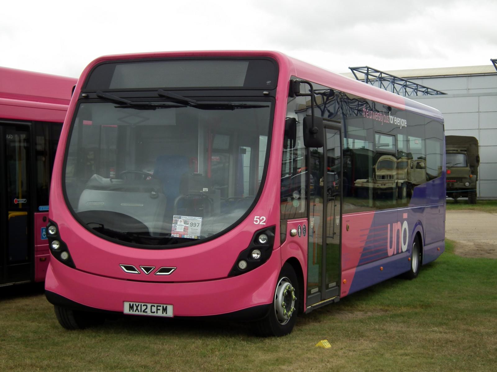
Uno (formerly UniversityBus) is an English bus service operated by the University of Hertfordshire, serving members of the general public, and also its own students and staff. The service was set up in 1992, growing out of a shuttle service previously operated for students at Wall Hall College located near Watford connecting them to the other campuses of the university and the Polytechnic (Hatfield) before that. It provides student transport to the university from local areas as well as improving east–west travel across Hertfordshire and has opened up new links from North London. Services have expanded as the university has closed outlying sites at Watford and Hertford and developed the new de Havilland Campus on the site of the former Hatfield Aerodrome, Hatfield. Other developments on this site, including business premises for companies such as Veolia, DHL and EE Limited have also provided passengers. Uno also operate urban bus networks in St Albans and Northampton, as wel ... [...More Info...] [...Related Items...] OR: [Wikipedia] [Google] [Baidu] |
Abbey Line
The Abbey Line, also called the St Albans Abbey branch line, is a railway line from Watford Junction to St Albans Abbey. The route passes through town and countryside in the county of Hertfordshire, just outside the boundaries of the Oyster Card and London fare zones. Its northern terminus in St Albans Abbey is located in the south of the city, around away from the larger St Albans City railway station on the Midland Main Line. The Abbey line is a semi-rural line and, due to its single-track operation, service frequencies are limited. The service is sometimes referred to locally as ''the Abbey Flyer''. History The line was opened by the London and North Western Railway (LNWR) on 5 May 1858 and was the first railway to reach St Albans. Originally there were two intermediate stations: * * In 1910 a station at Callowland opened, now . In 1924 the terminus at St Albans became to distinguish it from the Midland Railway main line station at , which opened in 186 ... [...More Info...] [...Related Items...] OR: [Wikipedia] [Google] [Baidu] |
Hill End Railway Station
Hill End railway station was on the Great Northern Railway branch from to St Albans in Hertfordshire, England. History The station, which was intended to service Hill End Hospital Hill End Hospital was a mental health facility in St Albans in Hertfordshire, England. History The hospital, which was designed by George Thomas Hine using a Compact Arrow layout, opened as the Hertfordshire County Asylum in April 1899. Hill End ..., opened on 1 August 1899, and closed on 1 October 1951. References Disused railway stations in Hertfordshire Former Great Northern Railway stations Railway stations in Great Britain opened in 1899 Railway stations in Great Britain closed in 1951 Transport in St Albans {{EastEngland-railstation-stub ... [...More Info...] [...Related Items...] OR: [Wikipedia] [Google] [Baidu] |
Railway Semaphore Signal
Railway semaphore signal is one of the earliest forms of fixed railway signals. This semaphore system involves signals that display their different indications to train drivers by changing the angle of inclination of a pivoted 'arm'. Semaphore signals were patented in the early 1840s by Joseph James Stevens, and soon became the most widely used form of mechanical signal. Designs have altered over the intervening years, and colour light signals have replaced semaphore signals in most countries, but in a few they remain in use. Origins The first railway semaphore signal was erected by Charles Hutton Gregory on the London and Croydon Railway (later the London Brighton and South Coast Railway) at New Cross, southeast London, about 1842 on the newly enlarged layout also accommodating the South Eastern Railway. John Urpeth Rastrick claimed to have suggested the idea to Hutton Gregory. The semaphore was afterwards rapidly adopted as fixed manual signals throughout Britain and t ... [...More Info...] [...Related Items...] OR: [Wikipedia] [Google] [Baidu] |
Nast Hyde Halt Railway Station
Nast Hyde Halt is a disused railway station in Hertfordshire. It was opened in 1910 to serve the new houses being built in the area. It is also said that a local householder, Oliver Bury, asked for the halt to be opened in order that he could use the line to commute to Kings Cross. cmglee_Alban_Way_Nast_Hyde_Halt_signal.jpg, Remains of Nast Hyde Halt railway station in May 2017 cmglee_Alban_Way_Nast_Hyde_Halt_platform.jpg, Nast Hyde Halt railway station platform in May 2017 External links Nast Hyde Halt at Disused-Stations.org.uk Disused railway stations in Hertfordshire Former Great Northern Railway stations Railway stations in Great Britain opened in 1910 Railway stations in Great Britain closed in 1951 {{EastEngland-railstation-stub ... [...More Info...] [...Related Items...] OR: [Wikipedia] [Google] [Baidu] |
Cole Green Way
The Cole Green Way is a rail trail which runs east-west from the eastern edge of Welwyn Garden City to Hertford in Hertfordshire. Part of National Cycle Network Route 61, and the Lea Valley Walk, it runs for more than six miles along the former Hertford, Luton & Dunstable branch line from Welwyn Garden City railway station to Hertford North railway station. History The original line opened on March, 1, 1858 and operated passenger traffic until June, 18, 1951. It was never a busy branch line, and numbers decreased quickly after the Hertford Loop Line was added to the Great Northern Line from London King's Cross, which gave faster access to Hertford North railway station. Prior to the Loop opening, trains on this branch terminated at Hertford Cowbridge. It closed completely to goods traffic on 1 August 1962 and the track was lifted shortly afterwards. The former trackbed has been used as a public footpath since and was refurbished by the local council to provide better fa ... [...More Info...] [...Related Items...] OR: [Wikipedia] [Google] [Baidu] |
Welwyn Garden City
Welwyn Garden City ( ) is a town in Hertfordshire, England, north of London. It was the second garden city in England (founded 1920) and one of the first new towns (designated 1948). It is unique in being both a garden city and a new town and exemplifies the physical, social and cultural planning ideals of the periods in which it was built. History Welwyn Garden City was founded by Sir Ebenezer Howard in 1920 following his previous experiment in Letchworth Garden City. Howard had called for the creation of planned towns that were to combine the benefits of the city and the countryside and to avoid the disadvantages of both. It was designed to be 'The Perfect Town'. The Garden Cities and Town Planning Association had defined a garden city as "a town designed for healthy living and industry of a size that makes possible a full measure of social life but not larger, surrounded by a rural belt; the whole of the land being in public ownership, or held in trust for the community ... [...More Info...] [...Related Items...] OR: [Wikipedia] [Google] [Baidu] |
Ware, Hertfordshire
Ware is a town in Hertfordshire, England close to the county town of Hertford. It is also a civil parish in East Hertfordshire district. Location The town lies on the north–south A10 road which is partly shared with the east–west A414 (for Hertford to the west and Harlow to the east). There is a large viaduct over the River Lea at Kings Meads. The £3.6m two-mile bypass opened on 17 January 1979. At the north end of the bypass is the Wodson Park Sports and Leisure Centre and Hanbury Manor, a hotel and country club. The former route of the A10 through the town is now the A1170. The railway station is on the Hertford East Branch Line and operated by Greater Anglia and is on a short single track section of the otherwise double track line. History Archaeology has shown that Ware has been occupied since at least the Mesolithic period (which ended about 4000 BC). The Romans had a sizeable settlement here and foundations of several buildings, including a temple, and two cemeteri ... [...More Info...] [...Related Items...] OR: [Wikipedia] [Google] [Baidu] |


.jpg)

