|
Tell Rashid
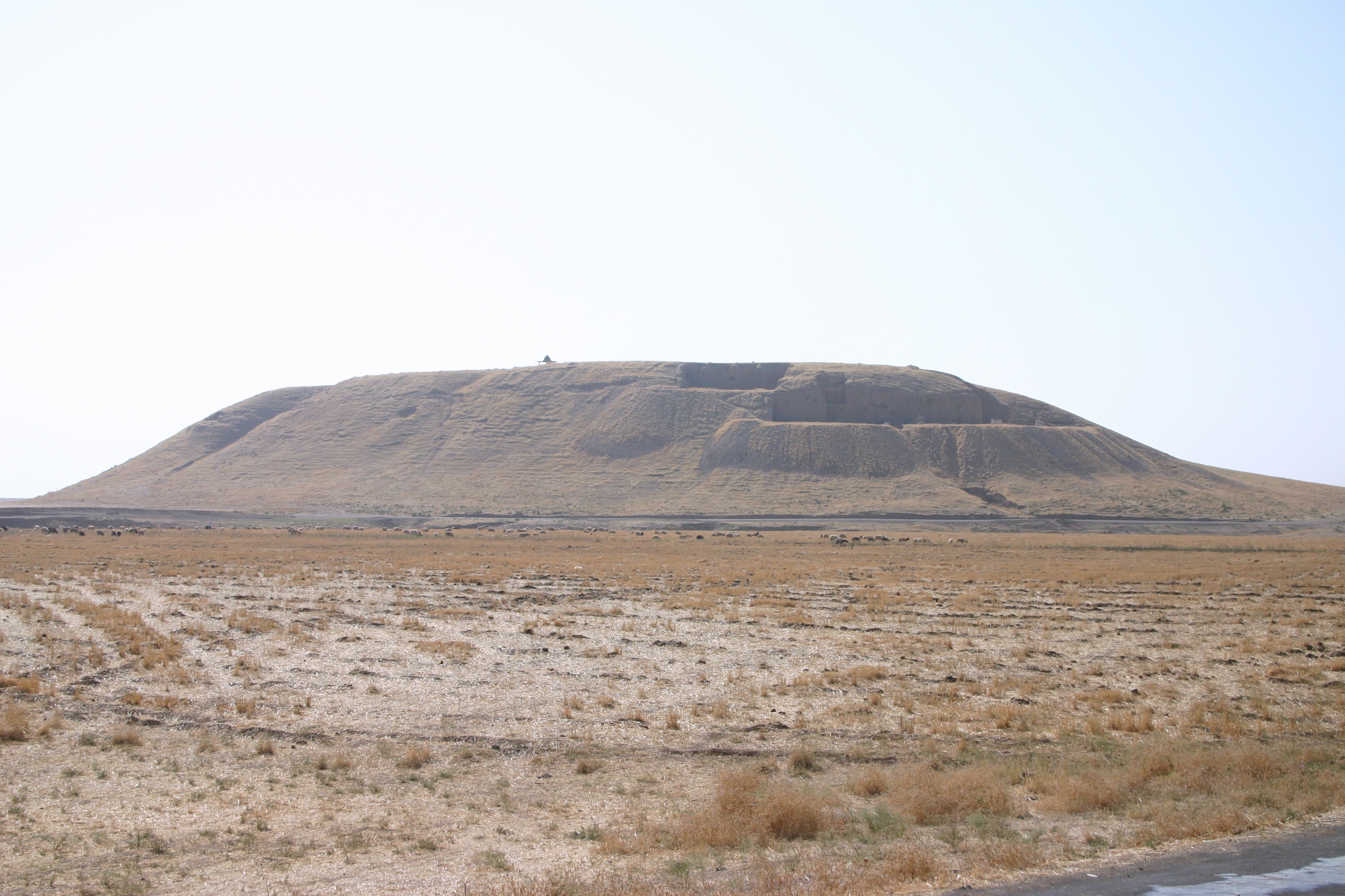
Tell Rashid is a tell, or archaeological settlement mound, in Diyala Governorate, Iraq. The site lies in the foothills of the Zagros Mountains, some south of Tell Abada, another Ubaid period site. It measures 54 by 30 m and extends 2.5 m above the surrounding plain. Tell Rashid was excavated for a single season in 1978 under the direction of Sabah Abboud Jasim as part of the archaeological salvage work being done for the construction of the Hemrin Dam. The excavation trench reached a depth of 5 m, at which point virgin soil (undisturbed by human activity) was reached. Four different occupation levels were recognised, all dating to the Ubaid period. Occupation history The oldest level, IV, consists of some mudbrick foundations that were part of a larger building that extended beyond the excavated area. Based on the ceramics, the level could be dated to Ubaid 2. Level III yielded significant architectural remains, consisting of at least three separate buildings. Two of these w ... [...More Info...] [...Related Items...] OR: [Wikipedia] [Google] [Baidu] |
Tell (archaeology)
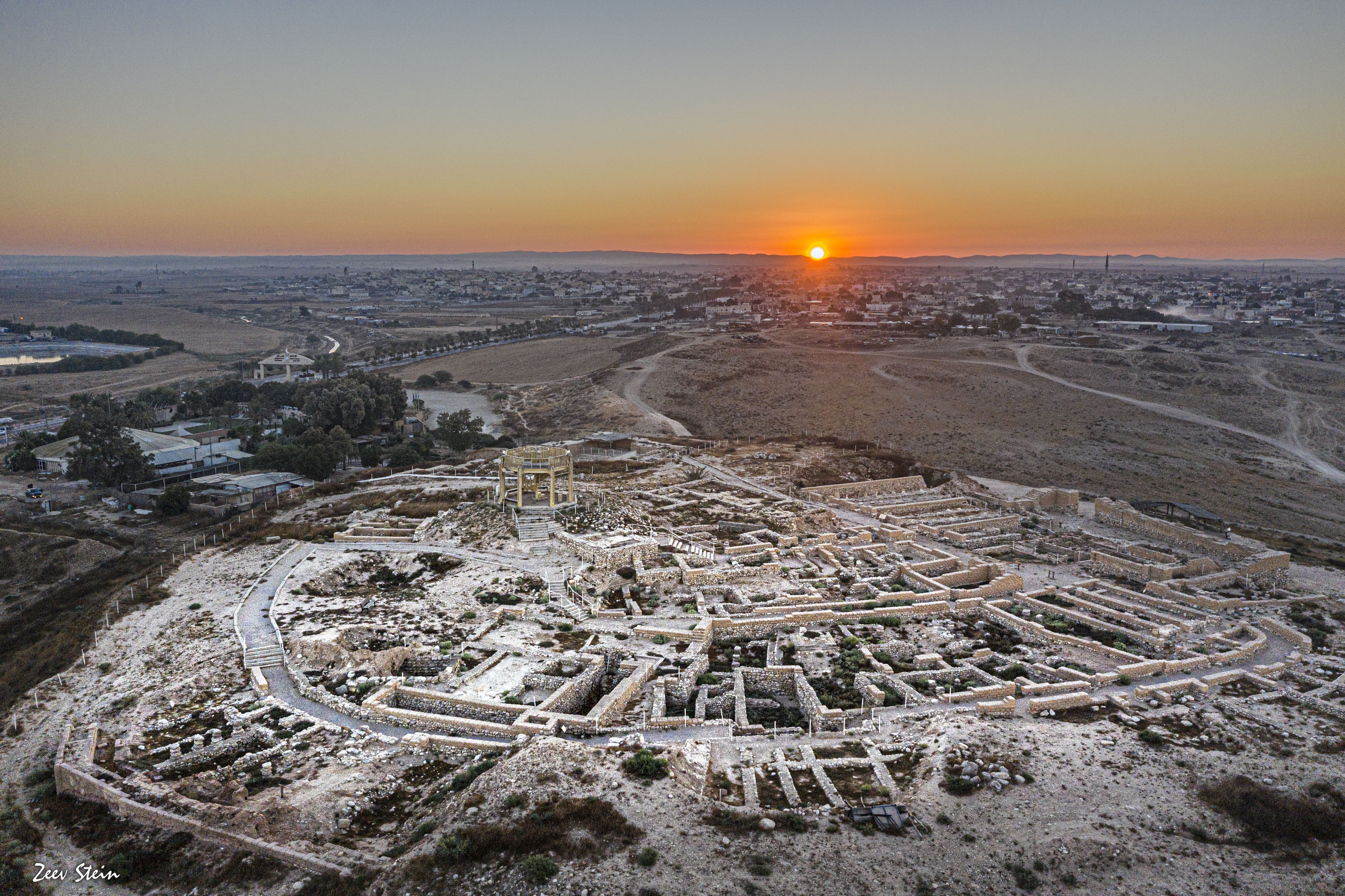
In archaeology, a tell or tel (borrowed into English from ar, تَلّ, ', 'mound' or 'small hill'), is an artificial topographical feature, a species of mound consisting of the accumulated and stratified debris of a succession of consecutive settlements at the same site, the refuse of generations of people who built and inhabited them, and of natural sediment. (Very limited snippet view).Matthews (2020)Introduction and Definition/ref> Tells are most commonly associated with the ancient Near East, but they are also found elsewhere, such as Southern and parts of Central Europe, from Greece and Bulgaria to Hungary and SpainBlanco-González & Kienlin, eds (2020), 6th page of chapter 1, see map. and in North Africa. Within the Near East, they are concentrated in less arid regions, including Upper Mesopotamia, the Southern Levant, Anatolia and Iran, which had more continuous settlement. Eurasian tells date to the Neolithic,Blanco-González & Kienlin, eds (2020), 2nd page of chapter 1 ... [...More Info...] [...Related Items...] OR: [Wikipedia] [Google] [Baidu] |
Spindle Whorl
A spindle whorl is a disc or spherical object fitted onto the spindle to increase and maintain the speed of the spin. Historically, whorls have been made of materials like amber, antler, bone, ceramic, coral, glass, stone, metal (iron, lead, lead alloy), and wood ( oak). Local sourced materials have been also used, such as chalk, limestone, mudstone, sandstone, slate, lydite and soapstone. Gallery File:Spindle Whorl (Sulsultin), 19th century, 05.588.7382.jpg, ''Spindle Whorl (Sulsultin)'', Chemainus, Coast Salish (Native American), 19th century, Brooklyn Museum File:Przęślik 0211.jpg, Whorl (12th or 13th century) found in Poland File:1017_-_Keramikos_Museum,_Athens_-_Spindle-whirls,_10th_century_BC_-_Photo_by_Giovanni_Dall'Orto,_Nov_12.jpg, Ancient Greek spindle whorls, 10th century BC, Kerameikos Archaeological Museum, Athens File:Muisca spindle whorl.jpg, Muisca spindle whorl (500AD – 1500AD). Archaeology Museum, Sogamoso, Colombia File:Object from the exhibition ... [...More Info...] [...Related Items...] OR: [Wikipedia] [Google] [Baidu] |
Tells (archaeology)
In archaeology, a tell or tel (borrowed into English from ar, تَلّ, ', 'mound' or 'small hill'), is an artificial topographical feature, a species of mound consisting of the accumulated and stratified debris of a succession of consecutive settlements at the same site, the refuse of generations of people who built and inhabited them, and of natural sediment. (Very limited snippet view).Matthews (2020)Introduction and Definition/ref> Tells are most commonly associated with the ancient Near East, but they are also found elsewhere, such as Southern and parts of Central Europe, from Greece and Bulgaria to Hungary and SpainBlanco-González & Kienlin, eds (2020), 6th page of chapter 1, see map. and in North Africa. Within the Near East, they are concentrated in less arid regions, including Upper Mesopotamia, the Southern Levant, Anatolia and Iran, which had more continuous settlement. Eurasian tells date to the Neolithic,Blanco-González & Kienlin, eds (2020), 2nd page of chapter 1, ... [...More Info...] [...Related Items...] OR: [Wikipedia] [Google] [Baidu] |
Archaeological Sites In Iraq
Archaeology or archeology is the scientific study of human activity through the recovery and analysis of material culture. The archaeological record consists of artifacts, architecture, biofacts or ecofacts, sites, and cultural landscapes. Archaeology can be considered both a social science and a branch of the humanities. It is usually considered an independent academic discipline, but may also be classified as part of anthropology (in North America – the four-field approach), history or geography. Archaeologists study human prehistory and history, from the development of the first stone tools at Lomekwi in East Africa 3.3 million years ago up until recent decades. Archaeology is distinct from palaeontology, which is the study of fossil remains. Archaeology is particularly important for learning about prehistoric societies, for which, by definition, there are no written records. Prehistory includes over 99% of the human past, from the Paleolithic until the advent o ... [...More Info...] [...Related Items...] OR: [Wikipedia] [Google] [Baidu] |
Tell Saadiya
Tell Saadiya (also Tell es-Saadiya) is a tell, or archaeological settlement mound, in Diyala Governorate (Iraq). Archaeological research Excavations at the site were conducted in 1979–1980. They were part of an international salvage operation organized by the Iraqi Directorate of Antiquities which aimed to protect historical monuments in the Gebel Hamrin region endangered by the building of a dam on the Diyala River{{Cite journal, last=Kozłowski, first=Stefan Karol, last2=Bieliński, first2=Piotr, date=1979, title=Tell El Saadiya, url=http://bazhum.muzhp.pl/media//files/Informator_Archeologiczny_badania/Informator_Archeologiczny_badania-r1979-t13/Informator_Archeologiczny_badania-r1979-t13-s289-290/Informator_Archeologiczny_badania-r1979-t13-s289-290.pdf, journal=Informator Archeologiczny, volume=13 (Hamrin program, Hamrin Dam Salvage Project). Archaeological works at Tell Saadiya were carried out by a team from the Polish Centre of Mediterranean Archaeology University o ... [...More Info...] [...Related Items...] OR: [Wikipedia] [Google] [Baidu] |
Turkey
Turkey ( tr, Türkiye ), officially the Republic of Türkiye ( tr, Türkiye Cumhuriyeti, links=no ), is a transcontinental country located mainly on the Anatolian Peninsula in Western Asia, with a small portion on the Balkan Peninsula in Southeast Europe. It shares borders with the Black Sea to the north; Georgia to the northeast; Armenia, Azerbaijan, and Iran to the east; Iraq to the southeast; Syria and the Mediterranean Sea to the south; the Aegean Sea to the west; and Greece and Bulgaria to the northwest. Cyprus is located off the south coast. Turks form the vast majority of the nation's population and Kurds are the largest minority. Ankara is Turkey's capital, while Istanbul is its largest city and financial centre. One of the world's earliest permanently settled regions, present-day Turkey was home to important Neolithic sites like Göbekli Tepe, and was inhabited by ancient civilisations including the Hattians, Hittites, Anatolian peoples, Mycenaea ... [...More Info...] [...Related Items...] OR: [Wikipedia] [Google] [Baidu] |
Yumuktepe
Yumuktepe (or Yümüktepe) is a tell (ruin mound) at within the city borders of Mersin, Turkey. In 1936, the mound was on the outskirts of Mersin, but after a rapid increase of population, the mound was surrounded by the Toroslar municipality of Mersin. Discovery and excavations Excavations during 1936-1938 by a British archaeologist John Garstang (1876–1956). He was the founder of the British Institute in Ankara, have revealed a neolithic settlement which continued up to medieval ages. However, the excavations halted during World War II and some documents in the Liverpool University have been lost after an air raid. After the war, John Garstang as well as Veli Sevin of Istanbul University and Isabella Caneva of Sapienza University of Rome continued the excavations. Archaeology There are 23 levels of occupation dating from ca. 6300 BC. In his book, ''Prehistoric Mersin'', Garstang lists the tools unearthed in the excavations. The earliest tools are made of either ston ... [...More Info...] [...Related Items...] OR: [Wikipedia] [Google] [Baidu] |
Sickle
A sickle, bagging hook, reaping-hook or grasshook is a single-handed agricultural tool designed with variously curved blades and typically used for harvesting, or reaping, grain crops or cutting Succulent plant, succulent forage chiefly for feeding livestock, either freshly cut or dried as hay. Falx was a synonym but was later used to mean any of a number of tools that had a curved blade that was sharp on the inside edge such as a scythe. Since the beginning of the Iron Age hundreds of region-specific variants of the sickle have evolved, initially of iron and later steel. This great diversity of sickle types across many cultures can be divided into smooth or serrated blades, both of which can be used for cutting either green grass or mature cereals using slightly different techniques. The serrated blade that originated in prehistoric sickles still dominates in the reaping of grain and is even found in modern grain-harvesting machines and in some kitchen knives. History Pre- ... [...More Info...] [...Related Items...] OR: [Wikipedia] [Google] [Baidu] |
Bitumen
Asphalt, also known as bitumen (, ), is a sticky, black, highly viscous liquid or semi-solid form of petroleum. It may be found in natural deposits or may be a refined product, and is classed as a pitch. Before the 20th century, the term asphaltum was also used. Full text at Internet Archive (archive.org) The word is derived from the Ancient Greek ἄσφαλτος ''ásphaltos''. The largest natural deposit of asphalt in the world, estimated to contain 10 million tons, is the Pitch Lake located in La Brea in southwest Trinidad (Antilles island located on the northeastern coast of Venezuela), within the Siparia Regional Corporation. The primary use (70%) of asphalt is in road construction, where it is used as the glue or binder mixed with aggregate particles to create asphalt concrete. Its other main uses are for bituminous waterproofing products, including production of roofing felt and for sealing flat roofs. In material sciences and engineering, the terms "asphalt" ... [...More Info...] [...Related Items...] OR: [Wikipedia] [Google] [Baidu] |
Blade
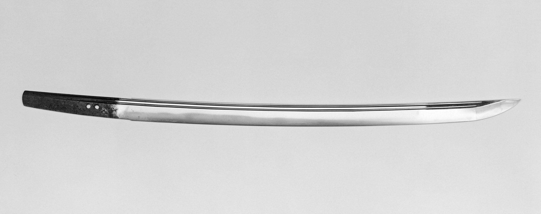
A blade is the portion of a tool, weapon, or machine with an edge that is designed to puncture, chop, slice or scrape surfaces or materials. Blades are typically made from materials that are harder than those they are to be used on. Historically, humans have made blades from flaking stones such as flint or obsidian, and from various metal such as copper, bronze and iron. Modern blades are often made of steel or ceramic. Blades are one of humanity's oldest tools, and continue to be used for combat, food preparation, and other purposes. Blades work by concentrating force on the cutting edge. Certain blades, such as those used on bread knives or saws, are serrated, further concentrating force on the point of each tooth. Uses During food preparation, knives are mainly used for slicing, chopping, and piercing. In combat, a blade may be used to slash or puncture, and may also be thrown or otherwise propelled. The function is to sever a nerve, muscle or tendon fibers, or ... [...More Info...] [...Related Items...] OR: [Wikipedia] [Google] [Baidu] |
Labret
A labret is a form of body piercing. Taken literally, it is any type of adornment that is attached to the lip (labrum). However, the term usually refers to a piercing that is below the bottom lip, above the chin. It is sometimes referred to as a "tongue pillar" or a "soul patch piercing". Pronunciation The traditional pronunciation of ''labret'' in anthropology is . It derives from the Latin ''labrum'' "lip" and the diminutive suffix ''-et.'' However, many in the body-piercing industry give it the pseudo-French pronunciation , though the French word is in fact borrowed from the English.''How do YOU Say L-a-b-r-e-t?'' (note: the etymology here is false.) Anthropology The labret was a traditional piercing among the American Northwest Coast Indians, where it was related t ...[...More Info...] [...Related Items...] OR: [Wikipedia] [Google] [Baidu] |
Sling (weapon)
A sling is a projectile weapon typically used to throw a blunt projectile such as a stone, clay, or lead " sling-bullet". It is also known as the shepherd's sling or slingshot (in British English). Someone who specializes in using slings is called a slinger. A sling has a small cradle or ''pouch'' in the middle of two retention cords. A projectile is placed in the pouch. There is a loop on the end of one side of the retention cords. Depending on the design of the sling, either the middle finger or the wrist is placed through a loop on the end of one cord, and a tab at the end of the other cord is placed between the thumb and forefinger. The sling is swung in an arc, and the tab released at a precise moment. This action releases the projectile to fly to the target. The sling is much more than merely an extension of a human arm. By its double-pendulum kinetics, the sling enables stones (or spears) to be thrown much further than they could be by hand alone. The sling is i ... [...More Info...] [...Related Items...] OR: [Wikipedia] [Google] [Baidu] |


.jpg)
.jpg)


.jpeg)
