|
Tanderagee Railway Station
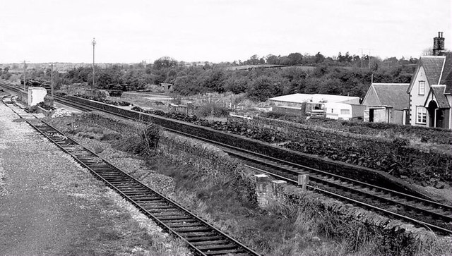
Tanderagee railway station was opened on 6 January 1852. It was originally named Madden Bridge and was located on the Madden road between the villages of Tandragee, County Armagh and Gilford, County Down, Northern Ireland Northern Ireland ( ga, Tuaisceart Éireann ; sco, label=Ulster Scots dialect, Ulster-Scots, Norlin Airlann) is a part of the United Kingdom, situated in the north-east of the island of Ireland, that is #Descriptions, variously described as .... It closed on 4 January 1965. Tanderagee is also spelt as Tandragee, after the nearby village. Tanderagee and Gilford railway station was the original name upon opening of the station. Only the two platforms remain, the station buildings having been demolished. References Disused railway stations in County Armagh Railway stations in Northern Ireland opened in 1852 1852 establishments in Ireland Railway stations in Northern Ireland opened in the 19th century {{NorthernIreland-railstation-st ... [...More Info...] [...Related Items...] OR: [Wikipedia] [Google] [Baidu] |
Tandragee
Tandragee () is a village in County Armagh, Northern Ireland. It is built on a hillside overlooking the Cusher River, in the civil parish of Ballymore and the historic barony of Orior Lower. It had a population of 3,486 people in the 2011 Census. This article contains quotations from this source, which is available under th Open Government Licence v3.0 Crown copyright. History Overlooking the village is Tandragee Castle. Originally the seat of the Chief of the Name of the O'Hanlon Irish clan and Lord of Orior, the Castle and surrounding countryside were confiscated and granted to Oliver St John and his heirs during the Tudor conquest of Ireland and the Plantation of Ulster. According to D. J. O'Donoghue's account of his 1825 Irish tour, Sir Walter Scott was fascinated by the life and career of Redmond O'Hanlon, a local Rapparee leader. Hoping to make him the protagonist of an adventure novel, Scott corresponded with Lady Olivia Sparrow, an Anglo-Irish landowner whose esta ... [...More Info...] [...Related Items...] OR: [Wikipedia] [Google] [Baidu] |
County Armagh
County Armagh (, named after its county town, Armagh) is one of the six counties of Northern Ireland and one of the traditional thirty-two counties of Ireland. Adjoined to the southern shore of Lough Neagh, the county covers an area of and has a population of about 175,000. County Armagh is known as the "Orchard County" because of its many apple orchards. The county is part of the historic province of Ulster. Etymology The name "Armagh" derives from the Irish word ' meaning "height" (or high place) and '. is mentioned in '' The Book of the Taking of Ireland'', and is also said to have been responsible for the construction of the hill site of (now Navan Fort near Armagh City) to serve as the capital of the kings (who give their name to Ulster), also thought to be 's ''height''. Geography and features From its highest point at Slieve Gullion, in the south of the county, Armagh's land falls away from its rugged south with Carrigatuke, Lislea and Camlough mountains, to ... [...More Info...] [...Related Items...] OR: [Wikipedia] [Google] [Baidu] |
Gilford, County Down
Gilford is a village in County Down, Northern Ireland. The village sits on the River Bann between the towns of Banbridge, Tandragee and Portadown. It covers the townlands of Loughans, Ballymacanallen and Drumaran. It had a population of 1,573 people in the 2001 Census. Gilford is within the Armagh, Banbridge and Craigavon district. History Following the Irish Rebellion of 1641, Captain John Magill acquired land in the parish of Tullylish and founded Gilford, the name of the village being derived from "Magill’s ford". He afterwards became Sir John Magill and built Gill Hall in Dromore, County Down. The Magill lands passed by marriage to the Meade family, who were made Barons Gillford in 1766 and later earls of Clanwilliam. In the 19th century, Gilford grew and its population swelled when a linen mill was built. Many mill houses can still be found in the village. When the mill shut in 1986, the village waned. Recently though, the village has started to recover and new s ... [...More Info...] [...Related Items...] OR: [Wikipedia] [Google] [Baidu] |
County Down
County Down () is one of the six counties of Northern Ireland, one of the nine counties of Ulster and one of the traditional thirty-two counties of Ireland. It covers an area of and has a population of 531,665. It borders County Antrim to the north, the Irish Sea to the east, County Armagh to the west, and County Louth across Carlingford Lough to the southwest. In the east of the county is Strangford Lough and the Ards Peninsula. The largest town is Bangor, on the northeast coast. Three other large towns and cities are on its border: Newry lies on the western border with County Armagh, while Lisburn and Belfast lie on the northern border with County Antrim. Down contains both the southernmost point of Northern Ireland ( Cranfield Point) and the easternmost point of Ireland ( Burr Point). It was one of two counties of Northern Ireland to have a Protestant majority at the 2001 census. The other Protestant majority County is County Antrim to the north. In March 2018, ''The ... [...More Info...] [...Related Items...] OR: [Wikipedia] [Google] [Baidu] |
Northern Ireland
Northern Ireland ( ga, Tuaisceart Éireann ; sco, label= Ulster-Scots, Norlin Airlann) is a part of the United Kingdom, situated in the north-east of the island of Ireland, that is variously described as a country, province or region. Northern Ireland shares an open border to the south and west with the Republic of Ireland. In 2021, its population was 1,903,100, making up about 27% of Ireland's population and about 3% of the UK's population. The Northern Ireland Assembly (colloquially referred to as Stormont after its location), established by the Northern Ireland Act 1998, holds responsibility for a range of devolved policy matters, while other areas are reserved for the UK Government. Northern Ireland cooperates with the Republic of Ireland in several areas. Northern Ireland was created in May 1921, when Ireland was partitioned by the Government of Ireland Act 1920, creating a devolved government for the six northeastern counties. As was intended, Northern Irela ... [...More Info...] [...Related Items...] OR: [Wikipedia] [Google] [Baidu] |
A Disused Railway Station - Geograph
A, or a, is the first letter and the first vowel of the Latin alphabet, used in the modern English alphabet, the alphabets of other western European languages and others worldwide. Its name in English is ''a'' (pronounced ), plural ''aes''. It is similar in shape to the Ancient Greek letter alpha, from which it derives. The uppercase version consists of the two slanting sides of a triangle, crossed in the middle by a horizontal bar. The lowercase version can be written in two forms: the double-storey a and single-storey ɑ. The latter is commonly used in handwriting and fonts based on it, especially fonts intended to be read by children, and is also found in italic type. In English grammar, " a", and its variant " an", are indefinite articles. History The earliest certain ancestor of "A" is aleph (also written 'aleph), the first letter of the Phoenician alphabet, which consisted entirely of consonants (for that reason, it is also called an abjad to distinguish it fr ... [...More Info...] [...Related Items...] OR: [Wikipedia] [Google] [Baidu] |
Northern Ireland Railways
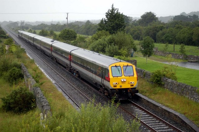
NI Railways, also known as Northern Ireland Railways (NIR) ( ga, Iarnród Thuaisceart Éireann); and for a brief period Ulster Transport Railways (UTR), is the railway operator in Northern Ireland. NIR is a subsidiary of Translink, whose parent company is the Northern Ireland Transport Holding Company (NITHCo), and is one of seven publicly owned train operators in the United Kingdom, the others being Direct Rail Services, Northern Trains, Transport for Wales Rail, Southeastern, LNER, and ScotRail. It has a common Board of Management with the other two companies in the group, Ulsterbus and Metro (formerly Citybus). The rail network in Northern Ireland is not part of the National Rail network of Great Britain, nor does it use Standard Gauge, instead using Irish Gauge in common with the Republic of Ireland. Also, NIR is the only commercial non-heritage passenger operator in the United Kingdom to operate a vertical integration model, with responsibility of all aspects of the netwo ... [...More Info...] [...Related Items...] OR: [Wikipedia] [Google] [Baidu] |
Scarva Railway Station
Scarva railway station serves Scarva in County Down, Northern Ireland. Despite serving the County Down village, the station itself is in County Armagh, the nearby Newry Canal being the boundary. History The station opened on 23 March 1859. The station was formerly the junction for the GNR(I) branch to Banbridge which opened in 1859 and closed on 2 May 1955. Scarva station was closed between 1965 and 1984. Service There is a limited service from the station with four trains towards or on Mondays to Saturdays only. There is no Sunday service. Scarva railway station is on the Belfast-Dublin railway line and is often passed at speed by the Enterprise Enterprise (or the archaic spelling Enterprize) may refer to: Business and economics Brands and enterprises * Enterprise GP Holdings, an energy holding company * Enterprise plc, a UK civil engineering and maintenance company * Enterprise ... en route to . References Railway stations in County Arma ... [...More Info...] [...Related Items...] OR: [Wikipedia] [Google] [Baidu] |
Portadown Railway Station
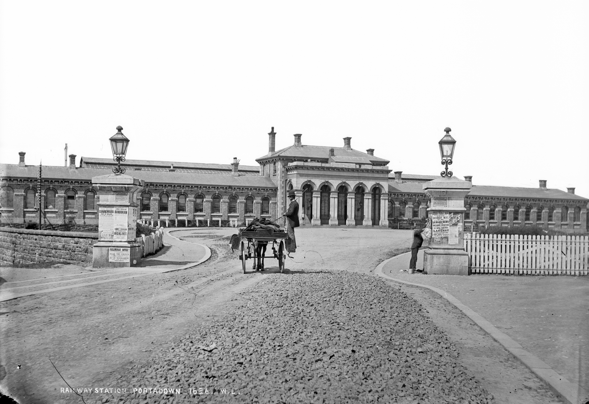
Portadown Railway Station serves Portadown in County Armagh, Northern Ireland. History The original Portadown station was sited half a mile east of the present station and opened on 12 September 1842, replacing a temporary station at Seagoe that had opened the preceding year. The Portadown station was moved to the present location in 1848 then reverted to its original site between 1863 and 1970. Goods traffic ceased on 4 January 1965. The present station opened in 1970, replacing a large and largely redundant station. At the time (1970) the station was called ''Portadown - Craigavon West'', a title that was quietly dropped after the "new city" Craigavon failed to materialise. The layout of the 1970 station was modified in 1997 to allow bi-directional working on all three platforms. The lines to Cavan via Armagh (closed 1957), and Derry via Dungannon and Omagh (closed 1965) diverged immediately west of the present station. In 2012, work began on a major refurbishment of the s ... [...More Info...] [...Related Items...] OR: [Wikipedia] [Google] [Baidu] |
Dublin And Belfast Junction Railway
Dublin and the Belfast Junction Railway (D&BJct, Irish: Iarnród Bhaile Átha Cliath agus Acomhal Bhéal Feirste) was an Irish gauge () railway in Ireland. The company was incorporated in 1845 and opened its line in stages between 1849 and 1853, with the final bridge over the River Boyne opening in 1855. It linked the Ulster Railway (UR) from Belfast to Portadown and Dublin and Drogheda Railway (D&D) from Drogheda to Dublin, completing the missing link in the Belfast–Dublin line. History The Boyne Viaduct at Drogheda was not built until 1854–55, at a cost of £124,000, to the design of Sir John Macneill, who was the consulting engineer for the D&BJct. Route The D&BJct line from Drogheda to Portadown connected the Ulster Railway's – – Belfast original line with the Dublin and Drogheda Railway's Dublin Amiens Street – Drogheda line, forming the main line between Dublin and Belfast. Aftermath In 1875, the D&BJct merged with the Dublin and Drogheda Railway (D&D ... [...More Info...] [...Related Items...] OR: [Wikipedia] [Google] [Baidu] |


