|
Talakadu
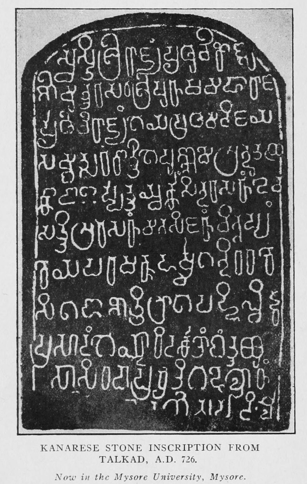
Talakadu (ತಲಕಾಡು) is a town on the left bank of the Kaveri river 45 km (28 miles) from Mysore and 133 km (82 miles) from Bangalore in Karnataka, India. Latinizations of the towns name vary, but include Talkād, Talakadu, Talakkadu, or Thalakadu. It had over 30 temples, most of which now lay buried in sand. The extant group of temples, where the eastward flowing Kaveri river changes course as the sand on its banks spreads over a wide area, is a popular pilgrimage site for Hindus. The origin of the town is lost in antiquity, but one tradition is that its name was derived from two Kirāta twin brothers, Tala and Kādu. The brothers cut down a tree after seeing wild elephants worship it and discovered it contained an image of Shiva and that the elephants were ''rishis'' transformed. The tree being miraculously restored, all obtained '' mōksha'' and the place was named Tala-kādu, which was translated into Sanskrit as Dala-vana. Two stone images declared to ... [...More Info...] [...Related Items...] OR: [Wikipedia] [Google] [Baidu] |
Hoysala Empire
The Hoysala Empire was a Kannadiga power originating from the Indian subcontinent that ruled most of what is now Karnataka between the 10th and the 14th centuries. The capital of the Hoysalas was initially located at Belur, but was later moved to Halebidu. The Hoysala rulers were originally from Malenadu, an elevated region in the Western Ghats. In the 12th century, taking advantage of the internecine warfare between the Western Chalukya Empire and Kalachuris of Kalyani, the Hoysalas annexed areas of present-day Karnataka and the fertile areas north of the Kaveri delta in present-day Tamil Nadu. By the 13th century, they governed most of Karnataka, minor parts of Tamil Nadu and parts of western Andhra Pradesh and Telangana in the Deccan Plateau. The Hoysala era was an important period in the development of South Indian art, architecture, and religion. The empire is remembered today primarily for Hoysala architecture; 100 surviving temples are scattered across Karnataka. W ... [...More Info...] [...Related Items...] OR: [Wikipedia] [Google] [Baidu] |
Group Of Temples At Talakad, Karnataka
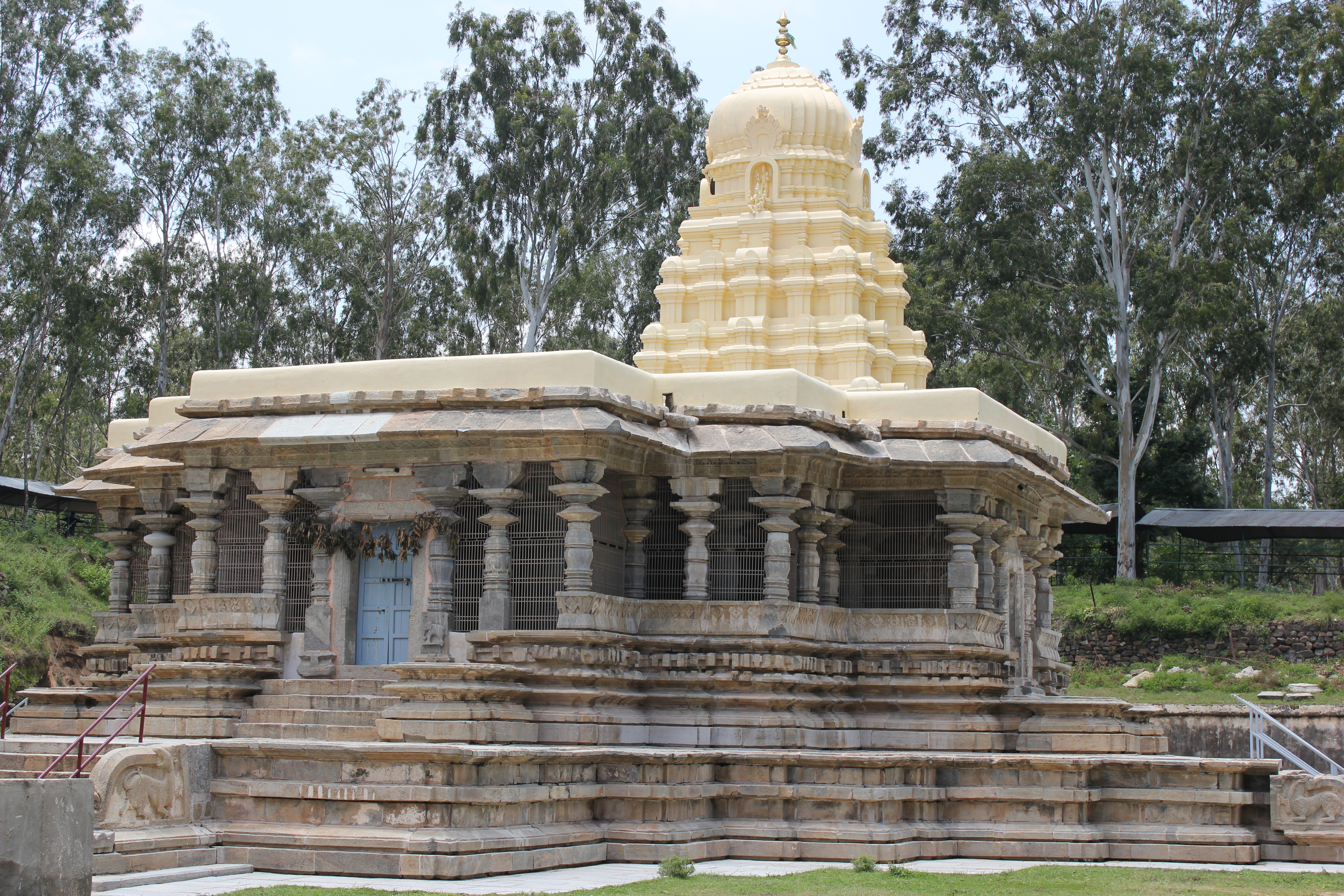
The Group of temples at Talakadu, located about 45 km south-east of the culturally important city of Mysore in the Karnataka state of India are ancient Hindu temples built by multiple South Indian dynasties. Archaeological excavations of the sand dunes at Talakad (or Talakadu) have shown the existence of several ruined temples built during the rule of the Western Ganga dynasty (c.345-999). However, according to historian I. K. Sarma, only two temples, the Pataleshvara (also spelt Patalesvara) and Maraleshvara (also spelt Maralesvara), built during the reign of King Rachamalla Satyavakya IV (r.975-986) are intact.Sarma (1992), pp111-113 According to the Archaeological Survey of India (ASI), the Vaidyeshvara temple (also spelt Vaidyesvara), the largest, the most intact and ornate of the group bears Ganga- Chola-Hoysala architectural features. Its consecration is assignable to the 10th century with improvements made up to the 14th century. According to the art historian Adam ... [...More Info...] [...Related Items...] OR: [Wikipedia] [Google] [Baidu] |
Mysore District
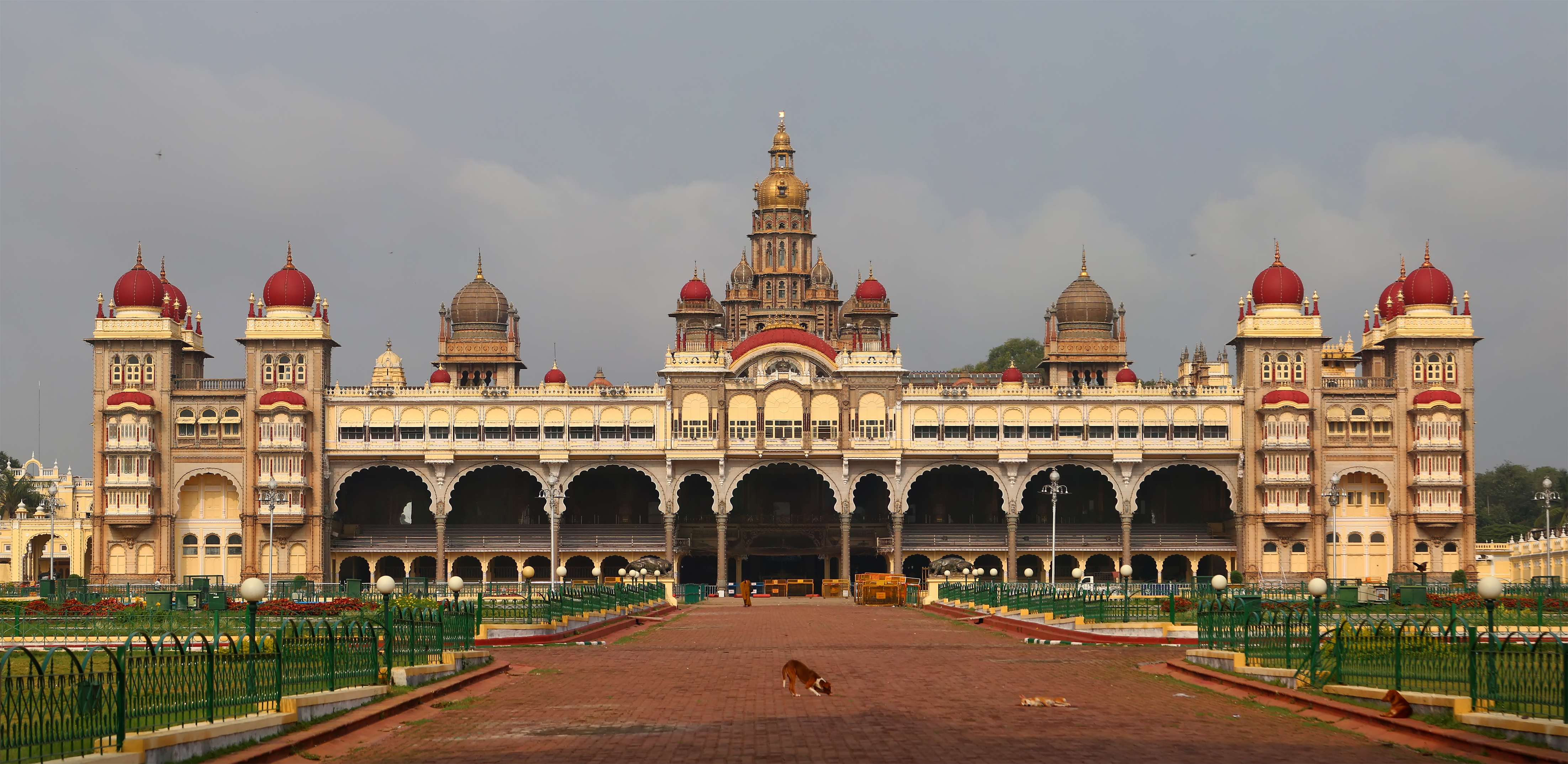
Mysore district, officially Mysuru district is an administrative district located in the southern part of the state of Karnataka, India. It is the administrative headquarters of Mysore division.Chamarajanagar District was carved out of the original larger Mysore District in the year 1998. The district is bounded by Chamrajanagar district to the southeast, Mandya district to the east and northeast, Kerala state to the south, Kodagu district to the west, and Hassan district to the north. This district has a prominent place in the history of Karnataka; Mysore was ruled by the Wodeyars from the year 1399 till the independence of India in the year 1947. It features many tourist destinations, from Mysore Palace to Nagarhole National Park. It is the third-most populous district in Karnataka (out of 31), after Bangalore Urban. Etymology Mysore district gets its name from the city of Mysore which is also the headquarters of the district. The original name of this city was Mahishapura de ... [...More Info...] [...Related Items...] OR: [Wikipedia] [Google] [Baidu] |
Vishnuvardhana
Vishnuvardhana (r. 1108–1152 CE) was a king of the Hoysala Empire in what is today the modern state of Karnataka, India. He ascended the Hoysala throne after the death of his elder brother Veera Ballala I in c.1108. Originally a follower of Jainism and known as Bitti Deva, he came under the influence of the Hindu philosopher Ramanujacharya, converted to Hindu Vaishnavism and took the name "Vishnuvardhana". His queen Shanthala however remained a Jain. This was the transition period from Jainism to Hinduism Vishnuvardhana took the first steps in creating an independent Hoysala Empire in South India through a series of battles against his overlord, the Western Chalukya King Vikramaditya VI, and the Chola Empire to the south. He recovered parts of Gangavadi province (modern southern Karnataka) from the hegemony of the Cholas in the battle of Talakad, and parts of Nolambavdi. According to historian Coelho, the Hoysalas gained the dignity of a kingdom due to the efforts of ... [...More Info...] [...Related Items...] OR: [Wikipedia] [Google] [Baidu] |
Western Gangas
Western Ganga was an important ruling dynasty of ancient Karnataka in India which lasted from about 350 to 1000 CE. They are known as "Western Gangas" to distinguish them from the Eastern Gangas who in later centuries ruled over Kalinga (modern Odisha and Northern Andhra Pradesh). The general belief is that the Western Gangas began their rule during a time when multiple native clans asserted their freedom due to the weakening of the Pallava empire in South India, a geo-political event sometimes attributed to the southern conquests of Samudra Gupta. The Western Ganga sovereignty lasted from about 350 to 550 CE, initially ruling from Kolar and later, moving their capital to Talakadu on the banks of the Kaveri River in modern Mysore district. After the rise of the imperial Chalukyas of Badami, the Gangas accepted Chalukya overlordship and fought for the cause of their overlords against the Pallavas of Kanchi. The Chalukyas were replaced by the Rashtrakutas of Manyakheta in 7 ... [...More Info...] [...Related Items...] OR: [Wikipedia] [Google] [Baidu] |
Western Ganga Dynasty
Western Ganga was an important ruling dynasty of ancient Karnataka in India which lasted from about 350 to 1000 CE. They are known as "Western Gangas" to distinguish them from the Eastern Gangas who in later centuries ruled over Kalinga (modern Odisha and Northern Andhra Pradesh). The general belief is that the Western Gangas began their rule during a time when multiple native clans asserted their freedom due to the weakening of the Pallava empire in South India, a geo-political event sometimes attributed to the southern conquests of Samudra Gupta. The Western Ganga sovereignty lasted from about 350 to 550 CE, initially ruling from Kolar and later, moving their capital to Talakadu on the banks of the Kaveri River in modern Mysore district. After the rise of the imperial Chalukyas of Badami, the Gangas accepted Chalukya overlordship and fought for the cause of their overlords against the Pallavas of Kanchi. The Chalukyas were replaced by the Rashtrakutas of Manyakhe ... [...More Info...] [...Related Items...] OR: [Wikipedia] [Google] [Baidu] |
States And Territories Of India
India is a federal union comprising 28 states and 8 union territories, with a total of 36 entities. The states and union territories are further subdivided into districts and smaller administrative divisions. History Pre-independence The Indian subcontinent has been ruled by many different ethnic groups throughout its history, each instituting their own policies of administrative division in the region. The British Raj mostly retained the administrative structure of the preceding Mughal Empire. India was divided into provinces (also called Presidencies), directly governed by the British, and princely states, which were nominally controlled by a local prince or raja loyal to the British Empire, which held '' de facto'' sovereignty ( suzerainty) over the princely states. 1947–1950 Between 1947 and 1950 the territories of the princely states were politically integrated into the Indian union. Most were merged into existing provinces; others were organi ... [...More Info...] [...Related Items...] OR: [Wikipedia] [Google] [Baidu] |
Moksha
''Moksha'' (; sa, मोक्ष, '), also called ''vimoksha'', ''vimukti'' and ''mukti'', is a term in Hinduism, Buddhism, Jainism and Sikhism for various forms of emancipation, enlightenment, liberation, and release. In its soteriological and eschatological senses, it refers to freedom from '' saṃsāra'', the cycle of death and rebirth. In its epistemological and psychological senses, ''moksha'' is freedom from ignorance: self-realization, self-actualization and self-knowledge. In Hindu traditions, ''moksha'' is a central concept and the utmost aim of human life; the other three aims being '' dharma'' (virtuous, proper, moral life), '' artha'' (material prosperity, income security, means of life), and '' kama'' (pleasure, sensuality, emotional fulfillment). Together, these four concepts are called Puruṣārtha in Hinduism. In some schools of Indian religions, ''moksha'' is considered equivalent to and used interchangeably with other terms such as ''vimoksha'', ''vi ... [...More Info...] [...Related Items...] OR: [Wikipedia] [Google] [Baidu] |
Matha
A ''matha'' (; sa, मठ, ), also written as ''math'', ''muth'', ''mutth'', ''mutt'', or ''mut'', is a Sanskrit word that means 'institute or college', and it also refers to a monastery in Hinduism.Matha Encyclopædia Britannica Online 2009 An alternative term for such a monastery is ''adheenam''. The earliest epigraphical evidence for ''mathas'' related to Hindu-temples comes from the 7th to 10th century CE. The most famous ''mathas'' or ''peethams'', which came to be affiliated with the Advaita tradition in the 14th century, are Govardhanmaṭha Pīṭhaṃ at [...More Info...] [...Related Items...] OR: [Wikipedia] [Google] [Baidu] |
Chola Dynasty
The Chola dynasty was a Tamil thalassocratic empire of southern India and one of the longest-ruling dynasties in the history of the world. The earliest datable references to the Chola are from inscriptions dated to the 3rd century BCE during the reign of Ashoka of the Maurya Empire. As one of the Three Crowned Kings of Tamilakam, along with the Chera and Pandya, the dynasty continued to govern over varying territories until the 13th century CE. The Chola Empire was at its peak under the Medieval Cholas in the mid-9th century CE. The heartland of the Cholas was the fertile valley of the Kaveri River. They ruled a significantly larger area at the height of their power from the later half of the 9th century till the beginning of the 13th century. They unified peninsular India south of the Tungabhadra River, and held the territory as one state for three centuries between 907 and 1215 CE. K. A. Nilakanta Sastri, ''A History of South India'', p 157 Under Rajaraja I an ... [...More Info...] [...Related Items...] OR: [Wikipedia] [Google] [Baidu] |
Bhavani River
Bhavani is an Indian river which flows through Indian states of Kerala and Tamil Nadu, India. It originates from the Western Ghats of Kerala and is one among the 3 rivers of Kerala which flows in eastward direction. Hydrography Bhavani river originates from Nilgiri hills of the Western Ghats, enters the Silent Valley National Park in Kerala and flows back towards Tamil Nadu. The Bhavani is a long perennial river fed mostly by the southwest monsoon and supplemented by the northeast monsoon. Its watershed drains an area of spread over Tamil Nadu (87%), Kerala (9%) and Karnataka (4%). The main river courses majorly through Coimbatore district and Erode district in Tamil Nadu. About 90 per cent of the river's water is used for agriculture irrigation. The river joins the Cauvery at the Kooduthurai holy site near Bhavani. Tributaries Twelve major rivulets including West and East Varagar rivers join Bhavani draining the southern Nilgiri slopes. At Mukkali, Bhavani takes an abr ... [...More Info...] [...Related Items...] OR: [Wikipedia] [Google] [Baidu] |
Moyar River
The Mayar River is one of the tributaries of the Bhavani in Tamil Nadu, South India. The Mayar river originates from a small town called Mayar off the Masinagudi–Ooty road. This is a natural line of separation between the state of Karnataka and Tamil Nadu and a separation between the forest of Bandipur National Park and the Mudumalai sanctuary to the south. The Mayar River Gorge is long and is also called the Mayar Canyon. The river flows into the gorge below Theppakadu in a roaring waterfall called Mayar Falls. Thiriveris checked by Bhavanisagar Dam on the plains near Satyamangalam, along with the Bhavani River Bhavani is an Indian river which flows through Indian states of Kerala and Tamil Nadu, India. It originates from the Western Ghats of Kerala and is one among the 3 rivers of Kerala which flows in eastward direction. Hydrography Bhavani river or .... References Rivers of Tamil Nadu Tributaries of the Kaveri River Rivers of India {{India-river-stub ... [...More Info...] [...Related Items...] OR: [Wikipedia] [Google] [Baidu] |


