|
Stromeferry
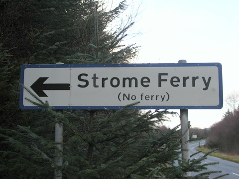
Stromeferry ( gd, Port an t-Sròim) is a village, located on the south shore of the west coast sea loch, Loch Carron, in western Ross-shire, Scottish Highlands and is in the Scottish council area of Highland. Its name reflects its former role as the location of one of the many coastal ferry services which existed prior to the expansion of the road network in the 20th century. It is served by Stromeferry railway station and is close to the A890 road. Stromeferry is on the southern bank of Loch Carron; Strome Castle is opposite on the northern bank. The village is referred to in Iain Banks's novel ''Complicity'', where the narrator describes the road sign marking the village, which states "Strome Ferry (No ferry)". Some local shinty players once competed as "Stromeferry (No Ferry) United". The village has been subject of various development proposals focussing on the derelict hotel. In November 2007, W.A. Fairhurst & Partners, on behalf of the Helmsley Group, secured an outli ... [...More Info...] [...Related Items...] OR: [Wikipedia] [Google] [Baidu] |
Stromeferry (with Ferry)
Stromeferry ( gd, Port an t-Sròim) is a village, located on the south shore of the west coast sea loch, Loch Carron, in western Ross-shire, Scottish Highlands and is in the Scottish council area of Highland. Its name reflects its former role as the location of one of the many coastal ferry services which existed prior to the expansion of the road network in the 20th century. It is served by Stromeferry railway station and is close to the A890 road. Stromeferry is on the southern bank of Loch Carron; Strome Castle is opposite on the northern bank. The village is referred to in Iain Banks's novel ''Complicity'', where the narrator describes the road sign marking the village, which states "Strome Ferry (No ferry)". Some local shinty players once competed as "Stromeferry (No Ferry) United". The village has been subject of various development proposals focussing on the derelict hotel. In November 2007, W.A. Fairhurst & Partners, on behalf of the Helmsley Group, secured an outline ... [...More Info...] [...Related Items...] OR: [Wikipedia] [Google] [Baidu] |
Stromeferry Railway Station
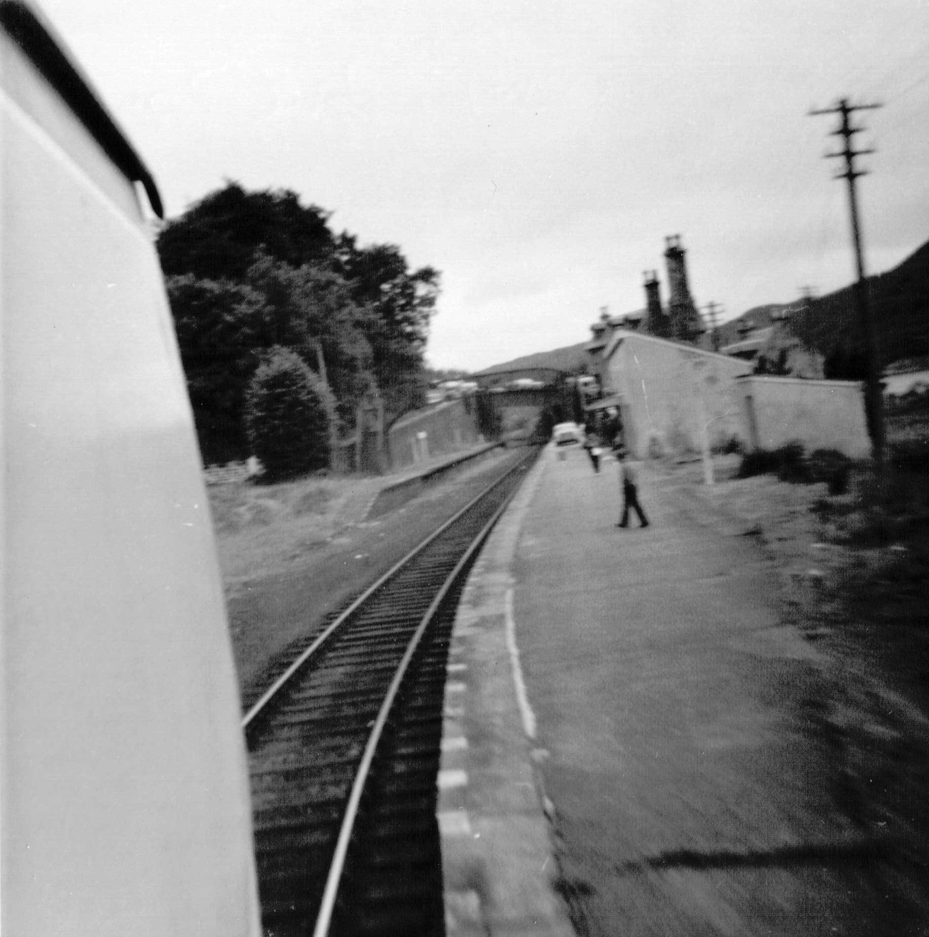
, symbol_location = gb , symbol = rail , image = Platform at Stromeferry station - geograph.org.uk - 2571610.jpg , borough = Stromeferry, Highland , country = Scotland , coordinates = , grid_name = Grid reference , grid_position = , manager = ScotRail , platforms = 1 , code = STF , original = Dingwall and Skye Railway , pregroup = Highland Railway , postgroup = LMSR , years = 19 August 1870 , events = Opened , mpassengers = , footnotes = Passenger statistics from the Office of Rail and Road Stromeferry railway station is a station on the Kyle of Lochalsh Line, serving the village of Stromeferry in the Highlands, northern Scotland. Stromeferry lies on the southern shore of Loch Carron, across from the ruined Strome Castle, near the west coast. The station is from , between Attadale and Duncraig. ScotRail, who manage the station, operate all services. History The station opened for passenger traffic on 19 August 1870. For the first 27 years of its ... [...More Info...] [...Related Items...] OR: [Wikipedia] [Google] [Baidu] |
Loch Carron
Loch Carron (Scottish Gaelic: "Loch Carrann") is a sea loch on the west coast of Ross and Cromarty in the Scottish Highlands, which separates the Lochalsh peninsula from the Applecross peninsula, and from the Stomeferry headland east of Loch Kishorn. It is the point at which the River Carron enters the North Atlantic Ocean. According to the marine charts, the tidal currents reach in the narrows, although not much water disturbance is visible in the flow. At the narrows, the depth of water is less than 20 metres, but in the basins on either side, it extends to a depth of more than 100 metres. Beneath the cliffs at Strome Castle is a colony of flame shells; with a population of over 250 million the loch is the world's largest flame shell bed, and was designated as a Nature Conservation Marine Protected Area (NCMPA) in 2017, with the protection being made permanent in 2018. The new MPA of 23 km2 took effect on 19 May 2019. Within the MPA the use of fishing gear tha ... [...More Info...] [...Related Items...] OR: [Wikipedia] [Google] [Baidu] |
Dingwall And Skye Railway
The Dingwall and Skye Railway was authorised on 5 July 1865 with the aim of providing a route to Skye and the Hebrides. However, due to local objections, another Act of Parliament was required before work could commence. This was passed on 29 May 1868. With the exception of the Strathpeffer Branch, the line is still open, being the major section of the Kyle of Lochalsh Line. History The line to Stromeferry opened for passenger traffic on 19 August 1870. It was in length and cost £238,500 () to build. The line was worked by the Highland Railway, and was ultimately absorbed on 2 August 1880. On 29 June 1893 the Highland Railway obtained re-authorisation to build the section to Kyle of Lochalsh. The line was inspected by Sir Francis Marindin of the Board of Trade on 29 October 1897, and opened for traffic on 2 November. The construction of the line cost £200,000 () and was built under the supervision of the engineer Murdoch Paterson. The pier at Kyle of Lochalsh cost £85 ... [...More Info...] [...Related Items...] OR: [Wikipedia] [Google] [Baidu] |
Ross-shire
Ross-shire (; gd, Siorrachd Rois) is a historic county in the Scottish Highlands. The county borders Sutherland to the north and Inverness-shire to the south, as well as having a complex border with Cromartyshire – a county consisting of numerous enclaves or exclaves scattered throughout Ross-shire's territory. Ross-shire includes most of Ross along with Lewis in the Outer Hebrides. Dingwall is the traditional county town. The area of Ross-shire is based on that of the historic province of Ross, but with the exclusion of the many enclaves that form Cromartyshire. For shreival purposes the area was first separated from the authority of the sheriff of Inverness by Act of Parliament during the reign of King James IV, the sheriff to sit at Tain or Dingwall. Sheriffs were seldom appointed, and further acts of 1649 and 1661 restated its separation from Inverness. The 1661 act also clarified the area encompassed, based on the pre-Reformation Diocese of Ross. Sir Geor ... [...More Info...] [...Related Items...] OR: [Wikipedia] [Google] [Baidu] |
Applecross
Applecross ( gd, A' Chomraich) is a peninsula north-west of Kyle of Lochalsh in the council area of Highland, Scotland. The name Applecross is at least 1,300 years old and is ''not'' used locally to refer to the 19th century village (which is correctly called 'Shore Street', or simply 'The Street') with the Applecross Inn, lying on the Applecross Bay, facing the Inner Sound, on the opposite side of which lies the Inner Hebridean island of Raasay. The monastery of Applecross was established by St Maelrubha, in the 7th century. A sculptured stone is the only remaining relic of Maelrubha, who built a chapel there. The Applecross peninsula ( gd, A' Chomraich, 'The Sanctuary') is a peninsula in Wester Ross, Highland, on the north west coast of Scotland. Geography This row of houses which is often referred to as 'Applecross', and is marked as Applecross on some maps, is actually called 'Shore Street' and is referred to locally just as 'The Street'. The name Applecross applie ... [...More Info...] [...Related Items...] OR: [Wikipedia] [Google] [Baidu] |
Plockton High School
Plockton High School is a 300-pupil high school in the village of Plockton, Scotland. The catchment area for the school stretches from Applecross in the north to Corran in the south. Since the opening of the Skye Bridge, increasing numbers of pupils from South Skye, who would have traditionally gone to Portree High School, have instead attended Plockton High School. The school has a small hostel to cater for pupils who live far away. Sgoil Chiùil na Gà idhealtachd Since its inauguration in 2000, ''Sgoil Chiùil na Gà idhealtachd'' (National Centre of Excellence in Traditional Music) has been located at the High School and is a music school. Any secondary school age pupil in Scotland can apply, and students from all over Scotland attend, most of whom stay in the school's hostel. Notable former pupils * John Farquhar Munro, MSP, 1950s. * Rhoda Grant, MSP Notable staff * Sorley MacLean, Rector Rector (Latin for the member of a vessel's crew who steers) may refer to: ... [...More Info...] [...Related Items...] OR: [Wikipedia] [Google] [Baidu] |
Glenelg, Highland
Glenelg ( gd, Glinn Eilg, also ''Gleann Eilg'' is a scattered community area and civil parish in the Lochalsh area of Highland in western Scotland. Despite the local government reorganisation the area is considered by many still to be in Inverness-shire, the boundary with Ross-shire (where the post town of Kyle of Lochalsh is situated) being at the top of Mam Ratagan ("Ratagan Gap" or "pass") the single-track road entry into Glenelg. The main village is called Kirkton of Glenelg and commonly referred to as "Glenelg". There is a smaller hamlet less than to the south by the jetty and skirting Glenelg Bay known as Quarry. There are several other clusters of houses scattered over Glenelg including up Glen Beag and Glen More and on the road leading to the ferry at Kyle Rhea. The parish covers a large area including Knoydart, North Morar and the ferry port of Mallaig. At the 2001 census it had a population of 1,507. The smaller "settlement zone" around Kirkton had a population o ... [...More Info...] [...Related Items...] OR: [Wikipedia] [Google] [Baidu] |
Kylerhea
Kylerhea (Scottish Gaelic: ''Caol Reatha'') is a village on the east coast of the Isle of Skye, in the Scottish Highlands, overlooking Kyle Rhea, a strait splitting Skye from the Scottish mainland. The village is named after Rhea, a Celtic mythological hero. A ferry service has linked Kylerhea with Glenelg on the mainland for centuries. The first car ferry was introduced in 1935, with a turntable located on the boat. Despite the existence of the now toll-free Skye Bridge, this ferry service, undertaken by the MV ''Glenachulish'', still runs during the summer months, due to its popularity as the more scenic and traditional route between Skye and the mainland. This service is now community-owned but used to be run by Murdo Mackenzie for almost twenty years. For centuries, Kylerhea was the crossing point for cattle reared across the Hebrides on its way to the markets of the mainland. Drovers would reach the village and wait for suitable tidal flows across Kyle Rhea, often re ... [...More Info...] [...Related Items...] OR: [Wikipedia] [Google] [Baidu] |
Highland (council Area)
Highland ( gd, A' Ghà idhealtachd, ; sco, Hieland) is a council area in the Scottish Highlands and is the largest local government area in the United Kingdom. It was the 7th most populous council area in Scotland at the 2011 census. It shares borders with the council areas of Aberdeenshire, Argyll and Bute, Moray and Perth and Kinross. Their councils, and those of Angus and Stirling, also have areas of the Scottish Highlands within their administrative boundaries. The Highland area covers most of the mainland and inner-Hebridean parts of the historic counties of Inverness-shire and Ross and Cromarty, all of Caithness, Nairnshire and Sutherland and small parts of Argyll and Moray. Despite its name, the area does not cover the entire Scottish Highlands. Name Unlike the other council areas of Scotland, the name ''Highland'' is often not used as a proper noun. The council's website only sometimes refers to the area as being ''Highland'', and other times as being '' ... [...More Info...] [...Related Items...] OR: [Wikipedia] [Google] [Baidu] |
Inverness
Inverness (; from the gd, Inbhir Nis , meaning "Mouth of the River Ness"; sco, Innerness) is a city in the Scottish Highlands. It is the administrative centre for The Highland Council and is regarded as the capital of the Highlands. Historically it served as the county town of the county of Inverness-shire. Inverness lies near two important battle sites: the 11th-century battle of Blà r nam Fèinne against Norway which took place on the Aird, and the 18th century Battle of Culloden which took place on Culloden Moor. It is the northernmost city in the United Kingdom and lies within the Great Glen (Gleann Mòr) at its northeastern extremity where the River Ness enters the Beauly Firth. At the latest, a settlement was established by the 6th century with the first royal charter being granted by DabÃd mac MaÃl Choluim (King David I) in the 12th century. Inverness and Inverness-shire are closely linked to various influential clans, including Clan Mackintosh, Clan Fraser an ... [...More Info...] [...Related Items...] OR: [Wikipedia] [Google] [Baidu] |
Plockton
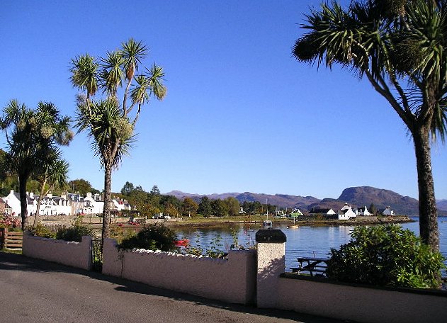
Plockton ( gd, Am Ploc/Ploc Loch Aillse) is a village in the Lochalsh, Wester Ross area of the Scottish Highlands with a 2020 population of 468. Plockton settlement is on the shores of Loch Carron. It faces east away from the prevailing winds, and together with the North Atlantic Drift gives it a mild climate despite the far-north latitude, allowing the Cordyline australis palm to prosper. History Most of the houses date from the nineteenth and twentieth centuries. It was established as a planned fishing village on the northern edge of the Lochalsh, built ‘when introducing sheep farming in 1814-20 and removing the population from their old hamlets in Glen Garron, founded the villages of Jeantown and Plockton on Loch Carronside’ (Geddes: 1945, pp38). Some maritime charts including MacKenzie (1776) and Heather (1804) mark the peninsula where the village sits as ‘Plack’, however it generally considered that the village was built on the ‘Ploc’ of Lochalsh, with ‘Plocâ ... [...More Info...] [...Related Items...] OR: [Wikipedia] [Google] [Baidu] |


