|
Strawberry, Arizona
Strawberry is an unincorporated community and census-designated place (CDP) in Gila County, Arizona, United States. The population was 961 at the 2010 census. History In June 1931, the Bureau of Prohibition destroyed a large whiskey still in Sandrock Canyon, north of Strawberry. The still had an estimated worth of $20,000. Seven hundred gallons of "mountain whiskey" were destroyed and three men arrested. Geography Strawberry is located in the northwest corner of Gila County at (34.4078063, -111.4934754). It is bordered to the south and east by Pine, and to the north by Coconino County. The county line follows the edge of the Mogollon Rim. Arizona State Route 87 passes through Strawberry. It is a two-hour drive——northeast from Phoenix. The town of Payson is southeast via Route 87, and Winslow is to the northeast. According to the United States Census Bureau, the Strawberry CDP has a total area of , of which , or 0.04%, is water. The community is in the valley of Stra ... [...More Info...] [...Related Items...] OR: [Wikipedia] [Google] [Baidu] |
Census-designated Place
A census-designated place (CDP) is a Place (United States Census Bureau), concentration of population defined by the United States Census Bureau for statistical purposes only. CDPs have been used in each decennial census since 1980 as the counterparts of incorporated places, such as self-governing city (United States), cities, town (United States), towns, and village (United States), villages, for the purposes of gathering and correlating statistical data. CDPs are populated areas that generally include one officially designated but currently unincorporated area, unincorporated community, for which the CDP is named, plus surrounding inhabited countryside of varying dimensions and, occasionally, other, smaller unincorporated communities as well. CDPs include small rural communities, Edge city, edge cities, colonia (United States), colonias located along the Mexico–United States border, and unincorporated resort and retirement community, retirement communities and their environs. ... [...More Info...] [...Related Items...] OR: [Wikipedia] [Google] [Baidu] |
Still
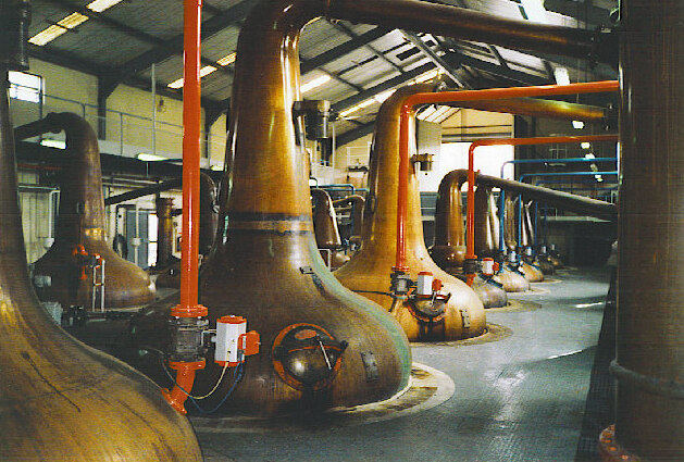
A still is an apparatus used to distill liquid mixtures by heating to selectively boil and then cooling to condense the vapor. A still uses the same concepts as a basic distillation apparatus, but on a much larger scale. Stills have been used to produce perfume and medicine, water for injection (WFI) for pharmaceutical use, generally to separate and purify different chemicals, and to produce distilled beverages containing ethanol. Application Since ethanol boils at a much lower temperature than water, simple distillation can separate ethanol from water by applying heat to the mixture. Historically, a copper vessel was used for this purpose, since copper removes undesirable sulfur-based compounds from the alcohol. However, many modern stills are made of stainless steel pipes with copper linings to prevent erosion of the entire vessel and lower copper levels in the waste product (which in large distilleries is processed to become animal feed). Copper is the preferred materia ... [...More Info...] [...Related Items...] OR: [Wikipedia] [Google] [Baidu] |
Marriage
Marriage, also called matrimony or wedlock, is a culturally and often legally recognized union between people called spouses. It establishes rights and obligations between them, as well as between them and their children, and between them and their in-laws. It is considered a cultural universal, but the definition of marriage varies between cultures and religions, and over time. Typically, it is an institution in which interpersonal relationships, usually sexual, are acknowledged or sanctioned. In some cultures, marriage is recommended or considered to be compulsory before pursuing any sexual activity. A marriage ceremony is called a wedding. Individuals may marry for several reasons, including legal, social, libidinal, emotional, financial, spiritual, and religious purposes. Whom they marry may be influenced by gender, socially determined rules of incest, prescriptive marriage rules, parental choice, and individual desire. In some areas of the world, arrang ... [...More Info...] [...Related Items...] OR: [Wikipedia] [Google] [Baidu] |
Race (United States Census)
Race and ethnicity in the United States census, defined by the federal Office of Management and Budget (OMB) and the United States Census Bureau, are the self-identified categories of race or races and ethnicity chosen by residents, with which they most closely identify, and indicate whether they are of Hispanic or Latino origin (the only categories for ethnicity). The racial categories represent a social-political construct for the race or races that respondents consider themselves to be and, "generally reflect a social definition of race recognized in this country." OMB defines the concept of race as outlined for the U.S. census as not "scientific or anthropological" and takes into account "social and cultural characteristics as well as ancestry", using "appropriate scientific methodologies" that are not "primarily biological or genetic in reference." The race categories include both racial and national-origin groups. Race and ethnicity are considered separate and dis ... [...More Info...] [...Related Items...] OR: [Wikipedia] [Google] [Baidu] |
Census
A census is the procedure of systematically acquiring, recording and calculating information about the members of a given population. This term is used mostly in connection with national population and housing censuses; other common censuses include censuses of agriculture, traditional culture, business, supplies, and traffic censuses. The United Nations (UN) defines the essential features of population and housing censuses as "individual enumeration, universality within a defined territory, simultaneity and defined periodicity", and recommends that population censuses be taken at least every ten years. UN recommendations also cover census topics to be collected, official definitions, classifications and other useful information to co-ordinate international practices. The UN's Food and Agriculture Organization (FAO), in turn, defines the census of agriculture as "a statistical operation for collecting, processing and disseminating data on the structure of agriculture, covering ... [...More Info...] [...Related Items...] OR: [Wikipedia] [Google] [Baidu] |
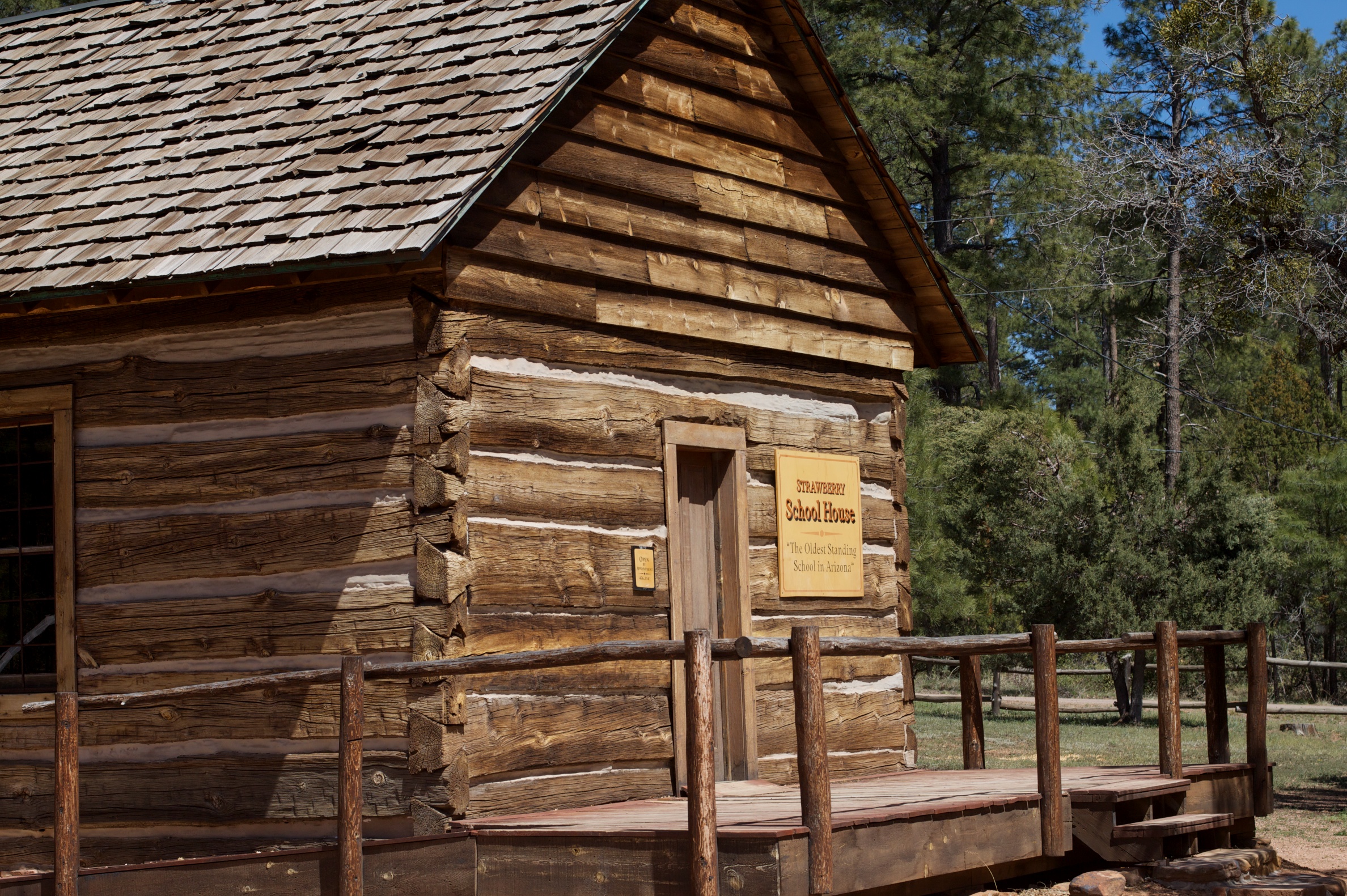
Strawberry School2
The garden strawberry (or simply strawberry; ''Fragaria × ananassa'') is a widely grown hybrid species of the genus ''Fragaria'', collectively known as the strawberries, which are cultivated worldwide for their fruit. The fruit is widely appreciated for its characteristic aroma, bright red color, juicy texture, and sweetness. It is consumed in large quantities, either fresh or in such prepared foods as jam, juice, pies, ice cream, milkshakes, and chocolates. Artificial strawberry flavorings and aromas are also widely used in products such as candy, soap, lip gloss, perfume, and many others. The garden strawberry was first bred in Brittany, France, in the 1750s via a cross of ''Fragaria virginiana'' from eastern North America and ''Fragaria chiloensis'', which was brought from Chile by Amédée-François Frézier in 1714. Cultivars of ''Fragaria'' × ''ananassa'' have replaced, in commercial production, the woodland strawberry (''Fragaria vesca''), which was the first strawb ... [...More Info...] [...Related Items...] OR: [Wikipedia] [Google] [Baidu] |
Verde River
The Verde River ( Yavapai: Haka'he:la) is a major tributary of the Salt River in the U.S. state of Arizona. It is about long and carries a mean flow of at its mouth. It is one of the largest perennial streams in Arizona. Description The river begins below the dam at Sullivan Lake, fed by Big Chino Wash and Williamson Valley Wash in Yavapai County. The Verde flows freely for through private, state, tribal and United States Forest Service lands, specifically the Tonto National Forest, before encountering the first of two dams that make Horseshoe Lake and Bartlett Lake. The cities of Camp Verde, Clarkdale and Cottonwood are the main population centers along the river. The Verde River and the Salt River confluence on the Salt River Pima-Maricopa Indian Community. The Salt River flows into the Gila River west of Phoenix. In 1984, the United States Congress designated of the Verde River as Wild and Scenic through the National Wild and Scenic River program. The Sceni ... [...More Info...] [...Related Items...] OR: [Wikipedia] [Google] [Baidu] |
United States Census Bureau
The United States Census Bureau (USCB), officially the Bureau of the Census, is a principal agency of the U.S. Federal Statistical System, responsible for producing data about the American people and economy. The Census Bureau is part of the U.S. Department of Commerce and its director is appointed by the President of the United States. The Census Bureau's primary mission is conducting the U.S. census every ten years, which allocates the seats of the U.S. House of Representatives to the states based on their population. The bureau's various censuses and surveys help allocate over $675 billion in federal funds every year and it assists states, local communities, and businesses make informed decisions. The information provided by the census informs decisions on where to build and maintain schools, hospitals, transportation infrastructure, and police and fire departments. In addition to the decennial census, the Census Bureau continually conducts over 130 surveys and p ... [...More Info...] [...Related Items...] OR: [Wikipedia] [Google] [Baidu] |
Winslow, Arizona
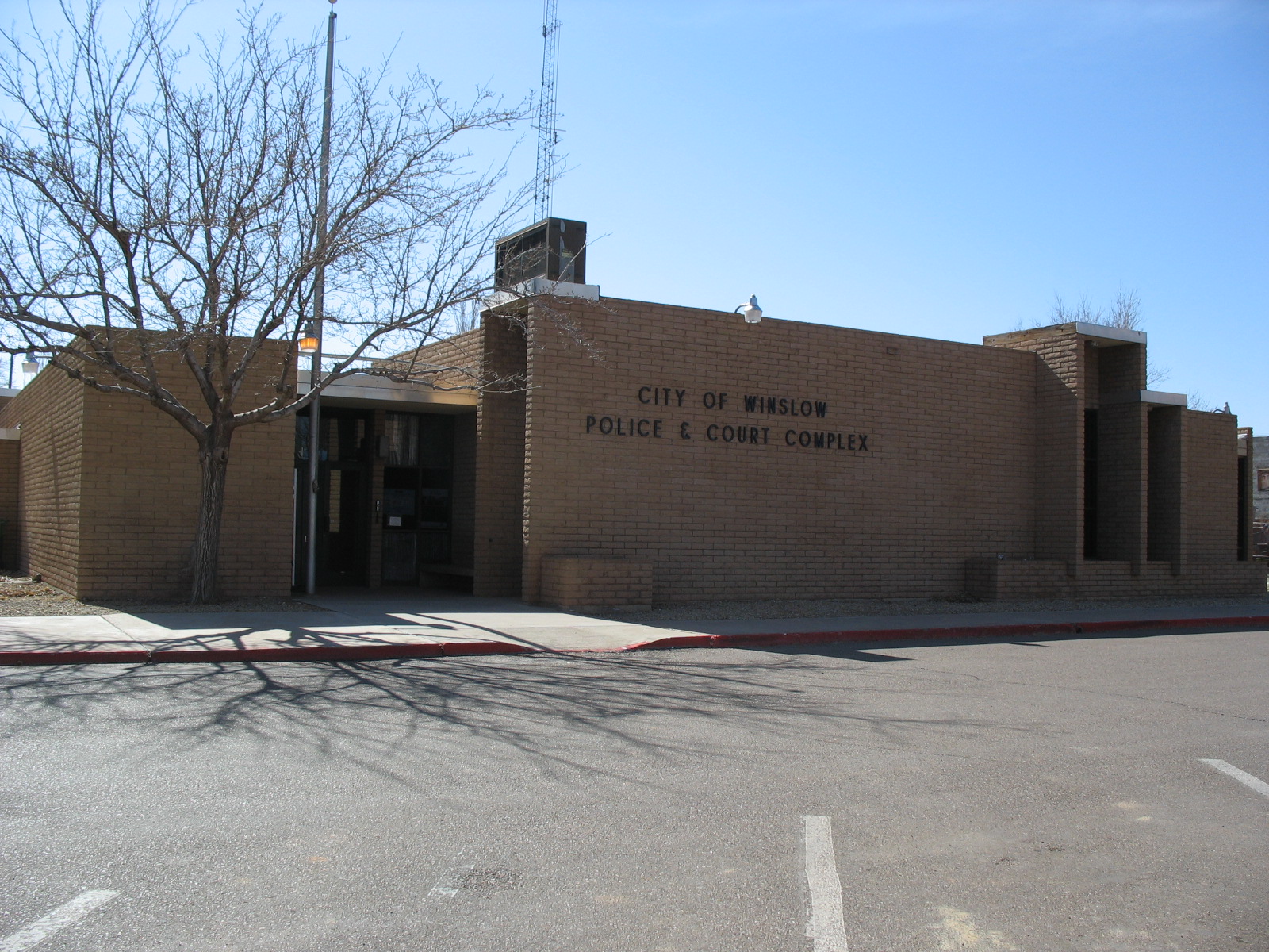
Winslow ( nv, ) is a city in Navajo County, Arizona, Navajo County, Arizona, United States. According to the 2010 United States Census, 2010 census, the population of the city is 9,655. It is approximately southeast of Flagstaff, Arizona, Flagstaff, west of Albuquerque, New Mexico, and southeast of Las Vegas. History Winslow was named for either Edward F. Winslow, president of St. Louis–San Francisco Railway, St. Louis and San Francisco Rail Road, which owned half of the old Atlantic and Pacific Railroad, or Tom Winslow, a prospector who lived in the area. The last Fred Harvey Company, Harvey House (La Posada Hotel), designed by Mary Colter, opened in 1930. The hotel closed in 1957 and was used by the Santa Fe Railway for offices. The railroad abandoned La Posada Historic District, La Posada in 1994 and announced plans to tear it down. It was bought and restored by Allan Affeldt and it serves as a hotel. U.S. Route 66 was originally routed through the city. A contract to ... [...More Info...] [...Related Items...] OR: [Wikipedia] [Google] [Baidu] |
Payson, Arizona
Payson is a town in northern Gila County, Arizona, United States. Due to Payson's location being very near to the geographic center of Arizona, it has been called "The Heart of Arizona". The town is surrounded by the Tonto National Forest, the largest of the six national forests in Arizona and is the ninth largest national forest in the United States. 2] Payson boasts a lively festival calendar, including the World’s Oldest Continuous Rodeo, established in 1884 and the Old Time Fiddlers Contest which celebrates the area’s musical heritage. As of the 2020 United States census, 2020 census, the population of Payson was 16,361. History The founding year of Payson is considered to be 1882, at which time the town was known as "Green Valley". On March 3, 1884, a post office was established with the help of Illinois Representative Levi Joseph Payson. In honor of the representative's help, the town's name was changed to "Payson". Payson had its first rodeo in 1884. The town d ... [...More Info...] [...Related Items...] OR: [Wikipedia] [Google] [Baidu] |
Arizona State Route 87
State Route 87 (SR 87) is a north–south highway that travels from I-10 near Picacho northward to State Route 264 near Second Mesa. Route description SR 87 begins to the north of I-10 at a junction with an unsigned orphan segment of SR 84, which serves as a direct connection to I-10 at Exit 211. SR 87 travels north for toward Coolidge, passing by the town of Eloy. In Coolidge, State Route 87 is known as Arizona Boulevard. The highway leaves Coolidge heading northwest and travels as a two-lane rural road through the Gila River Indian Community, until it reaches a junction with SR 587 on the border between the Gila River Indian Community and Chandler. North of this junction, SR 87 travels along Arizona Avenue in Chandler, intersecting Loop 202 before entering Mesa and becoming Country Club Drive. The highway then intersects with U.S. 60 and SR 202 for a second time, before leaving Mesa as the Beeline Highway. The Mesa and Chandler sections of SR 87 are discontinuou ... [...More Info...] [...Related Items...] OR: [Wikipedia] [Google] [Baidu] |
Mogollon Rim
The Mogollon Rim ( or or ) is a topographical and geological feature cutting across the northern half of the U.S. state of Arizona. It extends approximately , starting in northern Yavapai County and running eastward, ending near the border with New Mexico.The Mogollon Rim is not to be confused with the Mogollon Mountains in New Mexico located somewhat east of the eastern end of the Rim. The official estimate of the eastern end is near Show Low, although some sources extend it farther east. See It forms the southern edge of the Colorado Plateau in Arizona. Description The Rim is an escarpment defining the southwestern edge of the Colorado Plateau. Its central and most spectacular portions are characterized by high cliffs of limestone and sandstone, namely the Kaibab Limestone and Coconino Sandstone cliffs. The escarpment was created by erosion and faulting, cutting dramatic canyons into it, including Fossil Creek Canyon and Pine Canyon. The name Mogollon comes from Don J ... [...More Info...] [...Related Items...] OR: [Wikipedia] [Google] [Baidu] |


